The instrument's own words
page 1 · read by Gemma vision
611
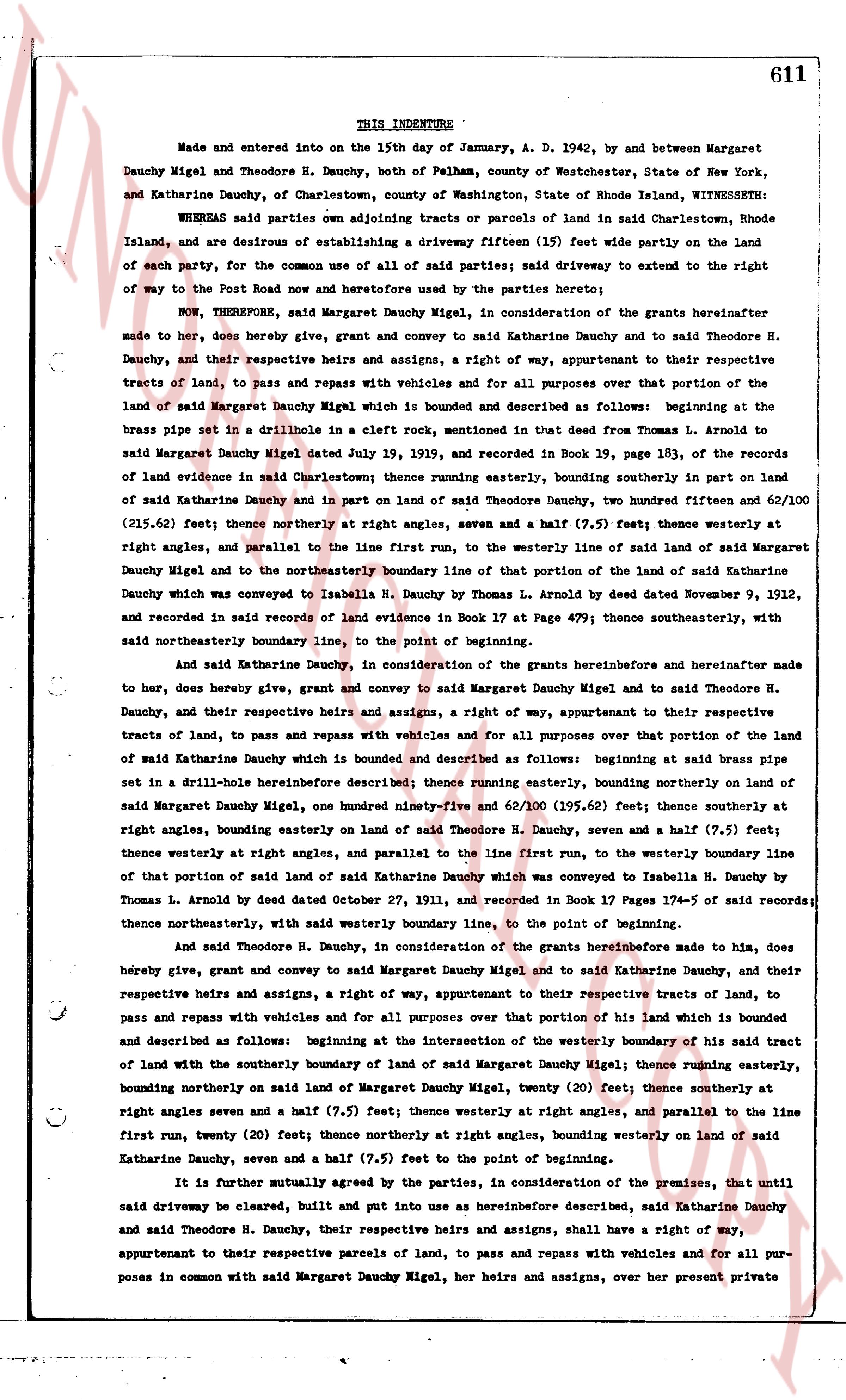
THIS INDENTURE
Made and entered into on the 15th day of January, A. D. 1942, by and between Margaret Dauchy Migel and Theodore H. Dauchy, both of Pelham, County of Westchester, State of New York, and Katharine Dauchy, of Charlestown, County of Washington, State of Rhode Island, WITNESSETH:
WHEREAS said parties own adjoining tracts or parcels of land in said Charlestown, Rhode Island, and are desirous of establishing a driveway fifteen (15) feet wide partly on the land of each party, for the common use of all of said parties; said driveway to extend to the right of way to the Post Road now and heretofore used by the parties hereto;
NOW, THEREFORE, said Margaret Dauchy Migel, in consideration of the grants hereinafter made to her, does hereby give, grant and convey to said Katharine Dauchy and to said Theodore H. Dauchy, and their respective heirs and assigns, a right of way, appurtenant to their respective tracts of land, to pass and repass with vehicles and for all purposes over that portion of the land of said Margaret Dauchy Migel which is bounded and described as follows: beginning at the brass pipe set in a drillhole in a cleft rock, mentioned in that deed from Thomas L. Arnold to said Margaret Dauchy Migel dated July 19, 1939, and recorded in Book 19, page 183, of the records of land evidence in said Charlestown; thence running easterly, bounding southerly in part on land of said Katharine Dauchy and in part on land of said Theodore H. Dauchy, two hundred fifteen and 62/100 (215.62) feet; thence northerly at right angles, seven and a half (7.5) feet; thence westerly at right angles, and parallel to the line first run, to the westerly line of land of said Margaret Dauchy Migel and to the northeasterly boundary line of that portion of the land of said Katharine Dauchy which was conveyed to Isabella H. Dauchy by Thomas L. Arnold by deed dated November 9, 1912, and recorded in said records of land evidence in Book 17 at Page 479; thence southeasterly, with said northeasterly boundary line, to the point of beginning.
And said Katharine Dauchy, in consideration of the grants hereinbefore and hereinafter made to her, does hereby give, grant and convey to said Margaret Dauchy Migel and to said Theodore H. Dauchy, and their respective heirs and assigns, a right of way, appurtenant to their respective tracts of land, to pass and repass with vehicles and for all purposes over that portion of the land of said Katharine Dauchy which is bounded and described as follows: beginning at said brass pipe set in a drill-hole hereinbefore described thence running easterly, bounding northerly on land of said Margaret Dauchy Migel, one hundred ninety-five and 62/100 (195.62) feet; thence southerly at right angles, bounding easterly on land of said Theodore H. Dauchy, seven and a half (7.5) feet; thence westerly at right angles, and parallel to the line first run, to the westerly boundary line of that portion of said land of said Katharine Dauchy which was conveyed to Isabella H. Dauchy by Thomas L. Arnold by deed dated October 27, 1911, and recorded in Book 17 Pages 17-4 of said records; thence northeasterly, with said westerly boundary line, to the point of beginning.
And said Theodore H. Dauchy, in consideration of the grants hereinbefore made to him, does hereby give, grant and convey to said Margaret Dauchy Migel and to said Katharine Dauchy, and their respective heirs and assigns, a right of way, appurtenant to their respective tracts of land, to pass and repass with vehicles and for all purposes over that portion of his land which is bounded and described as follows: beginning at the intersection of the westerly boundary of his said tract of land with the southerly boundary of land of said Margaret Dauchy Migel; thence running easterly, bounding northerly on said land of Margaret Dauchy Migel, twenty (20) feet; thence southerly at right angles seven and a half (7.5) feet; thence westerly at right angles, and parallel to the line first run, twenty (20) feet; thence northerly at right angles, bounding westerly on land of said Katharine Dauchy, seven and a half (7.5) feet to the point of beginning.
It is further mutually agreed by the parties, in consideration of the premises, that until said driveway be cleared, built and put into use as hereinbefore described, said Katharine Dauchy and said Theodore H. Dauchy, their respective heirs and assigns, shall have a right of way, appurtenant to their respective parcels of land, to pass and repass with vehicles and for all purposes in common with said Margaret Dauchy Migel, her heirs and assigns, over her present private
The page as recorded