The instrument's own words
page 1
and to the use of the said grantee, and his heirs and assigns forever, and
I the aforementioned grantor, do hereby for myself and for my heirs, executors
and administrators, covenant with the said grantee, his heirs and assigns
that I am lawfully seized in fee simple of the whole of the aforesaid premises; that
the same are free from all encumbrances; that I have good right, full
power and lawful authority to sell and convey the same in manner aforesaid;
and that the said grantee and his heirs and assigns shall have and shall have
presently and at all times hereafter peaceably and quietly seise and enjoy the
said premises, and that I the said grantor and my heirs, executors
and administrators shall and will warrant and defend the same to the said
grantee and his heirs and assigns forever against the lawful claims of all
persons whomsoever. In witness whereof I have hereunto set my hand and seal
this 28th day of October A.D. 1825.
Signed, Sealed and delivered in the presence of
Samuel Avery & Louve
$7.50
Ms. J. H. Steward
State of Providence
county of Providence
On this 28th day of October A.D. 1825 before
me personally appeared Alfred H. Steward to me known and known
by me to be the party executing the foregoing instrument and he
did acknowledge and declare the instrument to be his act and
deed.
By Storey & Louve
received for record October 28, 1825 at 10 o'clock a.m.
and recorded by me secretary under the seal of the town clerk
KNOW ALL Men Who these presents, That I Edward
Steward and Sadie Elizabeth Seale his wife, both of the Town of North
Providence, county of Providence and State of Rhode Island In
consideration of the sum of Ten dollars ($10.to) to me in trust by Jane d
Hamilton of the city of Providence, county of Providence and State of
Rhode Island, of the receipt whereof is purely acknowledged, do hereby
remise, release and forever quit claim unto the said Jane d
Hamilton, her heirs and assigns forever, all the right title
interest property claim and demand in which we concurre, or of
right ought to have or claim, in and to a certain tract of land
with all the buildings and improvements thereon standing
page 2
86
situated in the Town of Narragansett in said County of Washington
in said State of Rhode Island, bounded and described as follows, viz:
beginning at a stake and
stone on the east bank by land formerly of George F. Smith; thence
northerly, bounding westerly by said Smith's land two hundred fifty (250)
feet to a stake and stone; thence easterly fifty (50) feet to a stake and stone
and thence southerly two hundred fifty (250) feet to a stake and stone
on the head bank; thence southerly to the high water; thence westerly fifty (50)
feet and thence northerly to the first mentioned bound; bounded northerly
and easterly by land now of formerly of John M. Money and southerly
by the sea; it was a small strip of land bounded as aforesaid
beginning at the SE corner of Smith's land now of formerly of said
George F. Smith; thence easterly twelve (12) feet and thence southerly in
a straight line 17 1/2 poles until it parallel with said Smith's land one
hundred twenty one (121) feet; thence southeasterly by the road toward
of said Smith thence northerly one hundred fifty nine (159) feet
to the place of beginning; overalling to said Money and northerly by said
road and a boundary of said Money; thence by the road and easterly
by land now of J. Money; thence south meaning boundary to boundary
and surveying according to said boundaries, our deeds and adhering the
premises conveyed to Edward Strafer and said Sarah Elizabeth
Water by me deed of date 1st October 1772 and
recorded in the records of said town in the form of conveyance
in page 134 dated page 171; to have and to hold the
same, with all the rights, privileges and appurtenances thereunto
belonging into and unto the use of any of the heirs of the family named Hamilton,
their heirs into and unto the use of any of the aforementioned,
their heirs and assigns forever, and we the aforementioned,
Edward Strafer and Sarah Elizabeth with their heirs for themselves and
to their heirs, executors and administrators to be servant with
the said heirs of Hamilton their heirs and assigns that we will
warrant and defend the above described premises unto the
said Hamilton, their heirs and assigns forever, against the
all claims and demands of all persons claiming by way, through
or under us, or Edward Strafer and said Sarah Elizabeth
their heirs in consideration of the sum paid as aforesaid, sufficiently
paid and secure a certain interest in the said June 5, Hamilton
their heirs and assigns all our right of entry and door in and
to the aforementioned premises.
In testimony whereof, we have set our hands
and seals this 30th day of October in the year of our Lord one
thousand seven hundred and twenty first (1721).
Signed and sealed in presence of
[Signature] Donn D. Smith
[Signature] Thomas Rande Rigard
[Signature] Edward Strafer Def.
[Signature] Sarah Elizabeth Strafer Def.
page 3
87
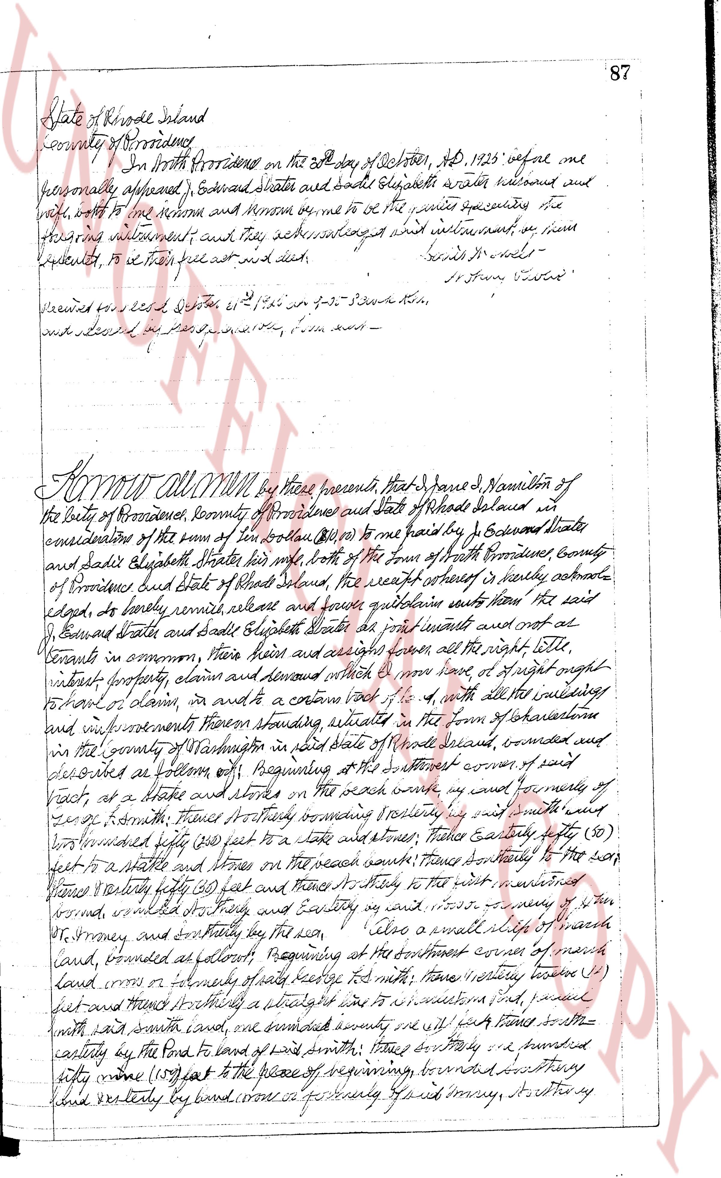
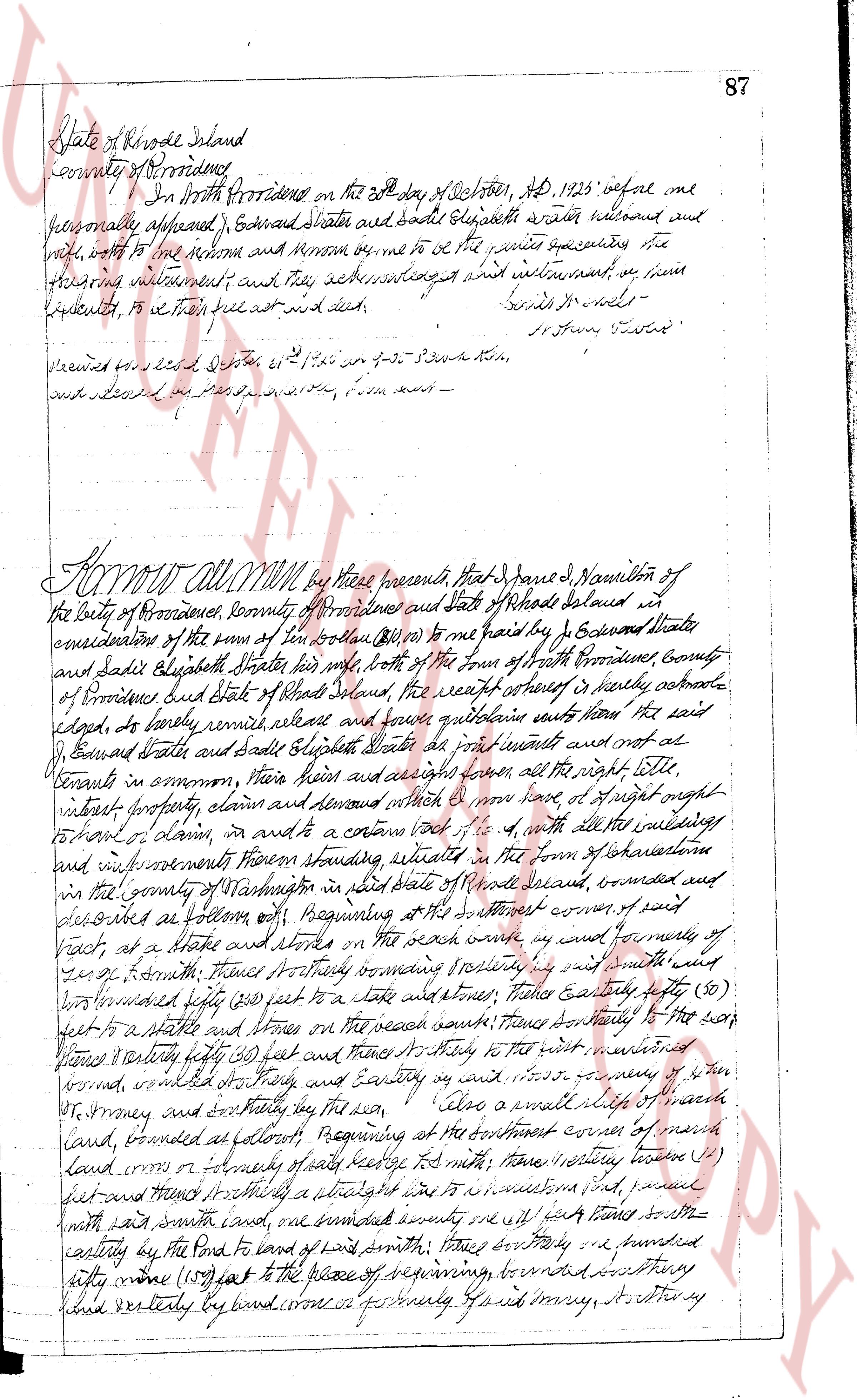
State of Rhode Island
county of Providence
In North Providence on the 8th day of October, AD 1923 before me
personally appeared, Edward Slater and Sadie Elizabeth Slater witnessed and
sworn, wrote to the Clerk and Meenon me to be the true preceding the
following instrument; and that they acknowledged within instrument, by their
handset, to be their act and deed. [Signatures]
Received for record October 11 1923 on p-3 south book,
and listed as a fee of $1.50 paid by them ---
KNOW ALL MEN by these presents, that I, James J. Hamilton of
the city of Providence, county of Providence and State of Rhode Island selesai in
consideration of the sum of ten dollars ($10.00) to me paid by I, Edward Slater
and Sadie Elizabeth Slater his wife, both of the Town of North Providence, County
of Providence and State of Rhode Island, the receipt whereof is hereby acknowledged,
do, hereby remise release and forever quitclaim unto the said
Edward Slater and Sadie Elizabeth Slater his wife amounts and not at
tenants in common, their heirs and assigns forever, all the right title,
interest, property, claim and demand which ever I or some of right out-
to hold or claim, or intend to claim right of to it, with all the buildings
and improvements thereon standing absolute, situated in the town of Charlestown
in the county of Washington in said State of Rhode Island selesai, bounded and
described as follows: Beginning at the southeast corner of said
tract, at a stake and stone on the road which runs east and westly and runs westerly
zero feet, from thence Northerly running boundary by said smith's way
one hundred fifty (150) feet to a stake and stone, thence easterly fifty (50)
feet to a stake and stone on the road aforesaid, thence southerly to the road
runs easterly fifty (50) feet and then traces of thirty (30) feet to the west, returning
formed, outlined thereby, and easterly on said road a distance of forty (40)
feet, northerly and southerly by the sun --- also a small right of way
land, formed as follows: Beginning at the southeast corner of said
land runs east or formerly of said ledge to said smith; thence northerly between (1)
feet and thence southerly a distance of one hundred feet, and parallel
with said south land, one hundred seventy one (171) feet stones southerly
easterly by the Pond of land of Lewis smith; thence southerly one hundred
thirty nine (139) feet to the place of beginning, bounded northerly
said westerly by land corners of formerly said smith, southerly
The page as recorded