The instrument's own words
page 1 · read by Gemma vision
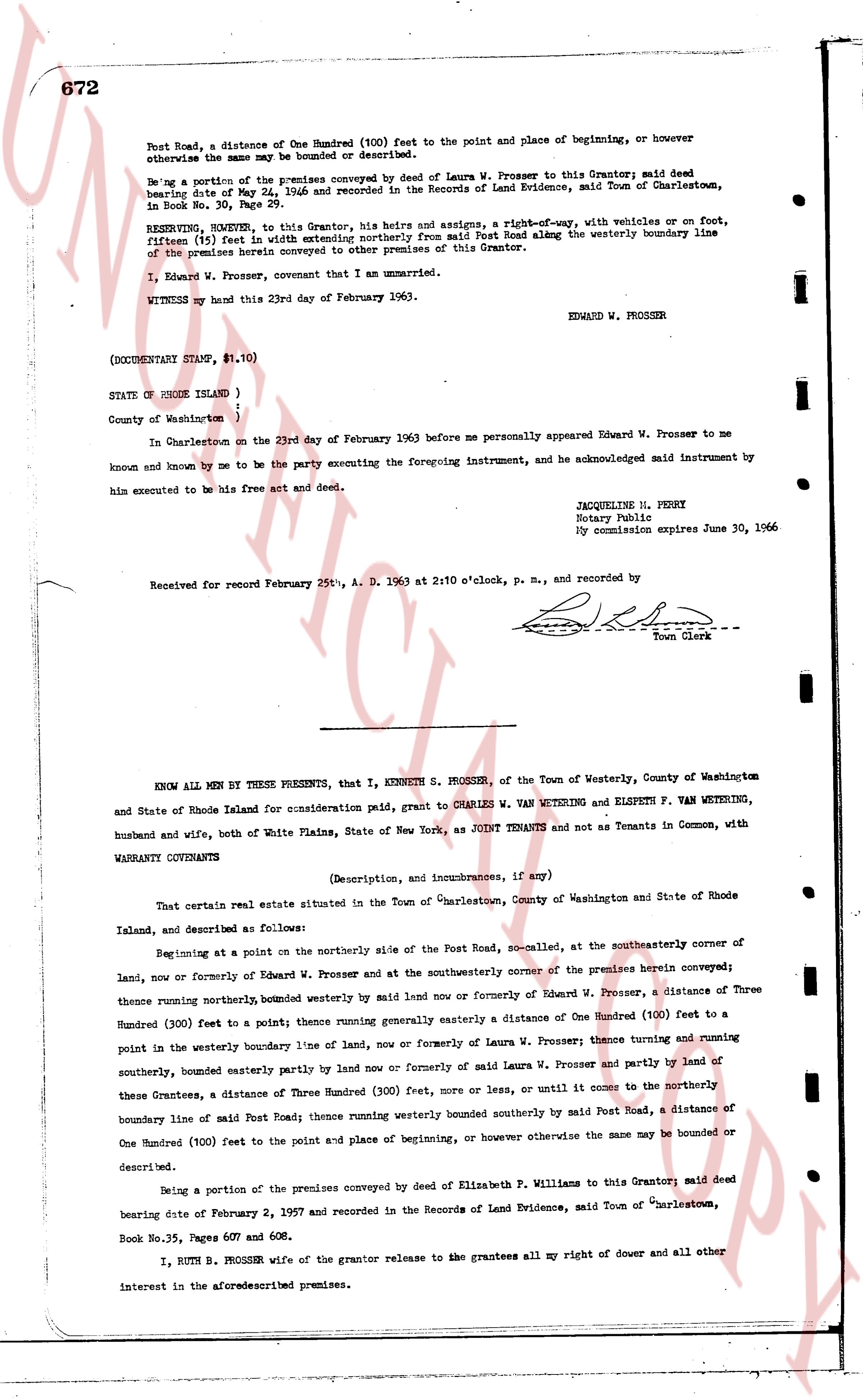
672
Post Road, a distance of One Hundred (100) feet to the point and place of beginning, or however otherwise the same may be bounded or described.
Being a portion of the premises conveyed by deed of Laura W. Prosser to this Grantor; said deed bearing date of May 24, 1946 and recorded in the Records of Land Evidence, said Town of Charlestown, in Book No. 30, Page 29.
RESERVING, HOWEVER, to this Grantor, his heirs and assigns, a right-of-way, with vehicles or on foot, fifteen (15) feet in width extending northerly from said Post Road along the westerly boundary line of the premises herein conveyed to other premises of the Grantor.
I, Edward W. Prosser, covenant that I am unmarried.
WITNESS my hand this 23rd day of February 1963. EDWARD W. PROSSER
(DOCUMENTARY STAMP, $1.10)
STATE OF RHODE ISLAND )
) ss.
County of Washington )
In Charlestown on the 23rd day of February 1963 before me personally appeared Edward W. Prosser to me known and known by me to be the party executing the foregoing instrument, and acknowledged said instrument by him executed to be his free act and deed.
JACQUELINE M. PERBY
Notary Public
My commission expires June 30, 1966
Received for record February 25th, A. D. 1963 at 2:10 o'clock, p. m., and recorded by
[Signature]
Town Clerk
----
KNOW ALL MEN BY THESE PRESENTS, that I, KENNETH S. PROSSER, of the Town of Westerly, County of Washington and State of Rhode Island for consideration paid, grant to CHARLES W. VANWETERING and ELSPETH F. VANWETERING, husband and wife, both of White Plains, State of New York, as JOINT TENANTS and not as Tenants in Common, with WARRANTY COVENANTS
(Description, and incumbrances, if any)
That certain real estate situated in the Town of Charlestown, County of Washington and State of Rhode Island, and described as follows:
Beginning at a point on the northerly side of the Post Road, so-called, at the southeasterly corner of land, now or formerly of Edward W. Prosser and at the southeasterly corner of the premises herein conveyed; thence running northerly, bounded westerly by said land now or formerly of Edward W. Prosser, a distance of Three Hundred (300) feet to a point; thence running generally easterly a distance of One Hundred (100) feet to a point in the westerly boundary line of land, now or formerly of Laura W. Prosser; thence turning and running southerly, bounded easterly partly by land now or formerly of said Laura W. Prosser and partly by land of these Grantees, a distance of Three Hundred (300) feet, more or less, or until it comes to the northerly boundary line of said Post Road; thence running westerly bounded southerly by said Post Road, a distance of One Hundred (100) feet to the point and place of beginning, or however otherwise the same may be bounded or described.
Being a portion of the premises conveyed by deed of Elizabeth P. Williams to this Grantor; said deed bearing date of February 2, 1957 and recorded in the Records of Land Evidence, said Town of Charlestown, Book No.35, Pages 607 and 608.
I, RUTH B. PROSSER wife of the grantor release to the grantees all my right of dower and all other interest in the aforementioned premises.
page 2 · read by Gemma vision
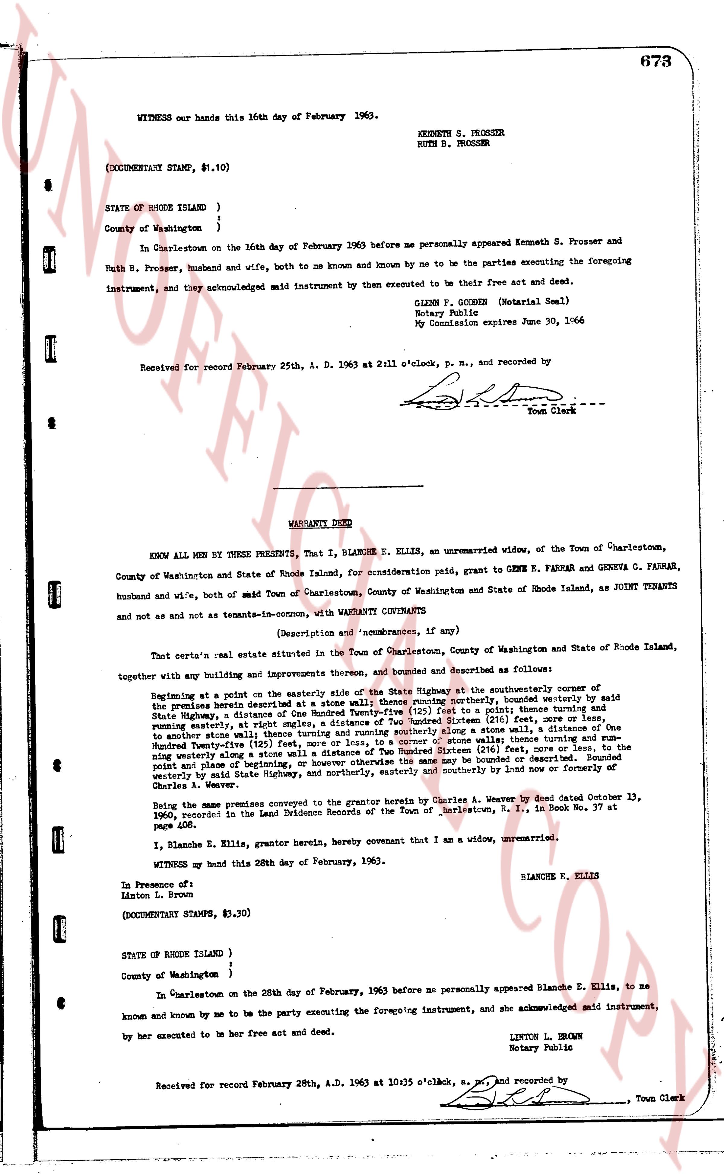
673
WITNESS our hands this 16th day of February 1963.
KENNETH S. PROSSER
RUTH B. PROSSER
(DOCUMENTARY STAMP, $.10)
STATE OF RHODE ISLAND }
}
County of Washington }
In Charlestown on the 16th day of February 1963 before me personally appeared Kenneth S. Prosser and Ruth B. Prosser, husband and wife, both to me known and known by me to be the parties executing the foregoing instrument, and they acknowledged said instrument by them executed to be their free act and deed.
GLENN F. GOGGEN (Notarial Seal)
Notary Public
My Commission expires June 30, 1966
Received for record February 25th, A. D. 1963 at 2:11 o'clock, p. m., and recorded by [?]
Town Clerk
----
WARRANTY DEED
KNOW ALL MEN BY THESE PRESENTS, That I, BLANCHE E. ELLIS, an unmarried widow, of the Town of Charlestown, County of Washington and State of Rhode Island, for consideration paid, grant to GENE E. FARRAR and GENEVA C. FARRAR, husband and wife, both of said Town of Charlestown, County of Washington and State of Rhode Island, as JOINT TENANTS and not as and not as tenants in common, with WARRANTY COVENANTS
(Description and nonburances, if any)
That certain real estate situate in the Town of Charlestown, County of Washington and State of Rhode Island, together with any buildings and improvements thereon, and bounded and described as follows:
Beginning at a point on the easterly side of the State Highway at the southeasterly corner of the premises herein described at a stone wall; thence running northerly, bounded westerly by said State Highway, at about 100 feet distance, by a stone wall, north 30 degrees east, 100 feet, to a point, thence running easterly, at about 100 feet distance, by a stone wall, north 60 degrees east, 200 Hundred Systemed (216 feet), more or less, and running easterly, at about 100 feet distance, by a stone wall, north 60 degrees east, 100 feet, to another stone wall; thence running easterly and running southerly along a stone wall, north 60 degrees east, 100 feet, to another stone wall; thence running southerly along a stone wall, north 60 degrees east, 100 feet, to another stone wall; thence running easterly and running southerly along a stone wall, north 60 degrees east, 100 feet, to another stone wall; thence running easterly and running southerly along a stone wall of distance of Two Hundred Systemed (216 feet), more or less, to the point of beginning; bounded easterly by a stone wall, bounded northerly by the premises of [?] point from plane beginning; bounded easterly by a stone wall, bounded southerly by the State Highway, and northerly easterly by said State Highway, and northerly easterly by said State Highway, and northerly easterly by said State Highway, and northerly easterly by said State Highway, and northerly easterly by said State Highway, and northerly easterly by said State Highway, and northerly easterly by said State Highway, and northerly easterly by said State Highway, and northerly easterly by said State Highway, and northerly easterly by said State Highway, and northerly easterly by said State Highway, and northerly easterly by said State Highway, and northerly easterly by said State Highway, and northerly easterly by said State Highway, and northerly easterly by said State Highway, and northerly easterly by said State Highway, and northerly easterly by said State Highway, and northerly easterly by said State Highway, and northerly easterly by said State Highway, and northerly easterly by said State Highway, and northerly easterly by said State Highway, and northerly easterly by said State Highway, and northerly easterly by said State Highway, and northerly easterly by said State Highway, and northerly easterly by said State Highway, and northerly easterly by said State Highway, and northerly easterly by said State Highway, and northerly easterly by said State Highway, and northerly easterly by said State Highway, and northerly easterly by said State Highway, and northerly easterly by said State Highway, and northerly easterly by said State Highway, and northerly easterly by said State Highway, and northerly easterly by said State Highway, and northerly easterly by said State Highway, and northerly easterly by said State Highway, and northerly easterly by said State Highway, and northerly easterly by said State Highway, and northerly easterly by said State Highway, and northerly easterly by said State Highway, and northerly easterly by said State Highway, and northerly easterly by said State Highway, and northerly easterly by said State Highway, and northerly easterly by said State Highway, and northerly easterly by said State Highway, and northerly easterly by said State Highway, and northerly easterly by said State Highway, and northerly easterly by said State Highway, and northerly easterly by said State Highway, and northerly easterly by said State Highway, and northerly easterly by said State Highway, and northerly easterly by said State Highway, and northerly easterly by said State Highway, and northerly easterly by said State Highway, and northerly easterly by said State Highway, and northerly easterly by said State Highway, and northerly easterly by said State Highway, and northerly easterly by said State Highway, and northerly easterly by said State Highway, and northerly easterly by said State Highway, and northerly easterly by said State Highway, and northerly easterly by said State Highway, and northerly easterly by said State Highway, and northerly easterly by said State Highway, and northerly easterly by said State Highway, and northerly easterly by said State Highway, and northerly easterly by said State Highway, and northerly easterly by said State Highway, and northerly easterly by said State Highway, and northerly easterly by said State Highway, and northerly easterly by said State Highway, and northerly easterly by said State Highway, and northerly easterly by said State Highway, and northerly easterly by said State Highway, and northerly easterly by said State Highway, and northerly easterly by said State Highway, and northerly easterly by said State Highway, and northerly easterly by said State Highway, and northerly easterly by said State Highway, and northerly easterly by said State Highway, and northerly easterly by said State Highway, and northerly easterly by said State Highway, and northerly easterly by said State Highway, and northerly easterly by said State Highway, and northerly easterly by said State Highway, and northerly easterly by said State Highway, and northerly easterly by said State Highway, and northerly easterly by said State Highway, and northerly easterly by said State Highway, and northerly easterly by said State Highway, and northerly easterly by said State Highway, and northerly easterly by said State Highway, and northerly easterly by said State Highway, and northerly easterly by said State Highway, and northerly easterly by said State Highway, and northerly easterly by said State Highway, and northerly easterly by said State Highway, and northerly easterly by said State Highway, and northerly easterly by said State Highway, and northerly easterly by said State Highway, and northerly easterly by said State Highway, and northerly easterly by said State Highway, and northerly easterly by said State Highway, and northerly easterly by said State Highway, and northerly easterly by said State Highway, and northerly easterly by said State Highway, and northerly easterly by said State Highway, and northerly easterly by said State Highway, and northerly easterly by said State Highway, and northerly easterly by said State Highway, and northerly easterly by said State Highway, and northerly easterly by said State Highway, and northerly easterly by said State Highway, and northerly easterly by said State Highway, and northerly easterly by said State Highway, and northerly easterly by said State Highway, and northerly easterly by said State Highway, and northerly easterly by said State Highway, and northerly easterly by said State Highway, and northerly easterly by said State Highway, and northerly easterly by said State Highway, and northerly easterly by said State Highway, and northerly easterly by said State Highway, and northerly easterly by said State Highway, and northerly easterly by said State Highway, and northerly easterly by said State Highway, and northerly easterly by said State Highway, and northerly easterly by said State Highway, and northerly easterly by said State Highway, and northerly easterly by said State Highway, and northerly easterly by said State Highway, and northerly easterly by said State Highway, and northerly easterly by said State Highway, and northerly easterly by said State Highway, and northerly easterly by said State Highway, and northerly easterly by said State Highway, and northerly easterly by said State Highway, and northerly easterly by said State Highway, and northerly easterly by said State Highway, and northerly easterly by said State Highway, and northerly easterly by said State Highway, and northerly easterly by said State Highway, and northerly easterly by said State Highway, and northerly easterly by said State Highway, and northerly easterly by said State Highway, and northerly easterly by said State Highway, and northerly easterly by said State Highway, and northerly easterly by said State Highway, and northerly easterly by said State Highway, and northerly easterly by said State Highway, and northerly easterly by said State Highway, and northerly easterly by said State Highway, and northerly easterly by said State Highway, and northerly easterly by said State Highway, and northerly easterly by said State Highway, and northerly easterly by said State Highway, and northerly easterly by said State Highway, and northerly easterly by said State Highway, and northerly easterly by said State Highway, and northerly easterly by said State Highway, and northerly easterly by said State Highway, and northerly easterly by said State Highway, and northerly easterly by said State Highway, and northerly easterly by said State Highway, and northerly easterly by said State Highway, and northerly easterly by said State Highway, and northerly easterly by said State Highway, and northerly easterly by said State Highway, and northerly easterly by said State Highway, and northerly easterly by said State Highway, and northerly easterly by said State Highway, and northerly easterly by said State Highway, and northerly easterly by said State Highway, and northerly easterly by said State Highway, and northerly easterly by said State Highway, and northerly easterly by said State Highway, and northerly easterly by said State Highway, and northerly easterly by said State Highway, and northerly easterly by said State Highway, and northerly easterly by said State Highway, and northerly easterly by said State Highway, and northerly easterly by said State Highway, and northerly easterly by said State Highway, and northerly easterly by said State Highway, and northerly easterly by said State Highway, and northerly easterly by said State Highway, and northerly easterly by said State Highway, and northerly easterly by said State Highway, and northerly easterly by said State Highway, and northerly easterly by said State Highway, and northerly easterly by said State Highway, and northerly easterly by said State Highway, and northerly easterly by said State Highway, and northerly easterly by said State Highway, and northerly easterly by said State Highway, and northerly easterly by said State Highway, and northerly easterly by said State Highway, and northerly easterly by said State Highway, and northerly easterly by said State Highway, and northerly easterly by said State Highway, and northerly easterly by said State Highway, and northerly easterly by said State Highway, and northerly easterly by said State Highway, and northerly easterly by said State Highway, and northerly easterly by said State Highway, and northerly easterly by said State Highway, and northerly easterly by said State Highway, and northerly easterly by said State Highway, and northerly easterly by said State Highway, and northerly easterly by said State Highway, and northerly easterly by said State Highway, and northerly easterly by said State Highway, and northerly easterly by said State Highway, and northerly easterly by said State Highway, and northerly easterly by said State Highway, and northerly easterly by said State Highway, and northerly easterly by said State Highway, and northerly easterly by said State Highway, and northerly easterly by said State Highway, and northerly easterly by said State Highway, and northerly easterly by said State Highway, and northerly easterly by said State Highway, and northerly easterly by said State Highway, and northerly easterly by said State Highway, and northerly easterly by said State Highway, and northerly easterly by said State Highway, and northerly easterly by said State Highway, and northerly easterly by said State Highway, and northerly easterly by said State Highway, and northerly easterly by said State Highway, and northerly easterly by said State Highway, and northerly easterly by said
The page as recorded