The instrument's own words
page 1 · read by Gemma vision
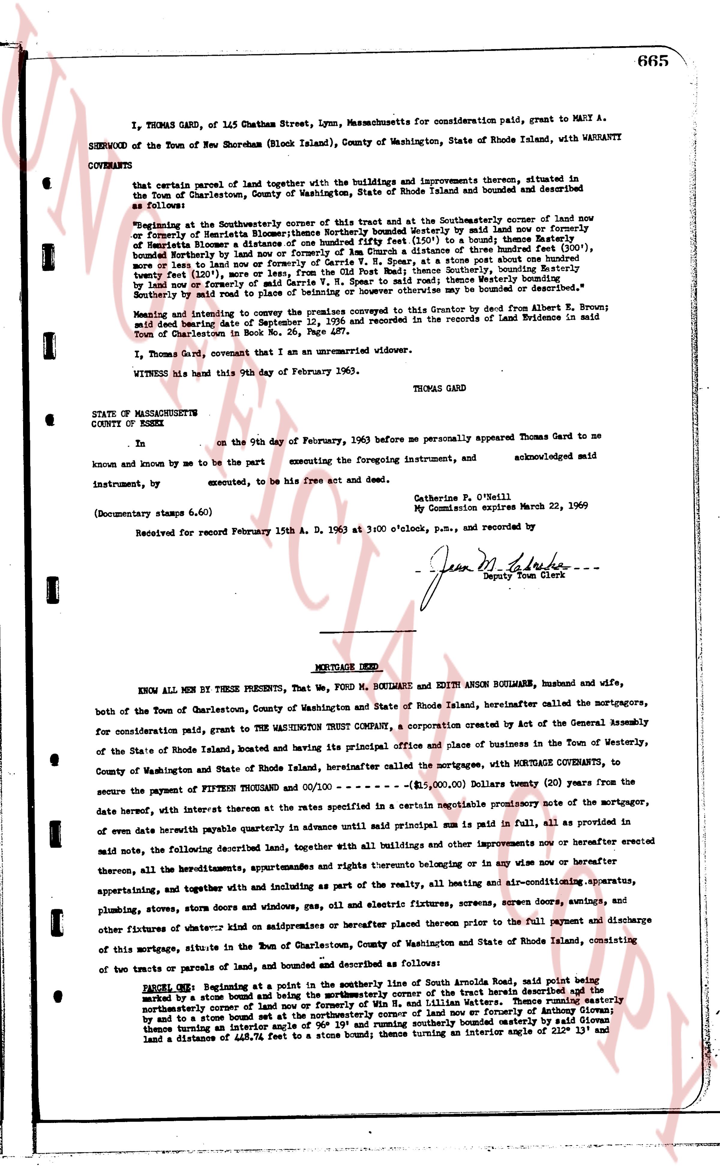
665
I, THOMAS GARD, of 145 Chatham Street, Lynn, Massachusetts for consideration paid, grant to MARY A.
SHERWOOD of the Town of New Shoreham (Block Island), County of Washington, State of Rhode Island, with WARRANTY
COVENANTS
that certain parcel of land together with the buildings and improvements thereon, situated in the Town of Charlestown, County of Washington, State of Rhode Island and bounded and described as follows:
Beginning at the Southeasterly corner of this tract and at the Southeasterly corner of land now or formerly of Henrietta Bloomer; thence Northerly bounded Westerly by said land now or formerly of Henrietta Bloomer to a stone bound 111.3 feet (300') in a boundary thence Easterly 80.0 feet bounded Northerly by land now or formerly of An Drum a distance of three hundred feet (300') more or less land now or formerly of Carrie V. [?], to a stone post which marks the boundary twenty feet (20') from the boundary of land now or formerly of Carrie V. [?], South to said mark; thence Southerly, bounding Easterly twenty feet (20') from the boundary of land now or formerly of Carrie V. [?], South to said mark; thence Westerly bounded Southerly by said land now or formerly of Carrie V. [?], to a stone bound; said tract may be bounded or described as "
Meeting and intending to convey the premises conveyed to this Grantor by deed from Albert B. Brown; said deed dating September 12, 1936 and recorded in the Records of Land Evidence in said Town of Charlestown in Book No. 26, Page 457.
I, Thomas Gard, covenant that I am an unmarried widower.
WITNESS his hand this 9th day of February 1963.
THOMAS GARD
STATE OF MASSACHUSETTS
COUNTY OF ESSEX
Ss.
on the 9th day of February, 1963 before me personally appeared Thomas Gard to me
known and known by me to be the party executing the foregoing instrument, and acknowledged said
Instrument, by executing, to be his free act and deed.
Catherine F. O'Neill
My Commission expires March 22, 1969
(Documentary stamps 6.60)
Received for record February 15th A. D. 1963 at 3:00 o'clock, p.m., and recorded by
- Jean M. [?] -
Deputy Town Clerk
----
MORTGAGE DEED
KNOW ALL MEN BY THESE PRESENTS, That We, FORD M. SOULMAN and EDITH ANNE SOULMAN, husband and wife, both of the Town of Charlestown, County of Washington and State of Rhode Island, hereinafter called the mortgagors, for consideration paid, grant to THE WASHINGTON TRUST COMPANY, a corporation created by Act of the General Assembly of the State of Rhode Island, located and having its principal office and place of business in the Town of Westerly, County of Washington and State of Rhode Island, hereinafter called the mortgagee, with MORTGAGE COVENANTS, to secure the payment of FIFTEEN THOUSAND and 00/100 --- ($15,000.00) Dollars (twenty (20) years from the date hereof, with interest thereon at the rates specified in a certain negotiable promissory note of the mortgagor, of oven date herewith payable in advance until said principal sum is paid in full, all of provided as in said note, the following described land, together with all buildings and any other improvements now or hereafter erected thereon, all the hereditaments, appurtenances and rights thereto belonging on or in any wise now or hereafter appertaining, and together with and including as part of the realty, all heating and air-conditioning apparatus, plumbing, stoves, storm doors and windows, gas, oil and electric fixtures, screens, screens door, antenna, and other fixtures of whatever kind now or superimposed or hereafter placed thereon prior to the full payment and discharge of this mortgage, situate in the Town of Charlestown, County of Washington and State of Rhode Island, consisting of two tracts or parcels of land, and bounded and described as follows:
PARCEL ONE: Beginning at a point in the southerly line of South Arnolda Road, said point being marked by a stone bound and at the northeasterly corner of the tract herein described the [?] easterly northeasterly corner of land now or formerly of Win H. and Lillian Waters; thence running easterly marked by and to a stone bound 111.3 feet (300') in a boundary now or formerly of Anthony Giovan; thence turning an interior angle of 96° 19' and running southerly bounded easterly by said Giovan land a distance of 448.74 feet to a stone bound; thence turning an interior angle of size 13° and
The page as recorded