The instrument's own words
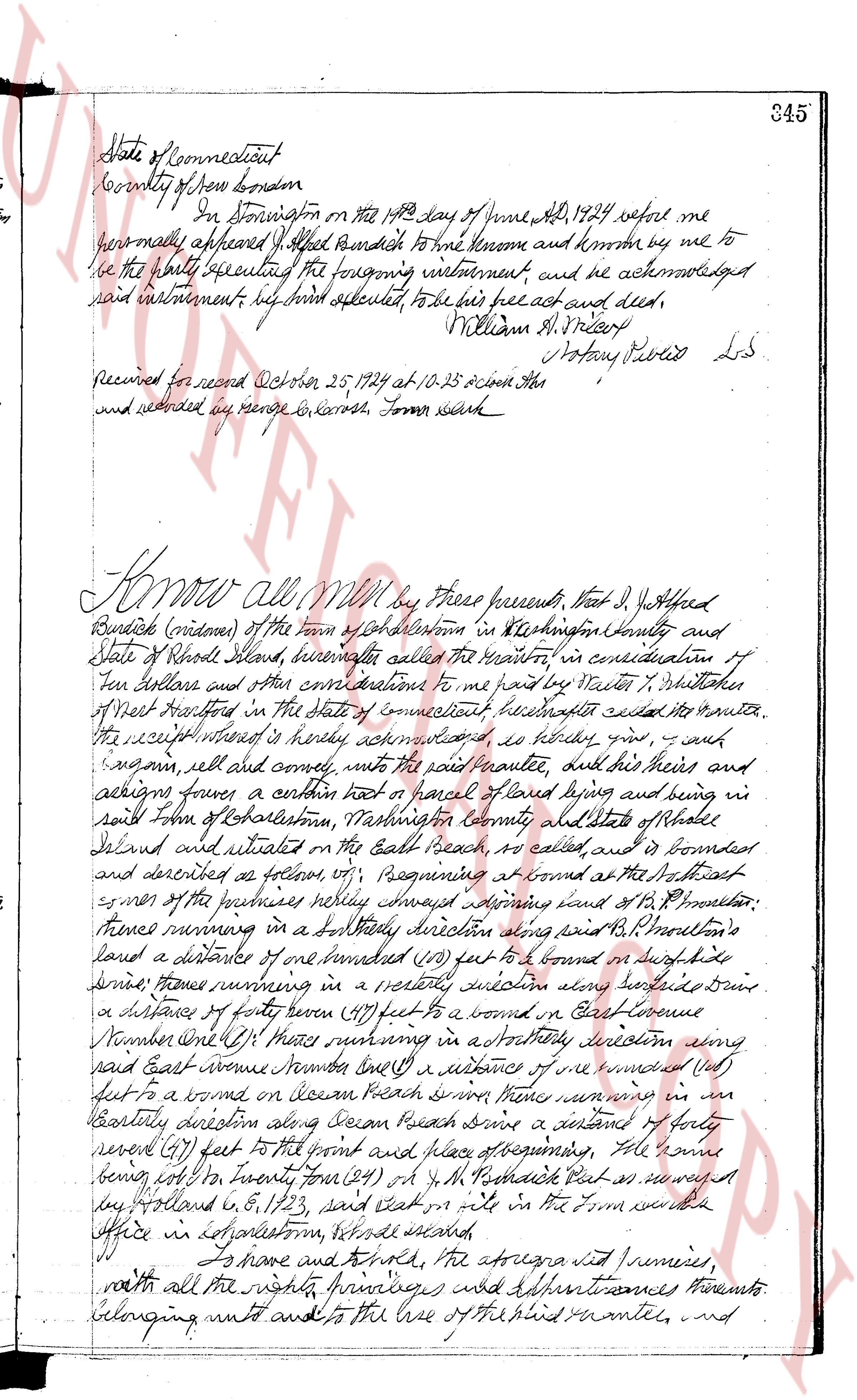
page 1
345
State of Connecticut
County of New London
In New London on the 14th day of June AD 1924 before me
personally appeared J. Alfred Burdick to me known and known by me to
be the party executing the foregoing instrument, and he acknowledged
said instrument, his hand affixed thereto, to be his free act and deed,
William A. Slocum
Notary Public L.S.
Received for record October 25, 1924 at 10.25 o'clock AM
and recorded by me George B. Karnoth Town clerk
Know all Men by these presents, that J. Alfred
Burdick (widower) of the Town of Charlestown in Washington County and
State of Rhode Island, hereinafter called the Grantor, in consideration of
ten dollars and other considerations to me paid by Sarah P. Whittaker
of New Hartford in the State of Connecticut hereinafter called the Grantee,
the receipt whereof is hereby acknowledged, as follows give and grant
assign sell and convey, into the said Grantee, and her heirs and
assigns forever a certain lot or parcel of landes being and being in
said Town of Charlestown, Washington County and State of Rhode
Island and situated on the East Beach, so called, and is bounded
and described as follows viz: Beginning at bound at the southeast
corner of the premises hereby conveyed adjoining land of H. P. Burdick
thence running in a northerly direction along said H. P. Burdick's
land a distance of one hundred (100) feet to a bound on south side
street, thence running in a westerly direction along said street a
distance of forty seven (47) feet to a bound on East Avenue
Number One (1) thence running in a northerly direction along
said East Avenue Number One (1) a distance of one hundred (100)
feet to a bound on Ocean Beach street, thence running in an
easterly direction along Ocean Beach street a distance of forty
seven (47) feet to the point and place of beginning, the same
being part of Lot number four (4) of M. P. Burdick's Plat as recorded
by Island C 8, 173, and said lot on the Town records at
Office in Charlestown, Rhode Island,
To have and to hold, the aforesaid premises,
with all the rights privileges and appurtenances thereunto
belonging unto and to the use of the said Grantee, and
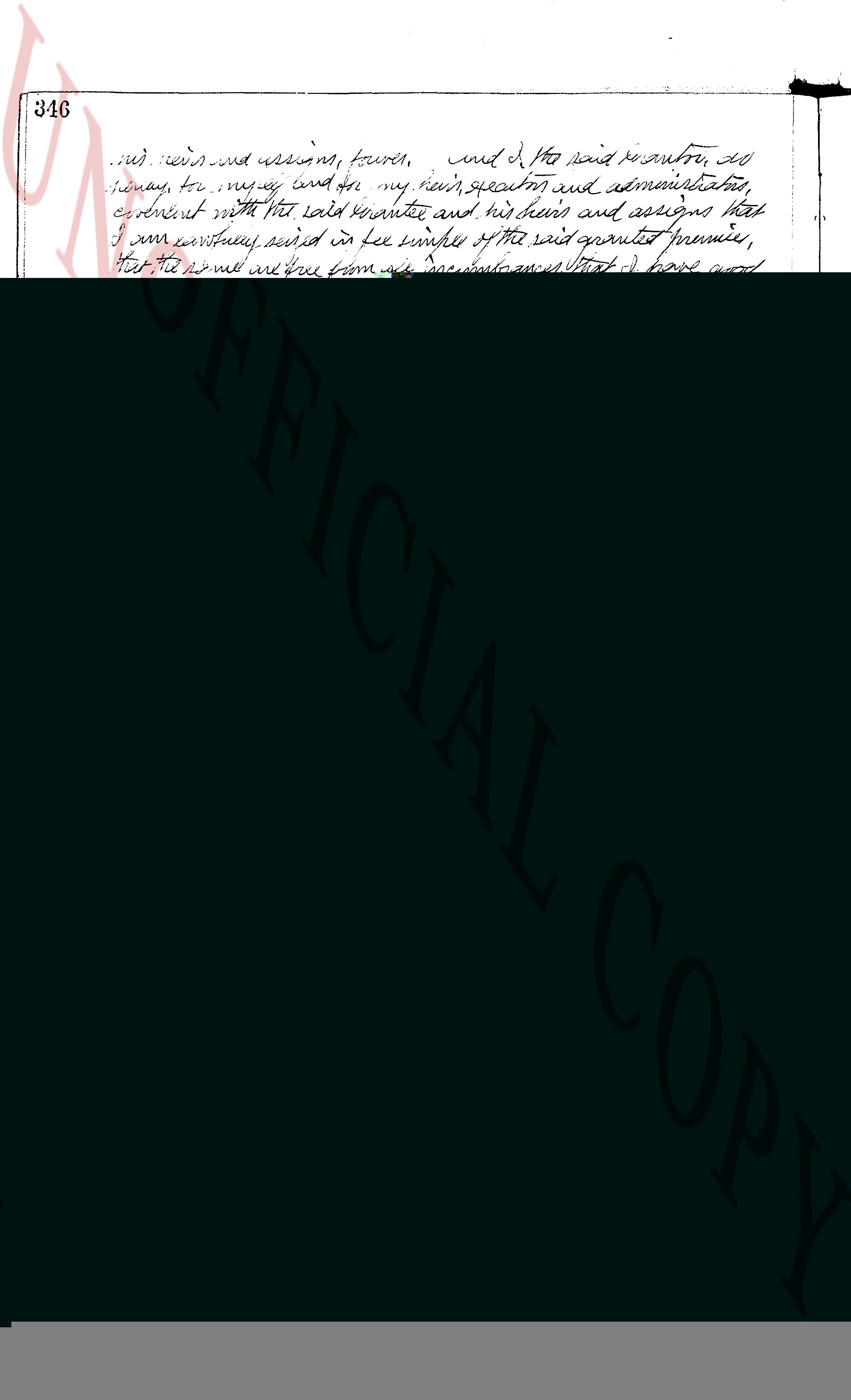
page 2
665
IN WITNESS WHEREOF, the said Corporation has caused these presents to be signed by its Treasurer
and Secretary, her unto duly authorized and the corporate seal to be hereunto affixed at Westerly, Rhode
Island, this 7th day of February, 1963.
CHARLESTOWN ESTATES, INC. (Corporate seal)
NELSON H. THORP ------------------- Treasurer
PAUL M. KEARNEY ------------------- Secretary
(Documentary stamps 1.65)
STATE OF RHODE ISLAND
COUNTY OF WASHINGTON )
Before me personally appeared Nelson H. Thorp, to
me known and known by me to be the Treasurer of said Corporation, and Paul M. Kearney, to me known and
known by me to be the Secretary of the said Corporation, and they acknowledged said instrument to be executed by
the free act and deed of said Corporation, and as well individually.
Rogers R. Trainor (Notarial Seal)
Notary Public
Received for record February 12th A. D. 1963 at 9:04 o'clock, a.m., and recorded by
(Signature)
Jean M. Clark
Deputy Town Clerk
We, Paul M. Kearney and Frances A. Kearney, husband and wife, both of the Town of Westerly, County
of Washington and State of Rhode Island, for consideration paid, grant to GUSTAV JOHNSON and ALICE I. JOHNSON,
husband and wife, both of West Hartford, County of Hartford and State of Connecticut, as Joint Tenants and
not Tenants in Common, meaning to the survivor with WARRANTY COVENANTS
a certain tract or parcel of land with all buildings and improvements thereon and including
the furnishing therein, situated on the westerly side of High School Road, all located at Quonoqu
containing South Basin, in the Town of Westerly, County of Washington and State of Rhode
Island, and bounded and described as follows, to wit:
Beginning at the northeast corner of the premises hereby conveyed, and the northwest corner of
land now or formerly of John & Mary-Lou-Louise (fio) meter, more or less; thence running southerly (50) feet, thence
running westerly one hundred forty (140) feet, more or less; thence turning an angle of ninety
(90) degrees and running northerly sixty-three (63) feet, more or less; thence turning an angle of ninety
(90) degrees running easterly one hundred forty (140) feet, to the point and place of beginning. Being all
together one hundred forty (140) feet wide and fifty (50) feet deep, and known as Lot #54 as shown and delineated on
a certain plan or plat entitled "The South Basin at
Quonoquitt, Westerly, R.I." drawn by R. S. Bartlett, New York, John L. Holland, C. E.,
Scale one inch equals one hundred feet, Revised July 7th, 1911.
Said tract or parcel of land is bounded Eastly by Highschool Road, southerly by land of Anne J.
Thorpe, westerly by land of Paul M. Kearney and Frances A. Kearney and northerly by Lot #55 and
in part by Lot #53 as all shown on the above mentioned plat.
Meaning and intending to convey a portion of the premises conveyed to these grantors by
Charlotte L. Doanealong, Conservator of the Proprietary of the Tract in W. Lycett, by deed dated
December 1st 1952 and duly recorded in the Land Evidence Records of the Town of Charlestown
in Book 34 Page 5.
WITNESS our hands this 7th day of February, 1963.
PAUL M. KEARNEY
FRANCES A. KEARNEY
(Documentary stamps 9.35)
STATE OF RHODE ISLAND, ETC. )
COUNTY OF WASHINGTON )
In Westerly on the 7th day of February, 1963 before me personally appeared Paul M. Kearney and
Frances A. Kearney to me known and known by me to be the parties executing the foregoing instrument, and
they acknowledged said instrument, by them executed, to be their free act and deed.
Nelson S. Thorp (Notarial Seal)
Notary Public
Received for record February 12th A. D. 1963 at 9:05 o'clock, a.m., and recorded by
(Signature)
Jean M. Clark
Deputy Town Clerk
The page as recorded