The instrument's own words
page 1 · read by Gemma vision
647
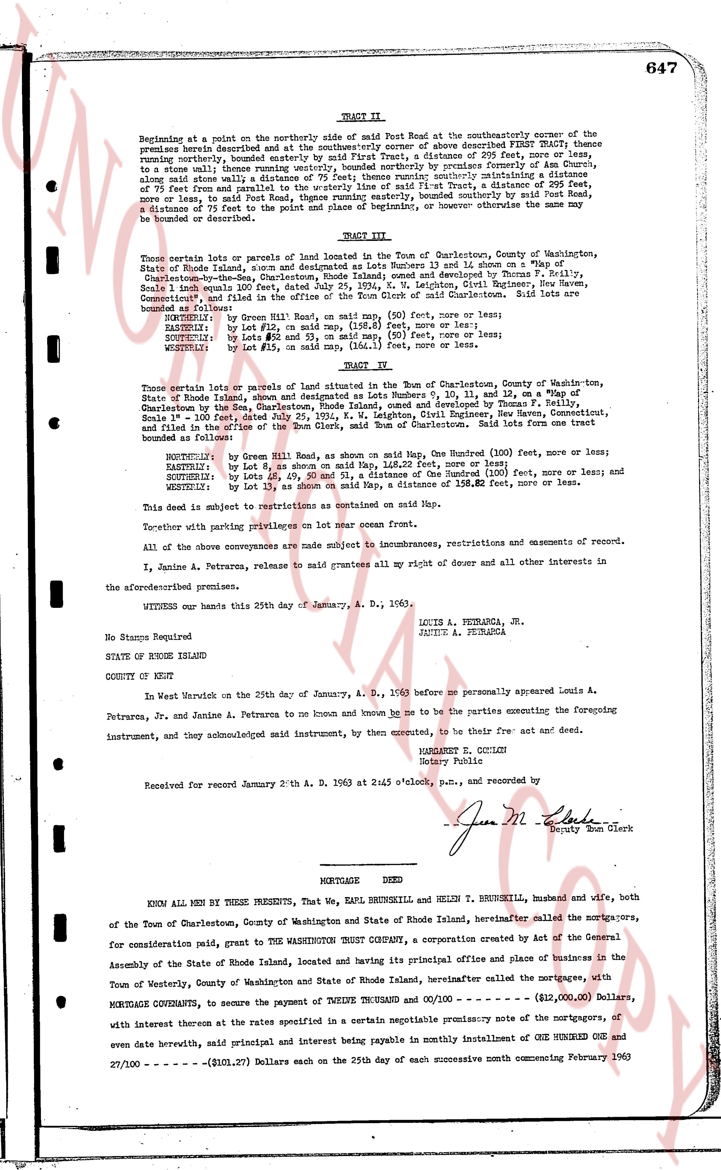
TRACT II.
Beginning at a point on the northerly side of said Post Road at the southeasterly corner of the premises herein described and at the southerly corner of above described FIRST TRACT; thence running northerly, bounded easterly by said First Tract, a distance of 295 feet, more or less, to a stone wall, thence running easterly along said stone wall by crossing former pasture, along said stone wall a distance of 75 feet; thence running southerly maintaining a distance of 75 feet from and parallel to the easterly line of said First Tract, a distance of 295 feet, more or less, to said Post Road; thence running easterly, bounded southerly by said Post Road, a distance of 75 feet to the point of beginning and place of origin, hereafter owe the name may be bounded or described.
TRACT III.
Those certain lot or parcels of land situated in the Town of Charlestown, County of Washington, State of Rhode Island, shown and designated as Lots Numbers 13 and 14, close on a "Map of Gladstone-on-the-Lake" Charlestown, R.I. surveyed and developed by Thomas F. Reilly, Scale 1 inch equals 100 feet, dated July 25, 1924, K. W. Leighton, Civil Engineer, New Haven, Connecticut, said map filed in the town clerk's office of said Charlestown. Said lots are bounded as follows:
NORTHERLY, by Lot 12, on said map, 158.6 feet, more or less;
EASTERLY, by Lot 12, on said map, 158.6 feet, more or less;
SOUTHERLY, by Lots #5 and #6, on said map, 158.6 feet, more or less;
WESTERLY, by Lot #11, on said map, 141.1 feet, more or less;
TRACT IV.
Those certain lot or parcels of land situated in the Town of Charlestown, County of Washington, State of Rhode Island, shown and designated as Lots Numbers 9, 10, 11, 12, and 15 on a "Map of Gladstone-on-the-Lake" Charlestown, R.I. surveyed and developed by Thomas F. Reilly, Scale 1 inch = 100 feet, dated July 25, 1924, K. W. Leighton, Civil Engineer, New Haven, Connecticut, and filed in the office of the Town Clerk, Charlestown, R.I. Said lots form one tract bounded as follows:
NORTHERLY, by Green Street on a map, the Hundred (100) feet, more or less;
EASTERLY, by Lot 8, as shown on said map, 144.62 feet, more or less;
SOUTHERLY, by Lots 16, 49, 50 and 51, a distance of the Hundred (100) feet, more or less; and
WESTERLY, by Lot 13, as shown on said map, a distance of 158.62 feet, more or less.
This deed is subject to restrictions as contained on said Map.
Together with parking privileges on lot near ocean front.
All of the above conveyances are made subject to incumbrances, restrictions and easements of record.
I, Janine A. Petrarca, reserve to maintain all my grants and of other and all interests in other to the aforementioned premises.
WITNESS our hands this 25th day of January, A. D., 1963.
LOUIS A. PETRARCA, JR.
JANINE A. PETRARCA
No Stamps Required
STATE OF RHODE ISLAND
COUNTY OF KENT
In West Warwick on the 25th day of January, A. D., 1963 before me personally appeared Louis A. Petrarca, Jr. and Janine A. Petrarca to me known and known me to be the parties executing the foregoing instrument, and they acknowledged said instrument, by their execution, to be their free act and deed.
MARGARET G. CICCONI
Notary Public
Received for record January 28th A. D. 1963 at 2:45 o'clock, p.m., and recorded by
June M. Elkins
Deputy Town Clerk
----
MORTGAGE DEED
KNOW ALL MEN BY THESE PRESENTS, That We, EARL BRUNSKILL and HELEN T BRUNSKILL, husband and wife, both of the Town of Charlestown, County of Washington and State of Rhode Island, hereinafter called the mortgagors, for consideration paid, grant to the WASHINGTON TRUST COMPANY, a corporation created by Act of the General Assembly of the State of Rhode Island, located and having its principal office and place of business in the Town of Westerly, County of Washington and State of Rhode Island, hereinafter called the mortgagee, with MORTGAGE COVENANTS, to secure the payment of TWELVE THOUSAND and 00/100 --- ($12,000.00) Dollars, with interest thereon at the rates specified in a certain negotiable promissory note of the mortgagors, of even date herewith, said principal and interest being payable in monthly installment of ONE HUNDRED ONE and 27/100 --- ($101.27) Dollars each on the 25th day of each successive month commencing February 1963
page 2 · read by Gemma vision
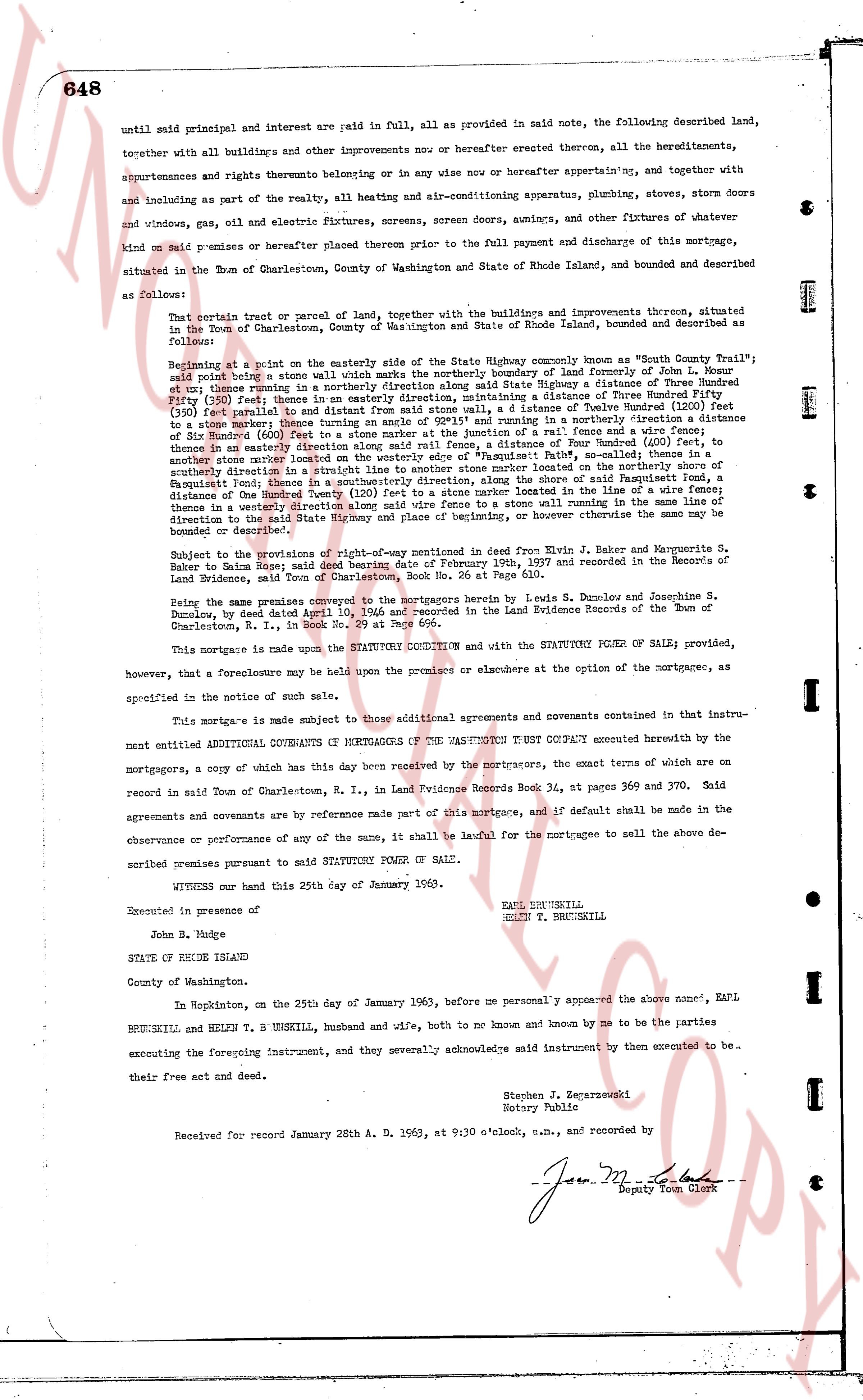
until said principal and interest are paid in full, all as provided in above noted, the following described land, together with all buildings and other improvements now or hereafter erected thereon, all the hereditaments, appurtenances and rights thereunto belonging or in any wise now or hereafter appertaining, and together with and including as part of the realty, all heating and air-conditioning apparatus, plumbing, stoves, storm doors and windows and glass, oil and electric fixtures, screens, screen doors, awnings, and other fixtures of whatever kind on said premises or hereafter placed therein prior to the full payment and discharge of this mortgage, situated in the Town of Charlestown, County of Washington and State of Rhode Island, bounded and described as follows:
That certain tract or parcel of land, together with the buildings and improvements thereunto, situated in the Town of Charlestown, County of Washington and State of Rhode Island, bounded and described as follows:
Beginning at a point on the easterly side of the State Highway commonly known as "South County Trail", said point being on a stone wall which marks the northerly boundary line of land of John L. Houre et ux; thence running in a northerly direction along said State Highway a distance of Three Hundred (300) feet to then running in a north easterly direction along a distance of Three Hundred (300) feet to then running in a north easterly direction along a distance of Three Hundred (300) feet parallel and to a distance of from said stone wall, a distance of Twelve Hundred (1200) feet to a then running in a south easterly direction along a distance of Three Hundred (300) feet to a distance of Six Hundred (600) feet to a stone marker at the junction of a fence and a vine fence; thence in an easterly direction along a distance of Three Hundred (300) feet to a stone wall; thence in a southerly direction along the westerly edge of the property "Faulkner's Path", said stone wall, thence in a southerly direction in a straight line to a stone wall located on the northerly boundary of the property "Faulkner's Path"; thence in a south westerly direction, along the shore of said Passaquogue Pond, a distance of the Hundred Twenty (120) feet to a stone marker located in the shore of the pond; thence in a westerly direction along a distance of Three Hundred (300) feet running in the same line of direction to the said State Highway and place of beginning, or otherwise however the same be bounded or described.
Subject to the provisions of the right-of-way mentioned in deed from Evin B. Baker and Marguerite S. Baker to Rain Moore Esq; said deed bearing date of February 19th, 1937 and recorded in the Records of Land Evidence, Town of Charlestown, R. I., in Book 24, page 560.
Being the same premises conveyed to the mortgagors herein by Lewis S. Dunley and Josephine S. Dunley, by deed dated April 10, 1956 and recorded in the Land Evidence Records of the Town of Charlestown, R. I., in Book 29, page 456.
This mortgage is made in the STATUTORY CONDITION and with the STATUTORY POWER OF SALE; provided, however, that a foreclosure may be held upon the premises or elsewhere at the option of the mortgagee, as specified in the notice of such sale.
This mortgage is made subject to those additional agreements and covenants contained in instrument entitled ADDITIONAL COVENANTS OF MORTGAGORS TO THE WASHINGTON TRUST COMPANY executed hereby with the mortgagors, a copy of which has this day been received by the mortgagors, the exact terms of which are on record in said Town of Charlestown, R. I., in Land Evidence Records Book 34, at pages 369 and 370. Said agreements and covenants are by reference made part of this mortgage, and if default shall be made in the observance or performance of any of the same, it shall be lawful for the mortgagee to sell the above described premises pursuant to said STATUTORY POWER OF SALE.
WITNESS our hand this 25th day of January 1963.
EARL BRUNSKILL
HELEN T. BRUNSKILL
Executed in presence of
John B. Judge
STATE OF RHODE ISLAND
County of Washington.
In Hopkinton, on the 25th day of January 1963, before me personally appeared the above named, EARL BRUNSKILL and HELEN T. BRUNSKILL, husband and wife, both to me and known by me to be the parties to executing the foregoing instrument, and they severally acknowledged said instrument to have been executed by them to be their free act and deed.
Stephen J. Czekarovski
Notary Public
Received for record January 28th A. D. 1963, at 9:30 o'clock, a.m., and recorded by
[Signature]
Deputy Town Clerk
The page as recorded