The instrument's own words
page 1 · read by Gemma vision
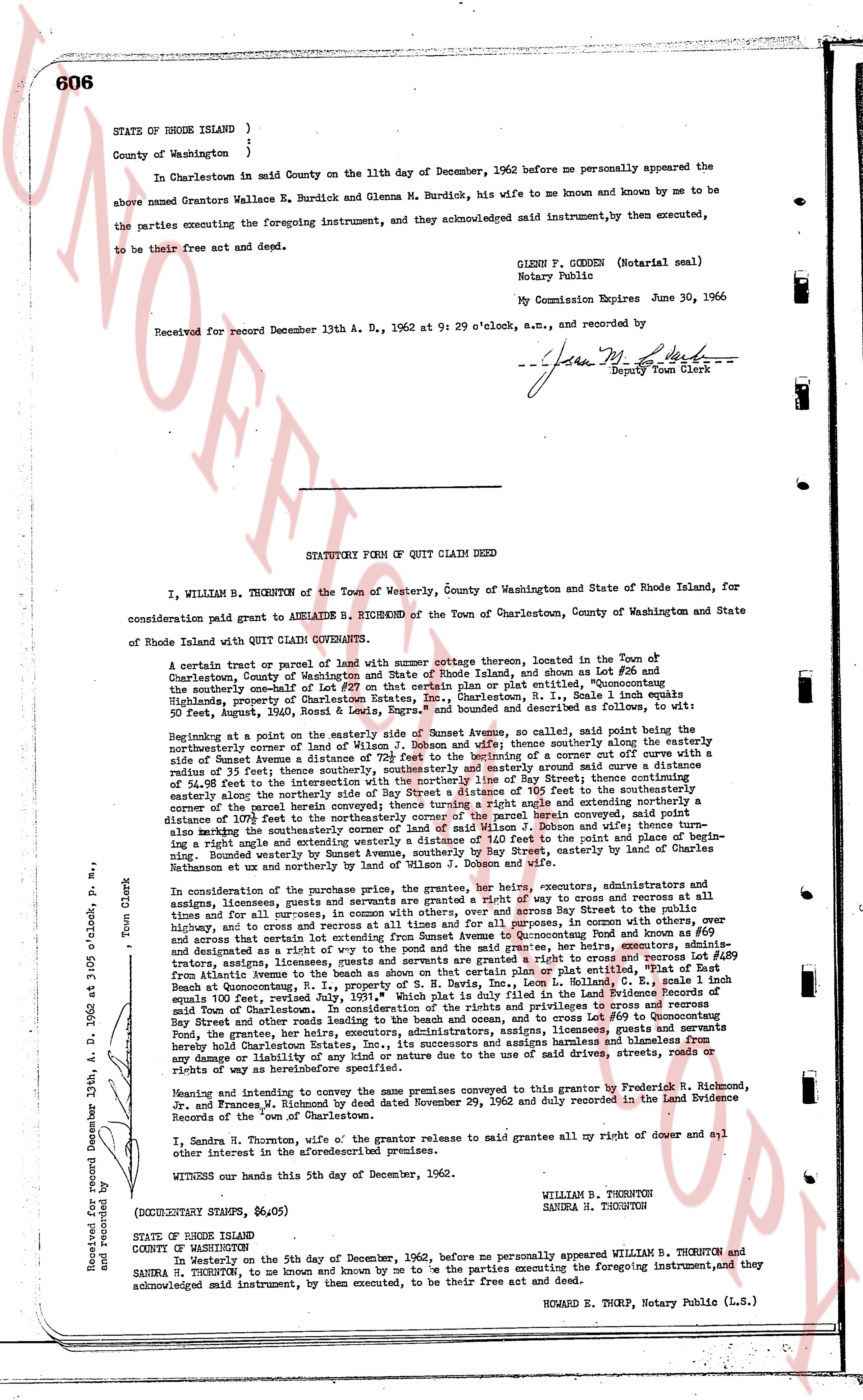
606
STATE OF RHODE ISLAND )
County of Washington }
In Charlestown said town on the 11th day of December, 1962 before me personally appeared the
above named Grantors Wallace E. Burdick and Glenna M. Burdick, his wife to me known and known by me to
be the parties executing the foregoing instrument, and they acknowledged said instrument, by them executed,
to be their free act and deed.
GLENN F. GODDEN (Notarial seal)
Notary Public
My Commission Expires June 30, 1966
Received for record December 13 A. D., 1962 at 2: 09 o'clock, a.m., and recorded by
/-Jean M. Herb-
Deputy Town Clerk
----
STATUTORY FORM OF QUIT CLAIM DEED
I, WILLIAM B. THORNTON of the Town of Westerly, County of Washington and State of Rhode Island, for
consideration paid grant to ADELAIDE B. RICHMOND of the Town of Charlestown, County of Washington and State
of Rhode Island with QUIT CLAIM COVENANTS.
A certain tract or parcel of land with summer cottage thereon, located in the Town of
Charlestown, County of Washington and State of Rhode Island and shown as lot #206 and
the northerly remainder of lot #205 on a certain subdivision plan or plat entitled, "Quonnocutting
Highlands, property of Charlestown Estates Inc., Charlestown, R.I., Scale 1 inch equals 80
feet, August 24, 1962," and is bounded and described as follows to wit:
Beginning at a point on the easterly side of Sunset Avenue, as so called, said point being the
northwesterly corner of the land of Wilson J. Dobson and wife; thence southerly along the easterly
side of Sunset Avenue a distance of 20 feet; thence southeasterly and southerly along said curve a distance
of 54.98 feet thereto; thence southeasterly along the easterly side of Bay Street, thence southeasterly a
distance of 54.98 feet to the intersection with the southeasterly corner of a distance of 105 feet to the southeasterly
easterly alone the northeasterly side of Bay Street, thence southeasterly a distance of 105 feet to the southeasterly
corner of the parcel herein conveyed thence turning a right angle and easterly on a line perpendicular
to said Bay Street a distance of 105 feet to the southeasterly corner of said parcel conveyed, said point
also marking the southeasterly corner of the land of Wilson J. Dobson and wife; and thence turn-
ing a right angle and running northwesterly a distance of 105 feet to the point of beginning. Bounded
on the west by Sunset Avenue, southerly by Bay Street, easterly by land of Charles
Rathman et ux and northerly by land of Wilson J. Dobson.
In consideration of the purchase price, the grantor, her heirs, executors, administrators and assigns,
by these presents, leases and grants a servitude and grant of a right of way to cross and access at all times,
and for all purposes, the land of the grantor, along the easterly side of Sunset Avenue, Bay Street in the Town
of Charlestown, and access to certain lot extending from Sunset Avenue to Quonnocutting Pond and to
the Quonnocutting Pond. In consideration of said grant, the grantor, her heirs, executors, adminis-
trators, assigns, licensees, grantees and servants grants a servitude and grant of a right of way on "Plat of East
Beach at Quonnocutting, R.I., property of S. H. Davis, Dec., Leon L. Colman, L.L.C., Scale 1 inch
equals 100 feet, August 24, 1962," along the easterly side of Sunset Avenue, Bay Street in the Town of
said Town of Charlestown. In consideration of the rights and privileges to cross and access
Bay Street and Sunset Avenue, the grantor, her heirs, executors, administrators, assigns, licensees,
Fond, the grantees, her heirs, executors, administrators, assigns, licensees, grantees and servants hereby
grant a servitude and grant of a right of way to cross and access Sunset Avenue and Bay Street without
any damage or liability of any kind or nature to the use of said drive, streets, roads or
rights of way as heretofore described.
Meaning and intending to convey the same premises conveyed to this grantor by Frederick H. Richmond,
Jr. and Frances W. Richmond his wife dated November 29, 1962 and duly recorded in the Land Evidence
Records of the Town of Charlestown.
I, Sandra H. Thornton, wife o' the grantor release to said grantee all my right of dower and all
other interest in the above described premises.
Witness our hands this 2nd day of December, 1962.
STATUTORY DAMPS, $6.05
WILLIAM B. THORNTON
SANDRA H. THORNTON
(STATE OF RHODE ISLAND
COUNTY OF WASHINGTON)
Before me on the 5th day of December, 1962, be personally appeared WILLIAM B. THORNTON and
SANDRA H. THORNTON, to me known and known by me to be the parties executing the foregoing instrument, and they
acknowledged said instrument, by them executed, to be their free act and deed.
RICHARD E. THORP, Notary Public (L.S.)
Received for record December 13th, A. D. 1962 at 3:05 P.M. and recorded by
Town Clerk
The page as recorded