The instrument's own words
page 1 · read by Gemma vision
605
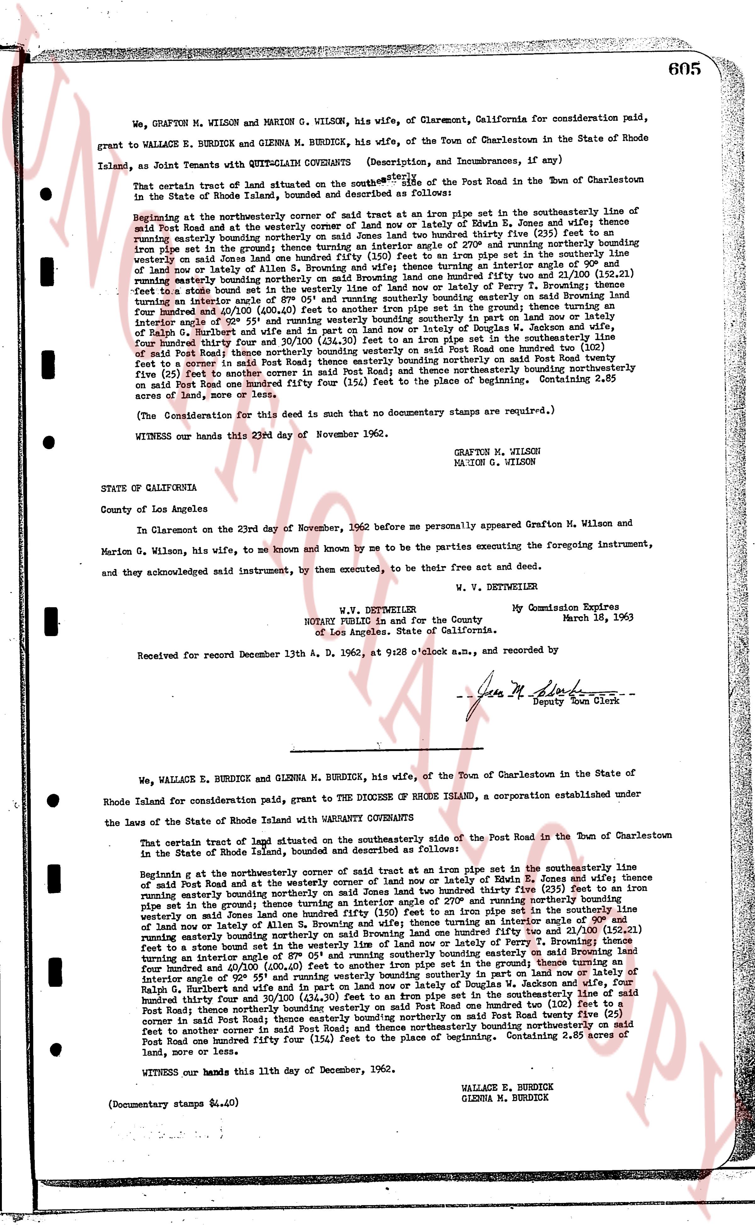
We, GRAFTON M. WILSON and MARION G. WILSON, his wife, of Claremont, California for consideration paid, grant to WALLACE E. BURDICK and GLENNA M. BURDICK, his wife, of the Town of Charlestown in the State of Rhode Island, as Joint Tenants with QUITCLAIM COVENANTS (Description, and Incumbrances, if any)
That certain tract of land situated on the southeasterly side of the Post Road in the Town of Charlestown in the State of Rhode Island and described as follows:
Beginning at the northeasterly corner of survey of said tract at an iron pipe set in the southeasterly line of said Post Road and at the westerly corner of land now or lately of Edna R. Jones and wife; thence running easterly said boundary northerly on said Jones land south forty one degrees thirty five (41 35') minutes running easterly bounding northerly on said Jones land south forty one degrees thirty five (41 35') minutes running easterly bounding northerly on said Jones land south forty one degrees thirty five (41 35') minutes running easterly bounding northerly on said Jones land south forty one degrees thirty five (41 35') minutes running easterly bounding northerly on said Jones land south forty one degrees thirty five (41 35') minutes running easterly bounding northerly on said Jones land south forty one degrees thirty five (41 35') minutes running easterly bounding northerly on said Jones land south forty one degrees thirty five (41 35') minutes running easterly bounding northerly on said Jones land south forty one degrees thirty five (41 35') minutes running easterly bounding northerly on said Jones land south forty one degrees thirty five (41 35') minutes running easterly bounding northerly on said Jones land south forty one degrees thirty five (41 35') minutes running easterly bounding northerly on said Jones land south forty one degrees thirty five (41 35') minutes running easterly bounding northerly on said Jones land south forty one degrees thirty five (41 35') minutes running easterly bounding northerly on said Jones land south forty one degrees thirty five (41 35') minutes running easterly bounding northerly on said Jones land south forty one degrees thirty five (41 35') minutes running easterly bounding northerly on said Jones land south forty one degrees thirty five (41 35') minutes running easterly bounding northerly on said Jones land south forty one degrees thirty five (41 35') minutes running easterly bounding northerly on said Jones land south forty one degrees thirty five (41 35') minutes running easterly bounding northerly on said Jones land south forty one degrees thirty five (41 35') minutes running easterly bounding northerly on said Jones land south forty one degrees thirty five (41 35') minutes running easterly bounding northerly on said Jones land south forty one degrees thirty five (41 35') minutes running easterly bounding northerly on said Jones land south forty one degrees thirty five (41 35') minutes running easterly bounding northerly on said Jones land south forty one degrees thirty five (41 35') minutes running easterly bounding northerly on said Jones land south forty one degrees thirty five (41 35') minutes running easterly bounding northerly on said Jones land south forty one degrees thirty five (41 35') minutes running easterly bounding northerly on said Jones land south forty one degrees thirty five (41 35') minutes running easterly bounding northerly on said Jones land south forty one degrees thirty five (41 35') minutes running easterly bounding northerly on said Jones land south forty one degrees thirty five (41 35') minutes running easterly bounding northerly on said Jones land south forty one degrees thirty five (41 35') minutes running easterly bounding northerly on said Jones land south forty one degrees thirty five (41 35') minutes running easterly bounding northerly on said Jones land south forty one degrees thirty five (41 35') minutes running easterly bounding northerly on said Jones land south forty one degrees thirty five (41 35') minutes running easterly bounding northerly on said Jones land south forty one degrees thirty five (41 35') minutes running easterly bounding northerly on said Jones land south forty one degrees thirty five (41 35') minutes running easterly bounding northerly on said Jones land south forty one degrees thirty five (41 35') minutes running easterly bounding northerly on said Jones land south forty one degrees thirty five (41 35') minutes running easterly bounding northerly on said Jones land south forty one degrees thirty five (41 35') minutes running easterly bounding northerly on said Jones land south forty one degrees thirty five (41 35') minutes running easterly bounding northerly on said Jones land south forty one degrees thirty five (41 35') minutes running easterly bounding northerly on said Jones land south forty one degrees thirty five (41 35') minutes running easterly bounding northerly on said Jones land south forty one degrees thirty five (41 35') minutes running easterly bounding northerly on said Jones land south forty one degrees thirty five (41 35') minutes running easterly bounding northerly on said Jones land south forty one degrees thirty five (41 35') minutes running easterly bounding northerly on said Jones land south forty one degrees thirty five (41 35') minutes running easterly bounding northerly on said Jones land south forty one degrees thirty five (41 35') minutes running easterly bounding northerly on said Jones land south forty one degrees thirty five (41 35') minutes running easterly bounding northerly on said Jones land south forty one degrees thirty five (41 35') minutes running easterly bounding northerly on said Jones land south forty one degrees thirty five (41 35') minutes running easterly bounding northerly on said Jones land south forty one degrees thirty five (41 35') minutes running easterly bounding northerly on said Jones land south forty one degrees thirty five (41 35') minutes running easterly bounding northerly on said Jones land south forty one degrees thirty five (41 35') minutes running easterly bounding northerly on said Jones land south forty one degrees thirty five (41 35') minutes running easterly bounding northerly on said Jones land south forty one degrees thirty five (41 35') minutes running easterly bounding northerly on said Jones land south forty one degrees thirty five (41 35') minutes running easterly bounding northerly on said Jones land south forty one degrees thirty five (41 35') minutes running easterly bounding northerly on said Jones land south forty one degrees thirty five (41 35') minutes running easterly bounding northerly on said Jones land south forty one degrees thirty five (41 35') minutes running easterly bounding northerly on said Jones land south forty one degrees thirty five (41 35') minutes running easterly bounding northerly on said Jones land south forty one degrees thirty five (41 35') minutes running easterly bounding northerly on said Jones land south forty one degrees thirty five (41 35') minutes running easterly bounding northerly on said Jones land south forty one degrees thirty five (41 35') minutes running easterly bounding northerly on said Jones land south forty one degrees thirty five (41 35') minutes running easterly bounding northerly on said Jones land south forty one degrees thirty five (41 35') minutes running easterly bounding northerly on said Jones land south forty one degrees thirty five (41 35') minutes running easterly bounding northerly on said Jones land south forty one degrees thirty five (41 35') minutes running easterly bounding northerly on said Jones land south forty one degrees thirty five (41 35') minutes running easterly bounding northerly on said Jones land south forty one degrees thirty five (41 35') minutes running easterly bounding northerly on said Jones land south forty one degrees thirty five (41 35') minutes running easterly bounding northerly on said Jones land south forty one degrees thirty five (41 35') minutes running easterly bounding northerly on said Jones land south forty one degrees thirty five (41 35') minutes running easterly bounding northerly on said Jones land south forty one degrees thirty five (41 35') minutes running easterly bounding northerly on said Jones land south forty one degrees thirty five (41 35') minutes running easterly bounding northerly on said Jones land south forty one degrees thirty five (41 35') minutes running easterly bounding northerly on said Jones land south forty one degrees thirty five (41 35') minutes running easterly bounding northerly on said Jones land south forty one degrees thirty five (41 35') minutes running easterly bounding northerly on said Jones land south forty one degrees thirty five (41 35') minutes running easterly bounding northerly on said Jones land south forty one degrees thirty five (41 35') minutes running easterly bounding northerly on said Jones land south forty one degrees thirty five (41 35') minutes running easterly bounding northerly on said Jones land south forty one degrees thirty five (41 35') minutes running easterly bounding northerly on said Jones land south forty one degrees thirty five (41 35') minutes running easterly bounding northerly on said Jones land south forty one degrees thirty five (41 35') minutes running easterly bounding northerly on said Jones land south forty one degrees thirty five (41 35') minutes running easterly bounding northerly on said Jones land south forty one degrees thirty five (41 35') minutes running easterly bounding northerly on said Jones land south forty one degrees thirty five (41 35') minutes running easterly bounding northerly on said Jones land south forty one degrees thirty five (41 35') minutes running easterly bounding northerly on said Jones land south forty one degrees thirty five (41 35') minutes running easterly bounding northerly on said Jones land south forty one degrees thirty five (41 35') minutes running easterly bounding northerly on said Jones land south forty one degrees thirty five (41 35') minutes running easterly bounding northerly on said Jones land south forty one degrees thirty five (41 35') minutes running easterly bounding northerly on said Jones land south forty one degrees thirty five (41 35') minutes running easterly bounding northerly on said Jones land south forty one degrees thirty five (41 35') minutes running easterly bounding northerly on said Jones land south forty one degrees thirty five (41 35') minutes running easterly bounding northerly on said Jones land south forty one degrees thirty five (41 35') minutes running easterly bounding northerly on said Jones land south forty one degrees thirty five (41 35') minutes running easterly bounding northerly on said Jones land south forty one degrees thirty five (41 35') minutes running easterly bounding northerly on said Jones land south forty one degrees thirty five (41 35') minutes running easterly bounding northerly on said Jones land south forty one degrees thirty five (41 35') minutes running easterly bounding northerly on said Jones land south forty one degrees thirty five (41 35') minutes running easterly bounding northerly on said Jones land south forty one degrees thirty five (41 35') minutes running easterly bounding northerly on said Jones land south forty one degrees thirty five (41 35') minutes running easterly bounding northerly on said Jones land south forty one degrees thirty five (41 35') minutes running easterly bounding northerly on said Jones land south forty one degrees thirty five (41 35') minutes running easterly bounding northerly on said Jones land south forty one degrees thirty five (41 35') minutes running easterly bounding northerly on said Jones land south forty one degrees thirty five (41 35') minutes running easterly bounding northerly on said Jones land south forty one degrees thirty five (41 35') minutes running easterly bounding northerly on said Jones land south forty one degrees thirty five (41 35') minutes running easterly bounding northerly on said Jones land south forty one degrees thirty five (41 35') minutes running easterly bounding northerly on said Jones land south forty one degrees thirty five (41 35') minutes running easterly bounding northerly on said Jones land south forty one degrees thirty five (41 35') minutes running easterly bounding northerly on said Jones land south forty one degrees thirty five (41 35') minutes running easterly bounding northerly on said Jones land south forty one degrees thirty five (41 35') minutes running easterly bounding northerly on said Jones land south forty one degrees thirty five (41 35') minutes running easterly bounding northerly on said Jones land south forty one degrees thirty five (41 35') minutes running easterly bounding northerly on said Jones land south forty one degrees thirty five (41 35') minutes running easterly bounding northerly on said Jones land south forty one degrees thirty five (41 35') minutes running easterly bounding northerly on said Jones land south forty one degrees thirty five (41 35') minutes running easterly bounding northerly on said Jones land south forty one degrees thirty five (41 35') minutes running easterly bounding northerly on said Jones land south forty one degrees thirty five (41 35') minutes running easterly bounding northerly on said Jones land south forty one degrees thirty five (41 35
The page as recorded