The instrument's own words
page 1 · read by Gemma vision
595
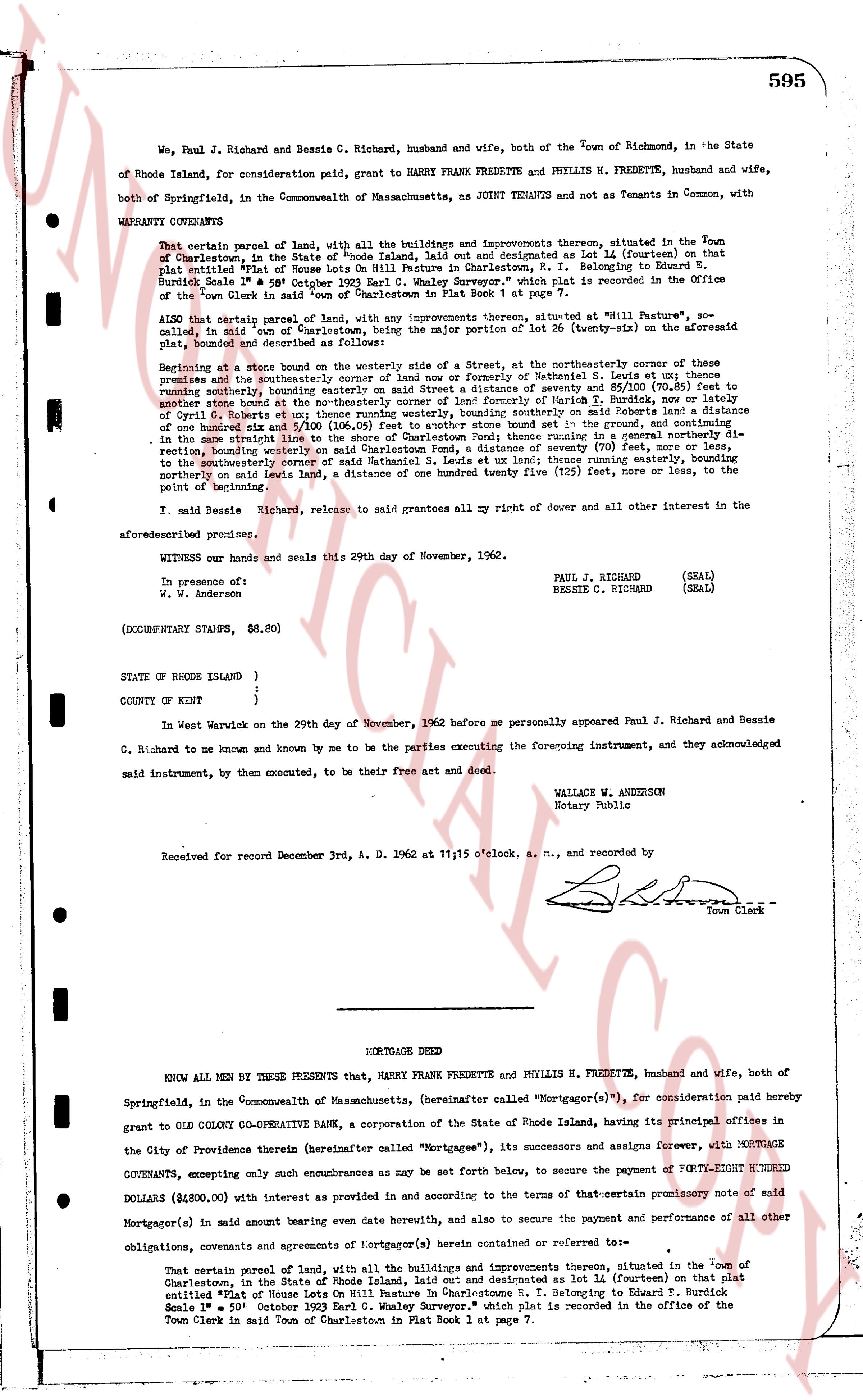
We, Paul J. Richard and Bessie C. Richard, husband and wife, both of the Town of Richmond, in the State of Rhode Island, for consideration paid, grant to HARRY FRANK FREDETTE and PHYLLIS H. FREDETTE, husband and wife, both of Springfield, in the Commonwealth of Massachusetts, as JOINT TENANTS and not as Tenants in Common, with WARRANTY COVENANTS
That certain parcel of land, with all the buildings and improvements thereon, situated in the Town of Charlestown, in the State of Rhode Island, laid out and designated as lot 14 (fourteen) on that plat entitled "Plot of House Lot On Mill Future in Charlestown, R. I." Belonging to Edward B. Surbick Hundick Scale 1" = 80' October 1923 Earl C. Whitey Surveyor," which plat is recorded in the Office of the Town Clerk in said Town of Charlestown in Plat Book 1 at page 7.
ALSO that certain parcel of land, with any improvements thereon, situated at "811 Battle"s, northwestly, in said Town of Charlestown, in the State of Rhode Island, designated as lot 26 (twenty-six) on the aforesaid plat, bounded and described as follows:
Beginning at a stone boundary on the westerly side of a Street, at the northwesterly corner of these premises and then southwesterly along the boundary of said land or now or formerly of Nathaniel S. Lewis et al; thence running southerly, bounding easterly on a Street distance of seventy & 85/100 (70.85) feet to another stone boundary at the northwesterly corner of a parcel of land, bounding easterly on a distance of one hundred five & 51/100 (105.51) feet running westerly, boundary southing on said Roberts land a distance of one hundred six & 51/100 (106.51) feet running southerly to a stone boundary in the record boundary of the premises then easterly along the boundary of said land or now or formerly of said Roberts; then running in a general northerly direction, bounding westerly on said Charlestown Pond, a distance of seventy (70) feet, more or less, to the southeasterly corner of a parcel of land, bounding easterly on these premises then running northerly bounding northerly on said Lewis land, a distance of one hundred twenty five (125) feet, more or less, to the point of beginning.
I, said Bessie C. Richard, release to said grantees all my right of dower and all other interest in the aforesaid premises.
WITNESS our hands and seals this 29th day of November, 1962.
PAUL J. RICHARD (SEAL)
BESSIE C. RICHARD (SEAL)
In presence of:
W. S. anderson
(DOCUMENTARY STAMPS, $8.80)
STATE OF RHODE ISLAND )
)
)
COUNTY OF KENT )
In West Warwick on the 29th day of November, 1962 before me personally appeared Paul J. Richard and Bessie C. Richard to me known and known by me to be the parties executing the foregoing instrument, and they acknowledged said instrument, by them executed, to be their free act and deed.
WALLACE W. ANDERSON
Notary Public
Received for record December 3rd, A. D. 1962 at 11:15 o'clock a. m., and recorded by
[Signature]
Town Clerk
----
MORTGAGE DEED
KNOW ALL MEN BY THESE PRESENTS that, HARRY FRANK FREDETTE and PHYLLIS H. FREDETTE, husband and wife, both of Springfield, in the Commonwealth of Massachusetts, (hereinafter called "Mortgagor(s)"), for consideration paid hereby grant to COLD COLONY CO-OPERATIVE BANK, a corporation of the State of Rhode Island, having its principal offices in the City of Providence therein (hereinafter called "Mortgagee"), its successors and assigns forever, with MORTGAGE COVENANTS, excepting only such encumbrances as may be set forth below, to secure the payment of FORTY-EIGHT HUNDRED DOLLARS ($4,800.00) with interest as provided in and according to the terms of that certain promissory note of said Mortgagor(s) in said amount having been given date herewith, and also to secure the payment and performance of all other obligations, covenants and agreements of Mortgagor(s) (a) herein stated or referred to therein:
That certain parcel of land, with all the buildings and improvements thereon, situated in the Town of Charlestown, in the State of Rhode Island, laid out and designated as lot 14 (fourteen) on that plat entitled "Plot of House Lot On Mill Future in Charlestown, R. I." Belonging to Edward B. Surbick Scale 1" = 80' October 1923 Earl C. Whitey Surveyor," which plat is recorded in the office of the Town Clerk in said Town of Charlestown in Plat Book 1 at page 7.
The page as recorded