The instrument's own words
page 1 · read by Gemma vision
594
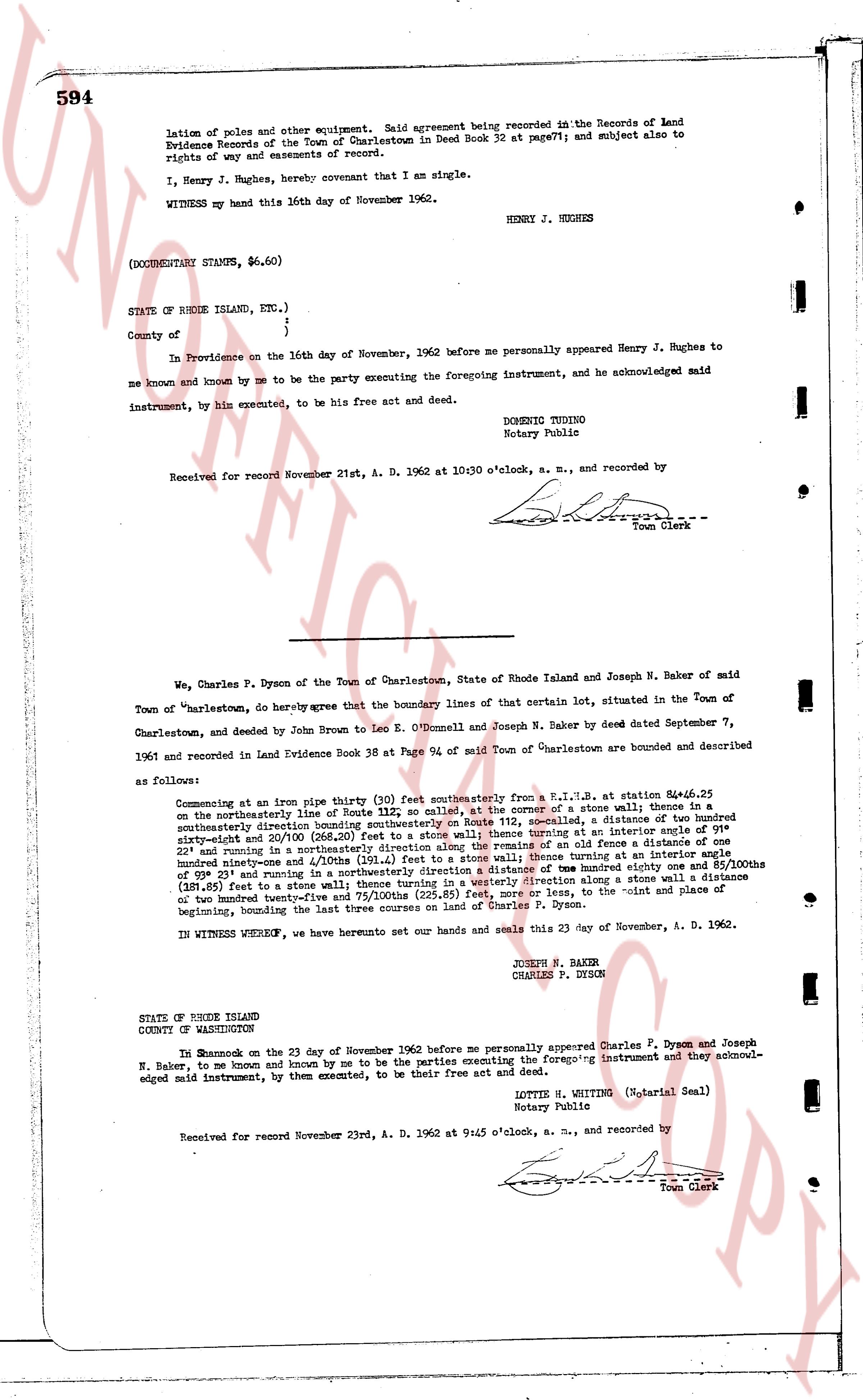
lation of poles and other equipment. Said agreement being recorded in the Records of Land Evidence Records of the Town of Charlestown in Deed Book 32 at page 77; and subject also to rights of way and easements of record.
I, Henry J. Hughes, hereby covenant that I am single.
WITNESS my hand this 16th day of November 1962.
HENRY J. HUGHES
(DOCUMENTARY STAMPS, $6.60)
STATE OF RHODE ISLAND, ETC.)
County of [?] )
) ss.
In Providence on the 16th day of November, 1962 before me personally appeared Henry J. Hughes to me known and known by me to be the party executing the foregoing instrument, and he acknowledged said instrument, by him executed, to be his free act and deed.
DOMENIC TOUINO
Notary Public
Received for record November 21st, A. D. 1962 at 10:30 o'clock, a. m., and recorded by
[Signature]
Town Clerk
----
We, Charles P. Dyson of the Town of Charlestown, State of Rhode Island and Joseph N. Baker of said Town of "Charlestown, do hereby agree that the boundary lines of that certain lot, situated in the Town of Charlestown, and deeded by John Brown to Leo E. O'Donnell and Joseph N. Baker by deed dated September 7, 1961 and recorded in Land Evidence Book 38 at Page 594 of said Town of Charlestown are bounded and described as follows:
Commencing at an Iron pipe thirty (30) feet southeasterly from a R.I.S.P. at station 84+6.25 on the northeasterly line of Route 112, so called, at the corner of a stone wall; a distance of one hundred twenty-three and 4/10ths (123.4) feet southeasterly along said wall to then a distance of two hundred sixty-4/10ths and 20/100 (260.20) feet to a stone wall; thence turning at an interior angle of one hundred twenty-three and 4/10ths (123.4) degrees to run north 45 degrees east 20 and 4/10ths (20.4) feet to a stone wall; thence turning at an interior angle of one hundred ninety-three and 4/10ths (193.4) feet to a stone wall; thence turning at an interior angle of one hundred ninety-three and 4/10ths (193.4) feet to a stone wall; thence turning at an interior angle of 90 degrees 23' and running in a northeasterly direction a distance of one hundred twenty-three and 10/10ths (123.10) feet along a stone wall in a southeasterly direction along a stone wall a distance of one hundred twenty-three and 4/10ths (123.4) feet to a stone wall; thence turning at an interior angle of one hundred twenty-three and 4/10ths (123.4) feet to a stone wall; thence turning at an interior angle of one hundred twenty-three and 4/10ths (123.4) feet to a stone wall; thence turning at an interior angle of 90 degrees 23' and running in a northeasterly direction a distance of one hundred twenty-three and 10/10ths (123.10) feet along a stone wall a distance of one hundred twenty-five and 75/100ths (125.85) feet, more or less, to the point and place of beginning, bounding the last three courses on land of Charles P. Dyson.
IN WITNESS WHEREOF, we have hereunto set our hands and seals this 23 day of November, A. D. 1962.
JOSEPH N. BAKER
CHARLES P. DYSON
STATE OF RHODE ISLAND
COUNTY OF WASHINGTON
On November on the 23 day of November 1962 before me personally appeared Charles P. Dyson and Joseph N. Baker to me known and known by me to be the parties executing the foregoing instrument and acknowledged said instrument, by them executed, to be their free act and deed.
LOTTIE H. WITTING (Notarial Seal)
Notary Public
Received for record November 23rd, A. D. 1962 at 9:45 o'clock, a. m., and recorded by
[Signature]
Town Clerk
The page as recorded