The Deed Walker · From Ninigret · Charlestown, Rhode Island land evidence, 1738 to today
Trail: 9358 › 7735

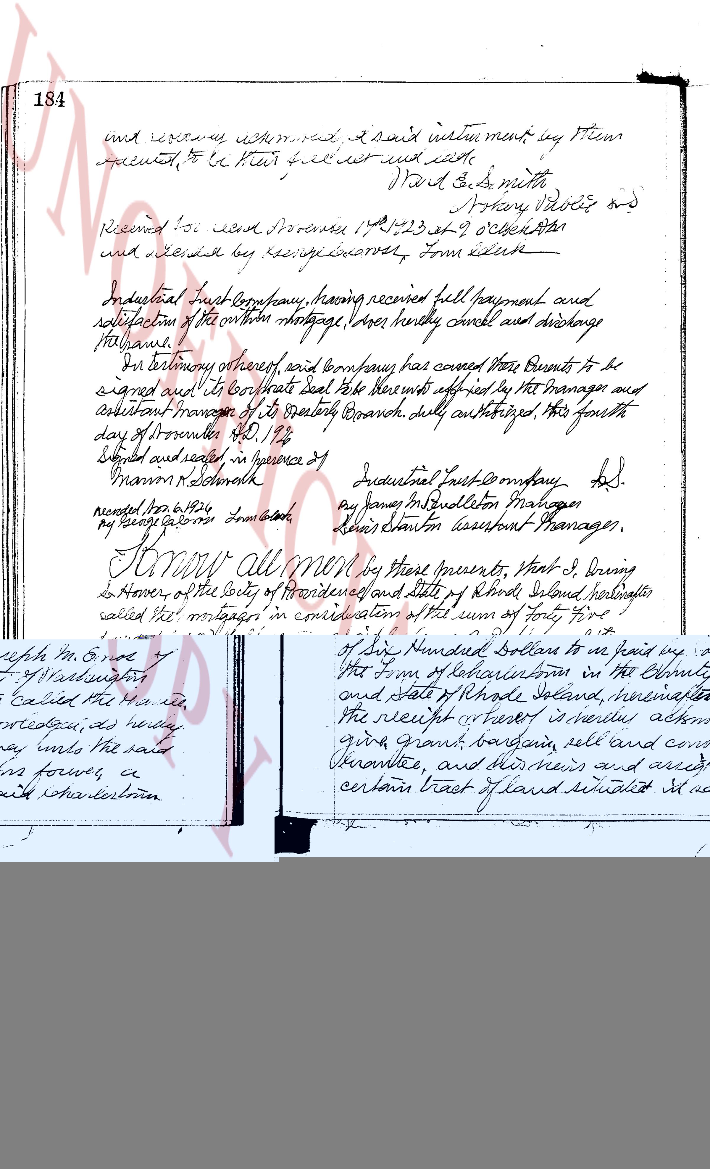
11/6/1926 · MORTGAGE DISCHARGE · book 21 page 184 doc 7735

From INDUSTRIAL TRUST CO life
To BRIGHTMAN ALICE M, BRIGHTMAN CHARLES S
Premises piece of land called "The Flat of Wetherell's" (East Greenwich)
Also on this page: MORTGAGE PECKHAM GEORGE B

Back — where this land came from

deed K. Burdick
“as the same premises conveyed to the mortgagor by deed from K. Burdick, dated May 16, 1814”
no book and page cited; the source is named, not recorded here
read by: gemma

Forward — where this land went

The grantee's later conveyances, by name — the man, not necessarily this land; the one that cites this deed as its source is the land

▶ 1926 · DEED · BRIGHTMAN CHARLES S; BRIGHTMAN ALICE M → BRIGHTMAN HENRY M · book 22 p 393
▶ 1926 · DEED · BRIGHTMAN CHARLES S; BRIGHTMAN ALICE M → SWANSON ERNESTINE E; SWANSON FRITZ J · book 22 p 395
▶ 1927 · DEED · BRIGHTMAN CHARLES S; BRIGHTMAN HENRY M; BRIGHTMAN LOIS L; BRIGHTMAN AL → · book 22 p 485
▶ 1928 · MORTGAGE · BRIGHTMAN CHARLES S; BRIGHTMAN ALICE M → WASHINGTON TRUST CO · book 23 p 218
▶ 1929 · MORTGAGE · BRIGHTMAN CHARLES S; BRIGHTMAN ALICE M → WASHINGTON TRUST COMPANY · book 24 p 33
▶ 1931 · MORTGAGE · BRIGHTMAN CHARLES S; BRIGHTMAN ALICE M → MORRIS PLAN CO OF RHODE ISLAND · book 25 p 52
▶ 1933 · DEED · BRIGHTMAN CHARLES S → BRIGHTMAN ALICE M · book 25 p 260
▶ 1933 · MORTGAGE · BRIGHTMAN CHARLES S; BRIGHTMAN ALICE M → WESTERLY LUMBER CO · book 25 p 270
▶ 1933 · MORTGAGE · BRIGHTMAN CHARLES S; BRIGHTMAN ALICE M → PERRIN CLIFFORD E; PERRIN WALTER L · book 25 p 274
▶ 1934 · MORTGAGE · BRIGHTMAN CHARLES S; BRIGHTMAN ALICE M → HOME OWNERS LOAN CORP · book 25 p 470
▶ 1935 · MORTGAGE ASSIGNMENT · WESTERLY LUMBER CO; BRIGHTMAN ALICE M → ASHAWAY NATIONAL BANK · book 26 p 54
▶ 1936 · DEED · BRIGHTMAN CHARLES S; BRIGHTMAN ALICE M → BROWN IRIS C · book 26 p 438
▶ 1936 · RELEASE STANDARD · ASHAWAY NATIONAL BANK; BRIGHTMAN ALICE M → WESTERLY LUMBER CO · book 26 p 439
▶ 1936 · MORTGAGE · BRIGHTMAN CHARLES S; BRIGHTMAN ALICE M → ASHAWAY NATIONAL BANK · book 26 p 440
▶ 1937 · DEED · BRIGHTMAN CHARLES S; BRIGHTMAN HENRY M; BRIGHTMAN HENRY S; BRIGHTMAN K → WILBUR MARY A · book 27 p 148
▶ 1938 · DEED · BRIGHTMAN CHARLES S; BRIGHTMAN ALICE M → BROWN ALBERT M · book 27 p 308

The instrument's own words

page 1
184 and recovery acknowledged, I said instrument by them executed, to be their full and void waste. Ward & S. Smith Notary Publics and Received for me and stored 1742/23 at 9 October 1824 and delivered by carriage carrier, Tom Liddell Industrial Trust Company, having received full payment and satisfaction of the within mortgage, does hereby cancel and discharge the same. In testimony whereof, said company has caused these presents to be signed and sealed; and its corporate seal to be hereunto affixed by the Managers and Assistant Managers of its Quarterly Branch, duly authorized, this fourth day of November A.D. 1924. Signed and sealed in presence of Industrial Trust Company, L.S. Marion N. Schmidt by James P. Budleton Manager and by Lewis Stanton Assistant Manager. recorded Nov 6, 1924 by my secretary Tom Liddell Know all men by these presents, that I, Bruno de Honor of the city of Providence and state of Rhode Island hereinafter called the "mortgagor" in consideration of the sum of forty five hundred dollars $4500 to be paid by George B. Redfield of the city of Providence and state of Rhode Island hereinafter called the "mortgagee", the receipt thereof hereby acknowledged, do remise, release, quit claim, sell and convey unto the said mortgagor and his heirs and assigns and friends forever, those lots or parcels of land, with any buildings and improvements thereon, situate in the town of East Greenwich in the state of Rhode Island, and more particularly described as follows: That piece of land, soil and stone described as follows: May seven 1814 That piece of land called "The Flat of Wetherell's" lies on N.W. boundary party, Tom Wetherell, east boundary, S.M. the ground survey, may "1814" and recorded in the records of said town as follows in page cited as form in Deed book 18 at page 18, Deed book 18, page 18 on the line on which it measures one hundred and one rods latitude and longitude that runs exactly to the boundary from long, and second, then running southeasterly on 1/4 right of said line being measured twenty (20) feet more or less and boundary on the six six of said plot two hundred fifteen (215) feet measured, and further otherwise bounded and abutted as the same premises conveyed to the mortgagor by deed from K. Burdick, dated May 16, 1814 and described in

The page as recorded
page 1

deed_walker_v1.9_2026-10-10 · the index is the town's own (i2l.uslandrecords.com); transcripts, chains and the assessor's cards are the Perry Machine's reading of it. Where the record we hold runs out, the page says so.