The instrument's own words
page 1
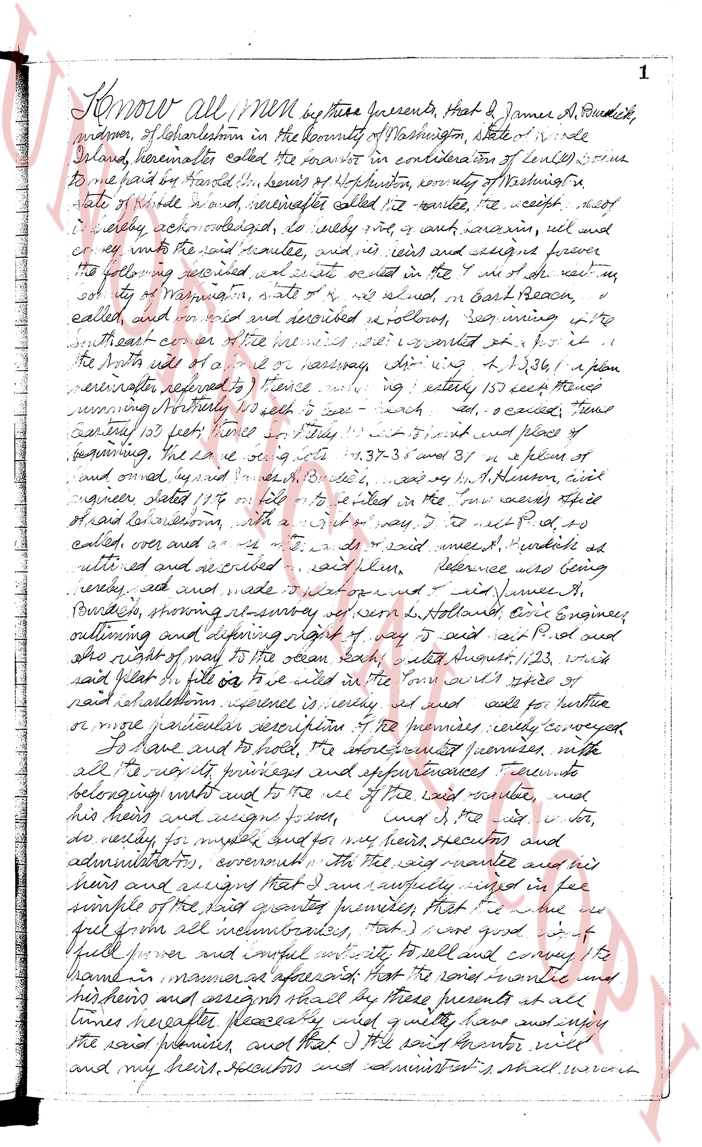
Know all men by these presents, That I James A. Burdick,
proprietor, of Charlestown in the County of Washington, state of Rhode
Island, hereinafter called the grantor in consideration of ten dollars paid
to me paid by Harold L. Simmons of Hotton, county of Washington, state
of Rhode Island named hereinafter called the grantee, the receipt of
which hereby acknowledged, do hereby grant and convey, sell and
convey unto the said grantee, and his heirs and assigns forever
the following described estate situated in the 1st district of the town of
county of Washington, state of Rhode Island, in East Peace,
called and known as revised and recorded bookstore, being situate in
the southeast corner of the house where it was built on for it
the North side of a road or highway, directing N 41 23/61 w a plan
hereinafter referred to 1 fence running easterly 150 feet more or
less running Northerly 110 feet 0 inches east 100 feet, o’clock, then
easterly 105 feet then Northerly 110 feet 0 inches and south of
beginning, the line runs north 1 37 3 and south 31 w a plan of
and owned by James A. Burdick, and by H. Hinson, civil
engineer dated 17/4 on file in the registry of the town aforesaid
of Charlestown, with a map of the same I do next P. L. to
catch over and as a T. S. A. of said named J. Burdick as
until end and as recorded with reference being
carried out and made into a map drawn on and signed James A.
Burdick, showing its survey as seen by H. Hinson, Civil Engineer,
outlining and defining right of way 5 feet wide Part P. L. and
the right of way to the ocean railway, said length 1,123, with
said plan on file in the town office in the town aforesaid
of said Charlestown property is hereby and as such for further
or more particular descriptions of the premises hereby conveyed
To have and to hold, the aforementioned premises, with
all the rights privileges and appurtenances thereunto
belonging unto and to the use of the said grantee, and
his heirs and assigns forever, and this is my act and
do hereby, for myself and for my heirs, executors and
administrators, covenant that the said grantee and his
heirs and assigns that I am and lawfully seized in fee
simple of the said grant premises, that I am free from all
full power and lawful authority to sell and convey the
same in manner aforesaid that the said grantee and
his heirs and assigns shall by these presents at all
times hereafter peaceably and quietly have and enjoy
the said premises, and that I the said grantor will
and my heirs, executors and administrators shall warrant
page 2
2
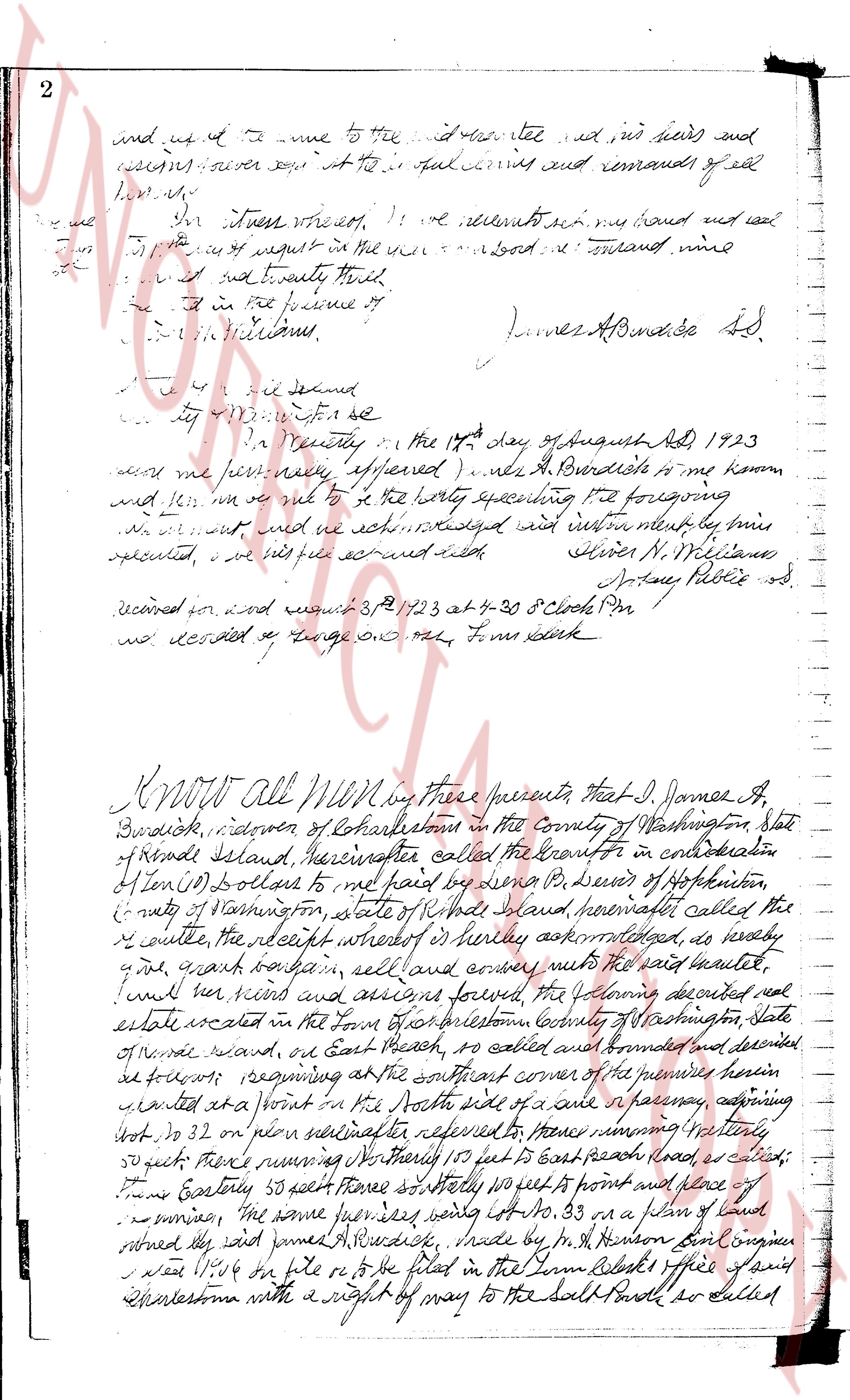
and set it at the time to the said grantee and his heirs and
assigns forever quit claim to all that certain and remains of said
land.
In witness whereof we have executed our hand and seal
to this quit claim in the year of our Lord one thousand nine
hundred and twenty three.
And in the presence of
[Signature]
James A. Burdick sd.
State of Rhode Island
County of Providence ss.
Before me personally appeared Mrs. A. Burdick to me known
and known to me to be the party executing the foregoing
instrument and acknowledged and executed the same to be her
act and deed.
Given under my hand and seal
Oliver N. Williams
Notary Public sd.
received for and recorded 3rd Oct 1823 at 4-30 o'clock PM
and recorded by George G. Hall, Town Clerk
KNOW All Men by these presents that I, James A.
Burdick, widower of Charlestown in the County of Washington, State
of Rhode Island, hereinafter called the grantor in consideration
of Ten (10) Dollars to me paid by Lena B. Seer of Hopkinton,
County of Washington, state of Rhode Island, hereinafter called the
grantee, the receipt whereof I hereby acknowledge, do hereby
give, grant bargain sell and convey unto the said grantee,
unl her heirs and assigns forever the following described real
estate located in the Town of Charlestown County of Washington State
of Rhode Island, on East Beach road, as called and bounded and described
as follows: beginning at the southeast corner of the premises herein
granted at a point in the South side of a road in a pasture, adjoining
Lot no. 32 on plan hereinafter referred to thence running easterly
50 feet; thence running Northerly 105 feet to East beach road, as called;
thence Easterly 50 feet thence Southerly 105 feet to a point of place of
beginning, the same parcels being marked Lot no. 33 on a plan of land
entitled the James A. Burdick, made by Mr. H. Benson Civil Engineer
and filed in the Town Clerk's office said
Charlestown with a right of way to the Salt Pond as labeled
The page as recorded