The instrument's own words
page 1 · read by Gemma vision
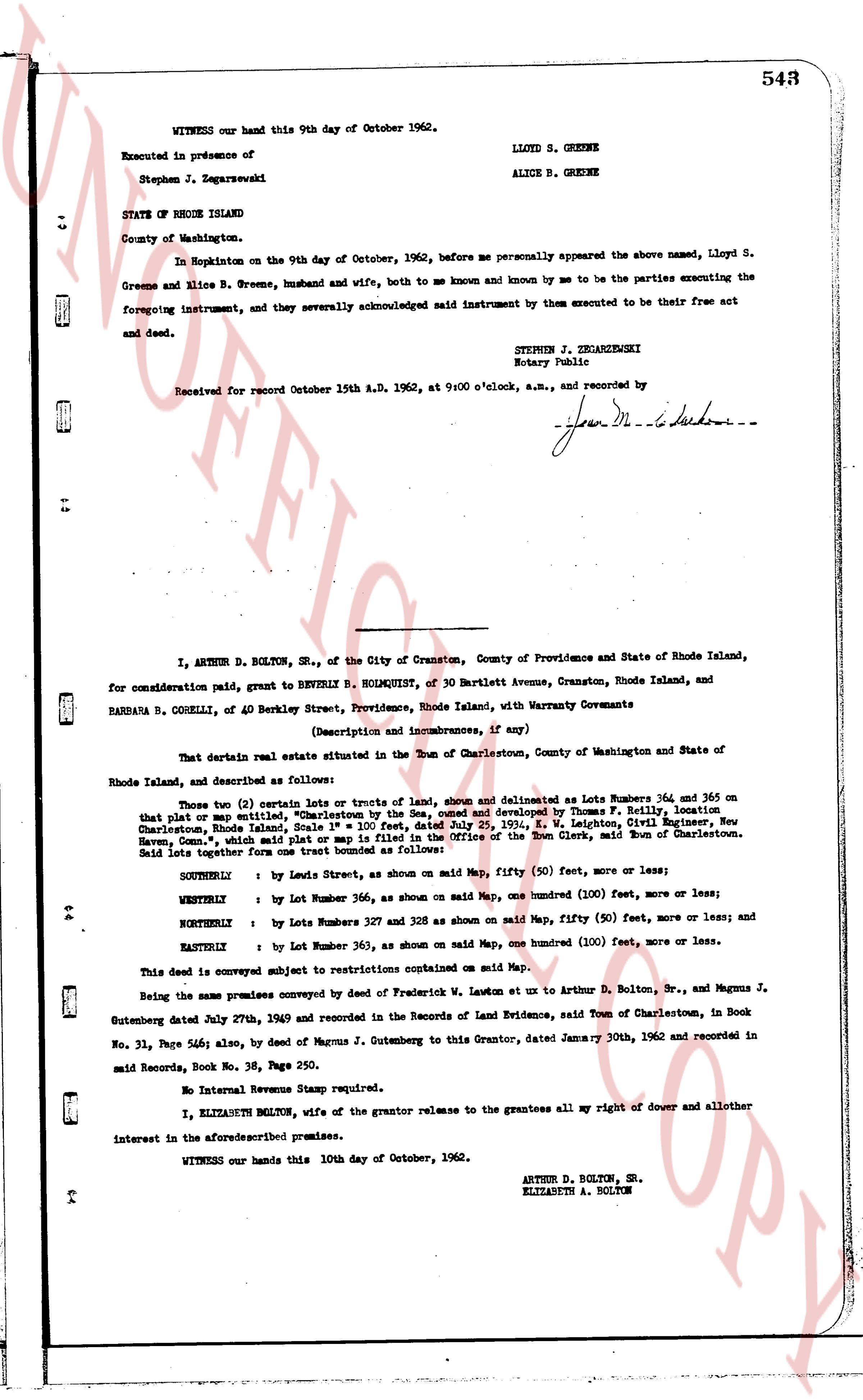
WITNESS our hand this 9th day of October 1962.
LLOYD S. GREENE
ALICE B. GREENE
Executed in presence of
Stephen J. Zegarzewski
STATE OF RHODE ISLAND
County of Washington.
In Hopkinton on the 9th day of October, 1962, before me personally appeared the above named, Lloyd S. Greene and Alice B. Greene, husband and wife, both to me known and known by me to be the parties executing the foregoing instrument, and they severally acknowledged said instrument by them executed to be their free act and deed.
STEPHEN J. ZEGARZEWSKI
Notary Public
Received for record October 15th A.D. 1962, at 9:00 o'clock, a.m., and recorded by
[signature]
----
I, ARTHUR D. BOLTON, SR., of the City of Cranston, County of Providence and State of Rhode Island, for consideration paid, grant to BEVERLY B. HOLMQUIST, of 30 Bartlett Avenue, Cranston, Rhode Island, and BARBARA B. CORELLI, of 40 Berkeley Street, Providence, Rhode Island, with Warranty Covenants
(Description and improvements, if any)
That certain real estate situate in the Town of Charlestown, County of Washington and State of Rhode Island, and described as follows:
Those two (2) certain Lots or tracts of Land, shown and denominated as Lots Numbers 364 and 365 on that plat or map entitled, "Charlestown by the Sea, owned and developed by Thomas F. Belloni" dated Charlestown, Rhode Island, Sept. 1st, 1936, and approved July 29, 1936, E. W. Leighton, Civil Engineer, New Haven, Conn., said plat or map is filed in the Office of the Town Clerk, said Town of Charlestown.
Said lots together form one tract bounded as follows:
SOUTHERLY : by Lewis Street, as shown on said Map, fifty (50) feet, more or less;
WESTERLY : by Lot Number 356, as shown on said Map, one hundred (100) feet, more or less;
WESTERLY : by Lots Numbers 327 and 328 as shown on said Map, fifty (50) feet, more or less; and
NORTHERLY : by Lot Numbers 363, as shown on said Map, one hundred (100) feet, more or less.
EASTERLY : by Lot Number 363, as shown on said Map, one hundred (100) feet, more or less.
This deed is conveyed subject to restrictions contained on said Map.
Being the same premises conveyed by deed of Frederick W. Lawton et ux to Arthur D. Bolton, Sr., and Magnus J. Gutenslager dated July 29th, 1940 and recorded in the Records of Land Evidence, said Town of Charlestown, in Book No. 31, Page 546; also, by deed of Magnus J. Gutenslager to this Grantor, dated January 30th, 1962 and recorded in said Records, Book No. 38, Page 250.
No Internal Revenue Stamps stamped requisite.
I, ELIZABETH BOLTON, wife of the grantor release to the grantees all my right of dower and all other interest in the aforesaid premises.
WITNESS our hands this 10th day of October, 1962.
ARTHUR D. BOLTON, SR.
ELIZABETH A. BOLTON
page 2 · read by Gemma vision
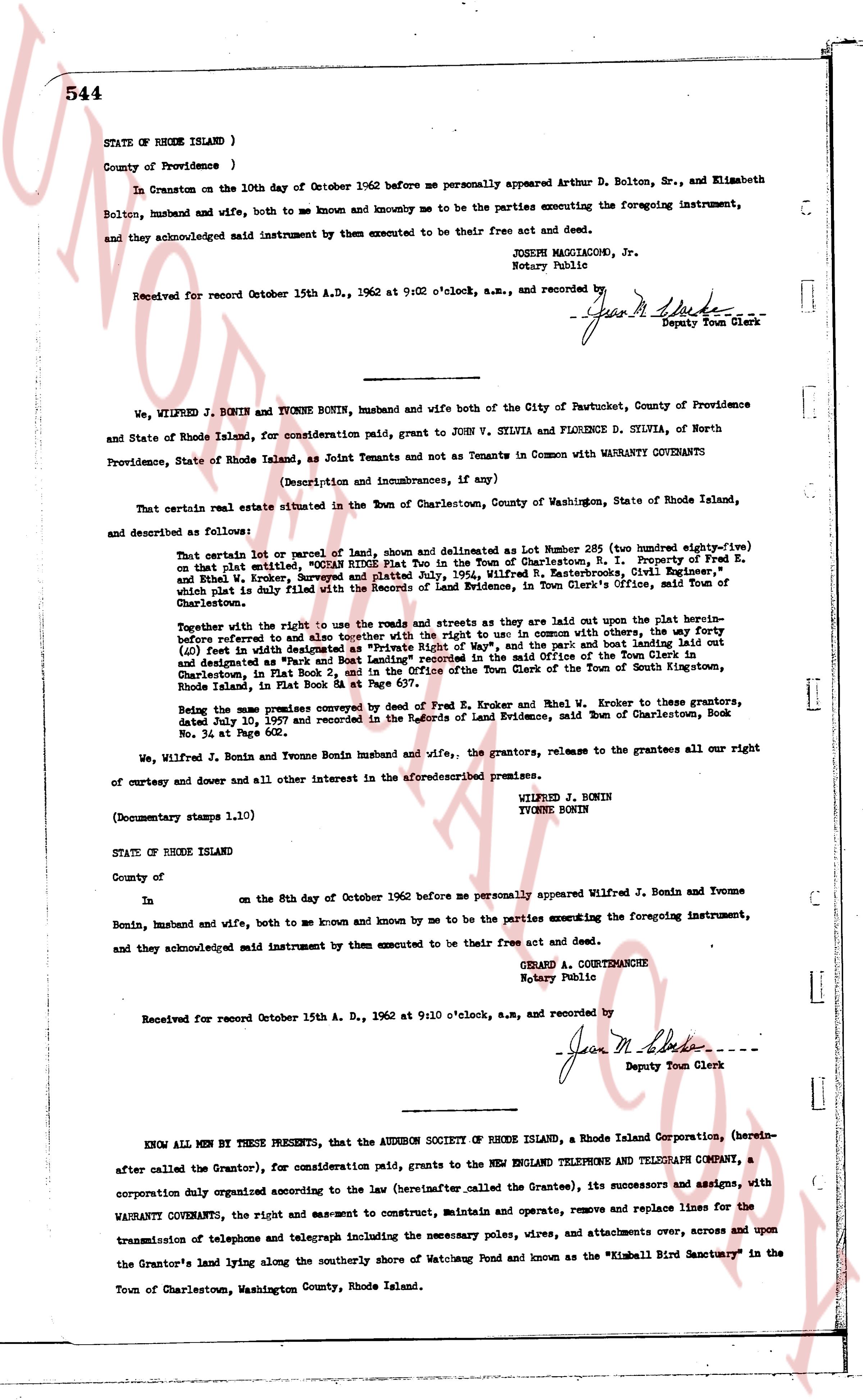
544
STATE OF RHODE ISLAND )
County of Providence )
In Cranston on the 10th day of October 1962 before me personally appeared Arthur D. Bolton, Sr., and Elizabeth Bolton, husband and wife, both to me known and knownby me to be the parties executing the foregoing instrument, Bolton, husband and acknowledged said instrument by them executed to be their free act and deed.
JOSEPH MAGGIACOMI, Jr.
Notary Public
Received for record October 15th A.D., 1962 at 9:02 o'clock, a.m., and recorded by
[Signature]
Deputy Town Clerk
----
We, WILFRED J. BORIN and YVONNE BORIN, husband and wife both of the City of Pawtucket, County of Providence and State of Rhode Island, for consideration paid, grant to JOHN V. SILVIA and FLORENCE D. SILVIA, of North Providence, State of Rhode Island, as Joint Tenants and not Tenants in Common with WARRANTY COVENANTS
(Description and incumbrances, if any)
That certain real estate situated in the Town of Charlestown, County of Washington, State of Rhode Island, and described as follows:
That certain lot or parcel of lands, shown and delineated as lot Number 286 (Two hundred eighty-six) on that plat entitled, "Proposed Subdivision of Lot No. 1, Property of Fred E., Holmquist, N. L. Property of Fred E., and Ethel W. Kroker, Surveyed and Platted July, 1954, Wilfred E. Rasterbrock, Civil Engineer," which plat is duly filed with the Records of Land Evidence, in Town Clerk's office, said Town of Charlestown.
Together with the right to use the roads and streets as they are laid out upon the plat hereinabove described and referred to and together with the right to use in common with others, the way to the (bluff) feet east of the granite boundary marker at the southeast corner of the said lot and lot Number 284 laid out and designated as "Park and Boat Landing" recorded in the said Office of the Town Clerk of the Town of Stoke in Gounthinston, Charlestown, in Plat Book 2, and in the Office of the Town Clerk of the Town of South Gounthinston, Rhode Island, in Plat Book 2.
Being the same premises conveyed by deed of Fred E. Kroker and Ethel W. Kroker to these grantors, dated July 10, 1957 and recorded in the Records of Land Evidence, said Town of Charlestown, Book No. 34 at Page 602.
We, Wilfred J. Borin and Yvonne Borin husband and wife., the grantors, release to the grantees all our right of curtesy and dower and all the other interest in the aforesaid premises.
(Documentary stamps 1.10)
WILFRED J. BORIN
YVONNE BORIN
STATE OF RHODE ISLAND
County of
In on the 8th day of October 1962 before me personally appeared Wilfred J. Borin and Yvonne Borin, husband and wife, both to me known and known by me to be the parties executing the foregoing instrument, and acknowledged said instrument by them executed to be their free act and deed.
GERARD A. COURTEMANCHE
Notary Public
Received for record October 15th A. D., 1962 at 9:10 o'clock, a.m., and recorded by
[Signature]
Deputy Town Clerk
----
KNOW ALL MEN BY THESE PRESENTS, that the AUDUBON SOCIETY OF RHODE ISLAND, a Rhode Island Corporation, (hereinafter called the Grantor), for consideration paid, grants to the NEW ENGLAND TELEPHONE AND TELEGRAPH COMPANY, a corporation duly organized according to the law (hereinafter called the Grantee), its successors and assigns, with WARRANTY COVENANTS, the right and easement to construct, maintain and operate, remove and replace lines for the transmission of telephone and telegraph including the necessary poles, wires and attachments over, across and upon the Grantor's land lying along the southerly shore of Watchung Pond and known as the "Kimball Bird Sanctuary" in the Town of Charlestown, Washington County, Rhode Island.
The page as recorded