The instrument's own words
page 1 · read by Gemma vision
535
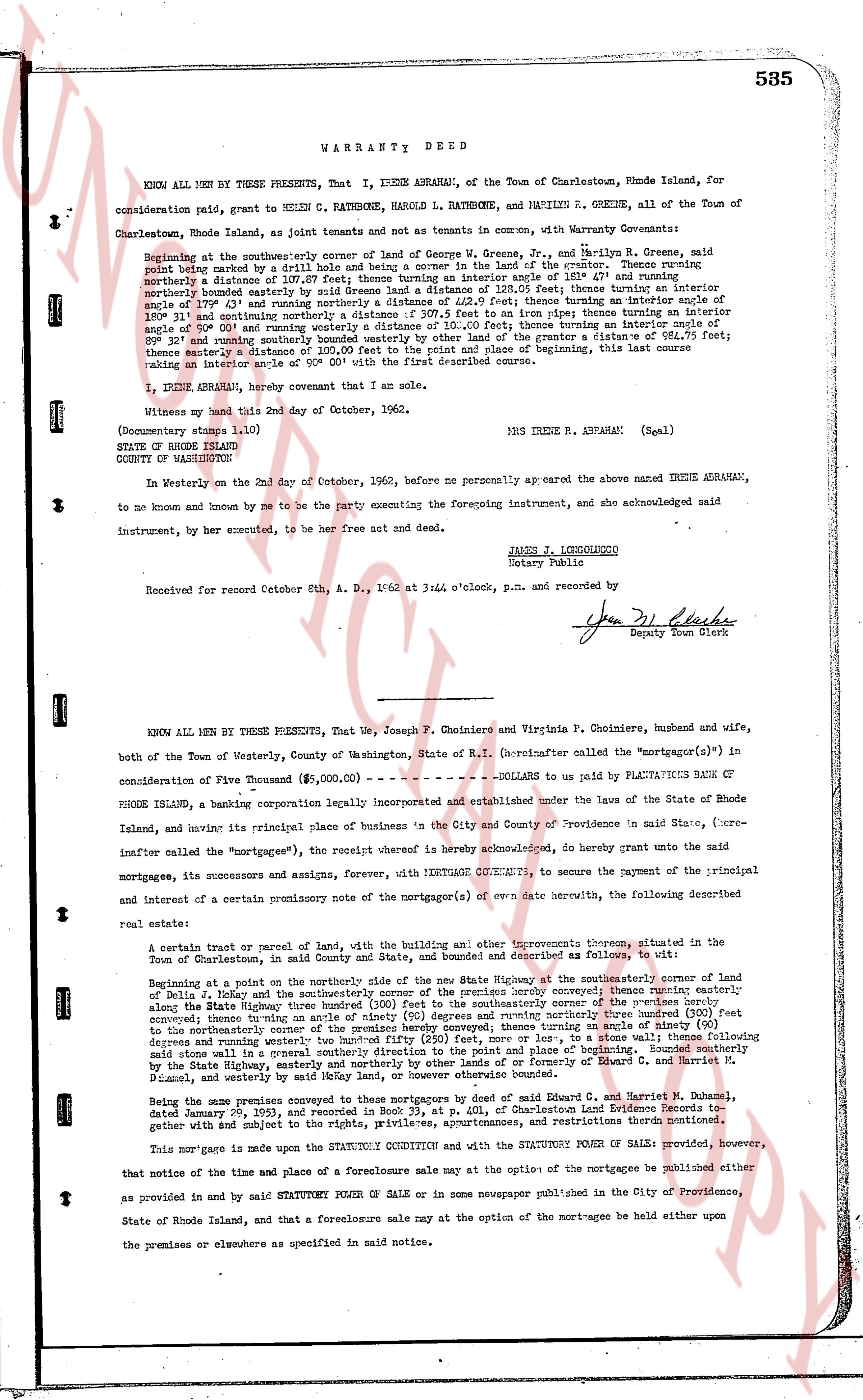
WARRANTY DEED
KNOW ALL MEN BY THESE PRESENTS, That I, IRENE ABRAHAM, of Charlestown, Rhode Island, for
consideration paid, grant to HELEN C. RATHBONE, HAROLD L. RATHBONE, and MARILYN R. GREENE, all of the Town of
Charlestown, Rhode Island, as joint tenants and not as tenants in common, with Warranty Covenants:
Beginning at the northeasterly corner of land of George W. Greene, Jr., and Marilyn R. Greene, said
point being marked by a drill hole in a stone wall, running thence northerly 107.87 feet; thence turning an interior angle of 101° 4' and running
northerly a distance of 107.87 feet; thence turning an interior angle of 101° 4' and running northerly a distance of 107.87 feet; interior
angle 179° 43' and running northerly a distance of 132.2 feet; thence turning an interior angle of 101° 4' and running
northerly a distance of 107.87 feet; thence turning an interior angle of 101° 4' and running northerly a distance of 107.87 feet; interior
angle 180° 31' and running northerly a distance of 307.5 feet to an iron pipe; thence turning an interior angle of 101° 4' and running
northerly a distance of 107.87 feet; thence turning an interior angle of 101° 4' and running northerly a distance of 107.87 feet; interior
angle 101° 4' and running southeasterly bounded westerly by other land of the grantor a distance of 984.75 feet;
thence turning an interior angle of 101° 4' and running southerly to the beginning, this last course
making an interior angle of 90° 00' with the first described course.
I, IRENE ABRAHAM, hereby covenant that I am the sole.
Witness my hand this 2nd day of October, 1962.
(Documentary stamps 1.10)
IRS IRENE R. ABRAHAM (Seal)
STATE OF RHODE ISLAND
COUNTY OF WASHINGTON
In Westerly on the 2nd day of October, 1962, before me personally appeared the above named IRENE ABRAHAM,
to me known and known by me to be the party consenting the foregoing instrument, and she acknowledged said
instrument, by her executed, to be her free act and deed.
JAMES J. LOCHIGHIERO
Notary Public
Received for record Octob 6th, A. D. 1962 at 3:44 o'clock, p.m. and recorded by
Yen Dl Clarke
Deputy Town Clerk
----
KNOW ALL MEN BY THESE PRESENTS, That We, Joseph F. Choinere and Virginia P. Choinere, husband and wife,
both of the Town of Westerly, County of Washington, State of R.I. (hereinafter called the "mortgagors"(s)") in
consideration of Five Thousand ($5,000.00) ----------------- DOLLARS to us paid by PLAUTAUITS BANK OF
RHODE ISLAND, a banking corporation legally incorporated and established under the laws of the State of Rhode
Island, and having its principal place of business in the City and County of Providence 'n said State, ("re-
inafter called the "mortgagee"), the receipt whereof is hereby acknowledged, do hereby grant unto the said
mortgagee, its successors and assigns, forever, WITH MORTGAGE COVENANTS, to secure the payment of the principal
and interest of a certain promissory note of the mortgagor(s) ev. date herewith described, the following described
real estate:
A certain tract or parcel of land, with the building and other improvements thereon, situated in the
Town of Charlestown, in the said County and State, and bounded and described as follows, to wit:
Beginning at a point on the northerly side of the way named State Highway of the southeasterly corner of land
of Julia L. Foley and the southeasterly corner of the premises hereby conveyed; thence running easterly
along the State Highway three hundred (300) feet to the southeasterly corner of said premises; thence running easterly
concave then straight along the State Highway three hundred (300) feet to the southeasterly corner of said premises; thence turning an angle of ninety (90)
degrees and running northerly three hundred (300) feet to the northeasterly corner of said premises; thence running westerly three hundred (300) feet
along a stone wall in a general southerly direction to the point and place of beginning. Bounded southerly
by the State Highway, easterly by land of [?] and others, northerly by land of [?] and westerly by land of
D. Daniel, and westerly by said Mekong Way, or otherwise bounded otherwise.
Being the same premises conveyed to these mortgagors by deed of Samuel R. and Harriet M. Daniel,
dated January 2nd, 1953 and recorded in the Charlestown Land Evidence Records together
with subject and the subject to the rights, privileges, appurtenances, and restrictions thereon mentioned.
This mortgage is made upon the STATUTORY CONDITION and with the STATUTORY POWER OF SALE: provided, however,
that notice of the time and place of a foreclosure sale may at the option of the mortgagee be published either
as provided in and by said STATUTORY POWER OF SALE or in some newspaper published in the City of Providence,
State of Rhode Island, and that a foreclosure sale may at the option of the mortgagee be held either upon
the premises or elsewhere as specified in said notice.
The page as recorded