The instrument's own words
page 1 · read by Gemma vision
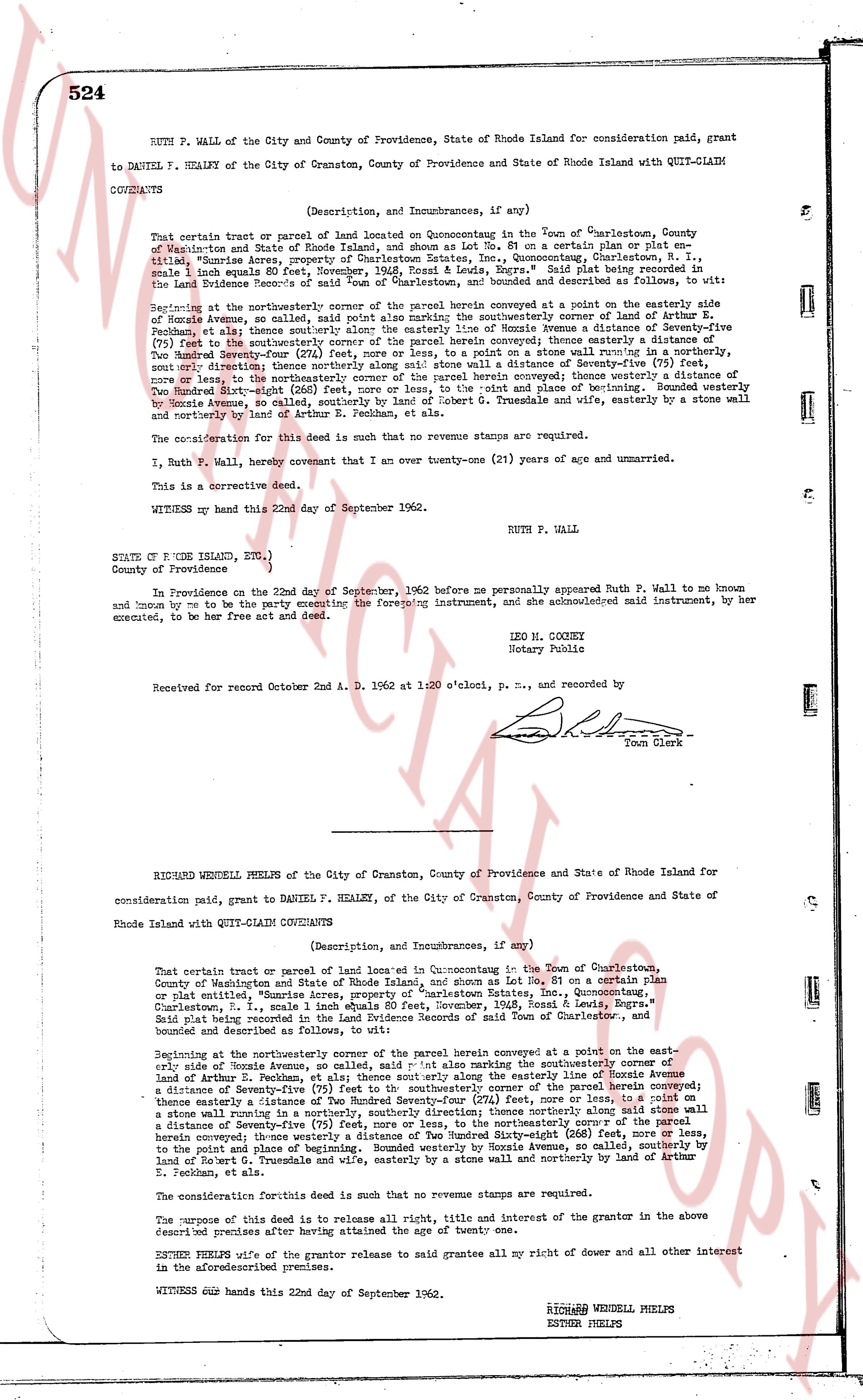
524 RUTH P. WALL of the City and County of Providence, State of Rhode Island for consideration paid, grant
to DANIEL F. HEALEY of the City of Cranston, County of Providence and State of Rhode Island with QUIT-CLAIM
COVENANTS
(Description, and Incumbrances, if any)
That certain parcel of real or parcel of land located on Quonochonticut in the Town of Charlestown, County
of Washington and State of Rhode Island, and shown as Lot No. 51 on a certain plat or plan, etc.,
titled, "Sunrise Acres, property of Charlestown Estates, Inc., Quonochonticut, Charlestown, R. I.,
scale 1 inch equals 80 feet, November, 1936, Essal L. Bonds, Engr." said plat being recorded in the
Town's Land Evidence records, and the said parcel of land is bounded and described as follows, to wit:
the Northwest corner being the point of beginning;
Beginning at the northwesterly corner of the parcel herein conveyed at a point on the easterly side
of Bonnie Avenue, so called, making said point also marking the southwesterly corner of land of Arthur
S. Peckham, etc.; thence south southeasterly along the easterly line of Bonnie Avenue a distance of seventy-five
(75) feet to the southwesterly corner of the parcel herein conveyed; thence easterly a distance of One
Hundred Seventy-four (174) feet, more or less, to a stone wall; thence north northeasterly along said stone wall a distance of seventy-five
(75) feet to the northwesterly corner of the parcel herein conveyed; thence westerly a distance of One
Hundred Seventy-four (174) feet, more or less, to the point and place of beginning. Bounded westerly
by Bonnie Avenue, so called, southeasterly by land of Robert G. Trundle and wife, easterly by a stone wall
and northerly by land of Arthur S. Peckham, etc.
The consideration for this deed is such that no revenue stamps are required.
I, Ruth P. Wall, hereby covenant that I am over twenty-one (21) years of age and unmarried.
This is a corrective deed.
WITNESS my hand this 22nd day of September 1962.
RUTH P. WALL
STATE OF R. IODE ISLAND, ETC.,
County of Providence
In Providence on the 22nd day of September, 1962 before me personally appeared Ruth P. Wall to me known
to me to be the party executing the foregoing instrument, and she acknowledged said instrument, by her
execution, to be her free act and deed.
LEO M. COONEY
Notary Public
Received for Record October 2nd A. D. 1962 at 11:00 o'clock, p. m., and recorded by
[Signature]
Town Clerk
----
RICHARD WENDELL PHELPS of the City of Cranston, County of Providence and State of Rhode Island for
consideration paid, grant to DANIEL F. HEALEY, of the City of Cranston, County of Providence and State of
Rhode Island with QUIT-CLAIM COVENANTS
(Description, and Incumbrances, if any)
That certain tract or parcel of land located in Quonochonticut in the Town of Charlestown, County
of Washington and State of Rhode Island, and shown as Lot No. 51 on a certain plat or plan, etc.,
titled, "Sunrise Acres, property of Charlestown Estates, Inc., Quonochonticut,
Charlestown, R. I., scale 1 inch equals 80 feet, November, 1936, Essal L. Bonds, Engr." said plat being recorded in the
Town's Land Evidence records, and the said parcel of land is bounded and described as follows, to wit:
Beginning at the northwesterly corner of the parcel herein conveyed at a point on the easterly side
of Bonnie Avenue, so called, making said point also marking the southwesterly corner of land of
Arthur S. Peckham, etc.; thence south southeasterly along the easterly line of Bonnie Avenue a distance
of seventy-five (75) feet to the southwesterly corner of the parcel herein conveyed; thence easterly a distance of One
Hundred Seventy-four (174) feet, more or less, to a stone wall; thence north northeasterly along said stone wall a distance of seventy-five
(75) feet to the northwesterly corner of the parcel herein conveyed; thence westerly a distance of One
Hundred Seventy-four (174) feet, more or less, to the point and place of beginning. Bounded westerly
by Bonnie Avenue, so called, southeasterly by land of Robert G. Trundle and wife, easterly by a stone wall and northerly by land of Arthur
S. Peckham, etc.
The consideration for this deed is such that no revenue stamps are required.
The purpose of this deed is to release all right, title and interest of the grantor in the above
described premises after having attained the age of twenty one.
ESTHER PHELPS wife of the grantor release to said grantee all my right of dower and all other interest
in the aforementioned premises.
WITNESS our hands this 22nd day of September 1962.
RICHARD WENDELL PHELPS
ESTHER PHELPS
The page as recorded