The instrument's own words
page 1 · read by Gemma vision
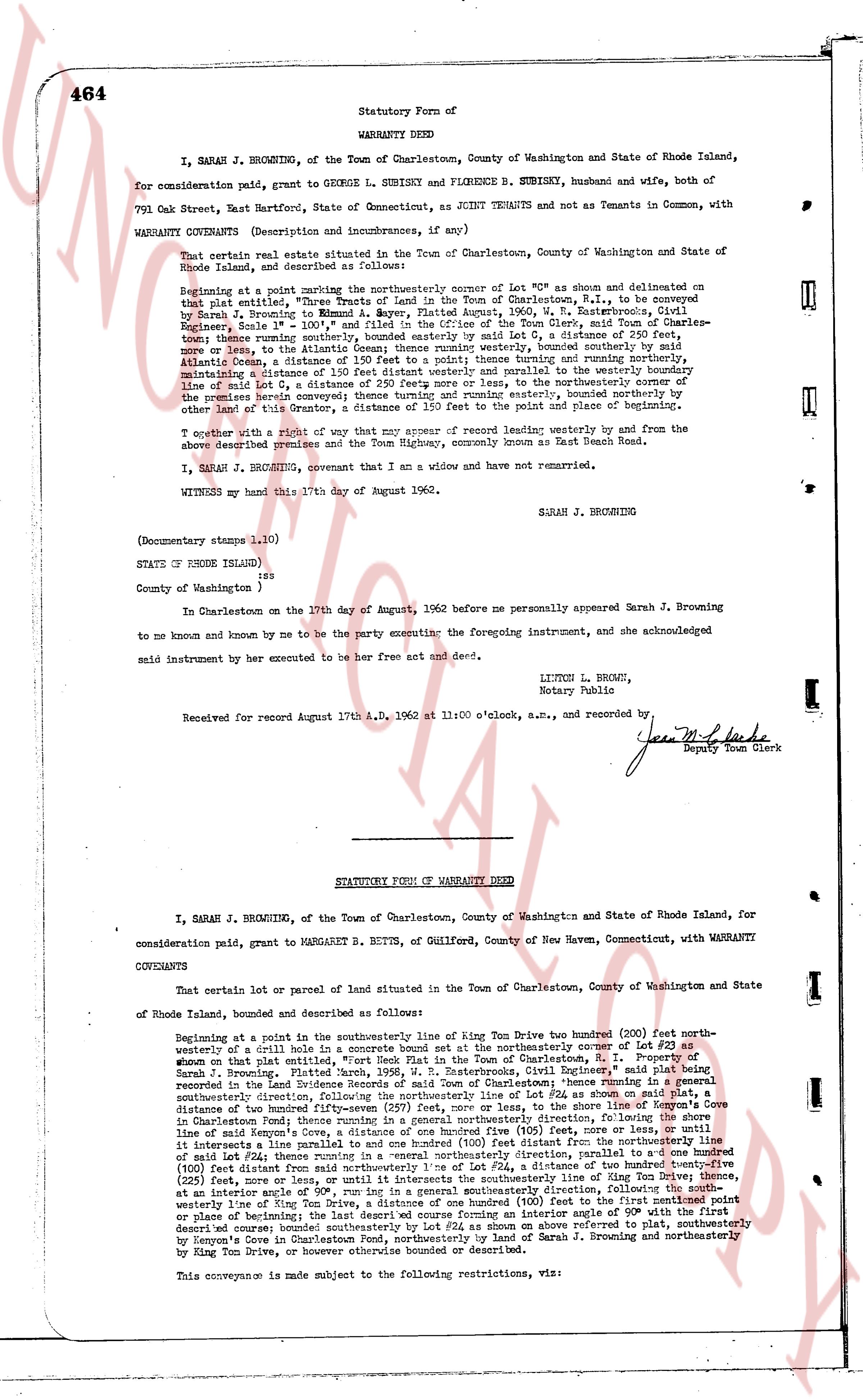
464 Statutory Form of
WARRANTY DEED
I, SARAH J. BROWNING, of the Town of Charlestown, County of Washington and State of Rhode Island,
for consideration paid, grant to GEORGE L. SUBISKY and FLORENCE B. SUBISKY, husband and wife, both of
791 Oak Street, East Hartford, State of Connecticut, as JOINT Tenants and not as Tenants in Common, with
WARRANTY COVENANTS (Description and incumbrances, if any)
That certain real estate situated in the Town of Charlestown, County of Washington and State of
Rhode Island, described as follows:
beginning at a point marking the northwesterly corner of Lot #24 as shown and delineated on
that plat entitled, "Three Tracts of Land in the Town of Charlestown, Co. of Washington, to be
conveyed by Sarah J. Browning to Robert G. S. Snyder, August 1962, R. E. Rutherford, C.E.,
Engineer, Scale 1" = 100'", and filed in the office of the Town Clerk, said Town of Charlestown-
more or less, the Along the Atlantic Ocean running southerly, bounded westerly by said Atlantic Ocean,
more or less, the Along the Atlantic Ocean running southerly, bounded westerly by said Atlantic Ocean,
Atlantic Ocean, a distance of 150 feet to a point thence turning northerly and running nearly
northerly, a distance of 250 feet more or less and parallel to the westerly boundary of
line of said Lot 24, a distance of 250 feet more or less and parallel to the westerly boundary of
the property herein conveyed and running northerly, to the northwesterly corner of the
property herein conveyed and running northerly, to the northwesterly corner of the
other land of this Grantor, a distance of 350 feet to the point and place of beginning.
Together with a right of way that may appear of record leading westerly from and by the
above described premises and the Town Highway, commonly known as East Beach Road.
I, SARAH J. BROWNING, covenant that I am a widow and have not remarried.
WITNESSED my hand this 17th day of August 1962. SARAH J. BROWNING
(Documentary stamps 1.10)
STATE OF RHODE ISLAND }
} ss:
County of Washington }
In Charlestown on the 17th day of August, 1962 before me personally appeared Sarah J. Browning
to me known and known by me to be the party executing the foregoing instrument, and she acknowledged
said instrument by her executed to be her free act and deed.
LITCHFIELD BROWN,
Notary Public
Received for record August 17th A.D. 1962 at 11:00 o'clock, a.m., and recorded by [Signature]
Deputy Town Clerk
----
STATUTORY FORM OF WARRANTY DEED
I, SARAH J. BROWNING, of the Town of Charlestown, County of Washington and State of Rhode Island, for
consideration paid, grant to MARGARET S. BUTTN, of Guilford, County of New Haven, Connecticut, with WARRANTY
COVENANTS
That certain lot or parcel of land situated in the Town of Charlestown, County of Washington and State
of Rhode Island, bounded and described as follows:
Beginning at a point in the southwesterly line of King Tom Drive two hundred (200) feet north-
westerly of a crestly line in a concrete bound set as the northeasterly corner of Lot #23 as
shown on that plat entitled "Three Tracts of Land in the Town of Charlestown, R. I. Property of
Sarah J. Browning, Platted March, 1965, R. E. Rutherford, Civil Engineer" and recorded
conveyed in the Land Evidence Records of Charlestown, Volume 38, Page 464; thence running in a general
southeasterly direction, following the northeasterly line of Lot #24 as shown on said plat, a
distance of two hundred fifty (250) feet more or less to a point (the line of the property conveyed in
said Charlestown deed running in a general southeasterly direction, following the shore line
of said Atlantic Ocean, from the point of beginning, a distance of two hundred fifty (250) feet, more or less,
it intersects a line parallel and one hundred (100) feet distant from the northeasterly line of
said Lot #24 thence turning in a general southeasterly direction, parallel to the northeasterly
(100) feet distant from said northeasterly line of Lot #24, a distance of two hundred twentyfive(225)
feet, more or less, to a point on the southeasterly line of Lot #24 as shown on said plat, thence turning
at an interior angle of 90°, running in a general southeasterly direction, following the south
westerly line of King Tom Drive, a distance of one hundred (100) feet to the first previously point
or place of beginning; bounded southeasterly by Lot #24 as shown on referred to plat, southeasterly
by Newport Cove in Charlestown, Rhode Island, as shown on plat of Sarah J. Browning and northeasterly
by King Tom Drive, or however otherwise bounded or described.
This conveyance is made subject to the following restrictions, viz:
The page as recorded