The instrument's own words
page 1
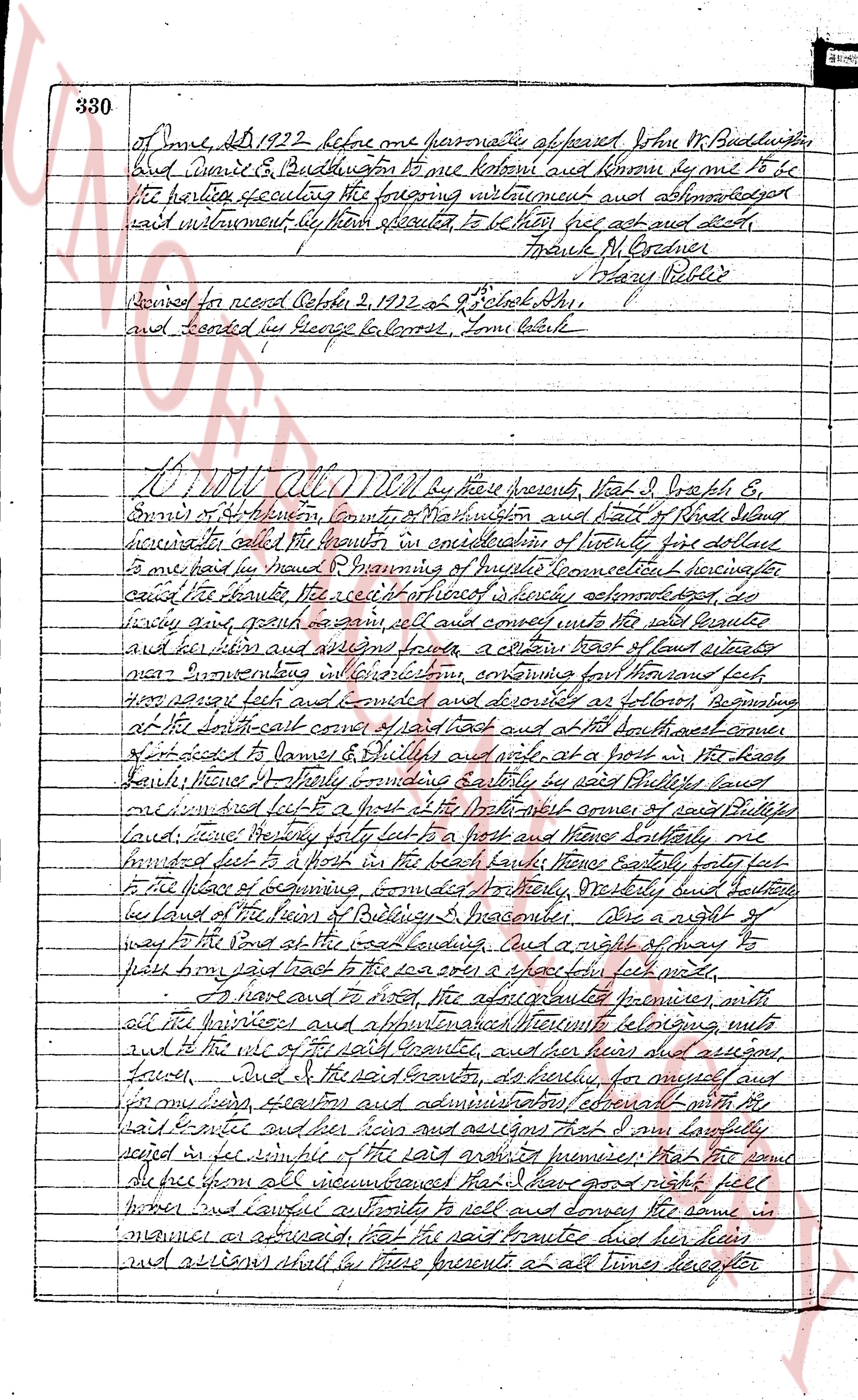
330 of June, AD 1922 before me personally appeared John M. Buddington
and Eunice E. Buddington to me known and known by me to be
the parties executing the foregoing instrument and acknowledged
said instrument by them spoken to, to be theirs free act and deed.
Frank M. Gardner
Mary O'Reilly
Received for record October 2, 1922 at 9 o'clock AM,
and recorded by George L. Cross, Town Clerk
KNOW ALL MEN by these presents, that I, Joseph E.
Emery of Hopkinton, County of Washington and State of Rhode Island
namely called the grantor in consideration of twenty five dollars
to me paid in hand by Samuel P. Manning of Warwick Connecticut
called the grantee the receipt of which is hereby acknowledged, do
convey grant give remise sell and convey unto the said grantee
and his heirs and assigns forever, a certain tract of land situated
near Narragansett in Providence, containing forty four thousand feet
three square feet and bounded as described as follows: Beginning
at the south east corner of said lot east and at the north east corner
of lot traded to James & William Wilde, at a post in the road
called Moore's highway bounding easterly by said Pulver's road
thence west fifty ft to a post at the north east corner of said Pulver's
lot, thence westerly forty feet to a post and thence southerly one
hundred feet to a post in the brook thence easterly forty feet
to the place of beginning, bounded northerly, westerly and southerly
by land of the town of Bridlebury's Meadows. Also a right of
way to the pond at the west boundary, and a right of way to
pass by said road to the sea over a strip ten feet wide.
To have and to hold the aforementioned premises, with
all the priviledges and appurtenances belonging unto
and to the use of the said grantee, and his heirs and assigns
forever, and I the said grantor, do hereby warrant for myself and
for my heirs, successors and administrators eternally with all
the said grantee and his heirs and assigns that I and my lawfully
set heirs in the tenure of the said above premises that the same
are free from all encumbrances that I have good right full
power and lawful authority to sell and convey the same in
manner as aforesaid that the said grantee and his heirs
and assigns shall have these presents at all times hereafter
page 2
peaceably and quietly have and enjoy the said premises, and that
I, the said grantor will and my heirs, executors and administrators
shall maintain and defend the same to the said grantee and her heirs
and assigns forever against the lawful claims and demands of all
persons.
In witness whereof I have hereunto set my hand and seal this
27th day of July in the year of our lord one thousand nine hundred
and twenty two
Signed and sealed in presence of Joseph E. Ennis J.S.
Frank H. Conrad
State of Rhode Island
County of Washington
On this 27th day on the 27th day of July AD 1922 before me
Personally appeared Joseph E. Ennis known to me to be the same
man to be the said party executing the foregoing instrument and
acknowledged said instrument to be his free act and
deed. Frank H. Conrad
J. S. Pelby Priblo J.S.
Received for record October 2, 1922 at 9:15 o'clock P.M.
and recorded by George H. Harris Town Clerk
Know All Men by these presents that Mary G.
Drabble of the city and county of Providence in the commonwealth
of Massachusetts hereinafter called the Grantor in consideration
of ten Dollars to me paid by Herman & Learned of the town of
Exeter county of Kent state of Rhode Island hereinafter
called the Grantee receipt whereof I hereby acknowledge
do hereby grant bargain sell and convey unto the said
Grantee and his heirs and assigns forever a certain lot or
parcel of land situated at Providence in the town of Westerly
county of Washington and state of Rhode Island bounded and
described as follows beginning at the southwest corner of lot
No 10 in plan of platting sites filed by the Peabody Trust
in the Town Clerks office on 20th Sept 1913 then East 115 feet thirty
two hundredths and fifty (250) feet to the highway thence bounding
along said highway forty five (45) feet hence Westward true
northwest eight fifty feet (250) feet to the south west corner of lot
Lot No 11 16 on the aforesaid plan thence northwesterly forty five (45)
The page as recorded