The instrument's own words
page 1
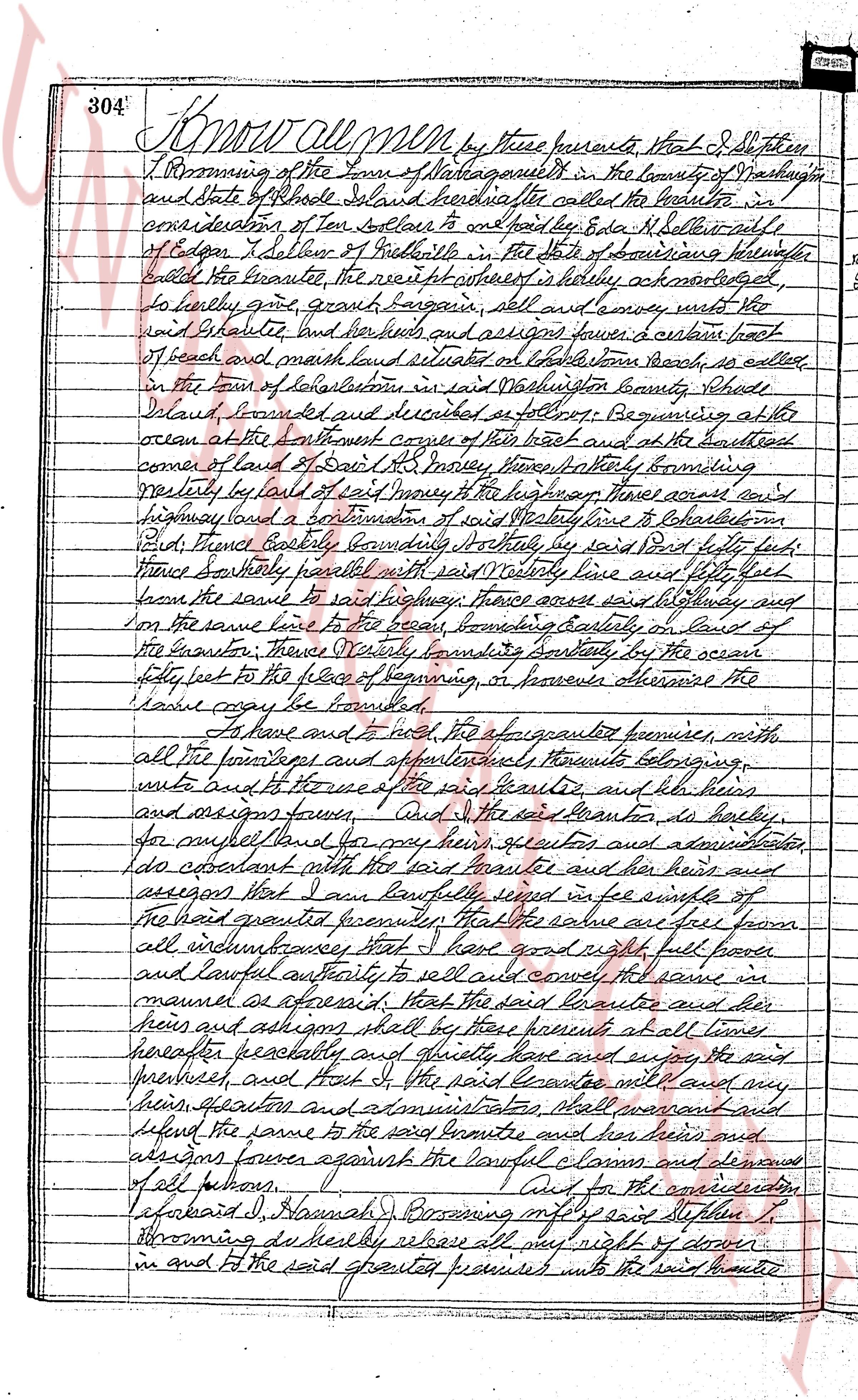
304 Know all men by these presents That I J. Stephen
I Storming of the Town of Narragansett in the County of Washington
and State of Rhode Island hereinafter called the Grantor in
consideration of Ten dollars to clear title and to hold by Edna M. Bellatt wife
of Edgar I. Bellatt of Providence in the State of Massachusetts hereinafter
called the Grantee the receipt whereof is hereby acknowledged
to hereby give, grant bargain, sell and convey unto the said
Rhode Island land and her heirs and assigns forever a certain plot
of beach and marsh land situated on Cable Point beach, as called
in the town of Narragansett in said Washington County Rhode
Island of following location in said Washington County Rhode
Island bounded and described as follows: Beginning at the
ocean at the Northeast corner of the beach and at the Southwest
corner of land of Sam L. Morley, thence Southwesterly following
westly by land of said Morley to the highway Thence across said
highway land and a section of salt marsh to the lake shore then
East Thence Easterly bounding Northwesterly by said Bird forty feet
thence Southerly parallel with said westerly line and fifty feet
from the same to said highway Thence across said highway and
on the same line to the said beach bounding Easterly by land of
the Grantor Thence Northeasterly bounding Southerly by the ocean
forty feet to the place of beginning, or however otherwise the
same may be bounded.
To have and to hold the aforesaid premises with
all the tenements and appurtenances thereto belonging
unto the said Grantee and her heirs and
assigns forever. And I the said Grantor do hereby
for myself land for my heirs executors and administrators
do covenant with the said Grantee and her heirs and
assigns that I am lawfully seized in fee simple of
the land granted premises That the above are free from
all encumbrances That I have good right full power
and lawful authority to sell and convey the same in
manner as aforesaid That the said Grantee and her heirs
and assigns shall by these presents at all times
henceforth peaceably and quietly have and enjoy the said
premises and That I the said Grantor will and my
heirs executors and administrators shall warrant and hold
defend the same to the said Grantee and her heirs and
assigns forever against the lawful claims and demands
of all persons. And for the consideration
aforesaid I Hannah J. Storming my wife said Stephen J.
Storming do hereby release all my right of dower
in and to the said granted premises unto the said Grantee
page 2
440
of the premises to the said Lessors heirs or assigns in as good order as they are now, or may be put in,
ordinary wear and tear, and damages by the elements, excepted, and that they will not assign this lease, nor
underlet the whole or any part of the premises, and will not make or suffer to be made any alterations in the
premises, without the consent in writing of the said Lessors, their heirs or assigns; and that the said Lessors,
their servants and agents, may at all reasonable times enter to view and make such repairs to such premises as
may be necessary.
The Lessors will not sell the leased premises unless the lessees are given first option to purchase.
The Lessors agree to furnish water to all the lessees when it is available.
The lessees agree to furnish their own toilet facilities.
Bathing privileges at Watchoug Pond are given to the Lessees.
IN WITNESS WHEREOF we have hereto sent hands and seals, this 1st day of May, 1962.
Executed in presence of:
GEORGE A. BEAUDET
RAYMOND R. GODON
JOSEPH J. JAENNES
ELMIRA JAENNES
ROGER R. GODON
LILLIAN T. GODON
DORIS GODON
STATE OF RHODE ISLAND
COUNTY OF PROVIDENCE
In Woonsocket on the 1st day of May A.D. 1962 before me personally appeared Roger R. Godon, Lillian T. Godon,
and Doris Godon and, Doris Godon to me known and known by me to be the parties executing the foregoing instrument,
Raymond G. Godon, and Doris Godon to me known and known by me to be the parties executing the foregoing instrument,
and acknowledged said instrument, by them executed, to be their free act and deed.
GEORGE A. BEAUDET
Notary Public
Received for record August 13th A.D. 1962, at 10:52 o'clock A.M. and recorded by
[Signature]
Deputy Town Clerk
THIS INDENTURE OF LEASE
Entered into on the 1st day of May A.D. 1962 and by between Roger R. Godon, Lillian T. Godon, Raymond G. Godon,
and Doris Godon hereinafter called the Lessors, and Mister R. Zatonicky and Lucille Zatonicky, hereinafter called
the Lessees.
WITNESSETH, That the said Lessors hereby demise and lease unto said Lessees The following described real estate
Beginning at a drill hole on a boulder located on the easterly side of Watcheug Pond in the Town of
CustomerID, State of Rhode Island, which point is the southeasterly corner of land owned by the Lessors to
a point;
Thence 400 feet in an easterly direction and along the southerly line of land owned by the lessors to
a point;
Thence northerly and at right angles 188 feet to the point of beginning;
Thence continuing northerly and in a straight line 67 feet to a point;
Thence easterly and at right angles 130 feet to a point;
Thence continuing northerly and at right angles 47 feet to a point;
Thence westerly and at right angles 100 feet to the point of beginning;
Thence westerly and at right angles 100 feet to the point of beginning;
Being lot No. 15 on a proposed plat of land owned by the Lessors;
TO HAVE AND TO HOLD the same with the appurtenances unto said Lessees their executors, administrators and
assigns, for the during the term of five years from the 1st day of May A.D. 1962 to the 30th day of April
A.D. 1967, yielding and paying therefor said term the yearly rent of fifty Dollars for each and every
year during the continuance of this Lease, until said rent is paid in full.
And the said Lessees for themselves and for their executors, administrators and assigns, covenant with the
said Lessors, their heirs and assigns that they will pay said rent at the times and in the manner aforesaid;
and that in case of failure on their part to pay the same within 30 days subsequent to the time above specified
(and it shall not be required that any demand be made for the same), or in case of failure to perform all the
covenants and agreements contained in this Lease on the part of the said Lessee to be kept and performed, the
said Lessors, their heirs and assigns, shall be at liberty to enter upon said premises and declare this lease
at an end and take immediate possession of the premises; and that the said Lessee will keep the interior of the
premises in good repair, including the setting of glass in windows and doors, during the continuance of this
lease;
The page as recorded