The instrument's own words
page 1 · read by Gemma vision
405
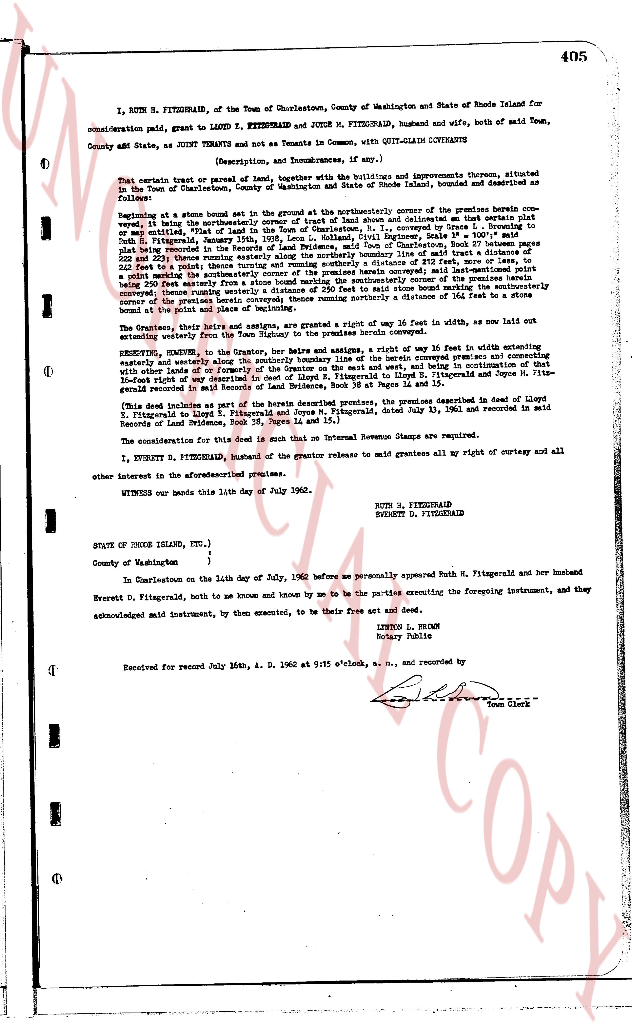
I, RUTH H. FITZGERALD, of the Town of Charlestown, County of Washington and State of Rhode Island for
consideration paid, grant to LLOYD E. FITZGERALD and JOYCE M. FITZGERALD, husband and wife, both of said Town,
County and State, as JOINT TENANTS and not as Tenants in Common, with QUIT-CLAIM COVENANTS
(Description, and Encumbrances, if any.)
That certain tract or parcel of land, together with the buildings and improvements thereon, situated
in the Town of Charlestown, County of Washington and State of Rhode Island, bounded and described as follows:
Beginning at a stone bound set in the ground at the northeasterly corner of the premises herein con-
veyed, it being the northeasterly corner of tract of land shown and delineated on that certain plat
or map entitled "Plat of land of Lloyd E. Fitzgerald", prepared by Thomas L. O'Neill 1st Engineer, scale 1" = 100', said
plat recorded in the Registry of Land Evidence, Providence, R.I., in Book 345, page 211, filed July 16, 1936,
plat recorded in the Registry of Land Evidence, Providence, R.I., in Book 345, page 211, filed July 16, 1936,
pages 211 and 212; thence running southwesterly along the southerly line of said plat of reference a distance of
202 feet to a point; thence running and similarly running a distance of 212 feet to a point; thence running
and similarly running a distance of 212 feet to a point; thence running southeasterly along the boundary line of said plat of reference a distance of
202 feet to a point; thence running and similarly running a distance of 212 feet to a point; thence running
and similarly running a distance of 212 feet to a point; thence running southeasterly along the boundary line of said plat of reference a distance of
202 feet easterly from a stone bound marking the southeasterly corner of the premises herein con-
veyed; thence running southeasterly along the boundary line of said plat of reference to a stone bound marking the
southeasterly corner of the premises herein conveyed; thence running northerly a distance of 164 feet to a stone
bound at the point of beginning.
The Grantees, their heirs and assigns, are granted a right of way 16 feet in width, as now laid out
extending westerly from the Town Highway to the premises herein conveyed.
RESERVING, however, to the Grantor, her heirs and assigns, a right of way 16 feet in width extending
easterly and westerly along the southerly boundary of the premises herein conveyed and connecting
with other lots of land formerly owned by Lloyd E. Fitzgerald on the east and west, and being in continuation of that
16-foot right of way described in the deed of Lloyd E. Fitzgerald to Lloyd E. Fitzgerald and Joyce M. Fitz-
gerald recorded in said Land Evidence, Book 36, Page 14, filed July 13, 1961.
(This deed includes as part of the herein described premises, the premises described in deed of Lloyd
E. Fitzgerald to Lloyd E. Fitzgerald and Joyce M. Fitzgerald, dated July 13, 1961 and recorded in said
Records of Land Evidence, Book 36, Page 14, filed July 13, 1961.)
The consideration for this deed is such that no Internal Revenue Stamps are required.
I, EVERETT D. FITZGERALD, husband of the grantor release to said grantees all my right of curtesy and
all other interest in the aforesaid premises.
WITNESS our hands this 11th day of July 1962.
RUTH H. FITZGERALD
EVERETT D. FITZGERALD
STATE OF RHODE ISLAND, ETC.)
)
County of Washington )
In Charlestown on the 11th day of July, 1962 before me personally appeared Ruth H. Fitzgerald and her husband
Everett D. Fitzgerald, both to me known and known by me to be the parties executing the foregoing instrument, and they
acknowledged said instrument, by them executed, to be their free act and deed.
LINTON L. BROWN
Notary Public
Received for record July 16th A. D. 1962 at 9:15 o'clock, a. m., and recorded by
[Signature]
Town Clerk
The page as recorded