The instrument's own words
page 1 · read by Gemma vision
403
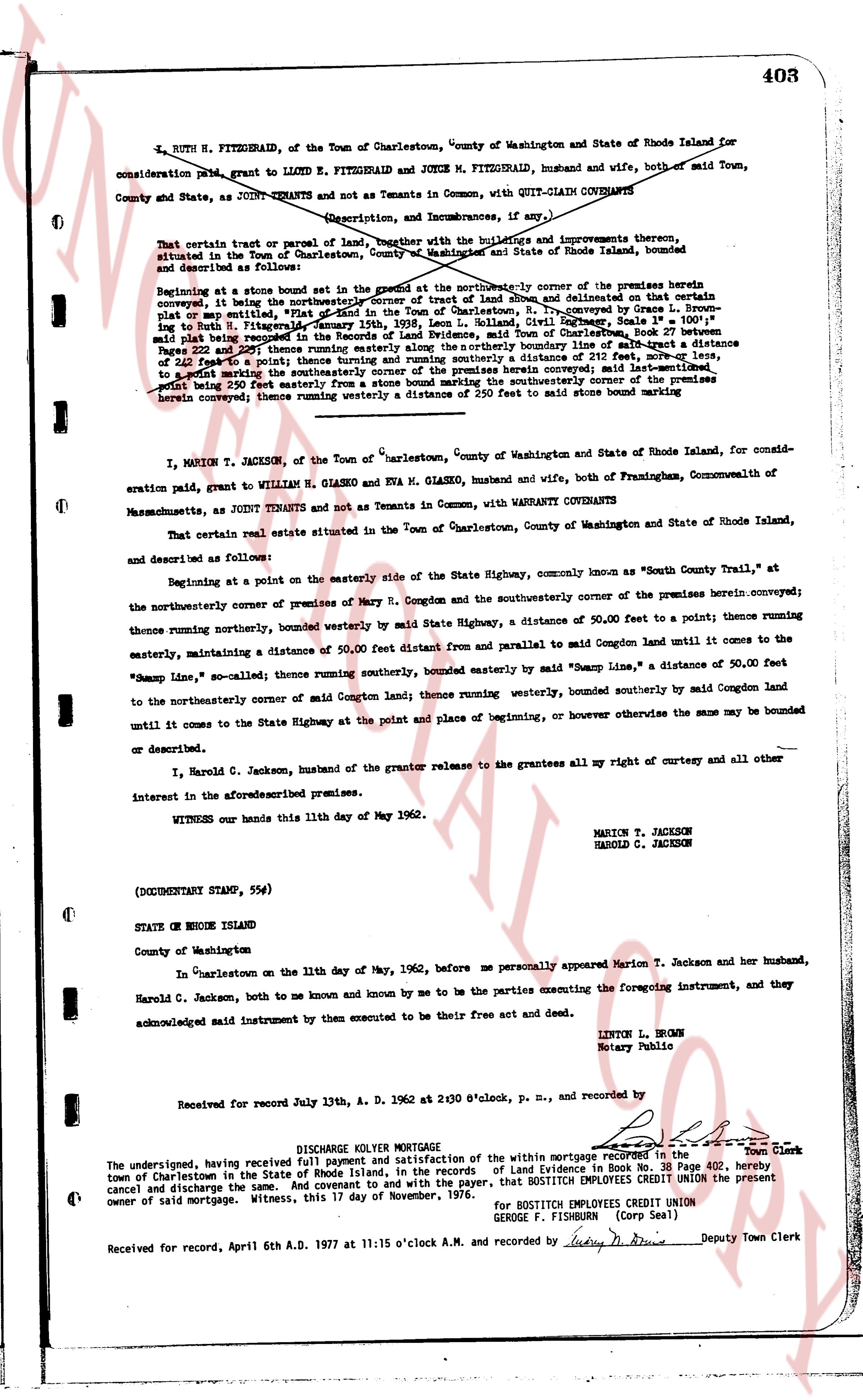
L. RUTH N. FITZGERALD, of the Town of Charlestown, County of Washington and State of Rhode Island for
consideration paid, grant to LLOYD E. FITZGERALD and DORIS M. FITZGERALD, husband and wife, both of said Town,
County and State, as JOINT TENANTS and not as Tenants in Common, with QUIT-CLAIM COVENANTS
(Description, and Incumbrances, if any,)
That certain parcel of land, together with the buildings and improvements thereon,
situated in the Town of Charlestown, County of Washington and State of Rhode Island, bounded
and described as follows:
Beginning at a stone bound set corner of the tract at the northeasterly corner of the premises herein
convex, it being the northeasterly corner of Street Lot 4 of the plat of land denoted as the "Villa" plat
or map end, filed in the Charlestown land evidence records, Book 24, page 111, and referring to L. Ruth
ning to Ruth H. Fitzgerald, January 15th, 1939, Leon L. Holland, Civil Engineer, Scale 1" = 100'
point paid being recorded in the Massachusetts land evidence records, Book 11, page 100, and
point 235 feet to the southeast thence turning easterly along the northerly boundary line of said tract a distance
of 235 feet to a point thence turning running southerly a distance of 250 feet to said stone bound marking
or start wanting the southerly corner of the premises herein convex; said last-mentioned
point being 250 feet easterly from a stone bound marking the southwesterly corner of the premises
herein convex; thence running westerly a distance of 250 feet to said stone bound marking
----
MARION T. JACKSON, of the Town of Charlestown, County of Washington and State of Rhode Island, for consid-
eration paid, grant to WILLIAM H. GLASKO and EVA M. GLASKO, husband and wife, both of Framingham, Commonwealth of
Massachusetts, as JOINT TENANTS and not as Tenants in Common, with WARRANTY COVENANTS
That certain real estate situated in the Town of Charlestown, County of Washington and State of Rhode Island,
and described as follows:
Beginning at a point on the easterly Side of the State Highway, commonly known as "South County Trail," at
the northeasterly corner of premises of Mrs. M. Congdon and the southeasterly corner of the premises herein conveyed;
thence running northerly the corner of premises of Mrs. M. Congdon and the southeasterly corner of the premises herein conveyed;
thence running northerly, bounded westerly by said State Highway, a distance of 50.00 feet to a point; thence running
easterly, maintaining a distance of 50.00 feet distant from and parallel to said Congdon land until it comes to the
"Swamp Line, so called"; thence running southerly, bounded easterly by said "Swamp Line," a distance of 50.00 feet
to the northeasterly corner of said M. Congdon land; thence running southerly, bounded southerly by said Congdon land
until it comes to the State Highway at the point of place and beginning, or however otherwise the same may be bounded
or described.
I, Harold C. Jackson, husband of the grantor release to the grantees all my right of curtesy and all other
interests in the aforesaid premises.
WITNESS our hands this 11th day of May 1962.
MARION T. JACKSON
HAROLD C. JACKSON
(DOCUMENTARY STAMP, 55¢)
STATE OF RHODE ISLAND
County of Washington
In Charlestown on the 11th day of May, 1962, before me personally appeared Marion T. Jackson and her husband,
Harold C. Jackson, both to me known and known by me to be the parties executing the foregoing instrument, and they
acknowledged said instrument by them executed to be their free act and deed.
LINTON L. BROWN
Notary Public
Received for record July 13th, A. D. 1962 at 2:30 o'clock p. m., and recorded by
[Signature] Town Clerk
----
DISCHARGE KOLTER MORTGAGE
The undersigned, having received full payment and satisfaction of the within mortgage recorded in the
town of Charlestown in the State of Rhode Island, in the Records of Land Evidences in Book No. 38 Page 402, hereby
cancel and discharge the same. And covenant to and with the payer, that BOSTITCH EMPLOYEES CREDIT UNION the present
owner of said mortgage. Witness, this 17 day of November, 1976.
for BOSTITCH EMPLOYEES CREDIT UNION
GEORGE F. FISHBURN (Corp Seal)
Received for record, April 6th A.D. 1977 at 11:15 o'clock A.M. and recorded by [Signature] Deputy Town Clerk
The page as recorded