The instrument's own words
page 1 · read by Gemma vision
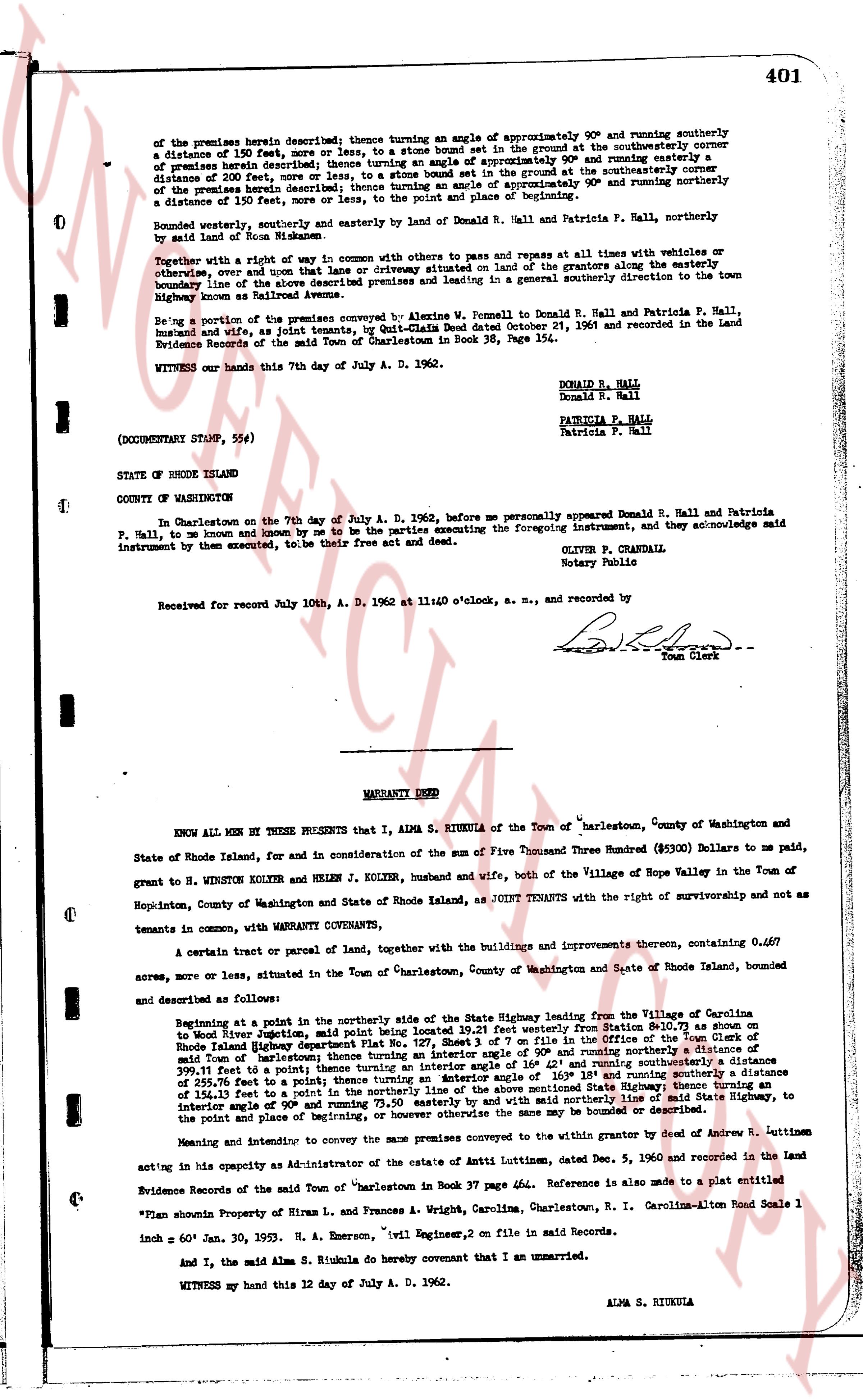
of the premises herein described; thence turning an angle of approximately 90° and running southerly a distance of 150 feet, more or less, to a stone bound set in the ground at the southwesterly corner of premises herein described; thence turning an angle of approximately 90° and running easterly a distance of 200 feet, more or less, to a stone bound set in the ground at the southeasterly corner of the premises herein described; thence turning an angle of approximately 90° and running northerly a distance of 150 feet, more or less, to the point of beginning first above described.
Bounded westerly and northerly and easterly by land of Beulah R. Hall and Patricia F. Hall, northerly by land of Ross R. McMasters.
Together with a right of way in common with others to pass and repass at all times with vehicles or otherwise, over and upon that lane or driveway situated on the land of the grantors along the easterly boundary line of the above described premises, said lane leading in a general southerly direction to the town Highway known as Railroad Avenue.
Being a portion of the premises conveyed by Alvine W. Pennell to Donald R. Hall and Patricia F. Hall, husband and wife, as a joint tenants, by Quit-Claim Deed dated October 21, 1961 and recorded in the Land Evidence Records of the said Town of Charlestown in Book 38, Page 354.
WITNESS our hands this 7th day of July A. D. 1962.
DONALD R. HALL
Donald R. Hall
PATRICIA F. HALL
Patricia F. Hall
(DOCUMENTARY STAMP, 55¢)
STATE OF RHODE ISLAND
COUNTY OF WASHINGTON
In Charlestown on the 7th day of July A. D. 1962, before me personally appeared Donald R. Hall and Patricia P. Hall, to me known and known by me to be the parties executing the foregoing instrument, and they acknowledge said instrument by them executed, to be their free act and deed.
OLIVER P. CRANDALL
Notary Public
Received for record July 10th, A. D. 1962 at 11:00 o'clock, a. m., and recorded by [?]
Town Clerk
----
WARRANTY DEED
KNOW ALL MEN BY THESE PRESENTS that I, ALMA S. RIUKULA of the Town of Charlestown, County of Washington and State of Rhode Island, for and in consideration of the sum of Five Thousand Three Hundred ($5300) Dollars to me paid, grant to H. WINSTON KOLYER and HELEN J KOLYER, husband and wife, both of the Village of Hope Valley in the Town of Hopkinton, County of Washington and State of Rhode Island, as JOINT TENANTS with the right of survivorship and not as tenants in common, with WARRANTY COVENANTS,
A certain tract or parcel of land, together with the buildings and improvements thereon, containing 0.467 acres, more or less, situated in the Town of Charlestown, County of Washington and State of Rhode Island, bounded and described as follows:
Beginning at a point in the northerly side of the State Highway leading from the Village of Carolina to Wood River Junction, said point being located 19.21 feet from the stone bound at Station 42+00 as shown on the Rhode Island Highway Department's State Highway Map, on file in the office of the Town Clerk of said Town of Charlestown; thence turning an interior angle of 90° and running northerly a distance of 399.11 feet to a point; thence turning an interior angle of 169° and running easterly a distance of 399.11 feet to a point; thence turning an interior angle of 169° 18s and running southerly a distance of 399.25 feet to a point; thence turning an interior angle of 90° and running westerly along the State Highway a distance of 399.25 feet to a point in the northerly side thereof, 171.50 easterly from and with said northerly line of State Highway, to the point and place of beginning, or however the same may be bounded or described.
Meaning and intending to convey the same premises conveyed to the within grantor by deed of Andrew R. Luttman acting in his capacity as administrator of the estate of Annie Luttman, dated Dec. 5, 1960 and recorded in the Land Evidence Records of the said "Charlestown in Book 37 page 464. Reference is also made to a plat entitled
"*Plan showing Property of Hiram L. and Frances A. Wright, Carolina, Charlestown, R. I. Carolina-Alton Road Scale 1 inch = 60' Jan. 30, 1953. H. A. Emerson, Civil Engineer, on file in said records."
And I, the said Alma S. Riukula do hereby covenant that I am unmarried.
WITNESS my hand this 12 day of July A. D. 1962.
ALMA S. RIUKULA
page 2 · read by Gemma vision
402
STATE OF RHODE ISLAND
COUNTY OF WASHINGTON
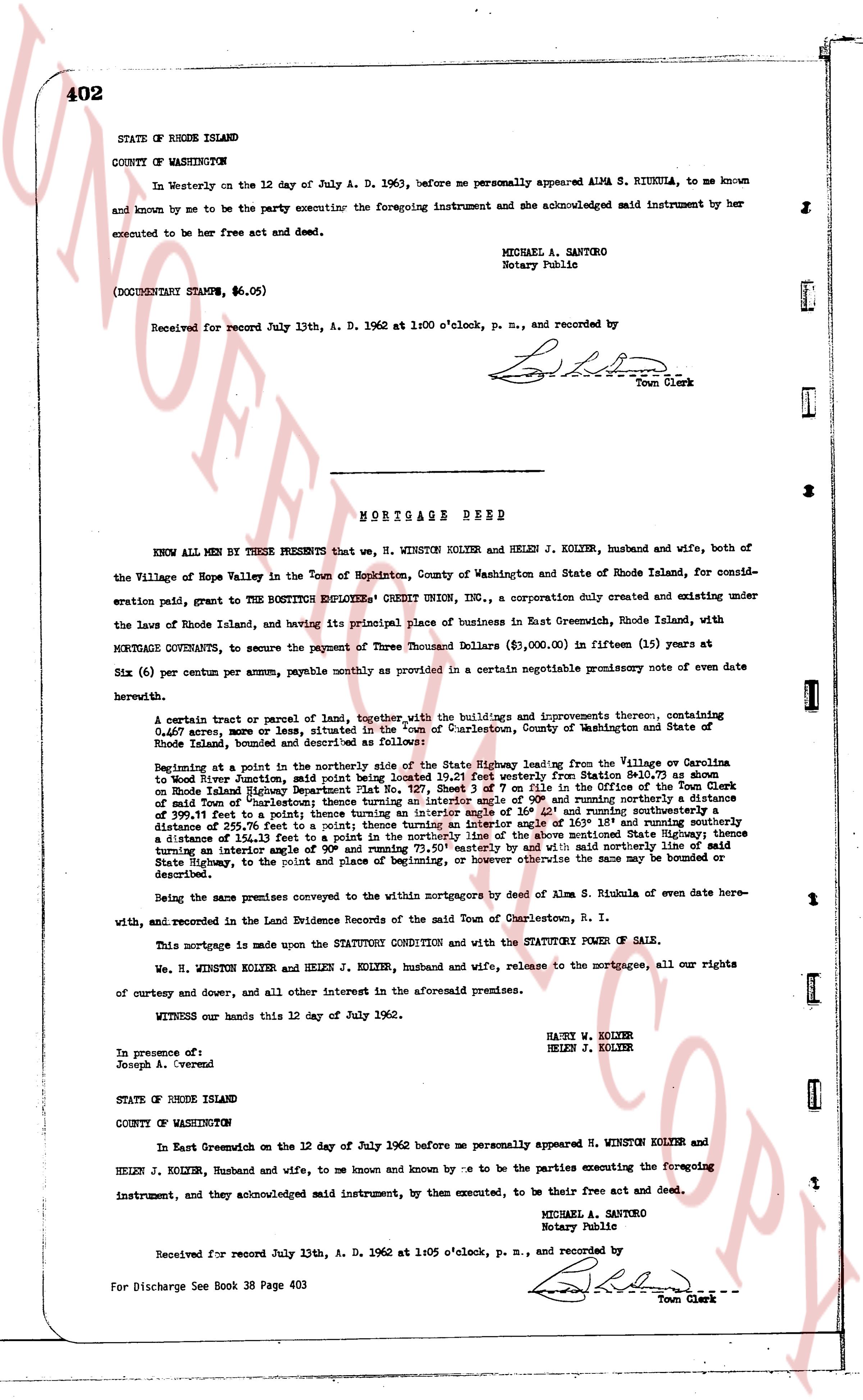
In Westerly on the 12 day of July A. D. 1962, before me personally appeared ALMA S. RIUKULA, to me known and known by me to be the party executing the foregoing instrument and she acknowledged said instrument by her executed to be her free act and deed.
MICHAEL A. SANTORO
Notary Public
(DOCUMENTARY STAMPS, $6.05)
Received for record July 13th, A. D. 1962 at 1:00 o'clock, p. m., and recorded by
[Signature]
Town Clerk
----
MORTGAGE DEED
KNOW ALL MEN BY THESE PRESENTS that we, H. WINSTON KOLYER and HELEN J. KOLYER, husband and wife, both of the Village of Hope Valley in the Town of Hopkinton, County of Washington and State of Rhode Island, for consideration paid, grant to THE BOUTITON EMPLOYEES CREDIT UNION, INC., a corporation duly created and existing under the laws of Rhode Island, and having its principal place of business in East Greenwich, Rhode Island, with MORTGAGE COVENANTS, to secure the payment of Three Thousand Dollars ($3,000.00) in (fifteen) (15) years at Six (6) per centum per annum, payable monthly as provided in a certain negotiable promissory note of date herewith
A certain tract or parcel of land, together with the buildings and improvements thereon, containing 0.067 acres, more or less, situated in the Town of Charlestown, County of Washington and State of Rhode Island, bounded and described as follows:
Beginning at a point in the northerly side of the State Highway leading from the Village or Charlestown to South Kingstown, said point being situated 193.27 feet easterly from Station 80+10.07 as shown on Rhode Island Highway Department Plat No. 127, Sheet 3 of 7 on file in the Office of the Town Clerk of said Town of Charlestown, and running southerly 111.06 feet and running southeasterly a distance of 295.70 feet to a point; thence turning an interior angle of 164° 42' and running southeasterly a distance of 295.70 feet to a point; thence turning an interior angle of 105° 18' and running southeasterly a distance of 295.70 feet to a point; thence turning an interior angle of 116° 42' of the above mentioned State Highway; thence turning an interior angle of 90° and running westerly 73.50' easterly but with said northerly line of said State Highway, to the point of place and beginning of, or however otherwise the same may be bounded or described.
Being the same premises conveyed to the within mortgagors by deed of Alma S. Riukula of even date here-with, and recorded in the Land Evidence Records of the said Town of Charlestown, R. I.
This mortgage is made upon the STATUTORY CONDITION and with the STATUTORY POWER OF SALE.
We, H. WINSTON KOLYER and HELEN J. KOLYER, husband and wife, release to the mortgagees, all our rights of courtesy and dower, and all other interest in the aforesaid premises.
WITNESS our hands this 12 day of July 1962.
HAUN W. KOLYER
HELEN J. KOLYER
In presence of
Joseph A. Overend
STATE OF RHODE ISLAND
COUNTY OF WASHINGTON
In East Greenwich on the 12 day of July 1962 before me personally appeared H. WINSTON KOLYER and HELEN J. KOLYER, husband and wife, to me and known by me to be the parties executing the foregoing instrument, and they acknowledged said instrument, by them executed, to be their free act and deed.
MICHAEL A. SANTORO
Notary Public
Received for record July 13th, A. D. 1962 at 1:05 o'clock, p. m., and recorded by
[Signature]
Town Clerk
For Discharge See Book 38 Page 403
The page as recorded