The instrument's own words
page 1 · read by Gemma vision
296
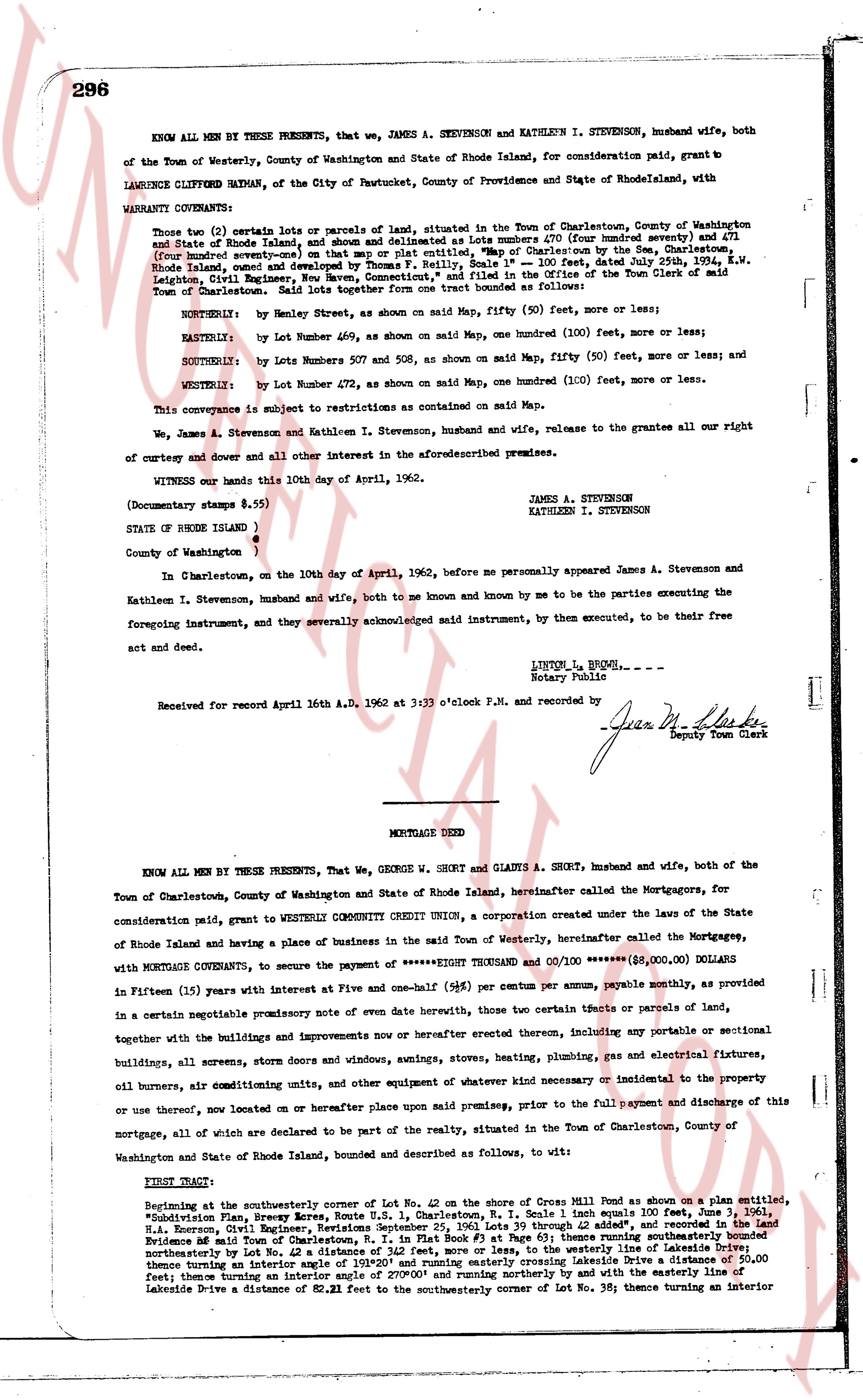
KNOW ALL MEN BY THESE PRESENTS, that we, JAMES A. STEVENSON and KATHLEEN I. STEVENSON, husband wife, both of the Town of Westerly, County of Washington and State of Rhode Island, for consideration paid, grant to LAWRENCE CLIFFORD HAYMAN, of the Town of Pawcutucket, County of Providence and State of Rhode Island, with WARRANTY CONVEYANCE:
Those (3) certain lots or parcels of land, situated in the Town of Charlestown, County of Washington and State of Rhode Island, and shown and delineated as Lots number 470 (four hundred seventy) and 471 (four hundred seventy-one) on that map or plat entitled, "Map of Charlestown by the Sea Charlestown, Rhode Island" and dated September 15, 1936, and recorded April 10, 1937, deed book 27, page 179, by Leighton, Civil Engineer, Roug New Haven, Connecticut," and filed in the Office of the Town Clerk of said Town of Charlestown. Said lots together form one tract bounded as follows:
NORTHERLY: by Henley Street, as shown on said map, fifty (50) feet, more or less;
EASTERLY: by Lot number 469, as shown on said map, one hundred (100) feet, more or less;
SOUTHERLY: by Lots number 507 and 508, as shown on said map, fifty (50) feet, more or less; and
WESTERLY: by Lot number 472, as shown on said map, one hundred (100) feet, more or less.
This conveyance is subject to restrictions as contained on said Map.
We, James A. Stevenson and Kathleen I. Stevenson, husband and wife, reserve to the grantees all our right of curtesy and dower and all other interest in the aforesaid premises.
WITNESS our hands this 10th day of April, 1962.
(Documentary stamps $5.55)
JAMES A. STEVENSON
KATHLEEN I. STEVENSON
STATE OF RHODE ISLAND )
County of Washington )
In Charlestown, on the 10th day of April, 1962, before me personally appeared James A. Stevenson and Kathleen I. Stevenson, husband and wife, both to me known and by me to be the parties executing the foregoing instrument, and they severally acknowledged said instrument, by them executed, to be their free act and deed.
LINTON L. BROWN,
Notary Public
Received for record April 16th A.D. 1962 at 3:33 o'clock P.M. and recorded by
Jean M. [?]
Deputy Town Clerk
----
MORTGAGE DEED
KNOW ALL MEN BY THESE PRESENTS, That we, GEORGE W. SHORET and GLAUDIS A. SHORET, husband and wife, both of the Town of Charlestown, County of Washington and State of Rhode Island, hereinafter called the Mortgagors, for consideration paid, grant to WESTERLY COMMUNITY CREDIT UNION, a corporation created under the laws of the State of Rhode Island and having a place of business in the said Town of Westerly, hereinafter called the Mortgagee, with MORTGAGE CONVEYANCE, to secure the payment of "$****** EIGHT THOUSAND SIX HUNDRED 00/100 ($*****,00.00) DOLLARS One thousand eight hundred sixty dollars" in Fifteen (15) years with interest at Five and one-half (5 1/2%) per centum per annum, payable monthly, as provided in a certain negotiable promissory note of even date herewith, those two certain parcels or parts of land, together with the buildings and improvements now or hereafter erected thereon, including any portable or sectional buildings, all screens, storm doors and windows, awnings, stoves, heating, plumbing, gas and electrical fixtures, oil burners, air conditioning units, and other equipment of whatever kind necessary or incidental to the property or use thereof, now located or hereafter place upon said premises, prior to the full payment and discharge of this mortgage, all of which are declared to be part of the realty, situated in the Town of Charlestown, County of Washington and State of Rhode Island, bounded and described as follows, to wit:
FIRST TRACT:
Beginning at the southeasterly corner of Lot No. 42 on the shore of Gross Mill Pond as shown on a plat entitled, "Subdivision Plan, Brawley Estate, Route No. 1, Charlestown, R.I. Scale 1 inch equals 100 feet, June 1, 1961," H.A. Emerson, Civil Engineer, recorded September 12, 1961, in Land Evidence Book 34 at Page # 83; thence running southeasterly bounded northerly by Lot No. 42 a distance of 34.52 feet, more or less, to the westerly line of Lakeside Drive; thence turning an interior angle of 270°00' and running northerly by said Lakeside Drive for a distance of 100.00 feet; thence turning an interior angle of 270°00' and running northerly by and with the easterly line of Lakeside Drive a distance of 65.23 feet to the southeasterly corner of Lot No. 38; thence turning an interior
The page as recorded