The instrument's own words
page 1 · read by Gemma vision
292
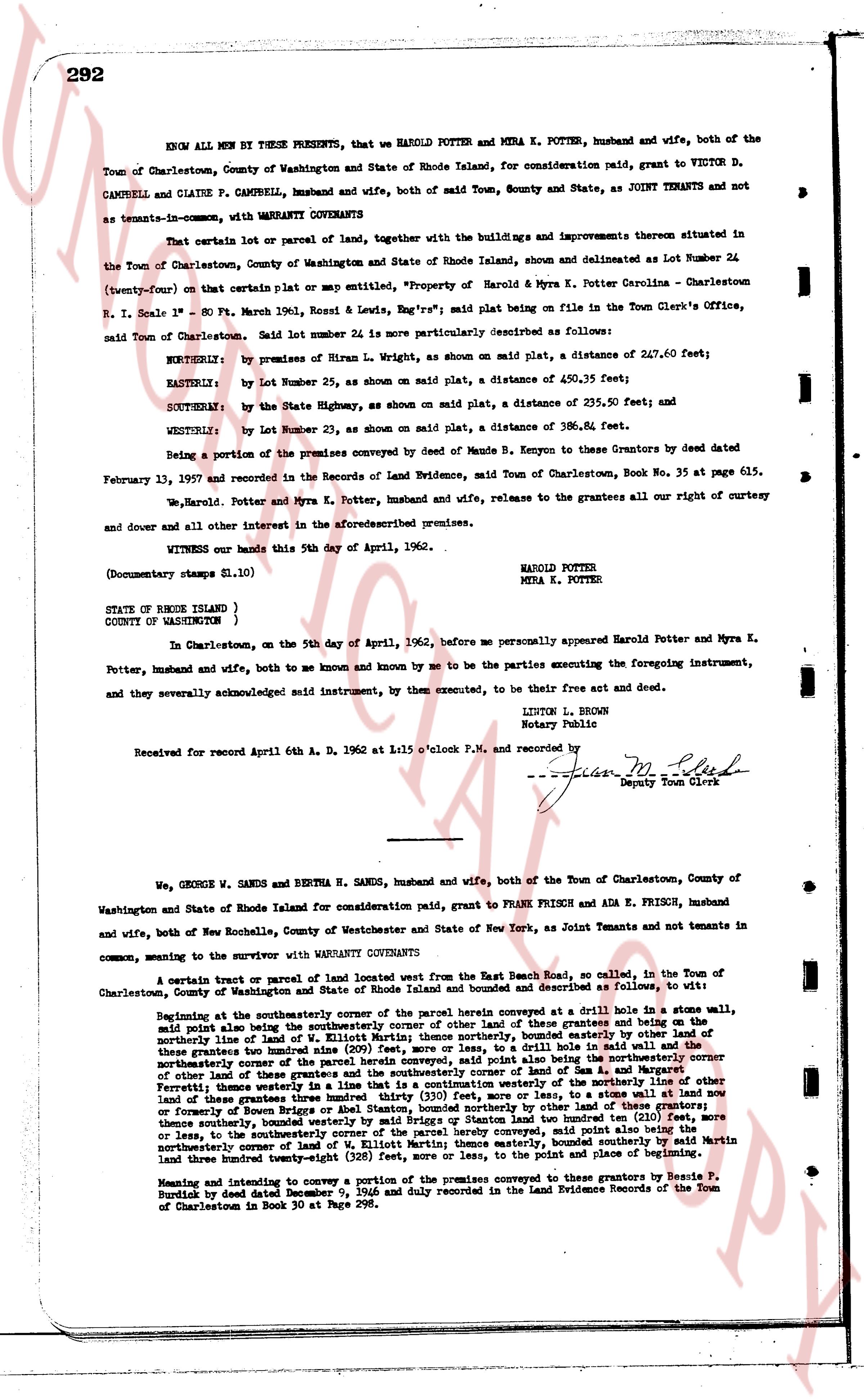
KNOW ALL MEN BY THESE PRESENTS, that we HAROLD POTTER and MYRA K. POTTER, husband and wife, both of the Town of Charlestown, County of Washington and State of Rhode Island, for consideration paid, grant to VICTOR D. CAMPBELL and CLAIRE P. CAMPBELL, husband and wife, both of said Town, County and State, as JOINT TENANTS and not as tenants-in-common, with WARRANTY COVENANTS
That certain lot or parcel of land, together with the buildings and improvements thereon situated in the Town of Charlestown, County of Washington and State of Rhode Island, shown and delineated as Lot Number 24 (twenty-four) on that certain plat or map entitled, "Property of Harold & Myra K. Potter Carolina - Charlestown R.I. Scale 1" = 80 Ft. March 1961, Noel & Engstrom's map filed being in the Town Clerk's Office, said Town of Charlestown. Said lot number 24 is more particularly described as follows:
NORTHERLY: by premises of Riran L. Wright, as shown on said plat, a distance of 247.60 feet;
EASTERLY: by Lot Number 25, as shown on said plat, a distance of 450.35 feet;
SOUTHERLY: by the State Highway, as shown on said plat, a distance of 235.50 feet; and
WESTERLY: by Lot Number 23, as shown on said plat, a distance of 386.81 feet.
Being a portion of the premises conveyed by deed of Maude B. Kenyon to Grantees by deed dated February 13, 1937 and recorded in the Records of Land Evidence, Town of Charlestown, Book No. 35 at page 615.
We, Harold Potter and Myra K. Potter, husband and wife, release to the grantees all our right of curtesy and dower and all other interest in the aforesaid premises.
WITNESS our hands this 5th day of April, 1962.
HAROLD POTTER
MYRA K. POTTER
(Documentary stamps $11.10)
STATE OF RHODE ISLAND )
COUNTY OF (WASHINGTON )
In Charlestown, on the 5th day of April, 1962, before me personally appeared Harold Potter and Myra K. Potter, husband and wife, both to me known and by me to be the parties executing the foregoing instrument, and they severally acknowledged said instrument, to be their free act and deed.
LINTON L. BROWN
Notary Public
Received for record April 6th A. D. 1962 at 11:05 o'clock P.M. and recorded by
[signature] [?] Deputy Town Clerk
----
We, GEORGE W. SANDS and BERTHA N. SANDS, husband and wife, both of the Town of Charlestown, County of Washington and State of Rhode Island for consideration paid, grant to FRANK FRISCH and ADA E. FRISCH, husband and wife, both of New Rochelle, County of Westchester and State of New York, as Joint Tenants and not tenants in common, meaning to the survivor with WARRANTY COVENANTS
A certain tract or parcel of land located west from the East Branch Road, so called, in the Town of Charlestown, County of Washington and State of Rhode Island and bounded and described as follows, to wit:
Beginning at the southeasterly corner of the parcel herein conveyed at a drill hole in a stone wall, said point also being the southeasterly corner with the land of the grantee and the northeasterly corner of the boundary line of the land of W. Elliott Martin, thence northerly, bounded easterly by land of other of these grantees two hundred nine (209) feet, more or less, to a drill hole in a stone wall, thence northwesterly corner of the land of W. Elliott Martin, the line so running being the northeasterly corner of other land of these grantees and the southeasterly corner of land of Sam L. and Margaret L. [?], thence easterly a distance of one hundred twenty-five (125) feet, more or less, to the northeasterly corner of other land of these grantees three hundred thirty (330) feet, more or less, to a stone wall at land now or formerly of George B. Sanders, the line so running being the northeasterly corner of land of other of these grantees two hundred ninety-four (294) feet, more or less, to a drill hole in a stone wall, thence southerly, bounded westerly by said Briggson or Sanders lot two hundred ten (210) feet, more or less, to the northeasterly corner of the land of W. Elliott Martin, thence easterly, bounded northerly by the northeasterly corner of the land of W. Elliott Martin; thence easterly, bounded southerly by said Martin land three hundred twenty-eight (328) feet, more or less, to the point and place of beginning.
Meaning and intending to convey a portion of the premises conveyed to the grantors by Henry P. Sanders by deed dated December 7, 1931 and duly recorded in the Land Evidence Records of the Town of Charlestown in Book 30 at Page 298.
The page as recorded