The instrument's own words
page 1 · read by Gemma vision
290
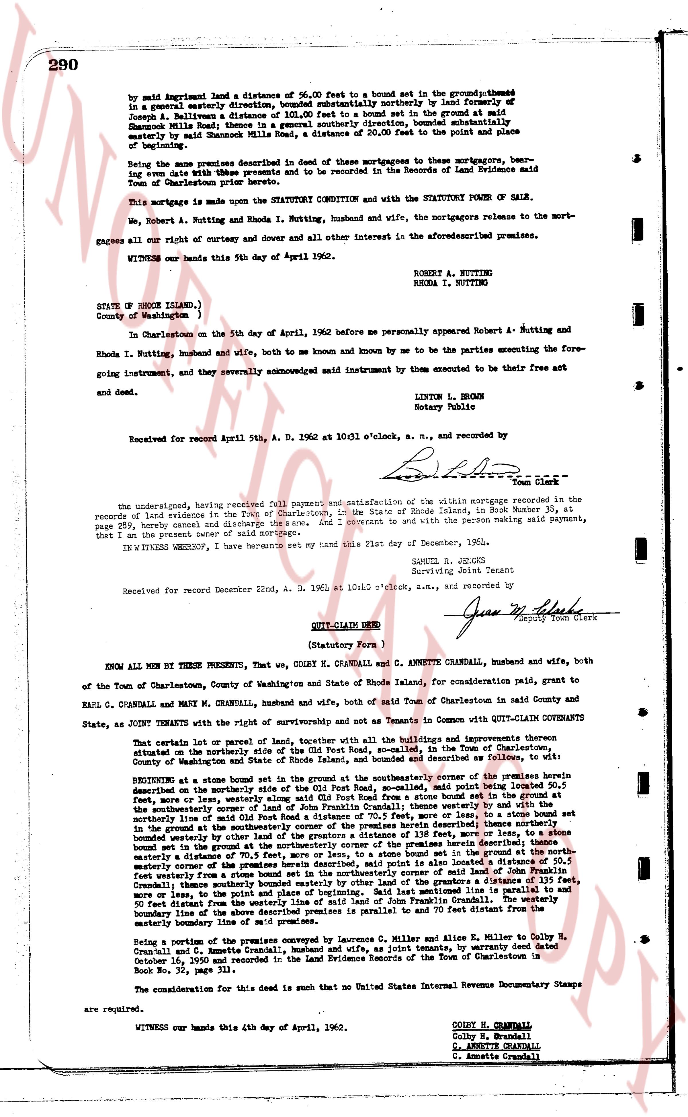
by said Agreement land a distance of 56.00 feet to a bound set in the ground;thence in a general easterly direction, bounded substantially northerly by land formerly of Joseph A. Ballivan a distance of 101.00 feet to a bound set in the ground at said Shamrock Mills Road;thence in a general south easterly direction, bounded substantially easterly by Shamrock Mills Road, a distance of 20.00 feet to the point and place of beginning.
Being the same premises described in deed of these mortgages to these mortgagors, bearing same date with these premises and to be recorded in the Records of Land Evidence said Town of Charlestown prior hereunto.
This mortgage is made upon the STATUTORY CONDITION and with the STATUTORY POWER OF SALE.
We, Robert A. Nutting and Rhoda I. Nutting, husband and wife, the mortgagors release to the mortgagees all our right of curtesy and dower and cover all other interest in the aforesaid premises.
WITNESS our hands this 5th day of April 1962.
ROBERT A. NUTTING
RHODA I. NUTTING
STATE of RHODE ISLAND,)
County of Washington )
In Charlestown on the 5th day of April, 1962 before me personally appeared Robert A. Nutting and Rhoda I. Nutting, husband and wife, both to me and known by me to be the parties executing the foregoing instrument, and they severally acknowledged said instrument by them executed to be their free act and deed.
LINTON L. BROWN
Notary Public
Received for record April 5th, A. D. 1962 at 10:31 o'clock, a. m., and recorded by
[Signature]
Town Clerk
the undersigned, having received full payment and satisfaction of the within mortgage recorded in the records of land evidence in the Town of Charlestown, in the State of Rhode Island, in Book Number 38, at page 289, hereby cancel and discharge the same. And I covenant to and with the person making said payment, that I am the present owner of said mortgage.
IN WITNESS WHEREOF, I have hereunto set my hand this 21st day of December, 1964.
SAMUEL R. JENCKS
Surviving Joint Tenant
Received for record December 22nd, A. D. 1964 at 10:40 o'clock, a.m., and recorded by
[Signature]
Deputy Town Clerk
----
QUIT-CLAIM DEED
(Statutory Form )
KNOW ALL MEN BY THESE PRESENTS, That we, COLBY H. CRANDALL and ANNETTE CRANDALL, husband and wife, both of the Town of Charlestown, County of Washington and State of Rhode Island, for consideration paid, grant to Earl C. CRANDALL and MARY M. CRANDALL, husband and wife, both of said Town of Charlestown in said County and State, as JOINT TENANTS with the right of survivorship and not as Tenants in Common with QUIT-CLAIM COVENANTS
That certain lot of land, parcel or lot of land, together with all the buildings and improvements thereon situated on the property described in the grantor's deed, said lot, pooled in the Town of Charlestown, County of Washington and State of Rhode Island, and described as follows or substantially as follows:
BEGINNING at a stone bound set in the ground at the southwesterly corner of the premises herein described on the northside of the Old Post Road, so-called, said point being thus described, namely bound thence northerly 50.5 feet, more or less, to a point set in the ground;thence easterly 110 feet to a stone bound set in the ground at the southwesterly corner of land of John Francis Crandall (thence westerly thence northerly 110 feet and a bound set in the ground at the southwesterly corner of land of John Francis Crandall) thence westerly thence northerly 110 feet to a bound set in the ground at the southwesterly corner of the premises herein described; thence northerly bound easterly by water on the length of the grantors a distance of 135 feet, more or less, and bound easterly bounded westerly by other water on the length of the premises herein described; thence southerly bound set in the ground at the south easterly corner of the premises herein described; thence easterly a distance of 70.5 feet, more or less, to a stone bound set in the ground;thence northerly 110 feet to a bound set in the ground at the north easterly corner of the premises herein described; it is also located a distance of 50.5 feet westerly from a stone bound set in the northwesterly corner of said land of John Francis Crandall, thence southerly a distance of 110 feet to a bound set in the ground;thence easterly a distance of 135 feet, more or less, to the point and place of beginning. Said lot parallel is line to parallel and 50 feet distant from the northside of the Old Post Road, so-called. Said lot is also located so that the boundary line of the above described premises is parallel and to 70 feet distant from the easterly boundary line of sm [?]
Being a portion of the premises conveyed by Lawrence G. Miller and Alice E. Miller to Colby H. Crandall and C. Annette Crandall, husband and wife, as joint tenants, by warranty deed dated October 10, 1950 and recorded in the Land Evidence Records of the Town of Charlestown in Book No. 32 page 311.
The consideration for this deed is such that no United States Internal Revenue Documentary Stamps are required.
WITNESS our hands this 4th day of April, 1962.
COLBY H. CRANDALL
Colby H. Crandall
C. ANNETTE CRANDALL
C. Annette Crandall
The page as recorded