The instrument's own words
page 1 · read by Gemma vision
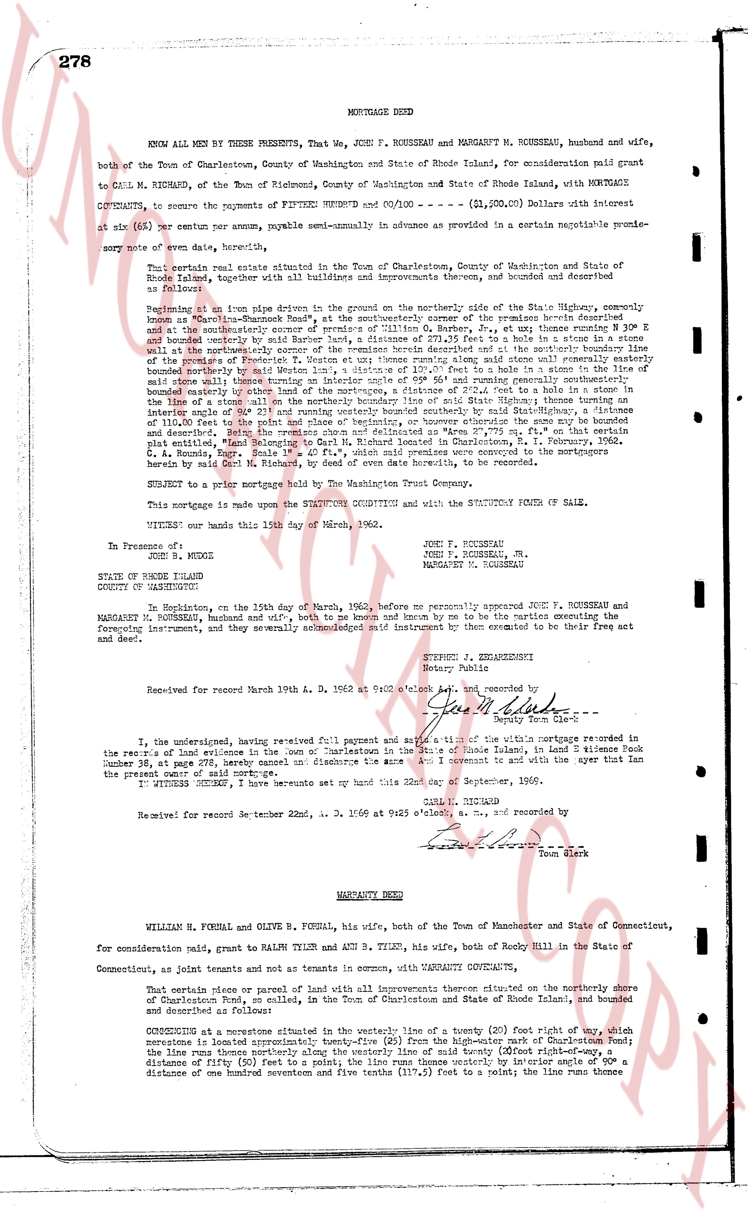
278
MORTGAGE DEED
KNOW ALL BY THESE PRESENTS, That We, John F. ROUSSEAU and MARGARET M. ROUSSEAU, husband and wife,
both of the Town of Charlestown, County of Washington and State of Rhode Island, for consideration paid grant
to CARL M. RICHARD, of the Town of Richmond, County of Washington and State of Rhode Island, with MORTGAGE
COVENANTS, to secure the payments of FIFTEEN HUNDRED and 00/100 --- ($1,500.00) Dollars with interest
at six (6%) per centum per annum, payable semi-annually in advance as provided in a certain negotiable promi-
sory note of even date hereof, thereby,
That certain real estate situated in the Town of Charlestown, County of Washington and State of
Rhode Island, together with all buildings and improvements thereon, and bounded and described as
follows:
Beginning at an iron pipe driven in the ground on the northerly side of the State Highway, commonly
known as "Champlain-Road Street", at the northeasterly corner of the premises herein described; then
a line runs southeasterly along said State Highway, by a stone wall, to a point, N 30° E and 100 feet E
and southeasterly over and bounded by my said land, for a distance of 271.25 feet to a stake in a stone in a
stone wall at the northeasterly corner of the premises herein described; then a line runs southerly along said
stone wall boundaries of my said land, for a distance of 150 feet to a stake said stone wall remains easterly
bounded northerly by state Western land, a distance of 137.5 feet to a hole in a stone in the line of
said stone wall boundaries of my said land, for a distance of 150 feet to a stake in a stone in a
bounded easterly by other land of the mortgagees, a distance of 232.5 feet to a stake in a stone in the
line of said stone wall boundaries of my said land, for a distance of 150 feet to a stake in a stone in an
interior angle of 90° 23' and running westerly bounded southerly by said State Highway, a distance
of 110.0 feet to a stake in a stone in a stone wall, then northerly along the same boundary as above
described, then the premises once more delineated as "Area 2, 75, 75 sq. ft." on that certain plat
certified by the surveyor, dated June 15, 1936, and recorded in the land evidence book 33, page 402,
C. A. Bouris, Engr. Scale 1" = 40', which said premises were conveyed to the mortgagors
herein by said Carl M. Richard, by deed of even date hereof, to be recorded.
SUBJECT to a prior mortgage held by The Washington Trust Company.
This mortgage is made upon the STATUTORY CONDITIONS and with the STATUTORY FORM OF SALE.
WITNESS our hands this 19th day of March, 1960.
John F. ROUSSEAU
John F. ROUSSEAU, Jr.
MARGARET M. ROUSSEAU
In Presence of:
[?]
STATE OF RHODE ISLAND
COUNTY OF WASHINGTON
In Hopkinton, on the 19th day of March, 1960, before me personally appeared JOHN F. ROUSSEAU and
MARGARET M. ROUSSEAU, husband and wife, both to me known and known by me to be the parties executing the
foregoing instrument, and they severally acknowledged said instrument to be executed by them to be their act
and deed.
STEVEN J. EHRHARDT
Notary Public
Received for record March 19th A. D. 1960 at 9:00 o'clock A.M. and recorded by
[Signature]
Deputy Town Clerk
I, the undersigned, having received full payment and satisfaction of the within mortgage referred to in
the records of land evidence in the town of Charlestown in the state of Rhode Island, in land evidence Book
number 38, at page 278, hereby cancel or discharge the same and do covenant and to with the aver that Ian
the present owner of said mortgage.
IN WITNESS WHEREOF, I have hereunto set my hand this 22nd day of September, 1966.
CARL M. RICHARD
Received for record September 22nd, A. D. 1966 at 9:45 o'clock a. m., and recorded by
[Signature]
Town Clerk
----
WARRANTY DEED
WILLIAM H. FORBAL and OLIVE B. FORBAL, his wife, both of the Town of Manchester and State of Connecticut,
for consideration paid, grant to MALVIN TYLER and ANN S. TYLER, his wife, both of Rocky Hill in the State of
Connecticut, as joint tenants and not as tenants in common, with WARRANTY COVENANTS,
That certain piece or parcel of land with all improvements thereon situated on the southerly shore of
Chaputicut Pond, as now called, in the Town of Charlestown and State of Rhode Island, bounded and
described as follows:
COMMENCING at a limestone situated in the center of the State Highway, a twenty foot right of way, which
limestone is located approximately fifty (50) feet from the high-water mark of Charlestown Pond; the
line runs then northerly along the westerly line of said twenty (20) foot right-of-way, a
distance of fifty (50) feet to a point; the line runs thence westerly by interior angle of 90° a
distance of one hundred seventy and five tenths (175.5 feet) to a point; the line runs thence
The page as recorded