The instrument's own words
page 1 · read by Gemma vision
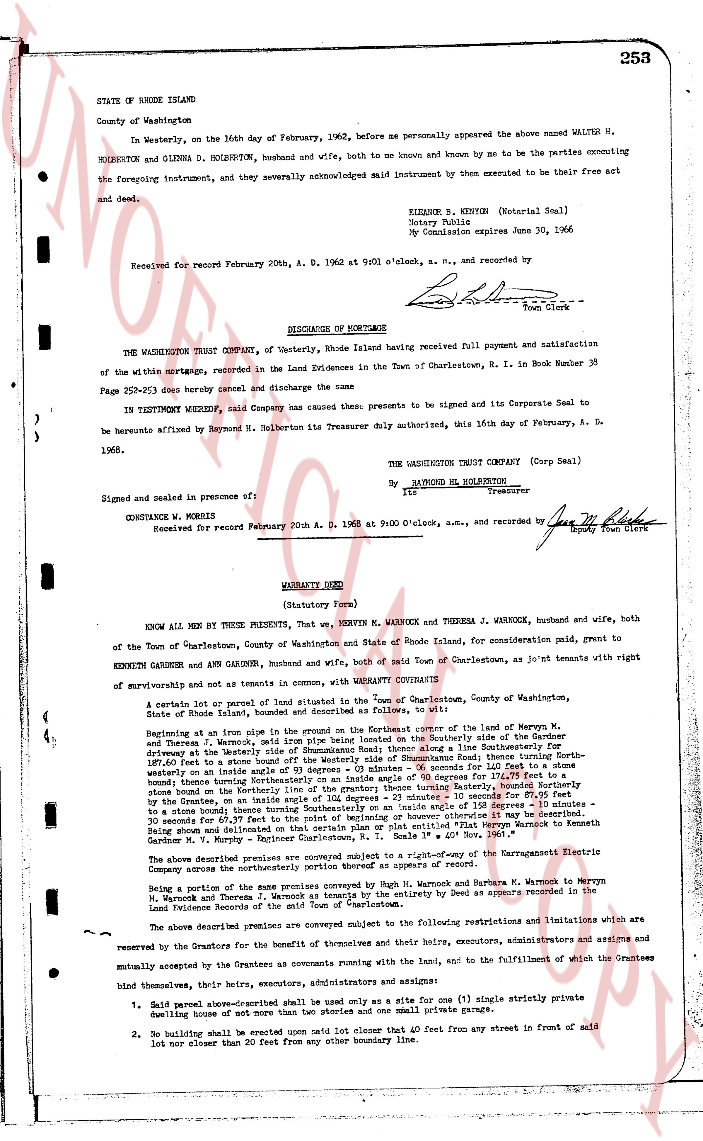
STATE OF RHODE ISLAND 253
County of Washington
In Westerly, on the 16th day of February, 1962, before me personally appeared the above named WALTER H. HOLBERTON and GLENDA D. HOLBERTON, husband and wife, both to me known and by me to be the parties executing the foregoing instrument, and they severally acknowledged said instrument by then executed to be their free act and deed.
ELEANOR B. KENYON (Notarial Seal)
Notary Public
My Commission expires June 30, 1966
Received for record February 20th, A. D. 1962 at 9 o'clock, a. m., and recorded by L.L. --- Town Clerk
DISCHARGE OF MORTGAGE
THE WASHINGTON TRUST COMPANY, of Westerly, Rhode Island having received full payment and satisfaction of the within mortgage, recorded in the Land Evidences in the Town of Charlestown, R. I. in Book Number 38 Page 252-253 does hereby cancel and discharge the same
IN TESTIMONY WHEREOF, said Company has caused these presents to be signed and its Corporate Seal to be hereunto affixed by Raymond H. Holberton its Treasurer duly authorized, this 16th day of February, A. D. 1962.
THE WASHINGTON TRUST COMPANY (Corp Seal)
By RAYMOND HL HOLBERTON
Its Treasurer
Signed and sealed in presence of:
CONSTANCE W. MORRIS
Received for record February 20th A. D. 1962 at 9:00 O'clock, a.m., and recorded by Jane M. Clark Deputy Town Clerk
----
WARRANTY DEED
(Statutory Form)
KNOW ALL MEN by THESE PRESENTS, That, we, MERVYN M. WARNOCK and THERESA J. WARNOCK, husband and wife, both of the Town of Charlestown, County of Washington and State of Rhode Island, for consideration paid, grant to KENNETH GARDNER and ANN GARDNER, husband and wife, both of said Town of Charlestown, as Jo'int tenants with right of survivorship and not as tenants in common, with WARRANTY CONVEYANTS
A certain lot or parcel of land situated in the Town of Charlestown, County of Washington, State of Rhode Island, bound and described as Follows, to wit:
Beginning at an iron pipe sunk in the ground on the Northeastern corner of the land of Mervyn M. and Theresa J. Warnock, said iron pipe being on the Southeasterly side of the Summerhouse Road driveway at the Westerly side of Summerhouse Road thence along a line Southeasterly 41.7 +/- feet to a stone bound on the Northeasterly side of Summerhouse Road; thence running Northwesterly on westerly side an angle of 93 degrees 03 minutes .05 seconds for 66.00 feet to a stone bound on the boundary fence turning Southeasterly 90 degrees 00 minutes for 126.00 feet to a stone bound on the boundary fence turning Northeasterly line of the grantey turning Easterly, bounded Northeasterly by the Grantees, on an angle inside 103 degrees 31 minutes .15 seconds for 66.00 feet to a stone bound on the boundary fence turning Southeasterly on an angle inside of 184 degrees 15 minutes .05 seconds 30 minutes for 66.00 feet to a stone bound on the boundary fence turning Southeasterly on an angle inside of 184 degrees 15 minutes .05 seconds 30 minutes for 66.00 feet to the point of beginning; or more particularly as shown on Plat entitled "Plat Mervyn Warnock to Kenneth Gardner M. V. Murphy - Engineer Charlestown, R.I. Scale 1" = 40' Nov. 1961."
The above described premises are conveyed subject to a right-of-way of a Saratoga remnant the Streeting Camp across the northeasterly corner of the premises as appears of record.
Being a portion of the same premises conveyed by Hugh M. Warnock and Barbara M. Warnock to Mervyn M. Warnock and Theresa J. Warnock as tenants by the entirety by Deed as appears recorded in the Land Evidence Records of the said Town of Charlestown.
The above described premises are conveyed subject to the following restrictions and limitations which are reserved for the Grantees for the benefit of themselves and their heirs, executors, administrators and assigns and mutually accepted by the Grantees as covenants running with the land, and to the fulfillment of which the Grantees bind themselves, their heirs, executors, administrators and assigns:
1. Said parcel above-described shall be used only as a site for one (1) single strictly private dwelling house of not more than 2 1/2 stories and one (1) private garage.
2. No building shall be erected upon said lot closer than 40 feet from any street in front of said lot nor closer than 20 feet from any other boundary line.
page 2 · read by Gemma vision
254
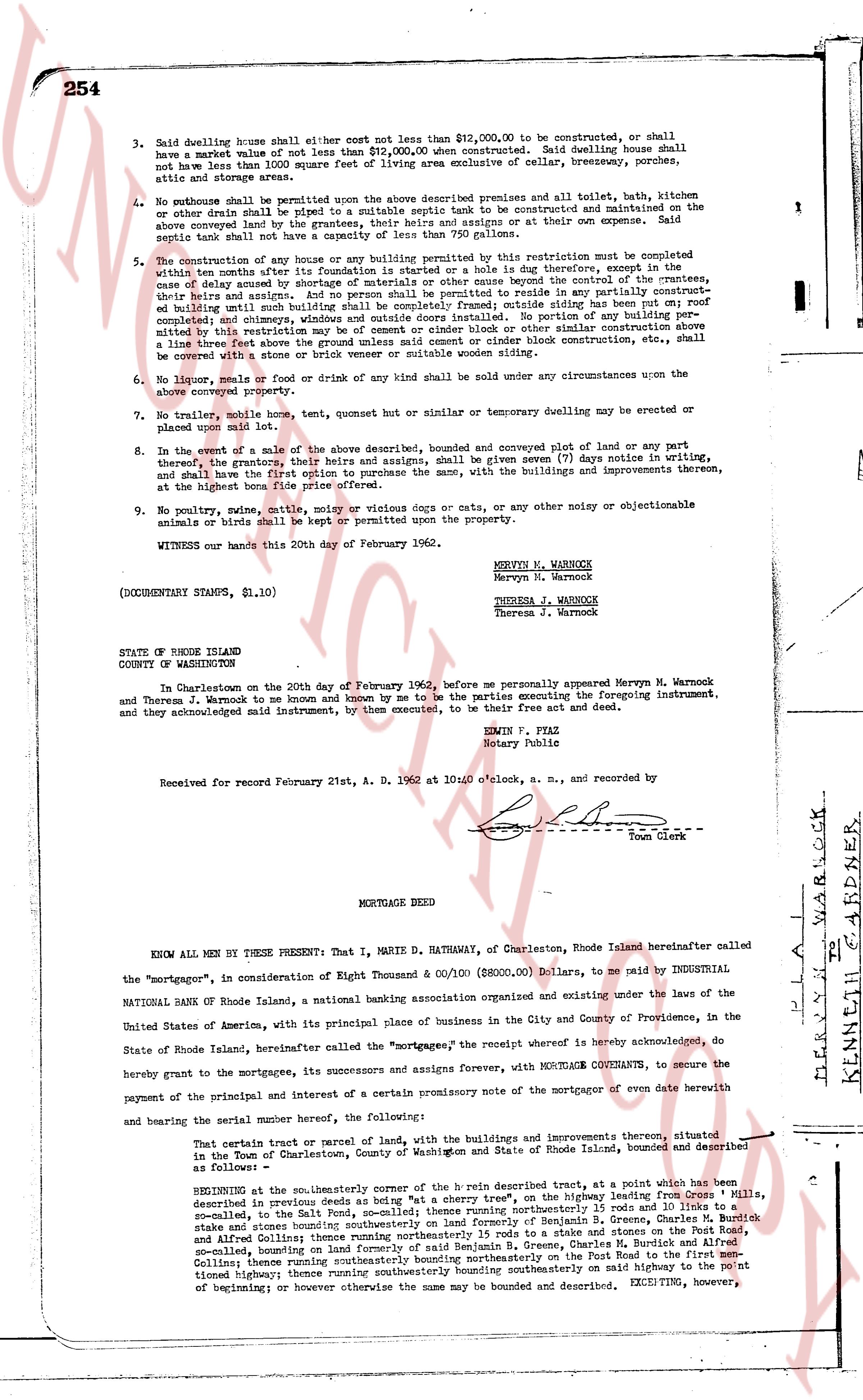
3. Said dwelling house shall either cost not less than $12,000.00 to be constructed, or shall have a market value of not less than $12,000.00 when constructed. Said dwelling house shall not have less than 1000 square feet of living area exclusive of cellar, breezeways, porches, patios, and storage areas.
4. No outhouse shall be permitted upon the above described premises and all toilet, bath, kitchen or other drain shall be piped to a suitable septic tank to be constructed and maintained on the above conveyed land by the grantees or their successors or assigns at their own expense; said septic tank shall not have a capacity of less than 750 gallons.
5. The construction of any house or any building permitted by this restriction must be completed within ten months after its foundation is started or a hole is dug therefor, except in the case of delay caused by shortage of labor or materials beyond the control of the grantees, their heirs and assigns. And no person shall be permitted to reside in any partly constructed, or unfinished building until such building shall be completed inside siding and roof; roof completed; chimneys and windows installed and outside doors installed. No portion of any building permitted by this restriction shall be constructed of wood frame or other similar construction unless it have a lime line three feet above the ground unless said cement or cinder block construction etc., shall be covered with stone, stucco or brick veneer or suitable wooden siding.
6. No store, hotel or drink of any kind shall be sold under any circumstances upon the above conveyed property.
7. No trailer, mobile home, tent, quenet bur or similar or temporary dwelling may be erected or placed upon said lot.
8. In the event of a sale of the above described premises, conveyed and conveyed plot of land or any part thereof, by the grantees, their heirs and assigns, shall be given seven (7) days notice in writing, and shall have the first option to purchase the same, with the buildings and improvements thereon, at their request for the full purchase price.
9. No poultry, swine, cattle, noisy or vicious dogs or cats, or any other noisy or objectionable animals or birds shall be kept or permitted upon the property.
WITNESS our hands this 20th day of February 1962.
MERVYN M. WARNOCK
Mervyn M. Warnock
THERESA J. WARNOCK
Theresa J. Warnock
(DOCUMENTARY STAMPS, $1.10)
STATE OF RHODE ISLAND
COUNTY OF WASHINGTON
In Charlestown on the 20th day of February 1962, before me personally appeared Mervyn M. Warnock and Theresa J. Warnock to me known and known by me to be the parties executing the foregoing instrument, and they acknowledged said instrument, by them executed, to be their free act and deed.
ERWIN P. PIAZ
Notary Public
Received for record February 21st, A. D. 1962 at 10:00 o'clock, a. m., and recorded by
[Signature]
Town Clerk
----
MORTGAGE DEED
KNOW ALL MEN BY THESE PRESENT: That I, MARIE D. HATHAWAY, of Charlestown, Rhode Island hereinafter called the "mortgagor", in consideration of Eight Thousand & 00/100 ($8000.00) Dollars, to me paid by INDUSTRIAL NATIONAL BANK of Rhode Island, a national banking association organized and existing under the laws of the United States of America, with its principal place of business in the City and County of Providence, in the State of Rhode Island, hereinafter called the "mortgagee", the receipt whereof is hereby acknowledged, do hereby grant to the mortgagees and its successors and assigns forever, WITH MORTGAGE COVENANTS, to secure the payment of the principal and interest of a certain promissory note of the mortgagor of even date herewith and bearing the serial number hereof, the following:
That certain tract or parcel of land, with the buildings and improvements thereon situated in the Town of Charlestown, County of Washington and State of Rhode Island, bounded and described as follows:
BEGINNING at the South East corner of the b line described heretofore, at a point which has been described in previous deeds as being "at a cherry tree", on the highway leading from "Crees Mills", so-called, to the Salt Pond, so-called; thence running northeasterly 15 rods and 10 links to a stake and stone wall, bounding southerly the land of Benjamin and Sarah Moore, thence running northeast to a stake and stone wall bounding southerly the land of Benjamin and Sarah Moore, thence running northeasterly 15 rods to a stake and stones on the Porks and Salt Pond Allbee Collins; thence running southeasterly 15 rods to a stake, on the land of Charles W. Allbee, so-called, bounding on land formerly of said Benjamin and Sarah Moore, thence running southeasterly on the Post Road to the first mentioned beginning; thence running southwesterly bounding southeasterly on said highway to the point of commencement; however otherwise the same may be bounded and described, EXCEPTING, however,
page 3 · read by Gemma vision
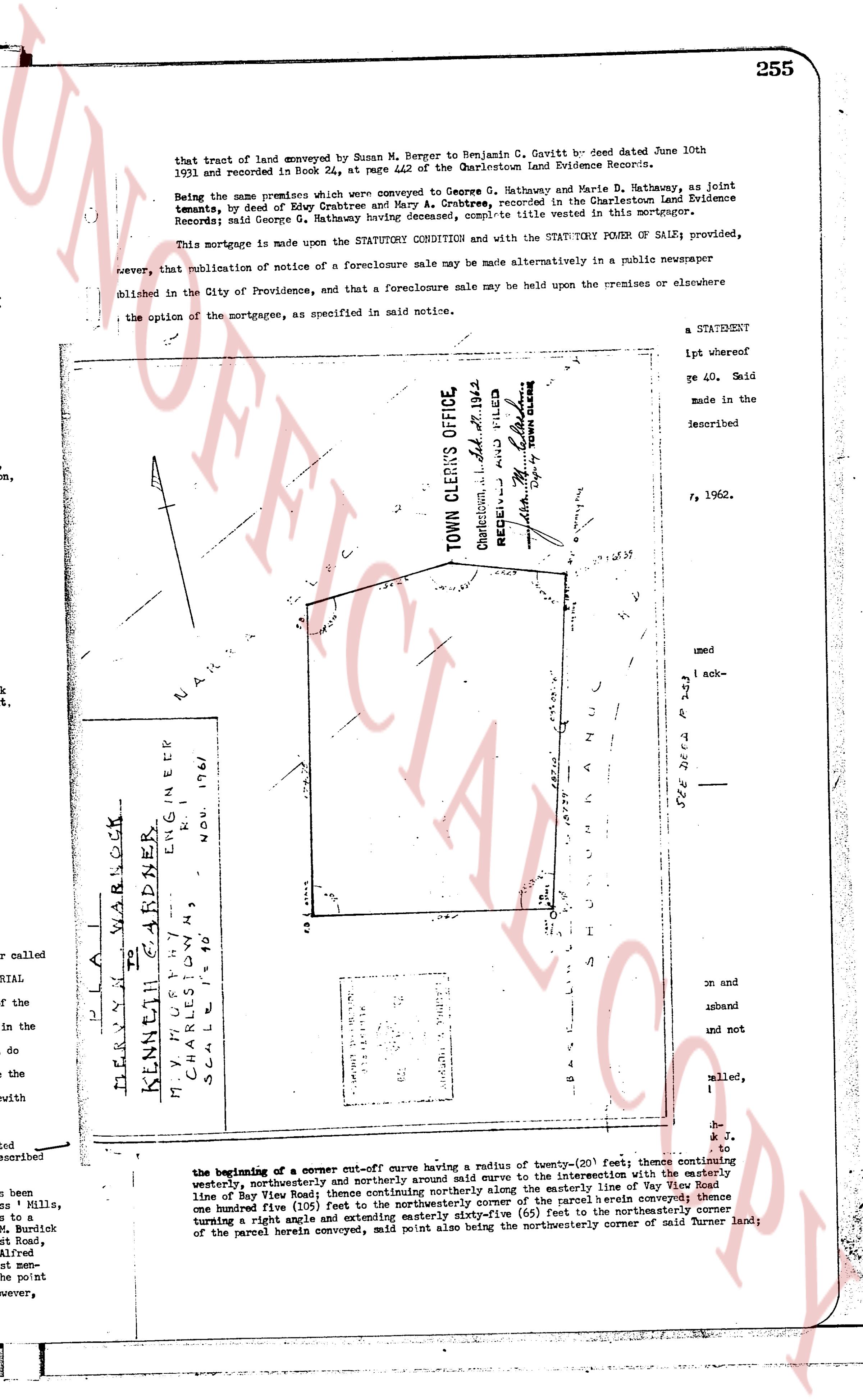
that tract of land conveyed by Susan M. Berger to Benjamin G. Cavitt by deed dated June 10th 1931 and recorded in Book 24, at page 442 of the Charlestown Land Evidence Records.
Being the same premises which were conveyed to George G. Hathaway and Marie M. Hathaway, as joint tenants, by deed of Edwy Crabtree and Mary A. Crabtree, recorded in the Charlestown Land Evidence Records; said George G. Hathaway having conveyed the marketable title vested in this mortgagor.
This mortgage is made upon the STATUTORY CONDITION and with the STATUTORY POWER OF SALES provided, however, that publication of notice of a foreclosure sale may be made alternatively in a public newspaper published in the City of Providence, and that a foreclosure sale may be held upon the premises or elsewhere the option of the mortgagee, as specified in said notice.
a STATEMENT
ipt whereof
re 40. Said
made in the
described
, 1962.
TOWN CLERKS OFFICE,
Charlestown, R.I. filed Feb 21 1962
RECEIVED AND FILED
By Deputy TOWN CLERK
[Signature]
[Map/Plat Image]
MERVYN M WARNOCK
KENNETH GARDNER
MY SURVEY BY
CHARLES DYKMAN
R.I.
ENGINEER
N.O.V. 17 1961
SCALE 1" = 100'
[Map annotations]
SEE DEED Bk 38 p 253
S H U N N A N U L
B A S C O M S L A N D S
S O U T H
S O U T H E A S T
S O U T H W E S T
N O R T H
N O R T H W E S T
N O R T H E A S T
N A R R A G A N S E T T
L A K E
the beginning of a corner cut-off curve having a radius of twenty-(20) feet; thence continuing northwesterly and northerly around said curve to the intersection with the easterly line of Bay View Road; thence continuing northerly along the easterly line of Bay View Road one hundred five (105) feet to the northwesterly corner of the parcel herein described; thence turning east 90 deg and extending easterly one hundred fifty-five (155) feet to the northeasterly corner of the parcel herein conveyed, said point also being the northwesterly corner of said Turner land;
The page as recorded