The instrument's own words
page 1 · read by Gemma vision
246
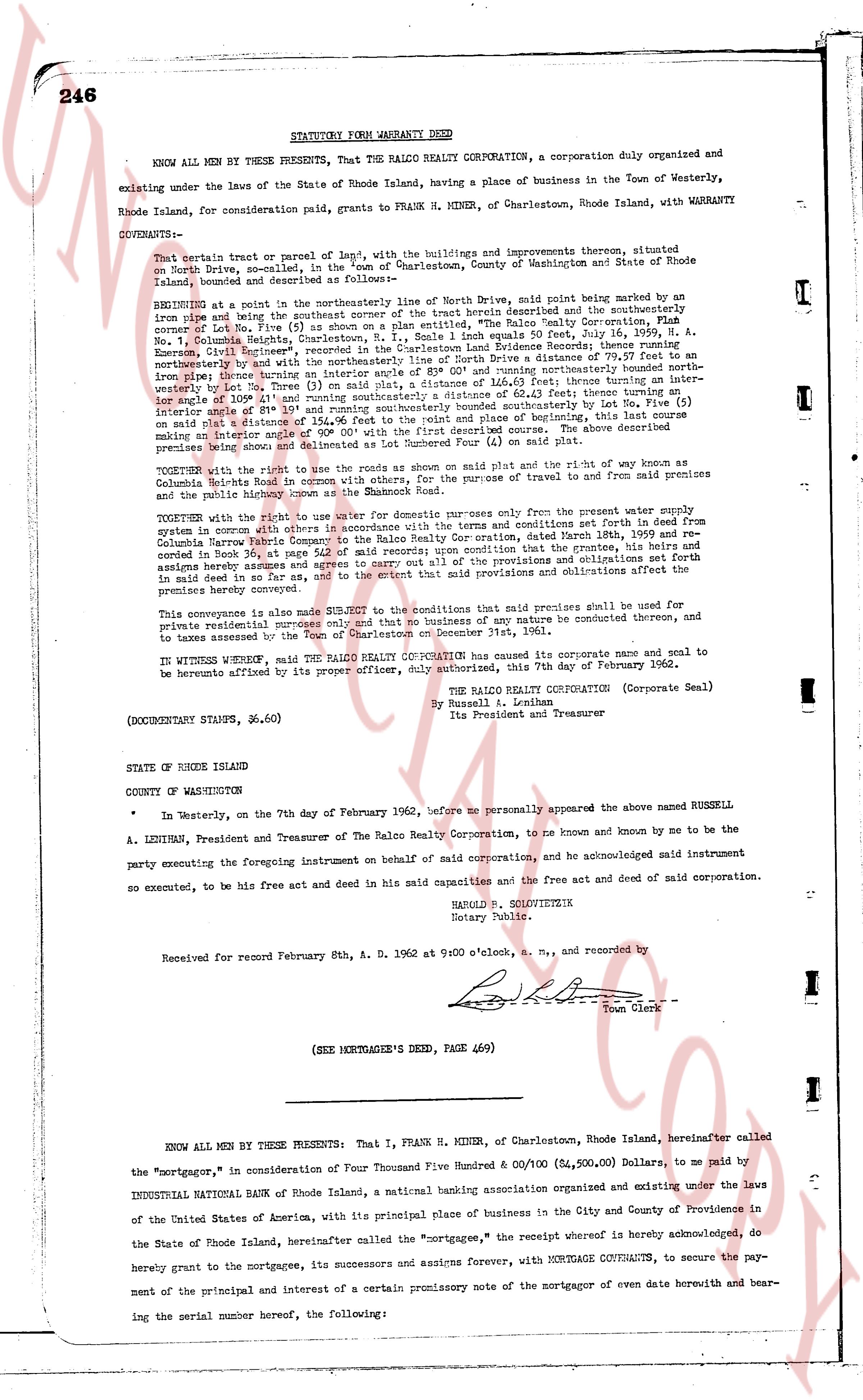
STATUTORY FORM WARRANTY DEED
KNOW ALL MEN BY THESE PRESENTS, That the RALCO REALTY CORP, a corporation duly organized and existing under the laws of the State of Rhode Island, having a place of business in the Town of Westerly, Rhode Island, for consideration paid, grants to FRANK H. MINER, of Charlestown, Rhode Island, with WARRANTY COVENANTS:
That certain tract of parce of land" of, with the buildings and improvements thereon, situated on North Drive, so-called, in the "Town of Charlestown, County of Washington and State of Rhode Island, bounded and described as follows:
BEGINNING at a point in the northeasterly line of North Drive, said point being marked by an iron pipe and being the southeasterly corner of the tract herein described and the southeasterly corner of Lot Five (5) of a plan entitled, "The Ralco Realty Corporation, Plan Number 1, Co. No. 1, Columbia Heights, Charlestown, R.I.," recorded in Charlestown Land Evidence Books 33, Page 111, by Russell A. Lenihan, President of the Ralco Realty Corporation Land Evidence Books 33, Page 111; thence running northeasterly and by the northeasterly line of North Drive a distance of 79.37 feet to an iron pipe, being the northeasterly corner of Lot Five (5) and running northeasterly bounding northeasterly bound north line, bearing North 31 degrees 0 minutes and 0 seconds East, 62 feet thence running intersectionally over boundary line of Lot 3, on said plat and distance of 114.63 feet thence running thence intersecting boundary line of Lot 4, on said plat and distance of 114.63 feet thence running intersectionally over boundary line of Lot 4, on said plat and distance of 64.42 feet thence running intersectionally making an interior angle of 90 degrees 00' and running southeasterly bound southeasterly by Lot Five (5) on said plat a distance of 114.63 feet thence running intersectionally over boundary line of North Drive, making an interior angle of 90 degrees 00' with the first described course. The above described premises being shown and delineated as Lot Five (5) on said plat.
TOGETHER with the right to use the roads as shown on said plat and the right of way known as Columbia Heights Rails road in common with others, for the purpose of travel to and from said premises and the public highway known as the Shamrock Road.
TOGETHER with the right to use the water supply for domestic purposes only from the present water supply system in common with other lot owners, subject to the terms and conditions set forth in deed from Columbia Harbor Radio Company to the Ralco Realty Corporation, dated March 24th, 1941, recorded in Book 23, page 147, of the Charlestown land evidence records, provided that the promisor, his heirs and assigns hereby assume and agrees to carry out all of the provisions and obligations set forth in said deed in so far as they are applicable to the provisions and obligations affecting the premises hereby conveyed.
This conveyance is also made SUBJECT to the restriction that said premises shall be used for private residential purposes only, and that no business of any nature shall be conducted thereunto, and to be lasted answered by the Town of Charlestown on December 31st, 1961.
IN WITNESS WHEREOF, said the RALCO REALTY CORPORATION has caused its corporate name and seal to be hereunto affixed by its proper officer, duly authorized, this 7th day of February 1962.
(Corporate Seal)
The RALCO REALTY CORPORATION
By Russell A. Lenihan,
Its President and Treasurer
(DOCUMENTARY STAMPS, $6.60)
STATE OF RHODE ISLAND
COUNTY OF WASHINGTON
In Westerly, on the 7th day of February 1962, before me personally appeared the above named RUSSELL A. LENIHAN, President and Treasurer of The Ralco Realty Corporation, and is known and known by me to be the party executing the foregoing Instrument on behalf of said corporation, and he acknowledged said instrument so executed, to be his free act and deed in said and in his capacity as deed and of said corporation.
HANNAH B. SOLOVETZIK
Notary Public
Received for record February 8th, A. D. 1962 at 9:00 o'clock, a. m., and recorded by
Town Clerk
----
(SEE MORTGAGEE'S DEED, PAGE 469)
KNOW ALL MEN BY THESE PRESENTS: That I, FRANK H. MINER, of Charlestown, Rhode Island, hereinafter called the "mortgagor," in consideration of Four Thousand Five Hundred & 00/100 ($4,500.00) Dollars, to me paid by INDUSTRIAL NATIONAL BANK of Rhode Island, a national banking association organized and existing under the laws of the United States of America, with its principal place of business in the City and County of Providence in the State of Rhode Island, hereinafter called the "mortgagee," the receipt whereof is hereby acknowledged, do hereby grant to the mortgagee, its successors and assigns forever, with MORTGAGE COVENANTS, to secure the payment of the principal and interest of a certain promissory note of the mortgagor of even date herewith and bearing the serial number hereof, the following:
The page as recorded