The instrument's own words
page 1 · read by Gemma vision
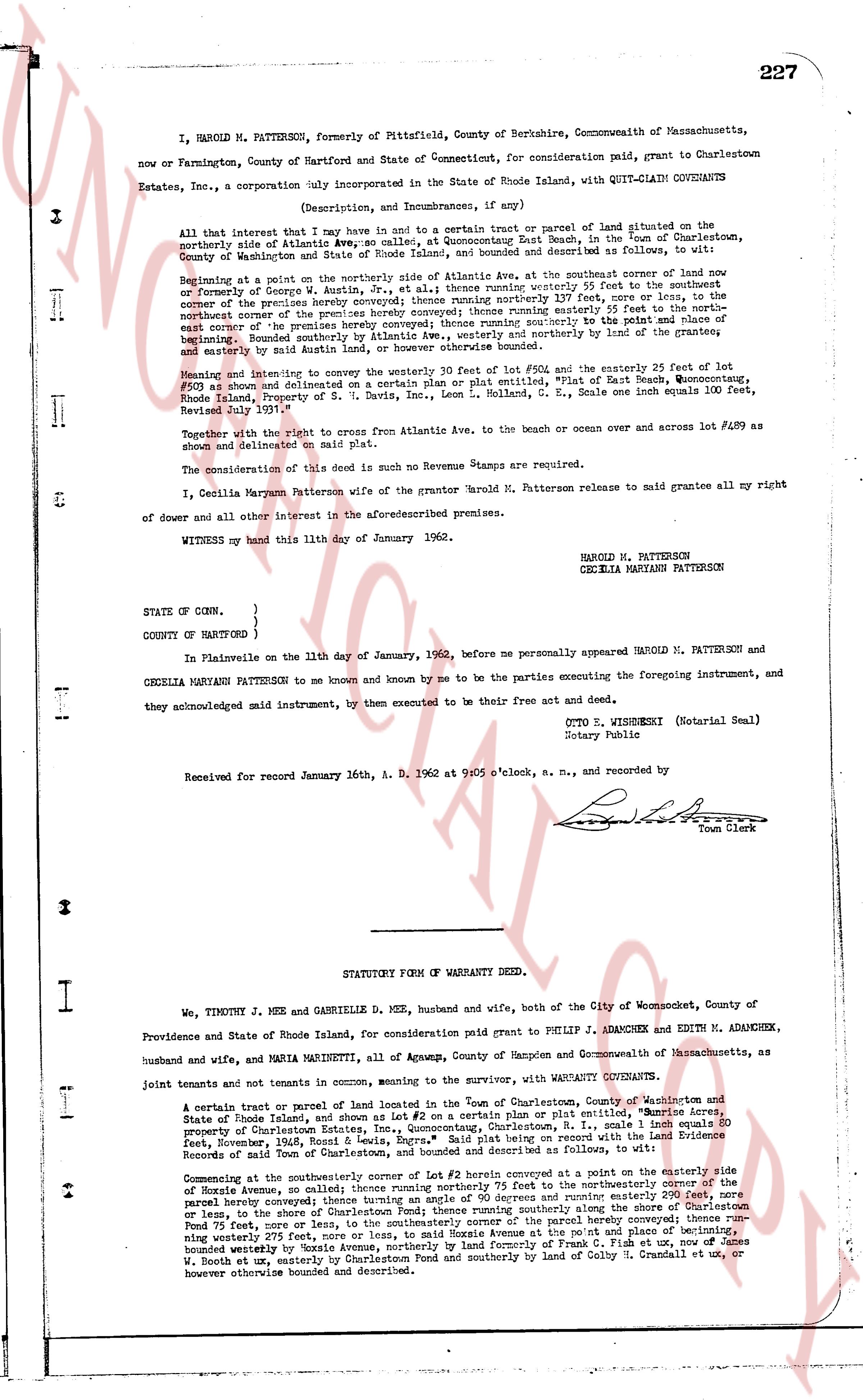
227
I, HAROLD M. PATTERSON, formerly of Pittsfield, County of Berkshire, Commonwealth of Massachusetts, now or Farmington, County of Hartford and State of Connecticut, for consideration paid, grant to Charlestown Estates, Inc., a corporation duly incorporated in the State of Rhode Island, with QUIT-CLAIM COVENANTS
(Description, and Incumbrances, if any)
All that interest that I now have and in the future to be a common trust or parcel of land situated on the northerly side of Atlantic Ave., near the center of Quonochontaug East Beach, in the Town of Charlestown, County of Washington and State of Rhode Island, any bounded and described as follows, to wit:
Beginning at a point on the northerly side of Atlantic Ave, at the southeaster corner of land now or formerly of George G. Atkin, in the Town of Charlestown, running northerly 25 feet to the easterly line of the premises hereby conveyed then running northerly 137 feet, more or less, to the northeast corner of the premises hereby conveyed then running southeasterly 25 feet to the point of beginning east corner of the premises hereby conveyed; then running southerly 137 feet to the point and place of beginning. Bounded southerly by Atlantic Ave., to the west and northerly by the land of the grantees, and easterly by said Atkin's land, the premises above bounded.
Meaning and intending to convey the westerly 20 feet of lot #502 and the easterly 25 feet of lot #500 as shown and delineated on a certain Plan or plat entitled, "Plat of East Beach, Quonochontaug, Rhode Island, Property of S. G. Davis, Inc., Ocean L. Rhode Island, S. E. Scale one inch equals 100 feet, Revised July 1901."
Together with the right of access from Atlantic Ave, to the beach or ocean over and across lot #500 as shown and delineated on said plat.
The consideration of this deed is such no Revenue Stamps are required.
I, Cecilia Maryann Patterson wife of the grantor Harold M. Patterson release to said grantees all my right of dower and all other interest in the aforementioned premises.
WITNESS my hand this 11th day of January 1962.
HAROLD M. PATTERSON
CECILIA MARYANN PATTERSON
STATE OF CONN. }
COUNTY OF HARTFORD }
In Plainville on the 11th day of January, 1962, before me personally appeared HAROLD M. PATTERSON and CECILIA MARYANN PATTERSON to me known and by me to be the parties executing the foregoing instrument, and they acknowledged said instrument, by them executed to be their free act and deed.
OTTO S. WISBRESKI (Notarial Seal)
Notary Public
Received for record January 16th, A. D. 1962 at 9:05 o'clock, a. m., and recorded by
[Signature]
Town Clerk
----
STATUTORY FORM OF WARRANTY DEED.
I We, TIMOTHY J. MEE and GABRIELLE D. MEE, husband and wife, both of City of Woonsocket, County of Providence and State of Rhode Island, for consideration paid grant to PHILIP J. ADAMCHEK and EDITH M. ADAMCHEK, husband and wife, and MARIA MARINETTI, of Agawam, County of Hampden and Commonwealth of Massachusetts, as joint tenants and not tenants in common, meaning to the warranty, with WARRANTY COVENANTS.
A certain tract of land or parcel of land located in the Town of Charlestown, County of Washington and State of Rhode Island, and shown as Lot #2 on a certain Plan or plat entitled, "South Shore Acres, Property of Charlestown Estates Inc., Ocean L. Rhode Island, S. E., Scale 1 inch equals 60 feet, November, 1963, Ronald R. Lewis, Engr." Said plat being recorded on the Land Evidence Records of the Town of Charlestown as follows, to wit:
Commencing at the southeasterly corner of Lot #2 herein described a point on the easterly side of Hoxie Avenue, so called; thence running northerly 75 feet to the northeasterly corner of the parcel conveyed hereby then running easterly 137 feet and northerly easterly running southerly 137 feet, or less, to the shore of Charlestown Pond thence running southerly along the shore of Charlestown Pond 75 feet, more or less, to the point of beginning. Bounded northerly by the land of the grantees, running west 137 feet, more or less, to northerly side of Hoxie Avenue at the point and place of beginning, bounded westerly by Hoxie Avenue, northerly by land formerly of Frank C. Field and southerly by land of W. Booth et ux, northerly by the shore of Charlestown Pond and southerly by land of Caleb H. Crandall et ux, or however otherwise bounded and described.
page 2 · read by Gemma vision
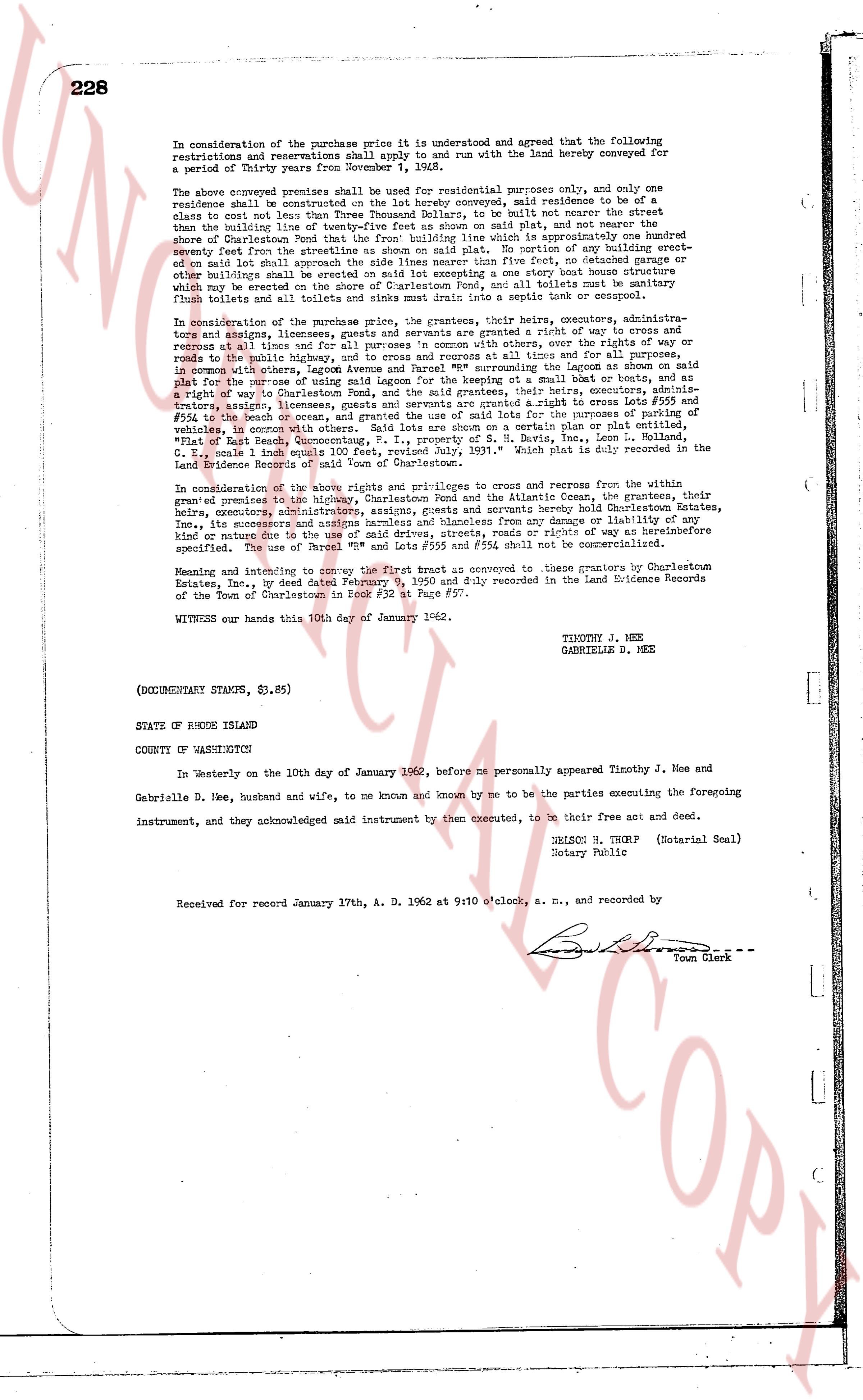
228
In consideration of the purchase price it is understood and agreed that the following restrictions and reservations shall apply to and run with the land hereby conveyed for a period of Thirty years from November 1, 1948.
The above conveyed premises shall be used for residential purposes only, and only one residence shall be constructed on the land hereby conveyed, said residence to be of a class not less than Two Thousand Dollars, to be built not nearer the street than the building line of twenty-five feet as shown on said plat, and not nearer the side shore of Charlestown than the building line of twenty-five feet which is approximately one hundred seventy feet from the streetline as shown on said plat. No portion of any building erected on said land shall approach within twenty-five feet of any setback defined by the town and other buildings shall be erected on said lot excepting one accessory one story box house structure which may be erected on said lot provided that such structure and all toilets must be sanitary approved flush toilets and all toilets and sinks must drain into a septic tank or cesspool.
In consideration of the purchase price, the grantors, their heirs, executors, administrators and assigns, however, reserve a right of way in and rights of way to and egress and recess at all times for and for all persons in common with others, over the rights of way or roads to the right of the Main Street, and the right of way as shown on said plat to be used in common with others, leggon Avenue and Parnell "M" surrounding the Lagoon as shown on said plat for the purpose of using said lands for residential purposes or said wall to be used as a retaining wall. The grantees, their heirs, executors, administrators, assigns, licensees and guests, are severally and jointly granted a right of way in and egress and recess at all times for and for all persons in common with others, over the rights of way or roads to the right of the Main Street, and the right of way as shown on said plat for the purpose of passing in vehicles, in common with others. Said lots are shown on a certain plan or plat of lots, filed in the town's office as Plat "M" and recorded in the Deed Book, Page 1, Volume "G", make 1 inch equals 100 feet, revised July 1931." Which plat is duly recorded in the Land Evidence Records of Charlestown in Book 1, Page 1.
In consideration of the above rights and privileges to and egress and recess from the within granted premises to the ministry, Charlestown Pond and the Atlantic Ocean, the grantees, their heirs, executors, administrators and assigns, hereby covenant hereby hold Charlestown Estates, Inc., its successors and assigns harmless and blameless from any damage or liability of any kind or nature of any cause what so ever arising out of the exercise of any right as above described specifically the use of Parcel "M" and lots #559 and #554 shall not be commercialized.
Meaning and intending to convey the first trust as conveyed to these grantors by Charlestown Estates, Inc., by deed dated February 9, 1950 and duly recorded in the Land Evidence Records of the Town of Charlestown in Book 27, page 227.
WITNESS our hands this 10th day of January 1962.
TIMOTHY J. MEE
GABRIELLE D. MEE
(DOCUMENTARY STAMPS, $3.85)
STATE OF RHODE ISLAND
COUNTY OF WASKECHETUS
In Westerly on the 10th day of January 1962, before me personally appeared Timothy J. Mee and Gabrielle D. Mee, husband and wife, to me known and known by me to be the parties executing the foregoing instrument, and they acknowledged said instrument by them executed, to be their free act and deed.
DELSON M. THORP (Notarial Seal)
Notary Public
Received for record January 17th, A. D. 1962 at 9:10 o'clock, a. m., and recorded by
[Signature]
Town Clerk
The page as recorded