The instrument's own words
page 1 · read by Gemma vision
223
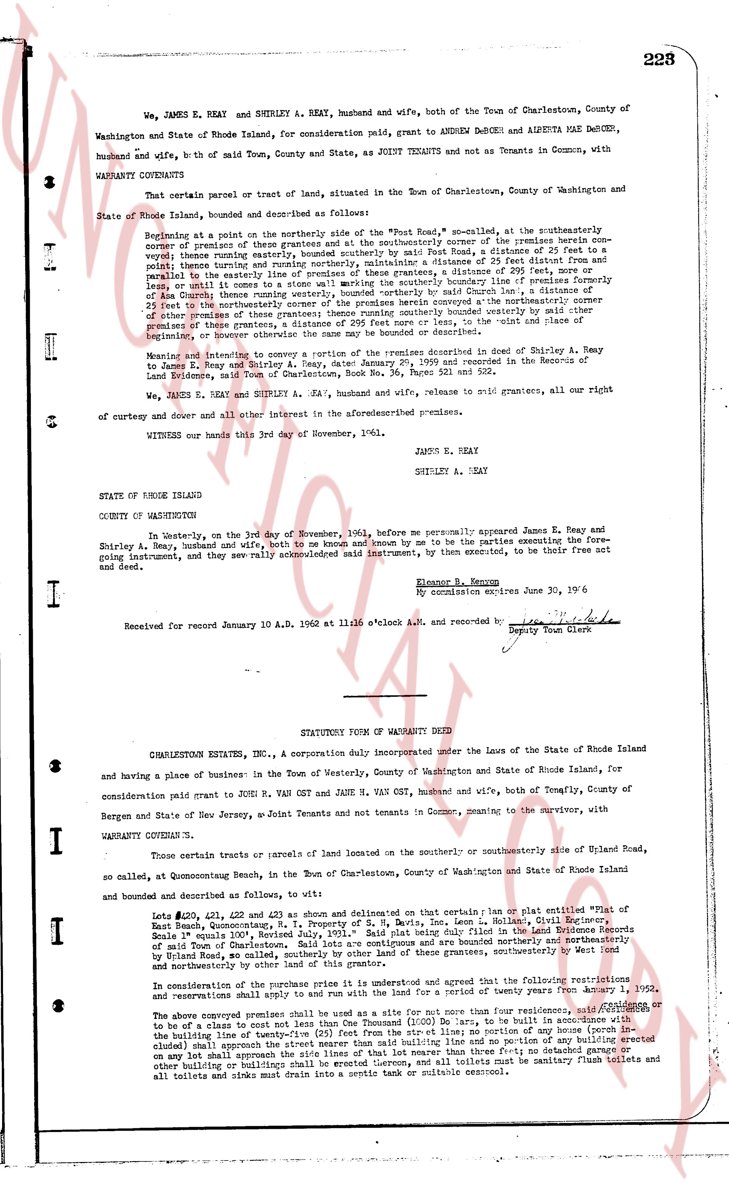
We, JAMES E. REAY and SHIRLEY A. REAY, husband and wife, both of the Town of Charlestown, County of Washington and State of Rhode Island, for consideration paid, grant to ANDREW DEBOER and ALBERTA MAE DEBOER, husband and wife, bth of said Town, County and State, as JOINT TENANTS and not as Tenants in Common, with WARRANTY COVENANTS
That certain parcel or tract of land, situated in the Town of Charlestown, County of Washington and State of Rhode Island, bounded and described as follows:
Beginning at a point on the northerly side of the "Post Road," so called, at the northeasterly corner of property of James E. Reay, and running thence at the northeasterly corner of the premises herein conveyed, easterly running easterly, bounded southerly by said Post Road, a distance of 25 feet to a point; thence turning northerly and running northerly, bounded easterly by a distance of 25 feet distance, and parallel to the easterly line of premises of these grantors, a distance of 295 feet, more or less, until it comes to a state road; thence turning easterly, bounded northerly by said road, a distance of 25 feet, and parallel to the easterly line of premises of these grantors, a distance of 295 feet, more or less, until it comes to a state road; thence turning southerly, bounded easterly by said March Lane, a distance of 25 feet to the northeasterly corner of the premises herein conveyed, and thence at the northeasterly corner of these premises, turning westerly bounded southerly by said easterly line of these premises of these grantors, a distance of 295 feet more or less, to the point and place of starting, a conveyence containing [?] acres more or less.
Meaning and intending to convey a portion of the premises described in deed of Shirley A. Reay to James E. Reay and Shirley A. Reay, dated January 29, 1959 and recorded in the Records of the Land Evidence, Rhode Island, Book No. 36, Page No. 502.
We, JAMES E. REAY and SHIRLEY A. REAY, husband and wife, release to said grantees, all our right of curtesy and dower and all other interest in the aforesaid described premises.
WITNESS our hands this 3rd day of November, 1961.
JAMES E. REAY
SHIRLEY A. REAY
STATE OF RHODE ISLAND
COUNTY OF WASHINGTON
In Westerly-on, the 3rd day of November, 1961, before me personally appeared James E. Reay and Shirley A. Reay, husband and wife, both to me known and by me to be the parties executing the foregoing instrument, and they severally acknowledged said instrument, by them executed, to be their free act and deed.
Eleanor B. Kenyon
My commission expires June 30, '62
Received for record January 10 A.D. 1962 at 11:06 o'clock A.M. and recorded by [signature] Deputy Town Clerk
----
STATUTORY FORM OF WARRANTY DEED
CHARLESTOWN ESTATES, INC., a Corporation duly incorporated under the Laws of the State of Rhode Island and having a place of business in the Town of Westerly, County of Washington and State of Rhode Island, for consideration paid grant to JOHN M. VAN GAST and JANE M. VAN GAST, husband and wife, both of Tenafly, County of Bergen and State of New Jersey, as Joint Tenants and not tenants in Common, granting to the survivor, with WARRANTY COVENANTS
Those certain tracts or parcels of land located on the southerly or southeasterly side of Upland Road, so called, at Quonocutaug Beach, in the Town of Charlestown, County of Washington and State of Rhode Island and bounded and described as follows, to wit:
Lots #220, #221, #222 and #223 as shown and delineated on that plan or plat entitled "Map of East Beach, Quonocutaug, in the Property of M. S. Davis, Inc., Leon H. Nolan, Civil Engineer" dated May 15th, 1951, Norton's Book 10, Page 101. Said plat being duly filed in the Land Evidence Records of said Town of Charlestown. Said lots are contiguous and premises are bounded northerly and northeasterly by Upland Road, as indicated on said plat, bounded easterly, southerly and southwesterly by other lots of land and northeasterly by other land of this grantor.
In consideration of the purchase of the premises it is agreed and granted that the following restrictions and reservations shall apply to and be binding upon the land for a period of twenty years from January 1, 1952.
The above comprised premises shall be used as a site for not more than four residences, [?] or to be of a class to cost not less than One Thousand (1000) Dollars, to be built in accordance with the building line of meaning of "building line" shall mean the line no portion of a building (except for steps or decks) shall approach the street nearer than said building line and no portion of any building erected on any lot shall approach the side lines of that lot nearer than five feet, nor shall any garage, other building or buildings be erected on any lot nearer than ten feet to the property line, and all toilets must be sanitary flush toilets and all toilets and sinks must drain into a septic tank or suitable cesspool.
The page as recorded