The instrument's own words
page 1
254
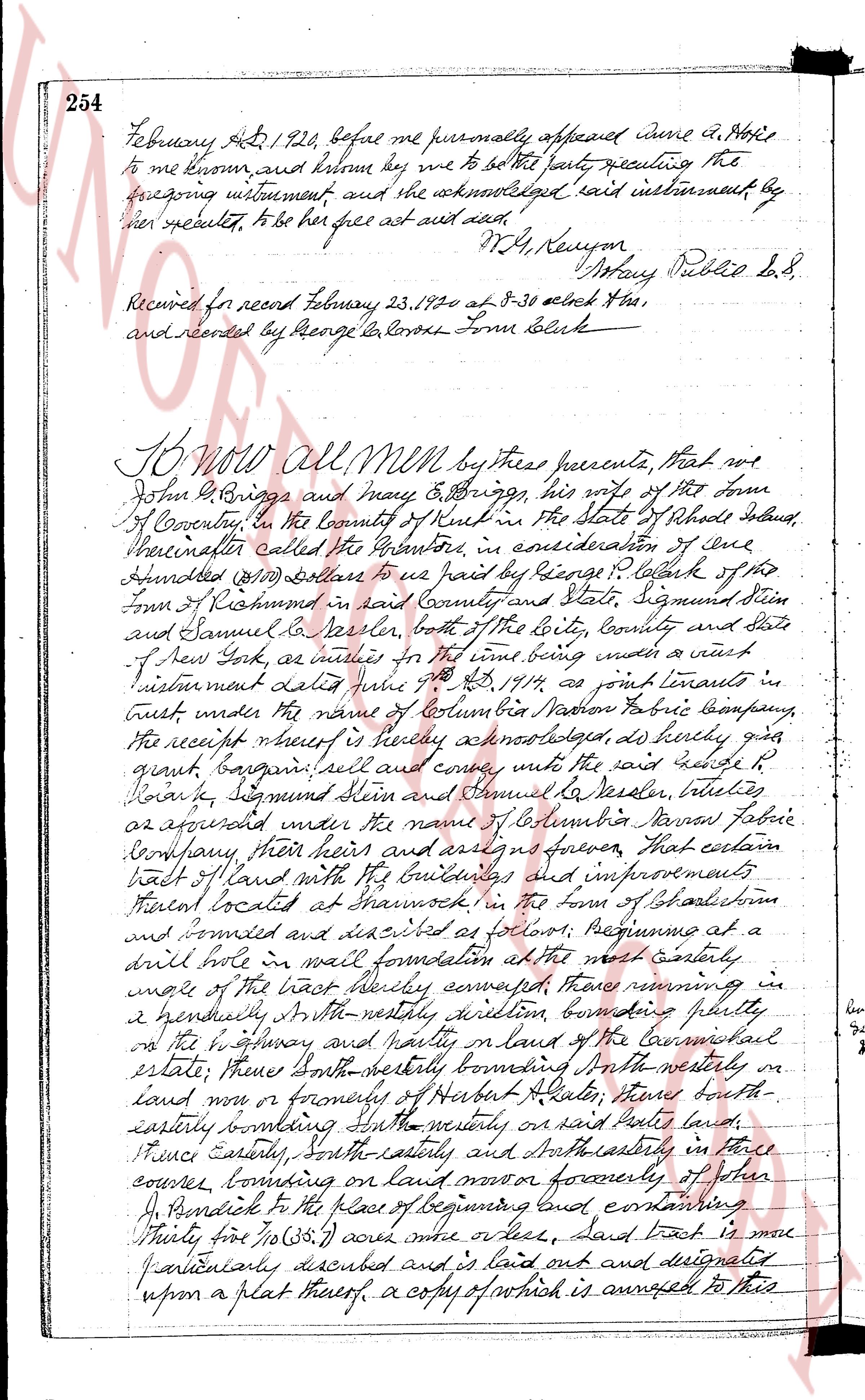
February 4th, 1824, before me personally appeared Anne D. Atwell
to me known, and known by me to be the party executing the
foregoing instrument and she acknowledged said instrument by
her signature, to be her free act and deed.
M. G. Kenyon
Notary Public &c &c.
Received for record February 23, 1824 at 8-30 o'clock A.M.
and recorded by George L. Corliss Town Clerk
KNOW all MEN by these presents, that we
John D. Briggs and Mary E. Briggs, his wife of the town
of Coventry, in the county of Kent in the State of Rhode Island,
hereinafter called the Grantor, in consideration of one
thousand ($1000) Dollars to us paid by George L. Corliss of the
Town of Richmond in said County and State, Sigmund Stein
and Samuel B. Seeler, both of the City, County and State
of New York, as trustees for the time being under a certain
instrument dated June 7th, 1817 as joint tenants in a trust
under the name of Columbia Narrow Fabric Company,
the receipt whereof is hereby acknowledged, do hereby grant
grant bargain sell and convey unto the said George L.
Corliss, Sigmund Stein and Samuel B. Seeler, trustees
as aforesaid under the name of Columbia Narrow Fabric
Company, their heirs and assigns forever, that certain
tract of land with the buildings and improvements
thereon located at Warwick in the town of Rhode Island
and bounded as follows: beginning at a
drill hole in wall foundation at the most easterly
angle of the first block thereby composed, thence running in
a generally N.W. the westerly direction bounding shortly
on the highway and partly on land of the Cornwall
estate; thence North westerly bounding North westerly on
land now or formerly of Herbert H. Slater, thence south-
easterly bounding South easterly on said Slaters land,
thence Easterly, South easterly and North easterly in three
courses, bounding on land now or formerly of John
P. Pondick to the place of beginning land containing
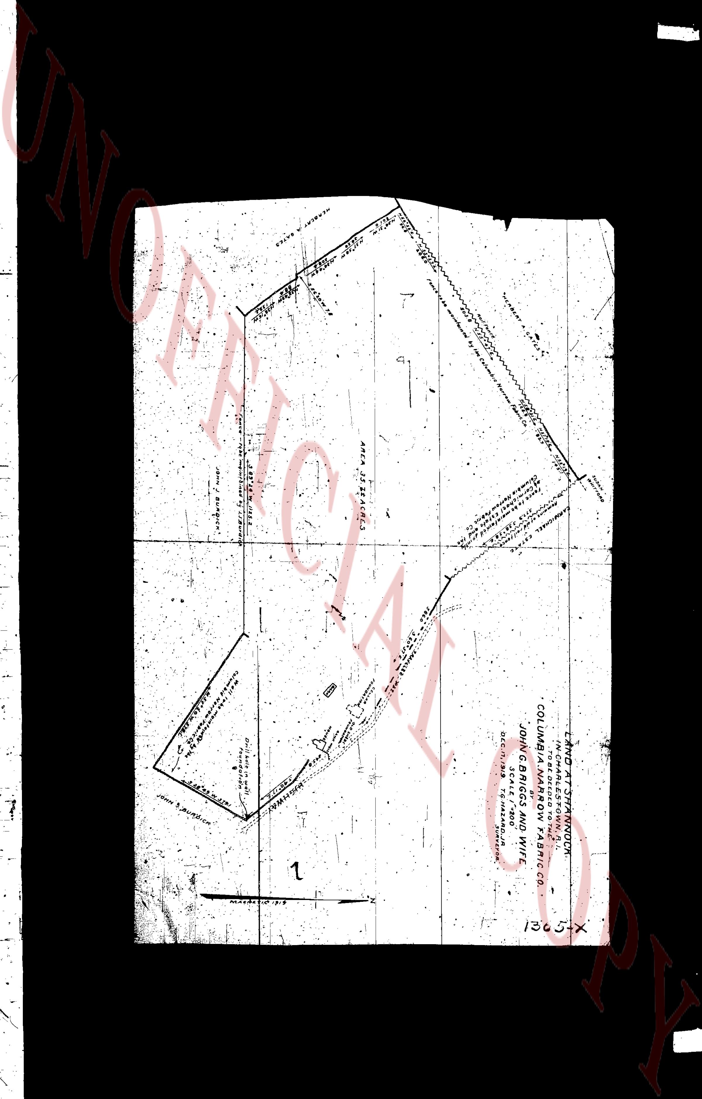
Thirty five (35) acres more or less, said tract is more
particularly described and is laid out and designated
upon a plat thereof, a copy of which is annexed to this
page 2
255
seed and make a part hereof and entitled Deed at Phenwick in
North Kingstown, R.I. to be ceded to the Columbian Namor Fabric Co. by John
W. Briggs and wife
To have and to hold the same, with
all the rights, privileges and appurtenances thereunto appertaining
unto and to the use of them the said George P. Clark, signed seal
and Samuel Co. Nealer, trustees for the time being under the
name of Columbian Namor Fabric Company made and it built
instrument dated June 9th, AD 1817, and to their successors
in trust or joint tenants under the name of Columbian Namor Fabric
Company their heirs and assigns for forever. And we the said
Grantors, as hereby for ourselves and for our heirs, executors and
administrators, covenant with the said George P. Clark, signed seal
and Samuel Co. Nealer, trustees as aforesaid, their heirs and
assigns, that we are lawfully seized in fee simple of the said
granted premises that the said are free from all incumbrances,
that we have a right good full power and lawful authority to sell
and convey the same in manner as aforesaid That the said
George P. Clark, signed seal and Samuel Co. Nealer, trustees
as aforesaid, their heirs and assigns, shall by these presents
at all times hereafter peaceably and quietly have and enjoy
the said premises, and that we, have’d and warrant with title
on our heirs, executed and administrators shall warrant and
defend the same to the said George P. Clark, signed seal and
Samuel Co. Nealer, trustees as aforesaid, their heirs and assigns
forever against the lawful claims and demands of all persons,
Signed for the consideration aforesaid, I, Mary E. Briggs,
wife of John W. Briggs, do hereby release all my right’s
therein and to the said granted premises unto the said
George P. Clark, signed seal and Samuel Co. Nealer, trustees
as aforesaid, their heirs and assigns, forever,
In witness whereof, we have hereunto set our hands
and seals this 25th day of December, 1819.
[Signatures] John W. Briggs LS
Mary E. Briggs LSS
County Signed and sealed and delivered in presence of
George A. Sweeny
State of Rhode Island,
County of Kent, SS
In East Greenwich in the 7th day of
January AD 1820 before me personally appeared
John W. Briggs and Mary E. Briggs each to me
known and known by me to be the parties
executing the foregoing instrument and severally
page 3
256
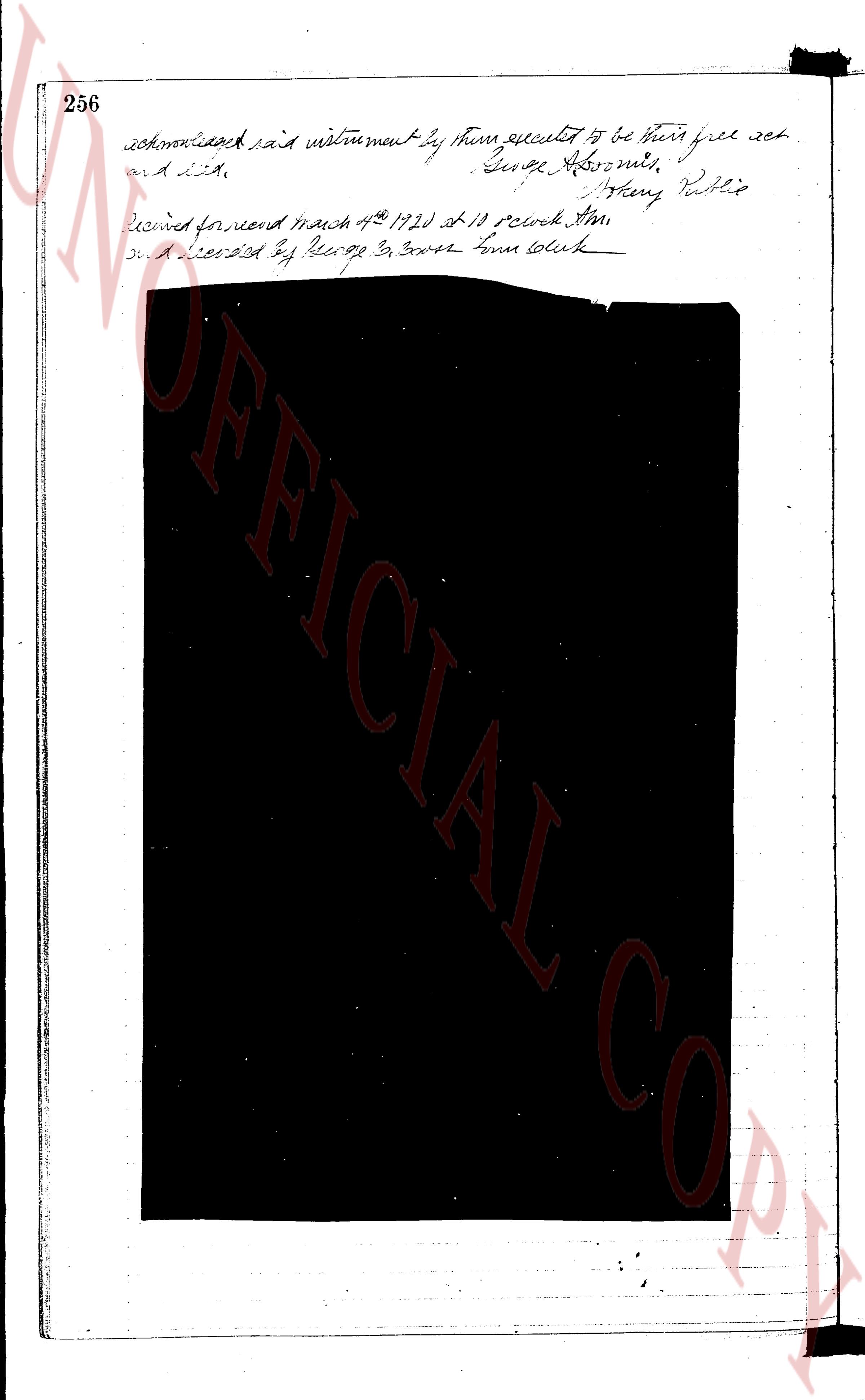
acknowledged said instrument by them executed to be their free act
and deed. George Abroms,
Henry Nellie
Recorded for me March 4th 1920 at 10 oclock AM
and delivered by Receipt Jr. Court house clerk
page 4
This image is a survey plat, not a text-based land-evidence register page. It contains technical measurements, boundary descriptions, and labels rather than narrative entries.
**Transcription:**
UNOFFICIAL COPY
HERBERT A. BARNES
NORTH 35° 47' 30" EAST 160.00 FEET
NORTH 35° 47' 30" EAST 160.00 FEET
NORTH 35° 47' 30" EAST 160.00 FEET
NORTH 35° 47' 30" EAST 160.00 FEET
NORTH 35° 47' 30" EAST 160.00 FEET
NORTH 35° 47' 30" EAST 160.00 FEET
NORTH 35° 47' 30" EAST 160.00 FEET
NORTH 35° 47' 30" EAST 160.00 FEET
NORTH 35° 47' 30" EAST 160.00 FEET
NORTH 35° 47' 30" EAST 160.00 FEET
NORTH 35° 47' 30" EAST 160.00 FEET
NORTH 35° 47' 30" EAST 160.00 FEET
NORTH 35° 47' 30" EAST 160.00 FEET
NORTH 35° 47' 30" EAST 160.00 FEET
NORTH 35° 47' 30" EAST 160.00 FEET
NORTH 35° 47' 30" EAST 160.00 FEET
NORTH 35° 47' 30" EAST 160.00 FEET
NORTH 35° 47' 30" EAST 160.00 FEET
NORTH 35° 47' 30" EAST 160.00 FEET
NORTH 35° 47' 30" EAST 160.00 FEET
NORTH 35° 47' 30" EAST 160.00 FEET
NORTH 35° 47' 30" EAST 160.00 FEET
NORTH 35° 47' 30" EAST 160.00 FEET
NORTH 35° 47' 30" EAST 160.00 FEET
NORTH 35° 47' 30" EAST 160.00 FEET
NORTH 35° 47' 30" EAST 160.00 FEET
NORTH 35° 47' 30" EAST 160.00 FEET
NORTH 35° 47' 30" EAST 160.00 FEET
NORTH 35° 47' 30" EAST 160.00 FEET
NORTH 35° 47' 30" EAST 160.00 FEET
NORTH 35° 47' 30" EAST 160.00 FEET
NORTH 35° 47' 30" EAST 160.00 FEET
NORTH 35° 47' 30" EAST 160.00 FEET
NORTH 35° 47' 30" EAST 160.00 FEET
NORTH 35° 47' 30" EAST 160.00 FEET
NORTH 35° 47' 30" EAST 160.00 FEET
NORTH 35° 47' 30" EAST 160.00 FEET
NORTH 35° 47' 30" EAST 160.00 FEET
NORTH 35° 47' 30" EAST 160.00 FEET
NORTH 35° 47' 30" EAST 160.00 FEET
NORTH 35° 47' 30" EAST 160.00 FEET
NORTH 35° 47' 30" EAST 160.00 FEET
NORTH 35° 47' 30" EAST 160.00 FEET
NORTH 35° 47' 30" EAST 160.00 FEET
NORTH 35° 47' 30" EAST 160.00 FEET
NORTH 35° 47' 30" EAST 160.00 FEET
NORTH 35° 47' 30" EAST 160.00 FEET
NORTH 35° 47' 30" EAST 160.00 FEET
NORTH 35° 47' 30" EAST 160.00 FEET
NORTH 35° 47' 30" EAST 160.00 FEET
NORTH 35° 47' 30" EAST 160.00 FEET
NORTH 35° 47' 30" EAST 160.00 FEET
NORTH 35° 47' 30" EAST 160.00 FEET
NORTH 35° 47' 30" EAST 160.00 FEET
NORTH 35° 47' 30" EAST 160.00 FEET
NORTH 35° 47' 30" EAST 160.00 FEET
NORTH 35° 47' 30" EAST 160.00 FEET
NORTH 35° 47' 30" EAST 160.00 FEET
NORTH 35° 47' 30" EAST 160.00 FEET
NORTH 35° 47' 30" EAST 160.00 FEET
NORTH 35° 47' 30" EAST 160.00 FEET
NORTH 35° 47' 30" EAST 160.00 FEET
NORTH 35° 47' 30" EAST 160.00 FEET
NORTH 35° 47' 30" EAST 160.00 FEET
NORTH 35° 47' 30" EAST 160.00 FEET
NORTH 35° 47' 30" EAST 160.00 FEET
NORTH 35° 47' 30" EAST 160.00 FEET
NORTH 35° 47' 30" EAST 160.00 FEET
NORTH 35° 47' 30" EAST 160.00 FEET
NORTH 35° 47' 30" EAST 160.00 FEET
NORTH 35° 47' 30" EAST 160.00 FEET
NORTH 35° 47' 30" EAST 160.00 FEET
NORTH 35° 47' 30" EAST 160.00 FEET
NORTH 35° 47' 30" EAST 160.00 FEET
NORTH 35° 47' 30" EAST 160.00 FEET
NORTH 35° 47' 30" EAST 160.00 FEET
NORTH 35° 47' 30" EAST 160.00 FEET
NORTH 35° 47' 30" EAST 160.00 FEET
NORTH 35° 47' 30" EAST 160.00 FEET
NORTH 35° 47' 30" EAST 160.00 FEET
NORTH 35° 47' 30" EAST 160.00 FEET
NORTH 35° 47' 30" EAST 160.00 FEET
NORTH 35° 47' 30" EAST 160.00 FEET
NORTH 35° 47' 30" EAST 160.00 FEET
NORTH 35° 47' 30" EAST 160.00 FEET
NORTH 35° 47' 30" EAST 160.00 FEET
NORTH 35° 47' 30" EAST 160.00 FEET
NORTH 35° 47' 30" EAST 160.00 FEET
NORTH 35° 47' 30" EAST 160.00 FEET
NORTH 35° 47' 30" EAST 160.00 FEET
NORTH 35° 47' 30" EAST 160.00 FEET
NORTH 35° 47' 30" EAST 160.00 FEET
NORTH 35° 47' 30" EAST 160.00 FEET
NORTH 35° 47' 30" EAST 160.00 FEET
NORTH 35° 47' 30" EAST 160.00 FEET
NORTH 35° 47' 30" EAST 160.00 FEET
NORTH 35° 47' 30" EAST 160.00 FEET
NORTH 35° 47' 30" EAST 160.00 FEET
NORTH 35° 47' 30" EAST 160.00 FEET
NORTH 35° 47' 30" EAST 160.00 FEET
NORTH 35° 47' 30" EAST 160.00 FEET
NORTH 35° 47' 30" EAST 160.00 FEET
NORTH 35° 47' 30" EAST 160.00 FEET
NORTH 35° 47' 30" EAST 160.00 FEET
NORTH 35° 47' 30" EAST 160.00 FEET
NORTH 35° 47' 30" EAST 160.00 FEET
NORTH 35° 47' 30" EAST 160.00 FEET
NORTH 35° 47' 30" EAST 160.00 FEET
NORTH 35° 47' 30" EAST 160.00 FEET
NORTH 35° 47' 30" EAST 160.00 FEET
NORTH 35° 47' 30" EAST 160.00 FEET
NORTH 35° 47' 30" EAST 160.00 FEET
NORTH 35° 47' 30" EAST 160.00 FEET
NORTH 35° 47' 30" EAST 160.00 FEET
NORTH 35° 47' 30" EAST 160.00 FEET
NORTH 35° 47' 30" EAST 160.00 FEET
NORTH 35° 47' 30" EAST 160.00 FEET
NORTH 35° 47' 30" EAST 160.00 FEET
NORTH 35° 47' 30" EAST 160.00 FEET
NORTH 35° 47' 30" EAST 160.00 FEET
NORTH 35° 47' 30" EAST 160.00 FEET
NORTH 35° 47' 30" EAST 160.00 FEET
NORTH 35° 47' 30" EAST 160.00 FEET
NORTH 35° 47' 30" EAST 160.00 FEET
NORTH 35° 47' 30" EAST 160.00 FEET
NORTH 35° 47' 30" EAST 160.00 FEET
NORTH 35° 47' 30" EAST 160.00 FEET
NORTH 35° 47' 30" EAST 160.00 FEET
NORTH 35° 47' 30" EAST 160.00 FEET
NORTH 35° 47' 30" EAST 160.00 FEET
NORTH 35° 47' 30" EAST 160.00 FEET
NORTH 35°
The page as recorded