The instrument's own words
page 1 · read by Gemma vision
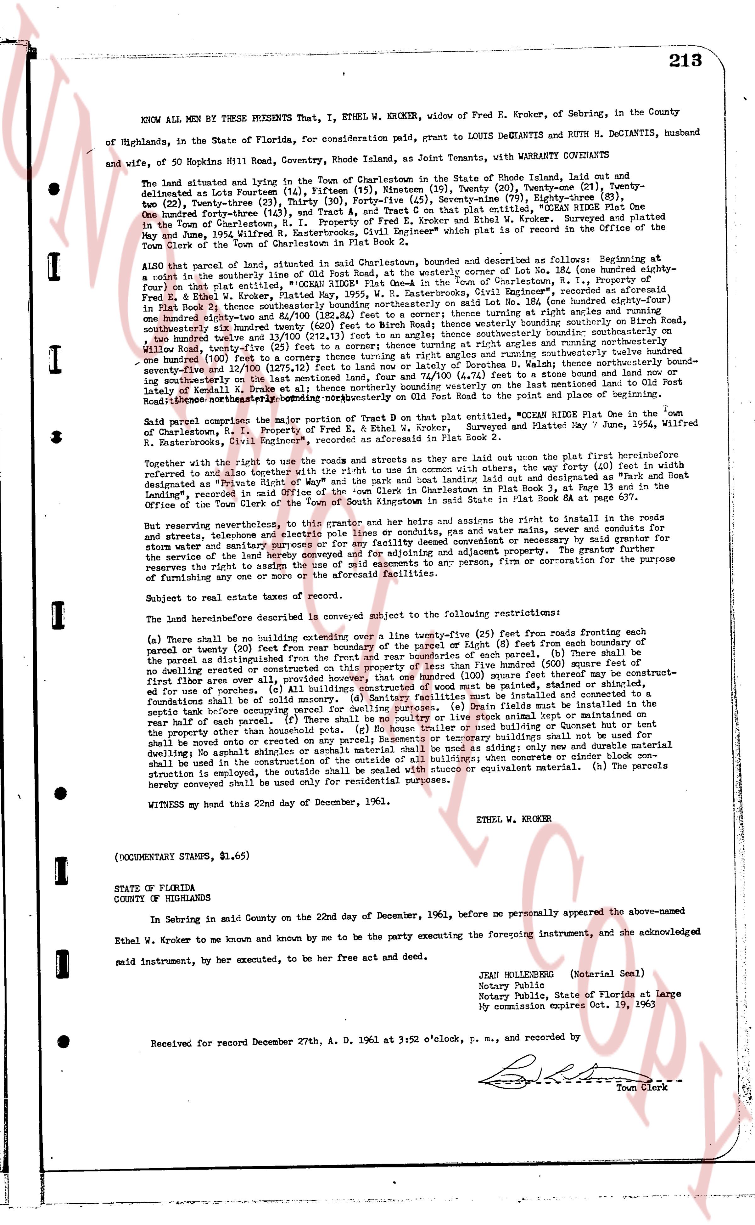
213
KNOW ALL MEN BY THESE PRESENTS That, I, ETHEL W. KROKER, widow of Fred E. Kroker, of Sebring, in the County of Highlands, in the State of Florida, for consideration paid, grant to LOUIS DECIANTIS and RUTH H. DECIANTIS, husband and wife, of 50 Hopkins Hill Road, Coventry, Rhode Island, as Joint Tenants, with WARRANTY COVENANTS
The land situated lying and being in the Town of Charlestown in the State of Rhode Island, laid out and platted as the Forsting Lake (Plat 1936) consisting of 159 parcels (19), Twenty (20), Twenty-one (21), Twenty-two (22), Twenty-three (23), Twenty-four (24), Thirty (30), Forty-five (45), Seventy-nine (79), Eighty-one (81), Eighty-three (83) one hundred forty-three (143) acres more or less, and specifically Lot 104, marked "CEDAR RIDGE Plot One" in the Town of Charlestown, R. I., Property of Fred E. Kroker and Ethel W. Kroker. surveyed and platted May 29th, 1936 by R. Banderhaus, Registered Civil Engineer, and recorded in the office of the Town Clerk of the Town of Charlestown in Plot Book 2a at page 11.
ALSO that parcel of land, situated lying in Charlestown, marked and described as follows: beginning at a point in the southerly line of Lot 104, marked "CEDAR RIDGE Plot One" in the Town of Charlestown, R. I., property of Fred E. Kroker and Ethel W. Kroker, Platted May 29th, 1936, by R. Banderhaus, Registered Civil Engineer, running one hundred eighty-three and 4/10 (183.4) feet south 41 degrees 10 minutes westerly on the southerly line of Lot 104 (one hundred eighty-four and 7/10 (184.7) feet same direction); thence westerly running on Birch Road, southeastly one hundred eighty-three and 10/100 (183.10) feet to another point; thence southerly one hundred twenty-two and 13/100 (122.13) feet to another point; thence angle southerly and running northwesterly one hundred (100) feet to a corner thence turning at right angles and running southeasterly one hundred (100) feet to a line of Lot 103, marked "CEDAR RIDGE Plot One" in the Town of Charlestown, R. I., running southeasterly one hundred (100) feet to a corner thence turning at right angles and running southwesterly one hundred (100) feet to a line of Lot 102, marked "CEDAR RIDGE Plot One" in the Town of Charlestown, R. I., running southeasterly one hundred (100) feet to a corner thence turning at right angles and running northwesterly one hundred (100) feet to the last mentioned point; thence turning at right angles and running southeasterly one hundred (100) feet to the last mentioned point; thence turning at right angles and running Road northwesterly thence southeasterly running northwesterly on Lot 100 Road to the point and place of beginning.
Said parcel comprises the major portion of Tract D on plat entitled "OCEAN RIDGE Plot One" in the Town of Charlestown, R. I., Property of Fred E. Kroker and Ethel W. Kroker, platted May 29th, 1936, by R. Banderhaus, Registered Civil Engineer", as recorded in aforesaid Plot Book 2a.
Together with the right to use the roads and streets and as they are laid out in the plot first described above, the way (40 feet in width) designated and referred to as although the right to use the right in common with the users of the way designated as "Path and Boat Landing", recorded in said Office of the Town Clerk in Charlestown Plot Book 2a at page 11.
But reserving nevertheless, the right to install in the roads and streets, telephone and electric pole lines or conduits, gas and water mains, sewer and conduits for storm water and sanitary sewer, and to maintain, repair or replace the same and to construct or maintain any structures for the service of the lands hereby conveyed and for widening and adjusting pavement. The grantor further reserves the right to assign any or all of the aforesaid rights to any person or firm or corporation for the purpose of installing any or all of the aforesaid facilities.
Subject to real estate taxes of record.
The land hereinabove described is conveyed subject to the following restrictions:
(a) There shall be no building structure extending over a line twenty-five (25) feet from roads running either of parcel or twenty (20) feet from boundary of the parcel or Eighty (8) feet from each boundary of such parcel (20) There shall be no dwelling erected or constructed on this property of less than five hundred (500) square feet first floor area over all exterior walls. (b) No building structure of more than 1000 square feet may be constructed for use of porches. (c) All buildings constructed of wood must be painted, stained or shingled, foundations shall be of concrete or stone or a combination of both. No building shall be constructed where a septic tank now exists occupying parcel for dwelling purposes. (d) Drain fields must be installed in the rear half of such parcel. (e) No building structure shall be constructed on this property other than a dwelling. No other property than the holdouts parcels. (f) No garage house or used building or Quonset hut or tent shall be moved onto or erected on this property. No other building structure than a dwelling may be constructed for dwelling as asphalt shale or asphalt material shall be used as siding; only new and durable material shall be used in the construction of the outside of the building when a dwelling is constructed. (g) Where a structure is employed, the same shall be sided with stucco or equivalent material. (h) The parcels hereby conveyed shall be used only for residential purposes.
WITNESS my hand this 22nd day of December, 1961. ETHEL W. KROKER
(DOCUMENTARY STAMPS, $1.65)
STATE OF FLORIDA
COUNTY OF HIGHLANDS
In Sebring in said County on the 22nd day of December, 1961, before me personally appeared the above-named Ethel W. Kroker to me known and by me known to be the party executing the foregoing instrument, and she acknowledged said instrument, by her execution, to be her free act and deed.
JEAN WELLSBORG (Notarial Seal)
Notary Public
Notary Public, State of Florida at Large
My commission expires Oct. 19, 1963
Received for record December 27th, A. D. 1961 at 3:52 o'clock, p. m., and recorded by
[Signature]
Town Clerk
The page as recorded