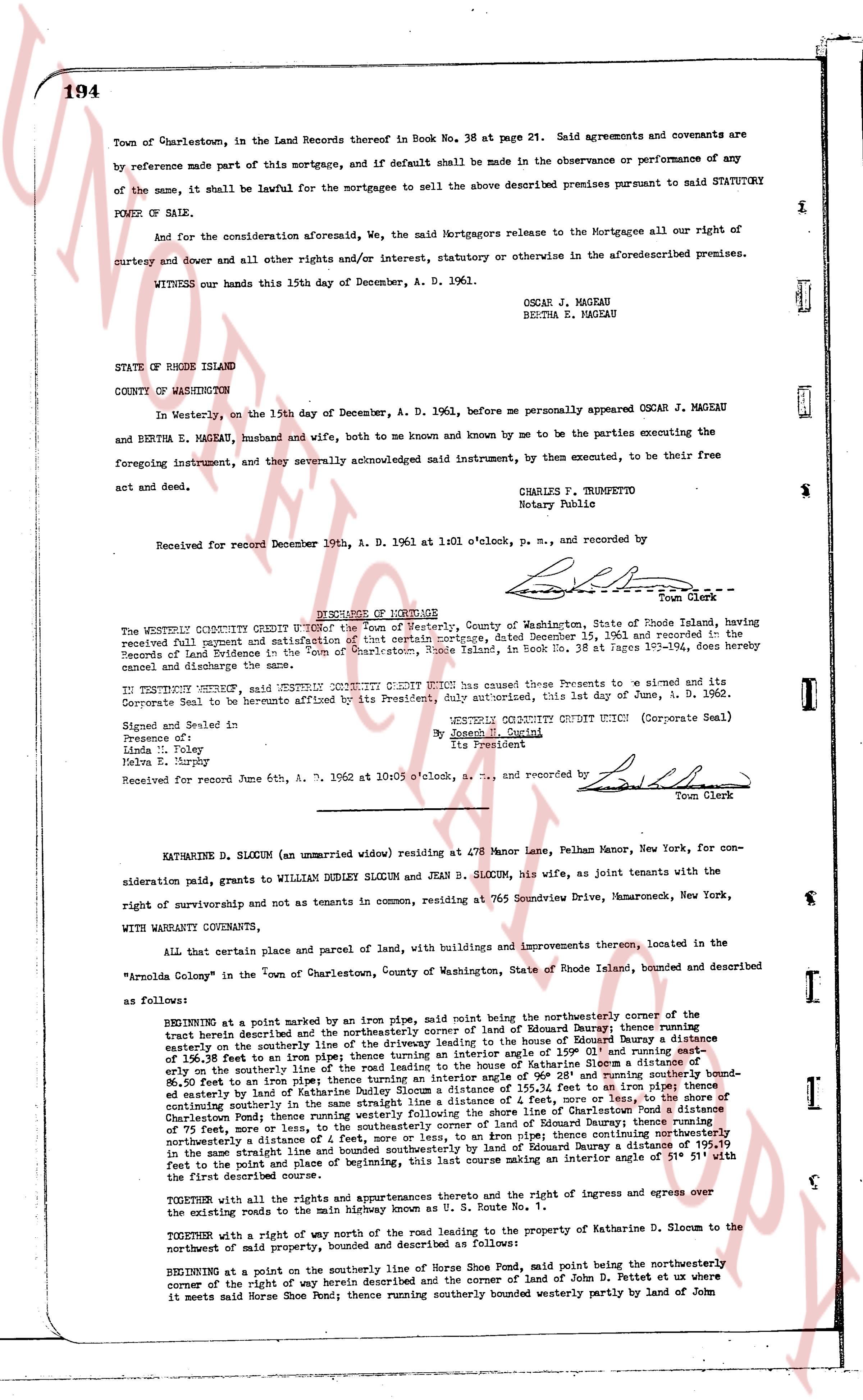
The instrument's own words
page 1 · read by Gemma vision
194
Town of Charlestown, in the Land Records thereof in Book No. 38 at page 21. Said agreements and covenants are by reference made part of this mortgage, and if default shall be made in the observance or performance of any of the same, it shall be lawful for the mortgagee to sell the above described premises pursuant to said STATUTORY POWER OF SALE.
And for the consideration aforementioned, We, the said Mortgagors hereas release to the Mortgagee all our right of curtesy and dower and all other rights and/or interest, statutory or otherwise in the aforementioned premises.
WITNESS our hands this 15th day of December, A. D. 1961.
OSCAR J. MAGEAU
BERTHA E. MAGEAU
STATE OF RHODE ISLAND
COUNTY OF WASHINGTON
In Westerly, on the 15th day of December, A. D. 1961, before me personally appeared OSCAR J. MAGEAU and BERTHA E. MAGEAU, husband and wife, both to me known and by me to be the parties executing the foregoing instrument, and they severally acknowledged said instrument, by them executed, to be their free act and deed.
CHARLES P. TRUMPETTO
Notary Public
Received for record December 19th, A. D. 1961 at 1:01 o'clock, p. m., and recorded by
[Signature]
Town Clerk
----
DISCHARGE OF MORTGAGE
The WESTERLY COMMUNITY CREDIT UNION of Westerly, County of Washington, State of Rhode Island, having received full payment and satisfaction of that certain mortgage, dated December 15, 1961 and recorded in the Records of Land Evidence in the Town of Charlestown, Rhode Island, in Book No. 38 at page 194, does hereby cancel and discharge the same.
IN TESTIMONY WHEREOF, said WESTERLY COMMUNITY CREDIT UNION has caused these Presents to be signed and its Corporate Seal to be hereunto affixed by its President, duly authorized this 1st day of June, A. D. 1962.
Signed and Sealed in
Presence of
Linda M. Foley
Melva E. Turphy
WESTERLY COMMUNITY CREDIT UNION (Corporate Seal)
By James J. [?]
its President
Received for record June 6th, A. D. 1962 at 10:05 o'clock, a. m., and recorded by
[Signature]
Town Clerk
----
KATHERINE D. SLOCUM (an unmarried widow) residing at 478 Manor Lane, Pelham Manor, New York, for consideration paid, grants to WILLIAM REDDIE SLOCUM and JEAN B. SLOCUM, his wife, as joint tenants with the right of survivorship and not as tenants in common, residing at 765 Soundview Drive, Hammonasset, New York,
WITH MERCHANTABLE COVENANTS,
All that certain place and parcel of land, with buildings and improvements thereon, located in the "Arnolda Colony" in the Town of Charlestown, County of Washington, State of Rhode Island land, bounded and described as follows:
BEGINNING at a point marked by an iron pipe, said point being the northeasterly corner of the tract herein described and on the northeasterly corner of the land of Edward Danby thence running easterly on the southerly line of the land of said Edward Danby to house of Edward Danby thence running southeasterly for an iron pipe thence turning an interior angle of 159° 01' and running easterly on the southerly line of the land of Edward Danby to the land of Steven Slocum a distance of 50.56 feet to an iron pipe thence turning an interior angle of 96° 28' and running southerly bounded easterly by the land of Steven Slocum a distance of 41.33 feet to an iron pipe thence turning an interior angle easterly by land of Katherine R. Hamden in a straight line a distance of 4 feet, more or less, to the shore of Charlestown Pond thence turning westerly bounded easterly by land of Katherine R. Hamden in a straight line a distance of 72 feet thence turning more or less northerly on the southerly corner of land of Edward Danby thence running northeasterly a distance of 72 feet more or less to an iron pipe thence turning an interior angle of 135° 00' and running northeasterly a distance of 3 feet, more or less, to an iron pipe thence turning an interior angle of 115° 00' and running northeasterly in the more straight line a distance of 100 feet more or less to an iron pipe thence running Southwest a distance of 195.16 feet to the point and place of beginning, this last course making an interior angle of 51° 51' with the first described course.
TOGETHER with all the rights and appurtenances thereto and the right of ingress and egress over the existing roads to the main highway known as U. S. Route No. 1.
TOGETHER with a right of way north of the road leading to the property of Katherine D. Slocum to the northwest of said property, bounded and described as follows:
BEGINNING at a point on the southerly line of the said road, said point being the northeasterly corner of the right of way of way of her land and the corner of land of John D. Pettit et ux where it meets said Horse Shoe Road; thence running southerly bounded westerly parte by land of John
The page as recorded