The instrument's own words
page 1 · read by Gemma vision
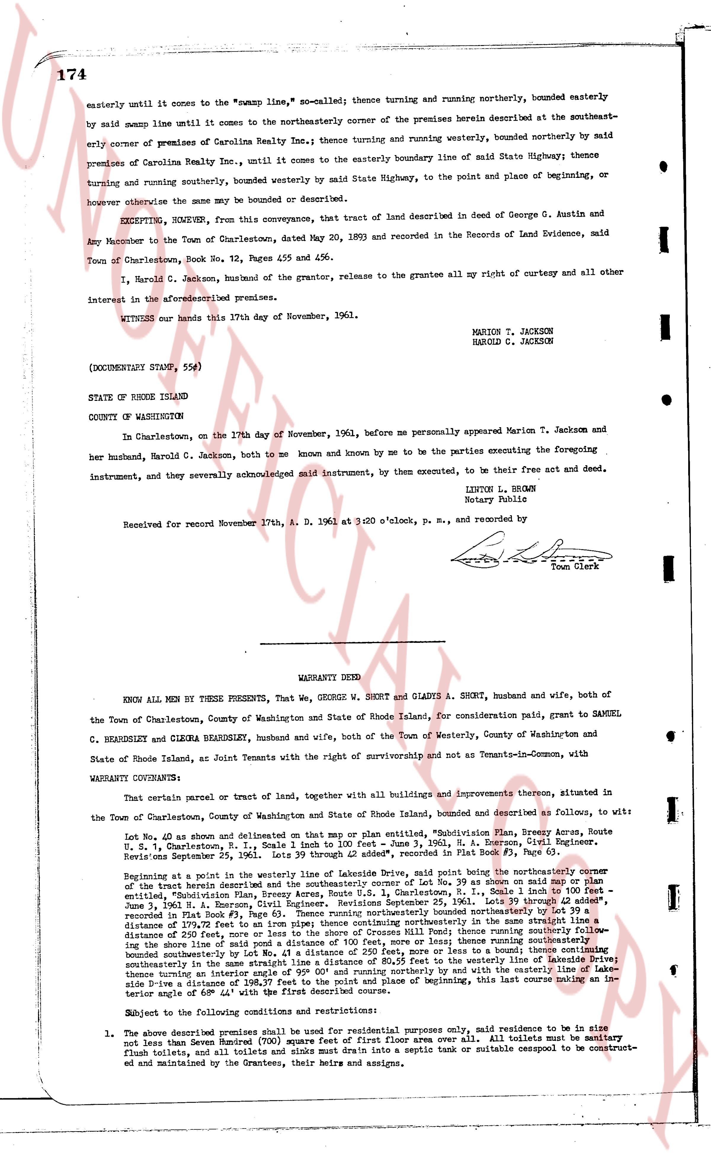
174
easterly until it comes to the "swamp line," so called; thence turning and running northerly, bounded easterly
by said swamp line until it comes to the northeasterly corner of the premises herein described at the southeast-
erly corner of premises of Carolina Realty Inc.; thence turning and running westerly, bounded northerly by said
premises of Carolina Realty Inc., until it comes to the easterly boundary line of said State Highway thence
turning and running southerly, bounded westerly by said State Highway, to the point and place of beginning, or
however otherwise the same may be bounded or described.
EXCEPTING, HOWEVER, from this conveyance, that tract of land described in deed of George C. Austin and
Amy ancestor to the Town of Charlestown, dated May 20, 1893 and recorded in the Records of Land Evidence, said
Town of Charlestown, Book No. 72, Pages 455 and 456.
I, Harold C. Jackson, husband of the grantor, release to the grantee all my right of curtesy and all other
interest in the aforesaid premises.
WITNESS our hands this 17th day of November, 1961.
MARION T. JACKSON
HAROLD C. JACKSON
(DOCUMENTARY STAMP, 55¢)
STATE OF RHODE ISLAND
COUNTY OF WASHINGTON
In Charlestown, on the 17th day of November, 1961, before me personally appeared Marion T. Jackson and
her husband, Harold C. Jackson, both to me known and known by me to be the parties executing the foregoing
instrument, by them executed, acknowledged said instrument, by them executed, to be their free act and deed.
LINTON L. BROWN
Notary Public
Received for record November 17th, A. D. 1961 at 3:20 o'clock, p. m., and recorded by
[Signature]
Town Clerk
----
WARRANTY DEED
KNOW ALL MEN BY THESE PRESENTS, That we, GEORGE W. SHORT and GLADYS A. SHORT, husband and wife, both of
the Town of Charlestown, County of Washington and State of Rhode Island, for consideration paid, grant to SAMUEL
C. BEARDSLEY and CLEORA BEARDSLEY, husband and wife, both of the Town of Westerly, County of Washington and
State of Rhode Island, as Joint Tenants with the right of survivorship and not as Tenants-in-Common, with
WARRANTY COVENANTS:
That certain parcel or tract of land, together with all buildings and improvements thereon, situated in
the Town of Charlestown, County of Washington and State of Rhode Island, bounded and described as follows, to wit:
Lot No. 40 as shown and delineated on that map or plan entitled, "Shubbery Plan, Beechy Acres, Route
U. S. 1, Charlestown, R. I.," sheet 2, dated September 25, 1961, R. I. Surveyor, June 3, 1961, R. I. Engineeer,
recorded September 25, 1961, "Lots 39 through 42 added," recorded in Plat Book # 3, Page 63.
Beginning at a point in the westerly line of weakly Lakeside Drive, first spoke being the northeasterly corner
of the tract herein described and the northeasterly corner of Lot No. 39 as shown on said map, Scale 1 inch to 100 feet
entitled, "Shubbery Plan, Beechy Acres, Route U. S. 1, Charlestown, R. I.," sheet 2, dated September 25, 1961,
June 3, 1961, H. A. Emerson, Civil Engineer, Revisions September 25, 1961, "Lots 39 through 42 added,"
recorded in Plat Book # 3, Page 63; thence turning and running southerly, bounded easterly by said Lakeside
Drive, a distance of 197.72 feet to an iron pipe, thence turning southeasterly in the same straight line a distance
of 200.00 feet to an iron pipe, bounded easterly by Lot No. 39, thence turning northerly, bounded easterly by said
line showing the shore line of said pond a distance of 100 feet, more or less; thence running southeasterly,
bounded southeasterly by said shore line a distance of 100 feet, more or less and to a bound iron pipe, thence
northeasterly in the same straight line a distance of 80.57 feet to the westerly line of Lakeside Drive, thence
turning an interior angle of 135° and running northerly, bounded easterly by said route a distance of 100 feet,
said line a distance of 198.37 feet to the point and place of beginning, this last course making an in-
terior angle of 68° 44' with the first described course.
Subject to the following conditions and restrictions:
1. The above described premises shall be used for residential purposes only, said residence to be in size
not larger than Seven Thousand square feet of first floor area only. All toilets must be sanitary
flush toilets, and all toilets and sinks must drain into a septic tank or suitable cesspool to be construct-
ed and maintained by the Grantees, their heirs and assigns.
page 2 · read by Gemma vision
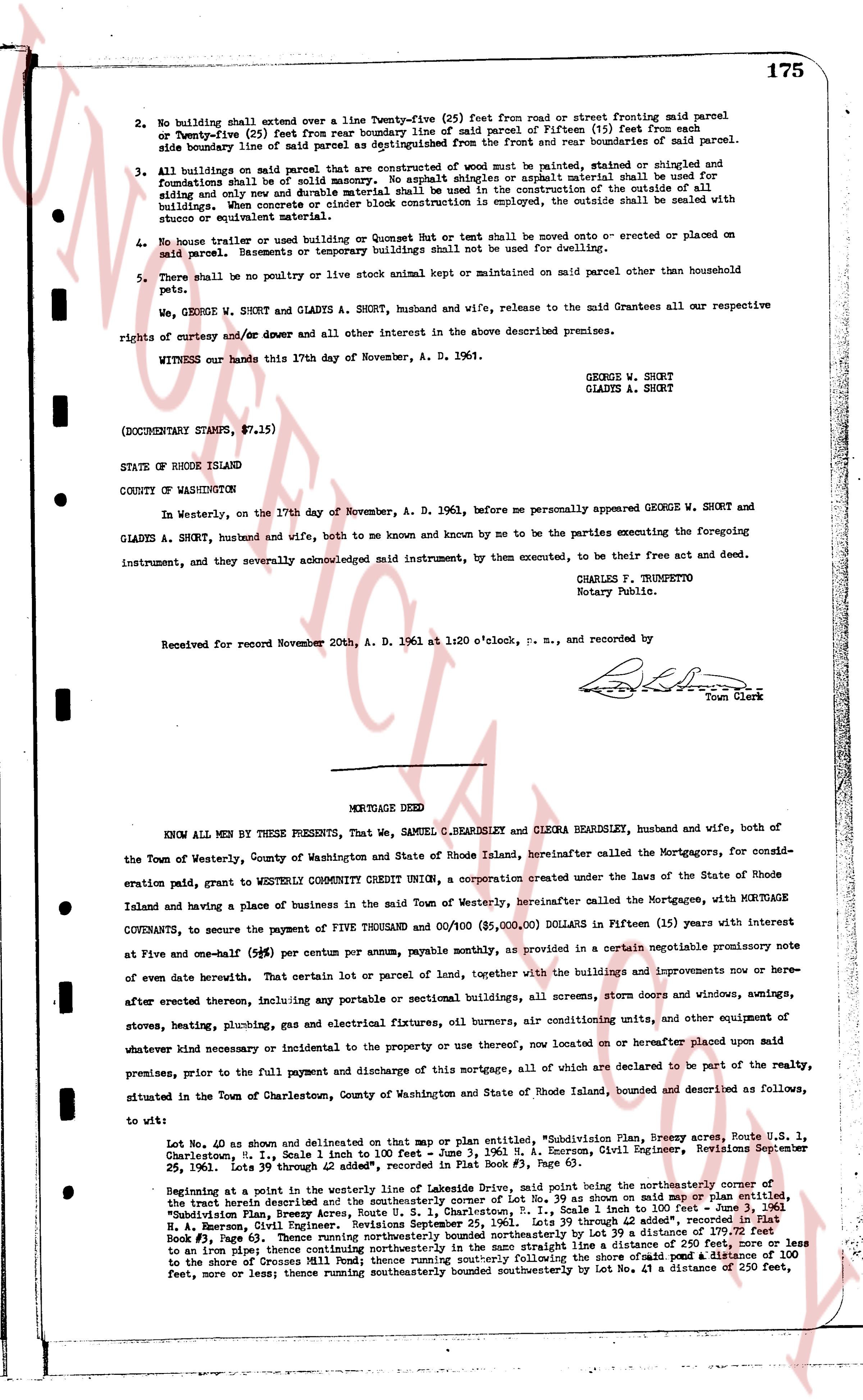
175
2. No building shall extend over a line Twenty-five (25) feet from road or street fronting said parcel or Twenty-five (25) feet from rear boundary line of said parcel of Fifteen (15) feet from each side boundary line of said parcel as distinguished from the front and rear boundaries of said parcel.
3. All buildings on said parcel that are constructed of wood must be painted, stained or shingled and foundations shall be of solid concrete, stone or other approved durable material; no temporary material shall be used in the construction of the outside of all buildings. When concrete or cinder block construction is employed, the outside shall be sealed with stucco or painted waterproof material.
4. No house trailer or used building or Quonset Hut or net structure shall be moved onto or erected or placed on said parcel. Basements or temporary buildings shall not be used for dwelling.
5. There shall be no poultry or live stock animal kept or maintained on said parcel other than household pets.
We, GEORGE W. SHORT and GLADYS A. SHORT, husband and wife, release to the said Grantees all our respective rights of curtesy and/or dower and all other interest in the above described premises.
WITNESS our hands this 17th day of November, A. D. 1961.
GEORGE W. SHORT
GLADYS A. SHORT
(DOCUMENTARY STAMPS, $7.15)
STATE OF RHODE ISLAND
COUNTY OF WASHINGTON
In Westerly, on the 17th day of November, A. D. 1961, before me personally appeared GEORGE W. SHORT and GLADYS A. SHORT, husband and wife, both to me known and known by me to be the parties executing the foregoing instrument, and they severally acknowledged said instrument, by them executed, to be their free act and deed.
CHARLES F. THUMPETTO
Notary Public.
Received for record November 20th, A. D. 1961 at 1:20 o'clock, p. m., and recorded by
[Signature]
Town Clerk
----
MORTGAGE DEED
KNOW ALL MEN BY THESE PRESENTS, That We, SAMUEL C. BEARDSLEY and CLEORA BEARDSLEY, husband and wife, both of the Town of Westerly, County of Washington and State of Rhode Island, hereinafter called the Mortgagors, for consideration paid, grant to WESTERLY COMMUNITY CREDIT UNION, a corporation created under the laws of the State of Rhode Island and having a place of business in the said Town of Westerly, hereinafter called the Mortgagee, with MORTGAGE COVENANTS, to secure the payment of FIVE THOUSAND AND 00/100 ($5,000.00) Dollars in Fifteen (15) years with interest at Five and one-half (5 1/2) per cent per annum, payable monthly, as provided in a certain promissory note of even date herewith. That certain lot or parcel of land, together with the buildings and improvements now and hereafter erected thereon, including any movable or sectional buildings, all screens, doors windows, awnings, stoves, heaters, plumbing, gas and electrical fixtures, oil burners, air conditioners units, and other equipment of whatever kind necessary or incidental to the property or use thereof, now located on or hereafter placed upon said premises, prior to the full payment and discharge of this mortgage, all of which are declared to be part of the realty, situated in the Town of Charlestown, County of Washington and State of Rhode Island, bounded and described as follows, to wit:
Lot No. 40 as shown and delineated on said map or plan entitled, "Subdivision Plan, Beery Acres, Route 1 S. E., Charlestown, R. I., Scale 1 inch to 100 feet - June 3, 1961, H. A. Emerson, Civil Engineer," Revisions September 25, 1961. Lots by through 42 recorded, book [?] in Record Book [?], Page [?].
Beginning at a point in the westerly line of Jenkins Lake Drive, as shown on said map or plan being northeasterly the corner of the third building lot and the road; thence running southeasterly as shown on said map or plan entitled "Subdivision Plan, Beery Acres, Route 1 S. E., Charlestown, R. I., Scale 1 inch to 100 feet - June 3, 1961, H. A. Emerson, Civil Engineer," then continuing southeasterly as shown on said map to a point 179.72 feet Book [?] Page [?] from the road; thence continuing northeasterly bounded northeasterly by Lot 39 a distance of 179.72 feet to an iron pipe; thence continuing northwesterly in the same straight line a distance of 100 feet or there or less to an iron pipe; thence running northwesterly as shown on said map to the shore opposite a distance of 100 feet to the shore of Jenkins Mill Pond; thence running southeasterly bounded southeasterly by Lot No. 41 a distance of 250 feet, more or less; thence running southeasterly bounded southeasterly by Lot No. 47 a distance of 250 feet,
The page as recorded