The instrument's own words
page 1 · read by Gemma vision
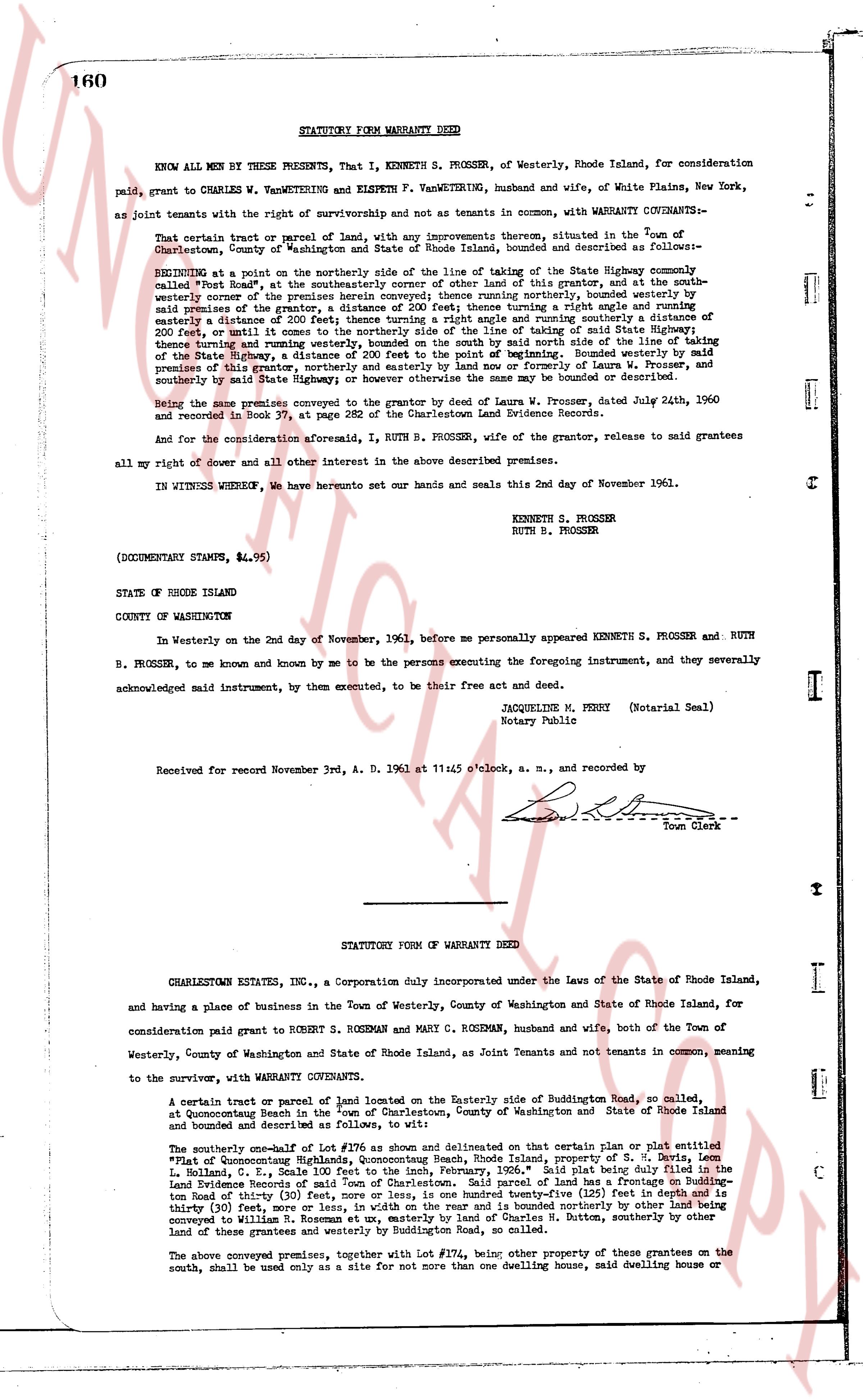
160
STATUTORY FORM WARRANTY DEED
KNOW ALL MEN BY THESE PRESENTS, That I, KENNETH S. PROSSER, of Westerly, Rhode Island, for consideration paid, grant to CHARLES W. VANWETERING and ELSPETH F. VANWETERING, husband and wife, of White Plains, New York, as joint tenants with the right of survivorship and not as tenants in common, with WARRANTY COVENANTS:--
That certain tract or parcel of land, with any improvements thereon, situated in the town of Charlestown, County of Washington and State of Rhode Island, bounded and described as follows:--
BEGINNING at a point on the northerly side of the line of taking of the State Highway commonly called Route 1, at a distance of 200 feet easterly of the center of this grant and a line running northwesterly corner of the premises herein conveyed; then running northerly, bounded westerly by said State Highway, turning a angle and running southeasterly a distance of 200 feet, thence turning a right angle and running southerly a distance of 200 feet, returning to the point of beginning; the said premises being a part of a taking of said State Highway of 200 feet thence turning and running westerly, bounded on the south by said line of the taking of said State Highway and bounded on the east by the line of taking of said State Highway, the premises of this grantor, northerly and easterly by land now or formerly of Laura W. Prosser, and southerly by said State Highway or however the same may be bounded or described.
Being the same premises conveyed to the grantor herein by deed of Laura W. Prosser, dated July 24th, 1960 and recorded in book 35 at page 48 of the Charlestown Land Evidence Records.
And for the consideration aforesaid, I, RUTH B. PROSSER, wife of the grantor, release to said grantees all my right of dower and all other interest in the above described premises.
IN WITNESS WHEREOF, we have hereunto set our hands and seals this 2nd day of November, 1961.
KENNETH S. PROSSER
RUTH B. PROSSER
(DOCUMENTARY STAMPS, $4.95)
STATE OF RHODE ISLAND
COUNTY OF WASHINGTON
In Westerly on the 2nd day of November, 1961, before me personally appeared KENNETH S. PROSSER and RUTH B. PROSSER, to me known and known by me to be the persons executing the foregoing instrument, and they severally acknowledged said instrument, by them executed, to be their free act and deed.
JACQUELINE M. PERRY (Notarial Seal)
Notary Public
Received for record November 3rd, A. D. 1961 at 11:45 o'clock, a. m., and recorded by [?]
Town Clerk
----
STATUTORY FORM of WARRANTY DEED
CHARLESTOWNS ESTATES, INC., a Corporation duly incorporated under the Laws of the State of Rhode Island, and having a place of business in the Town of Westerly, County of Washington and State of Rhode Island, for consideration paid grant to ROBERT S. ROSEMAN AND MARY C. ROSEMAN, husband and wife, both of the Town of Westerly, County of Washington and State of Rhode Island, as Joint Tenants and not tenants in common, ensuring to the survivor, with WARRANTY COVENANTS:
A certain tract or parcel of land situated on the Easterly side of Buddington Road, so called, at Conquananicut Neck in the town of Charlestown, County of Washington and State of Rhode Island and bounded and described as follows:--
The southerly one-half of Lot #176 as shown and delineated on that certain plat entitled "Plat of Conquananicut Highlands, Conquananicut Neck, Rhode Island, property of S. T. Butler" dated 1. 1. [?] 1956, by S. T. Butler, L. S., dated February, 1956." Said plat being duly filed in the Land Evidence Records of said town of Charlestown. Said parcel of land has a frontage on Buddington Road of thirty (30) feet, more or less, and extends thence easterly a distance of one hundred and thirty (30) feet, more or less, in width on the rear and is bounded northerly by other land being conveyed to Elspeth F. VanWetering and Charles W. VanWetering and S. T. Butler, southerly by other land of these grantees and westerly by Buddington Road, so called.
The above conveyed premises, together with Lot #174, being other property of these grantees on the south, shall be used only as a site for not more than one dwelling house, said dwelling house or
The page as recorded