The instrument's own words
page 1 · read by Gemma vision
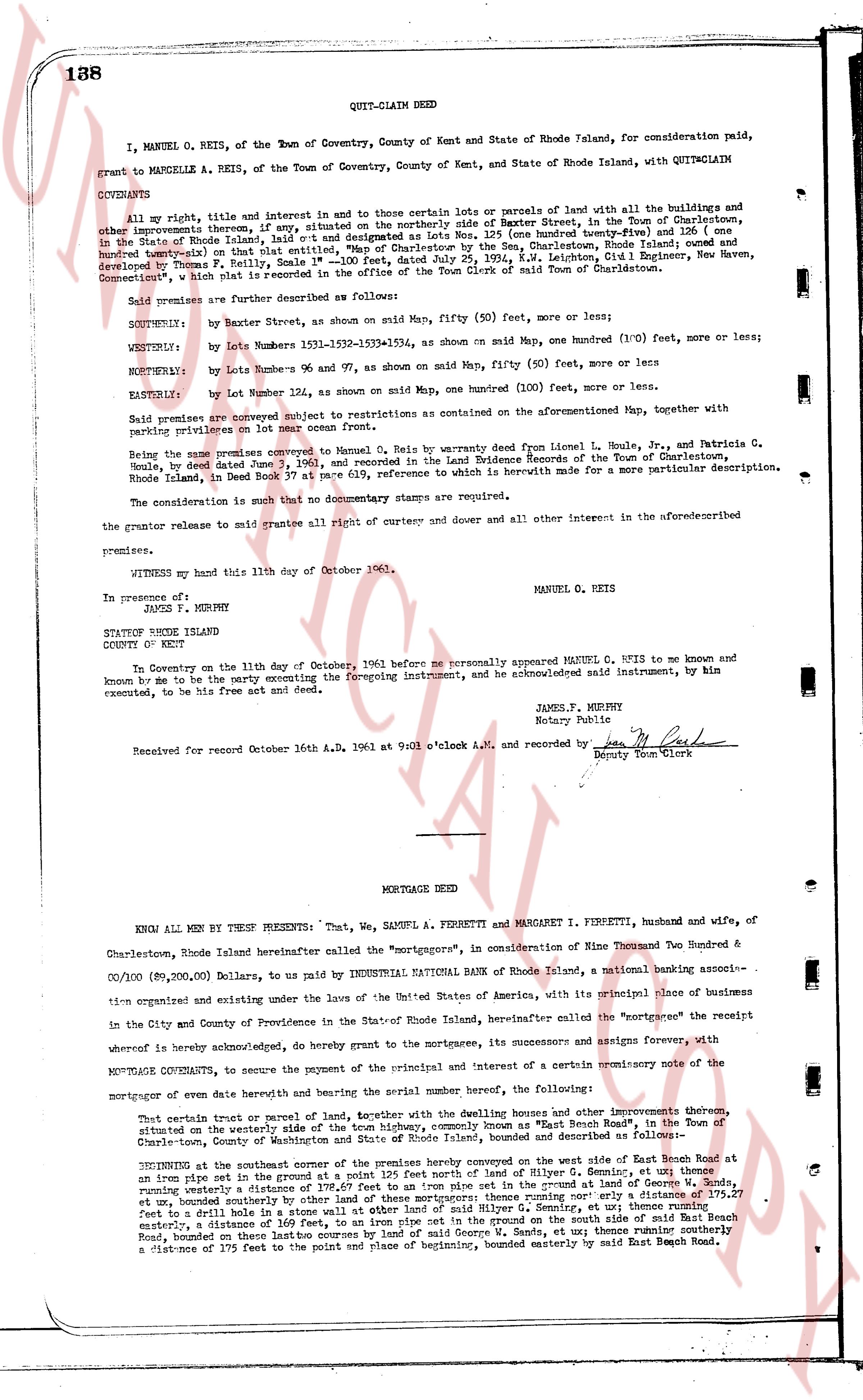
138 QUIT-CLAIM DEED
I, MANUEL O. REIS, of the Town of Coventry, County of Kent and State of Rhode Island, for consideration paid, grant to MARCELLE A. REIS, of the Town of Coventry, County of Kent, and State of Rhode Island, with QUIT-CLAIM COVENANTS:
All my right, title and interest in and to three certain lots or parcels of land with all the buildings and other improvements thereon, if any, situated on the northerly side of Baxter Street, in the Town of Charlestown, in the State of Rhode Island, laid out and designated as Lots Nos. 125 (one hundred twenty-five) and 126 (one hundred twenty-six) on that detailed "Map" entitled, "Map of the Charlestown-Westerly Line, Rhode Island and Connecticut, showing the receipt and development of F. R. Higgins, and the survey of A. S. Snyder, dated July 19, 1934, K.W. Lehman, Civil Engineer, New Haven, Connecticut," which map is recorded in office of the Town Clerk of said Town of Charlestown.
Said premises are further described as follows:
SOUTHERLY: by Baxter Street, as shown on said Map, fifty (50) feet, more or less;
WESTERLY: by Lots numbers 153-154-153-154, as shown on said Map, one hundred (100) feet, more or less;
NORTHERLY: by Lots number 96 and 97, as shown on said Map, fifty (50) feet, more or less;
EASTERLY: by Lot number 122, as shown on said Map, one hundred (100) feet, more or less.
Said premises are conveyed subject to restrictions as contained on the aforementioned Map, together with parking privileges on lot near ocean front.
Being the same premises conveyed to Manuel O. Reis by warranty deed from Leon L. Houle, Jr., and Patricia C. Houle, dated June 3rd 1958 as evidenced in the Land Evidence Records of the Town of Charlestown, Rhode Island, in Deed Book 37 at page 619, reference to which is herewith made for a more particular description.
The consideration is such that no documentary stamps are required.
the grantor releases to said grantee all right of curtesy and dower and all other interest in the aforementioned premises.
WITNESS my hand this 11th day of October 1961. MANUEL O. REIS
In presence of:
JAMES F. MURPHY
STATE OF RHODE ISLAND
COUNTY OF KENT
On this Tuesday on the 11th day of October, 1961 before me personally appeared MANUEL O. REIS to me known and known by me to be the party executing the foregoing instrument, and he acknowledged said instrument, by him executed, to be his free act and deed.
JAMES F. MURPHY
Notary Public
Received for record October 16th A.D. 1961 at 9 o'clock A.M., and recorded by [signature]
Deputy Town Clerk
----
MORTGAGE DEED
KNOW ALL MEN BY THESE PRESENTS: That, WE, SAMUEL A. FERRETTI and MARGARET I. FERRETTI, husband and wife, of Charlestown, Rhode Island hereinafter called the "mortgagors", in consideration of Nine Thousand Two Hundred & 00/100 ($9,200.00) Dollars, to us paid by INDUSTRIAL NATIONAL BANK of Rhode Island, a national banking association organized and existing under the laws of the United States of America, with its principal place of business in the City and County of Providence in the State of Rhode Island, hereinafter called the "mortgagee" the mortgagor hereby acknowledge, do hereby grant to the mortgagee, its successors and assigns forever, with MORTGAGE COVENANTS, to secure the payment of the principal and interest of a certain promissory note of the mortgagee of certain land thereunto herbying and bearing the several number hereof, the following:
That certain tract or parcel of land, together with the dwelling house and other improvements thereon, situated on the westerly side of the road known historically, common only as "East Beach Road", in the Town of Charlestown, County of Washington and State of Rhode Island, bounded and described as follows:
BEGINNING at the southeast corner of the premises hereby conveyed on the west side of said East Beach Road at an iron pin set in the ground at the intersection of said road and a line running northwesterly, at we thence running westerly a distance of 178.67 feet to an iron pipe set in the ground at land of George Reis, at we thence running northerly a distance of 100.00 feet to an iron pipe set in the ground, and thence running a distance of 175.27 feet to a drill hole in a stone wall on other land of said Gilley G. Semiro, at we thence running northerly easterly, a distance of 160.00 feet to an iron pipe set in the ground on the west side of said East Beach Road, and then running two hastro courses by land of said George W. Sands, at we thence running southerly a distance of 175 feet to the point and place of beginning, bounded easterly by said East Beach Road.
The page as recorded