The Deed Walker · From Ninigret · Charlestown, Rhode Island land evidence, 1738 to today
Trail: 7616 › 7835 › 7165

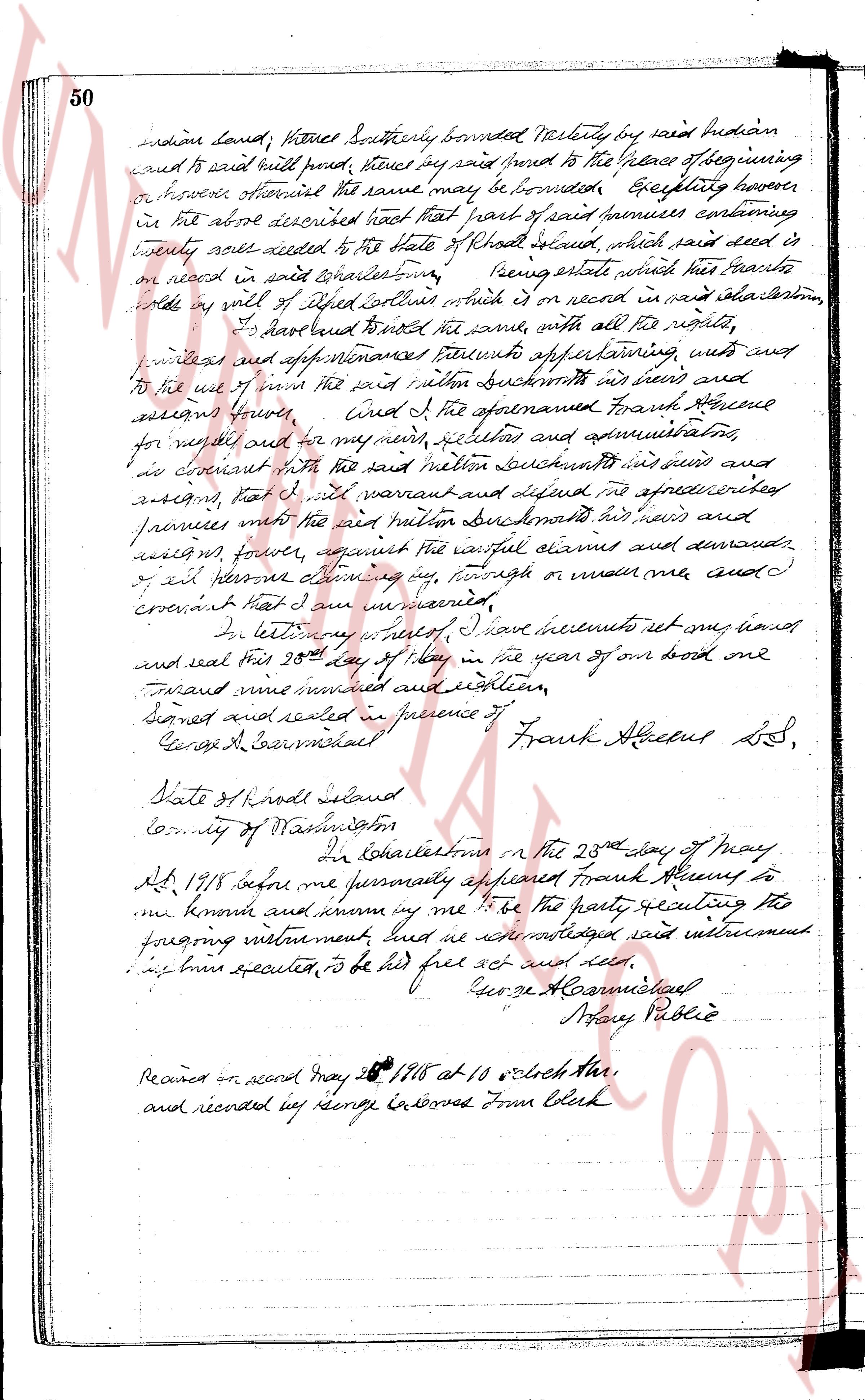
5/25/1918 · DEED · book 19 page 49 doc 7165

From GREENE FRANK A
To DUCKWORTH MILTON
Premises none · Lots 477 and 479 on Map of Charlestown by the Sea (Charlestown)

Back — where this land came from

This instrument states no source of title that we have read yet.

Forward — where this land went

Follow forward ▶ 1899 · DEED · TUCKER WELCOME C → GREENE VANGIE L · book 14 p 50
“reference is hereby made to a deed from Eugene B. Louence to Welcome Le Tuxer recorded in Land Evidence Book 19 page 49”
cites this instrument as its source · read by gemma

The grantee's later conveyances, by name — the man, not necessarily this land; the one that cites this deed as its source is the land

▶ 1918 · DEED · DUCKWORTH CARRIE E; DUCKWORTH MILTON → RICHARD ALFRED J · book 19 p 45
▶ 1921 · MORTGAGE DISCHARGE · DUCKWORTH MILTON; INDUSTRIAL TRUST CO; CARMICHAEL GEORGE A → WEBSTER LUCY A · book 18 p 419
▶ 1923 · DEED · DUCKWORTH CARRIE E; DUCKWORTH MILTON; CARMICHAEL GEORGE A → MILLS DAVID E · book 21 p 20
▶ 1924 · DEED · DUCKWORTH CARRIE E; DUCKWORTH MILTON; CARMICHAEL GEORGE A → RATHBONE WILLIAM B · book 21 p 361
▶ 1925 · DEED · DUCKWORTH CARRIE E; DUCKWORTH MILTON; CARMICHAEL GEORGE A → GARDNER ELLA H · book 21 p 424
▶ 1926 · DEED · DUCKWORTH CARRIE E; DUCKWORTH MILTON; CARMICHAEL GEORGE A → MILLS DAVID E · book 22 p 152
▶ 1932 · LEASE · DUCKWORTH MILTON → HIGGINS LORETTA P · book 25 p 66
▶ 1936 · DEED · DUCKWORTH CARRIE E; DUCKWORTH MILTON → LASKEY BRENDA B · book 26 p 359
▶ 1936 · DEED · CARMICHAEL WELCOME S; DUCKWORTH CARRIE E; DUCKWORTH MILTON; CARMICHAEL → · book 26 p 479
▶ 1940 · DEED · DUCKWORTH CARRIE E; DUCKWORTH MILTON → KENYON FREDERICK; KENYON GERTRUDE · book 28 p 206
▶ 1940 · EASEMENT · DUCKWORTH CARRIE E; DUCKWORTH MILTON → NARRAGANSETT ELECTRIC COMPANY · book 28 p 308
▶ 1943 · MORTGAGE DISCHARGE · DUCKWORTH MILTON → WILCOX ANITA H; WILCOX RICHARD W · book 28 p 205
▶ 1945 · MORTGAGE DISCHARGE · DUCKWORTH MILTON → HOXIE GEORGE W; HOXIE LILLIAN G · book 22 p 227
▶ 1950 · RELEASE · DUCKWORTH MILTON → BURDICK BECKY W; BURDICK HAROLD C · book 29 p 521
▶ 1951 · DEED · CARMICHAEL DOROTHY H; CARMICHAEL WELCOME S; DUCKWORTH CARRIE E; DUCKWO → KENYON NORMAN E; KENYON RUSSELL E · book 32 p 404
▶ 1951 · DEED · DUCKWORTH CARRIE E; DUCKWORTH MILTON → DUCKWORTH MILTON; DUCKWORTH CARRIE E · book 32 p 554

The instrument's own words

Attribution under review. The portal's file number is shared by more than one instrument, and the words below could not be placed with certainty on this one by their own evidence (page stamp, parties, dates); they may belong to a neighbouring instrument. Read them as the record of the page, not yet as this deed's own.
page 1
137 We, Earle C. Fish and Anna C. Fish, husband and wife, both of the City of Warwick and State of Rhode Island, as joint tenants for consideration paid, grant to Donald West and Cecilia H. West, husband and wife, both of the City of Warwick and State of Rhode Island, as joint tenants and not as tenants in common, in fee simple with WARRANTY COVENANTS (Description and incumbrances, if any) That certain real estate situated in the Town of Charlestown, County of Washington State of Rhode Island, and described as follows: Those certain lots or parcels of land, located in the Town of Charlestown, County of Washington and State of Rhode Island, and laid out and designated as Lots Numbers 477 and 479 shown on a "Map of Charlestown by the Sea, Charlestown, Rhode Island, owned and developed by Thomas P. Reilly, Scale 1" = 100 feet, dated July 25th, 1934, K. W. Leighton, Civil Engineer, New Haven, Connecticut," and filed in the office of the Town Clerk of said Charlestown. Said lots are bounded as follows: Northerly : by Henley Street, as shown on said Map, fifty (50) feet, more or less; Easterly : by Lot Number 476, as shown on said Map, one hundred (100) feet, more or less; Southerly : by Lots Numbers 514 and 515, as shown on said Map, fifty (50) feet, more or less; Westerly : by Lot Number 478, as shown on said Map, one hundred (100) feet, more or less. This deed is subject to restrictions as contained on said Map. We, Earle C. Fish and Anna C. Fish husband & wife the grantors release to the grantees all our right of curtesy & dower and all other interest in the aforesaidcribed premises. WITNESS our hands this 13th day of May 1952. EARLE C. FISH (SEAL) ANNA C. FISH (SEAL) (DOCUMENTARY STAMPS, 55¢) STATE OF RHODE ISLAND } } } County of Kent In Warwick on the 13th day of May 1952 before me personally appeared Earle C. Fish and Anna C. Fish to me known and known by me to be the parties executing the foregoing instrument, and they acknowledged said instrument, by them executed to be thier free act and deed. LLOYD S. FISH (Notarial Seal) Notary Public Received for record June 5th, A. D. 1952 at 2:10 o'clock, p. m., and recorded by [Signature] Town Clerk AHA 490.

The page as recorded
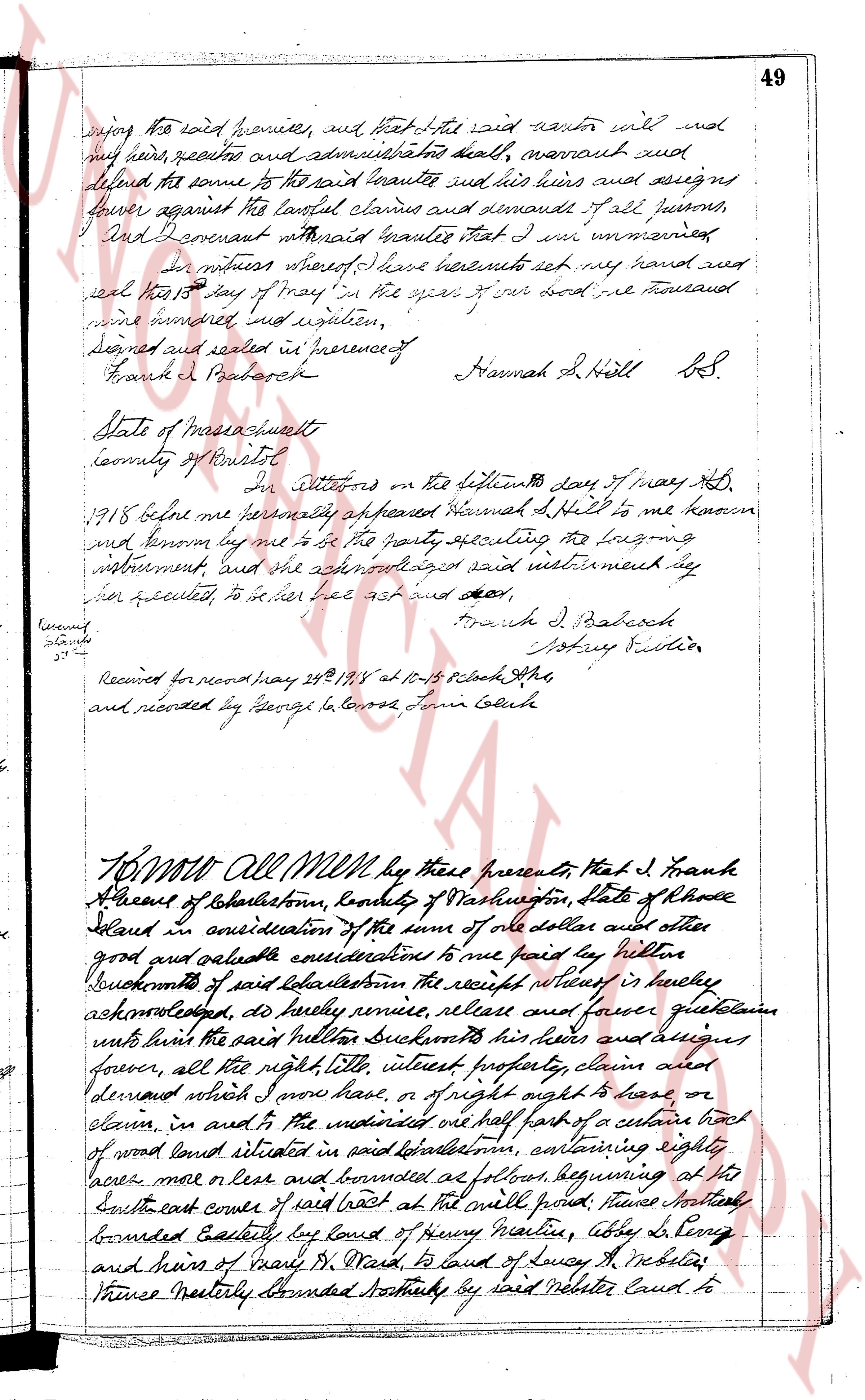
page 1page 2

deed_walker_v1.9_2026-10-10 · the index is the town's own (i2l.uslandrecords.com); transcripts, chains and the assessor's cards are the Perry Machine's reading of it. Where the record we hold runs out, the page says so.