The instrument's own words
page 1 · read by Gemma vision
98
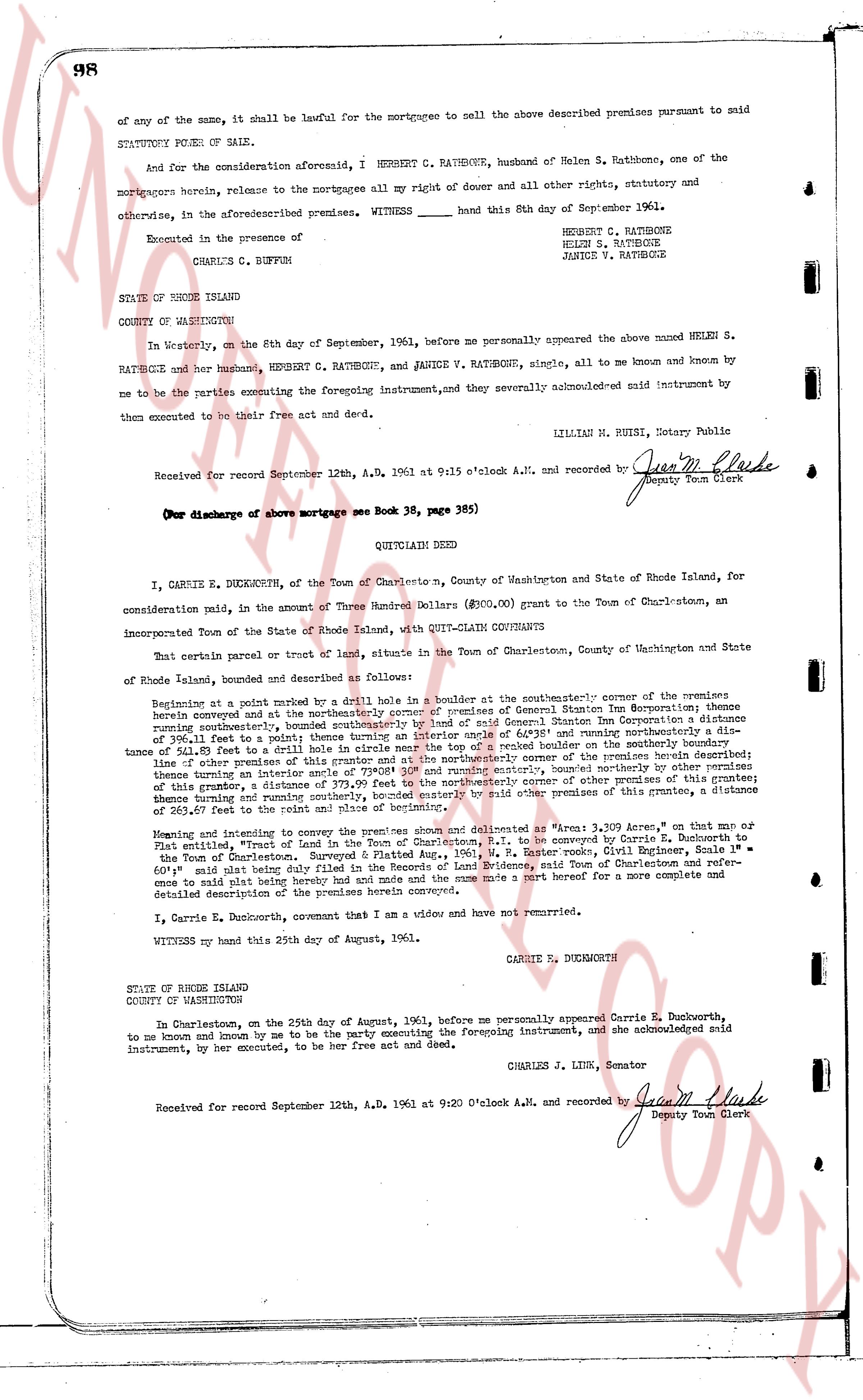
of any of the same, it shall be lawful for the mortgagee to sell the above described premises pursuant to said
STATUTORY POWER OF SALE.
And for the consideration aforesaid, I HERBERT C. RATHBONE, husband of Helen S. Rathbone, one of the
mortgagors herein, release to the mortgagee all my right of dower and all other rights, statutory and
otherwise, in the aforesaid premises. WITNESS hand this 8th day of September 1961.
Executed in the presence of
CHARLES C. BUFFUM
HERBERT C. RATHBONE
HELEN S. RATHBONE
JANICE V. RATHBONE
STATE OF RHODE ISLAND
COUNTY OF WASHINGTON
In Westerly, on the 8th day of September, 1961, before me personally appeared the above named HELEN S.
RATHBONE and her husband, HERBERT C. RATHBONE, and JANICE V. RATHBONE, single, all to me known and known by
me to be the parties executing the foregoing instrument, and severely acknowledged said instrument by
them executed to be their free act and deed.
LILLIAN M. RUSIE, Notary Public
Received for record September 12th, A.D. 1961 at 9:15 o'clock A.M. and recorded by [Signature]
Deputy Town Clerk
(For discharge of above mortgage see Book 38, page 98)
----
QUITCLAIM DEED
I, CARRIE E. DUCKWORTH, of the Town of Charlestown, County of Washington and State of Rhode Island, for
consideration paid pin, in the amount of Three Hundred Dollars ($300.00) grant to the Town of Charlestown, an
incorporated Town of the State of Rhode Island, with QUIT-CLAIM grants
That certain parcel or tract of land, situate in the Town of Charlestown, County of Washington and State
of Rhode Island, bounded and described as follows:
Beginning at a point marked by a drilled hole 1/2 inch by 4 inches at the southeasterly corner of the remainder
herein conveyed and at the northeast corner of property of General Sterling Inn Corporation; thence bearing
northwest 31° 15' east, bounded southeasterly by land of said General Sterling Inn Corporation a distance
of 111.41 feet to a point; thence 1/2 inch in circle near the top of a spiked boulder on the southerly boundary
of the property in intersection with the center line of said road marking a point; thence bearing north 31° 15'
east 117.5 feet to a point; thence bearing north 31° 15' east a distance of 379.99 feet to the northeasterly corner of other premises of this
grantor; other of other premises of this grantor and at the northeasterly corner of the remainder
herein conveyed and terminating at the northeasterly corner, bounded northerly by other premises
of this grantor, a distance of 111.41 feet to a point; thence bearing south 58° 45' west, a distance of 379.99 feet to
this grantor, a distance of 263.47 feet to the point and place of beginning.
Meaning and intending to convey the premises shown and delineated as "Area 1, 3.309 Acres" on that map or
plat entitled, "Tract of Land belonging to Carrie E. Duckworth, P.P., to be conveyed by Carrie E. Duckworth to
the Town of Charlestown. Surveyed & Platted Aug., 1961, W. P. Easter books, Civil Engineering, Scale 1" =
60'" said plat being here with made and filed with the Town of Charlestown, Rhode Island, and said Town of Charlestown
once to said plat being hereby had and made and the same made a part hereof for a more complete and
detailed description of the premises herein conveyed.
I, Carrie E. Duckworth, covenant that I am a widow and have not remarried.
WITNESS my hand this 25th day of August, 1961.
CARRIE E. DUCKWORTH
STATE OF RHODE ISLAND
COUNTY OF WASHINGTON
In Charlestown, on the 25th day of August, 1961, before me personally appeared Carrie E. Duckworth,
to me known and known by me to be the party executing the foregoing instrument, and she acknowledged said
instrument, by her executed, to be her free act and deed.
CHARLES J. LINK, Senator
Received for record September 12th, A.D. 1961 at 9:20 O'clock A.M. and recorded by [Signature]
Deputy Town Clerk
The page as recorded