The instrument's own words
page 1 · read by Gemma vision
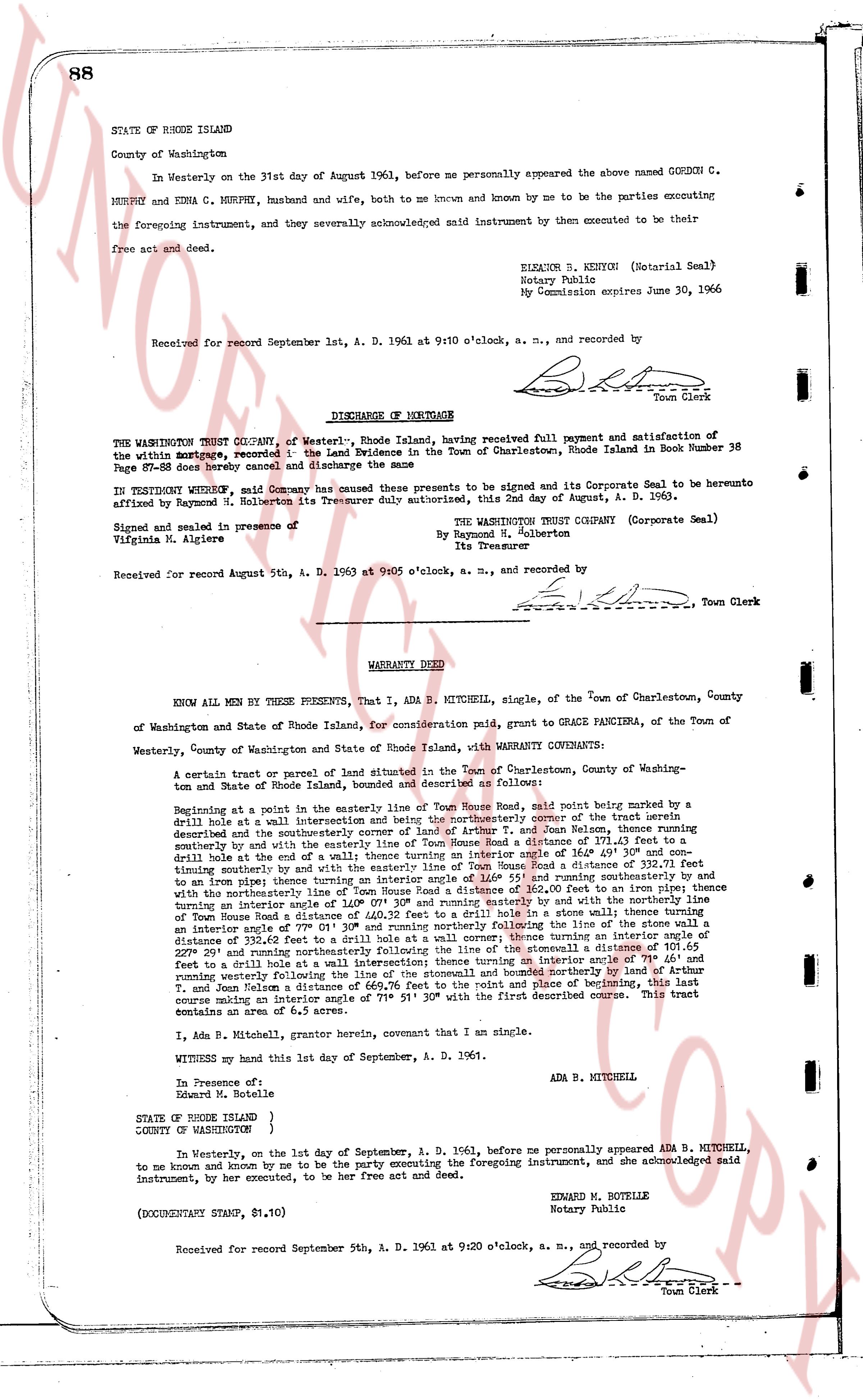
88
STATE OF RHODE ISLAND
County of Washington
In Westerly on the 31st day of August 1961, before me personally appeared the above named GORDON C. MURPHY and EDNA C. MURPHY, husband and wife, both to me known and known by me to be the parties executing the foregoing instrument, and they severally acknowledged said instrument by then executed to be their free act and deed.
(Notarial Seal)
ELEANOR S. KENYON
Notary Public
My Commission expires June 30, 1966
Received for record September 1st, A. D. 1961 at 9:10 o'clock, a. m., and recorded by
[Signature]
Town Clerk
----
DISCHARGE OF MORTGAGE
THE WASHINGTON TRUST COMPANY, of Westerly, Rhode Island, having received full payment and satisfaction of the within mortgage, recorded in the Land Evidence in the Town of Charlestown, Rhode Island in Book Number 38 Page Number 78, hereby cancel and discharge the same.
IN TESTIMONY WHEREOF, said Company has caused these presents to be signed and its Corporate Seal to be hereunto affixed by Raymond N. Holberton its Treasurer duly authorized, this 2nd day of August, A. D. 1963.
(Corporate Seal)
THE WASHINGTON TRUST COMPANY
By Raymond N. Holberton
Its Treasurer
Signed and sealed in presence of
Virginia M. Algiere
Received for record August 5th, A. D. 1963 at 9:05 o'clock, a. m., and recorded by
[Signature]
Town Clerk
----
WARRANTY DEED
KNOW ALL MEN BY THESE PRESENTS, that I, ADA B. MITCHELL, single, of the Town of Charlestown, County of Washington and State of Rhode Island, for consideration paid, grant to GRACE PANCIERA, of the Town of Westerly, County of Washington and State of Rhode Island, with WARRANTY COVENANTS:
A certain tract or parcel of land situated in the Town of Charlestown, County of Washington and State of Rhode Island, bounded and described as follows:
Beginning at a point in the easterly line of Town House Road, said point being marked by a drill hole at a wall intersection and being the southeasterly corner of the tract herein described and the southeasterly corner of a tract of land of T. and Jean Bolensa, then running southeasterly and by said wall to a drill hole in said wall a distance of 101.65 feet then running southeasterly by said wall to a drill hole in said wall a distance of 111.30 feet then running southeasterly to a drill hole at the end of a wall thence turning an interior angle of 164° 49' 30" and continuing southeasterly by a stone wall to a drill hole in said wall a distance of 111.10 feet then running southeasterly to an iron pipe thence turning an interior angle of 146° 55' and running southeasterly 200 feet and then northerly 110 feet thence turning an interior angle of 109° 01' 30" and running easterly and by the northerly line then running northerly 100 feet to a drill hole in a stone wall, then running northwesterly in Town House Road a distance of 400.32 feet to a stone wall, then turning an interior angle of 77° 11' 30" and running westerly along said wall, then turning an interior angle of 97° 11' 30" and running northerly along the stone wall in a distance of 332.62 feet to a drill hole at a wall corner; thence turning an interior angle of 101.65° 20' and running northerly along said wall to a drill hole in said wall a distance of 101.65 feet to a drill hole at a wall intersection; thence turning an interior angle of 71° 46' and running northwesterly along said wall to a drill hole marked by a drill hole 300 feet to T. and Jean Bolensa a distance of 669.76 feet to the point and place of beginning, this last course making an interior angle of 71° 51' 30" with the first described course. This tract contains an area of 6.5 acres.
I, Ada B. Mitchell, grantor herein, covenant that I am sole.
WITNESS my hand this 1st day of September, A. D. 1961.
ADA B. MITCHELL
In presence of:
Edward M. Botelle
STATE OF RHODE ISLAND }
COUNTY OF WASHINGTON }
In Westerly, on the 1st day of September, A. D. 1961, before me personally appeared ADA B. MITCHELL, to me known and known by me to be the party executing the foregoing instrument, and she acknowledged said instrument, by her executed, to be her free act and deed.
EDWARD M. BOTELLE
Notary Public
(DOCUMENTARY STAMP, $1.10)
Received for record September 5th, A. D. 1961 at 9:20 o'clock, a. m., and recorded by
[Signature]
Town Clerk
The page as recorded