The instrument's own words
page 1 · read by Gemma vision
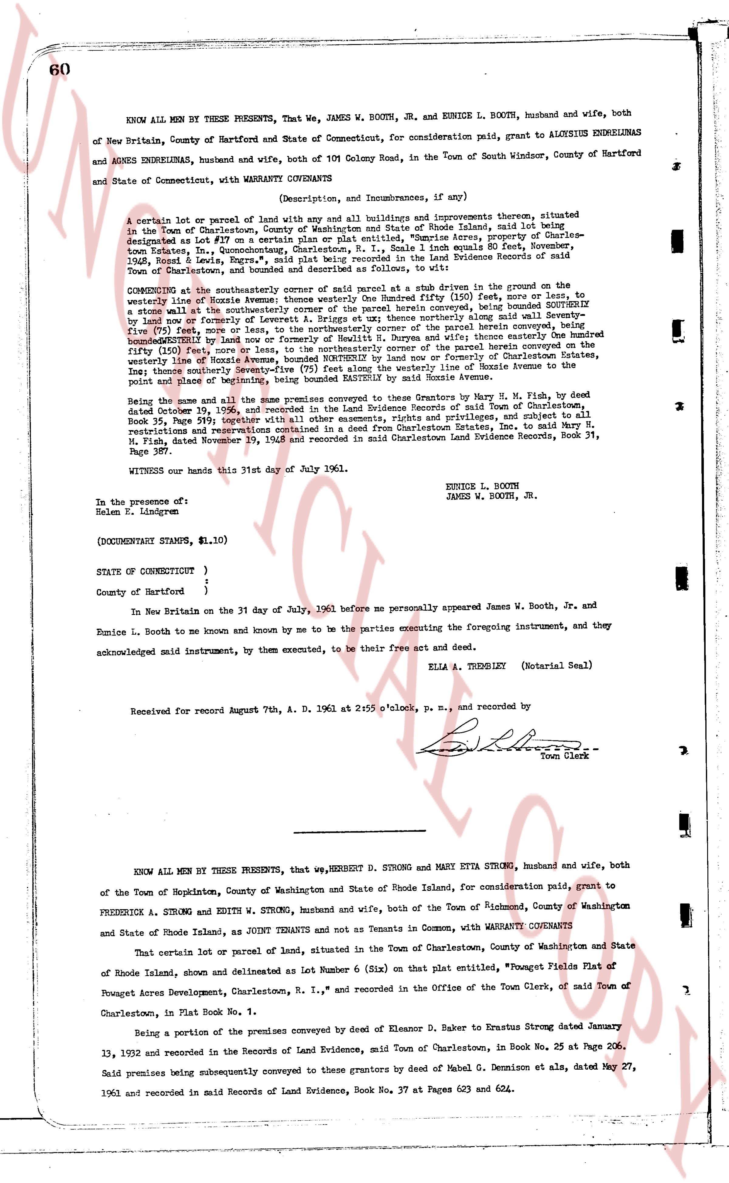
60
KNOW ALL MEN BY THESE PRESENTS, That We, JAMES W. BOOTH, JR. and EUNICE L. BOOTH, husband and wife, both of New Britain, County of Hartford and State of Connecticut, for consideration paid, grant to ALOYSIUS ENDRELUNAS and AGNES ENDRELUNAS, husband and wife, both of 101 Colony Road, in the Town of South Windsor, County of Hartford and State of Connecticut, with WARRANTY COVENANTS
(Description, and Incumbrances, if any)
A certain lot or parcel of land with any all buildings and improvements thereon, situated lain said being situated in the Town of Charlestown, County of Washington and State of Rhode Island, said land being designated as Lot Fifty (50) on a plat entitled, "Sunrise Acres, property of Charles-ton Estates, In., Cononningcoast, Charlestown, R. I.," said land equals 10 Roods 1q Acre November, 1905, and Land Records Book 24, page 111, recorded in the Land Evidence Records of said Town and designated and described as follows:
COMMENCING at the southwestern corner of said parcel at a shrub drew in the ground on the, to the east, center line of Hoxie Avenue, bounding said lot southeasterly (150) feet, more or less, to a stone wall at the southwestern corner of the parcel herein conveyed, being bounded southeasterly by said stone wall (75) feet, more or less, to the northwestern corner of said parcel being bounded southeasterly by said stone wall and then continuing northeasterly along said wall Seventy-five (75) feet, more or less, to the northeasterly corner view said conveyed, being bounded northeasterly by said stone wall and then continuing northerly (150) feet, more or less, to a boundary fifty (150) feet, more or less, to the northeasterly corner of the parcel herein conveyed on the northwestern boundary of Hoxie Avenue, bounding said lot northeasterly, or formally "Charlestown Estates, Inc." road center line boundary (75) feet, more or less, to the westerly angle line of Hoxie Avenue to the point and place of beginning, being bounded easterly by said noxie Avenue.
Being the same and all the same premises conveyed to these Grantors by Harry M. H. Fish, by deed dated October 30, 1936, and recorded in the Land Evidence Records of said Town of Charlestown, in Book 35, Page 519; together with all other easements, rights and privileges, and subject to all restrictions and reservations contained in the deed from Eleanor E. Baker, to Harry M. H. Fish, dated November 29, 1948 and recorded in said Charlestown Land Evidence Records, Book 31, Page 387.
WITNESS our hands this 31st day of July 1961.
EUNICE L. BOOTH
JAMES W. BOOTH, JR.
In the presence of:
Helen E. Lindgren
(DOCUMENTARY STAMPS, $1.10)
STATE OF CONNECTICUT {
}
County of Hartford {
on the 31 day of July, 1961 before me personally appeared James W. Booth, Jr. and Eunice L. Booth to me known and known by me to be the parties executing the foregoing instrument, and they acknowledged said instrument, by their executed, to be their free act and deed.
ELLA A. TRESLEY (Notarial Seal)
Received for record August 7th, A. D. 1961 at 2:55 o'clock, and recorded by [?]
Town Clerk
----
KNOW ALL MEN BY THESE PRESENTS, that We, HERBERT D. STRONG and MARY ETTA STRONG, husband and wife, both of the Town of Hopkinton, County of Washington and State of Rhode Island, for consideration paid, grant to FREDERICK A. STRONG and EDITH W. STRONG, husband and wife, both of the Town of Richmond, County of Washington and State of Rhode Island, as JOINT TENANTS and not as Tenants in Common, with WARRANTY COVENANTS
That certain lot or parcel of land, situated in the Town of Charlestown, County of Washington and State of Rhode Island, shown and delineated as Lot Number 6 (Six) on that plat entitled, "Powsgat Flats Plat of Powsgat Acres Development, Charlestown, R. I.," and recorded in the Office of the Town Clerk, of said Town of Charlestown, in Plat Book No. 1.
Being a portion of the premises conveyed by deed of Eleanor D. Baker to Ernstus Strong dated January 13, 1932 and recorded in the Records of Land Evidence, said Town of Charlestown, in Book 25 at Page 206.
Said premises being subsequently conveyed to these grantors by deed of Mabel G. Dennison et als, dated May 27, 1961 and recorded in said Mains Records of Land Evidence, Book No. 37 at Pages 623 and 624.
The page as recorded