The instrument's own words
page 1 · read by Gemma vision
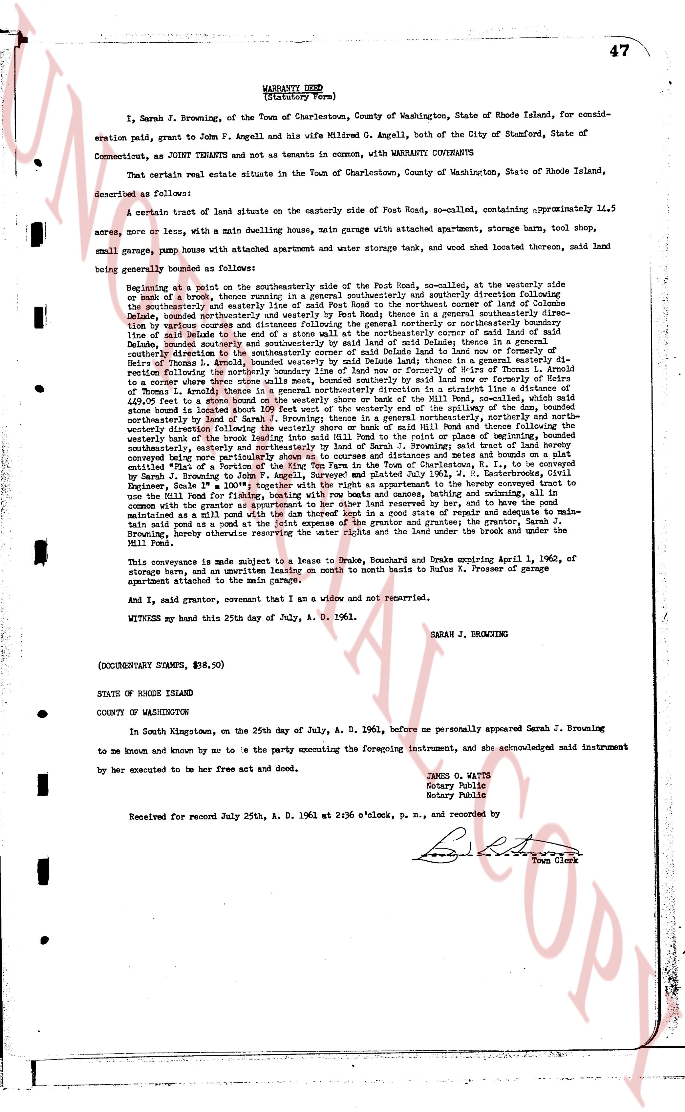
47
WARRANTY DEED
(Statutory Form)
I, Sarah J. Browning, of the Town of Charlestown, County of Washington, State of Rhode Island, for consideration paid, grant to John F. Angell and his wife Mildred G. Angell, both of the City of Stamford, State of Connecticut, as JOINT TENANTS and not as tenants in common, with WARRANTY COVENANTS
That certain real estate situate in the Town of Charlestown, County of Washington, State of Rhode Island, described as follows:
A certain tract of land situate on the easterly side of Post Road, so-called, containing approximately 14.5 acres, more or less, with a main dwelling house, main garage with attached apartment store water tank, and shed without thereon located, said land being generally bounded as follows:
Beginning at a point on the southerly side of the Post Road, so-called, at the westerly side or edge of a brook, thence running in a general southeasterly and southerly direction following division fence on the southeasterly and easterly line of said Post Road to a monument corner of land of Columna DeLuca, thence running easterly and southeasterly on said Post Road thence in a general southeasterly direction by various courses and distances following the general northerly or northeasterly boundary line of said Columna DeLuca to the northeast corner of said land of Mildred G. Angell, thence in a general southeasterly direction to the northeast corner of land of Mildred G. Angell, thence bounded southeasterly by the land of Mildred G. Angell, bounded southeasterly by said Dalice Leand; thence in a general easterly direction to the northeast corner of land of Thomas L. Arnold, bounded southeasterly by land of one or more heirs of Thomas L. Arnold, bounded southeasterly by said Dalice Leand; thence in a general easterly direction following the northerly line of land of one or more heirs of Thomas L. Arnold to a point where three stone walls meet, bounded southeasterly by said land nor southeasterly by land of one or more heirs of Thomas L. Arnold; thence in a general southeasterly direction to a creek line flowing into the westerly shore or bank of the Mill Pond, so-called, with said stone walls bounded 109 feet West of the westerly end of the Mill Pond and thence following the westerly shore or bank of said Mill Pond to a point where said creek or inlet of said Mill Pond meets the southeasterly boundary line of land of one or more heirs of Thomas L. Arnold, bounded northeasterly, northerly and northeasterly westerly then the boundary of the land of one or more heirs of Thomas L. Arnold, bounded northeasterly, northerly and northeasterly westerly direction following the westerly shore or bank of said Mill Pond thence following the southeasterly boundary line of land of one or more heirs of Thomas L. Arnold to a point where said creek or inlet of said Mill Pond meets the southeasterly and northeasterly boundary of land of Sarah J. Browning; said tract of land hereby conveyed being part of the land of Sarah J. Browning, as conveyed to her and her husband by deed dated and recorded as entitled "Map A portion of the Region of the Kim Farm in the Town of Charlestown, R. I.", to be conveyed by Sarah J. Browning to John F. Angell and Mildred G. Angell, as joint tenants, by deed of reference in Plat Book 1, Engineer Scale 1" = 100' together with the right as an appurtenance to her the boundary conveyed tract to use the Mill Pond for fishing and other purposes, to use the botany and recreation and to have the pond maintained as a mill pond with the dam thereof to be maintained by the grantor and grantee; the grantor, Sarah J. Browning, hereby reserving the water rights and the land under the brook and under the Mill Pond.
This conveyance is made subject to a lease to Drake, Bouchard and Drake expiring April 1, 1962, of storage barn, and an unwritten leasing on month to month basis to Rufus K. Prosser of garage apartment attached to the main garage.
And I, said grantor, covenant that I am a widow and not remarried.
WITNESS my hand this 25th day of July, A. D. 1961.
SARAH J. BROWNING
(DOCUMENTARY STAMPS, $38.50)
STATE OF RHODE ISLAND
COUNTY OF WASHINGTON
In South Kingstown, on the 25th day of July, A. D. 1961, before me personally appeared Sarah J. Browning to me known and known by me to be the party executing the foregoing instrument, and she acknowledged said instrument by her execution to be her free act and deed.
JAMOS O. WATTS
Notary Public
Notary Public
Received for record July 25th, A. D. 1961 at 2:36 o'clock, p. m., and recorded by
Town Clerk
The page as recorded