The instrument's own words
page 1 · read by Gemma vision
32
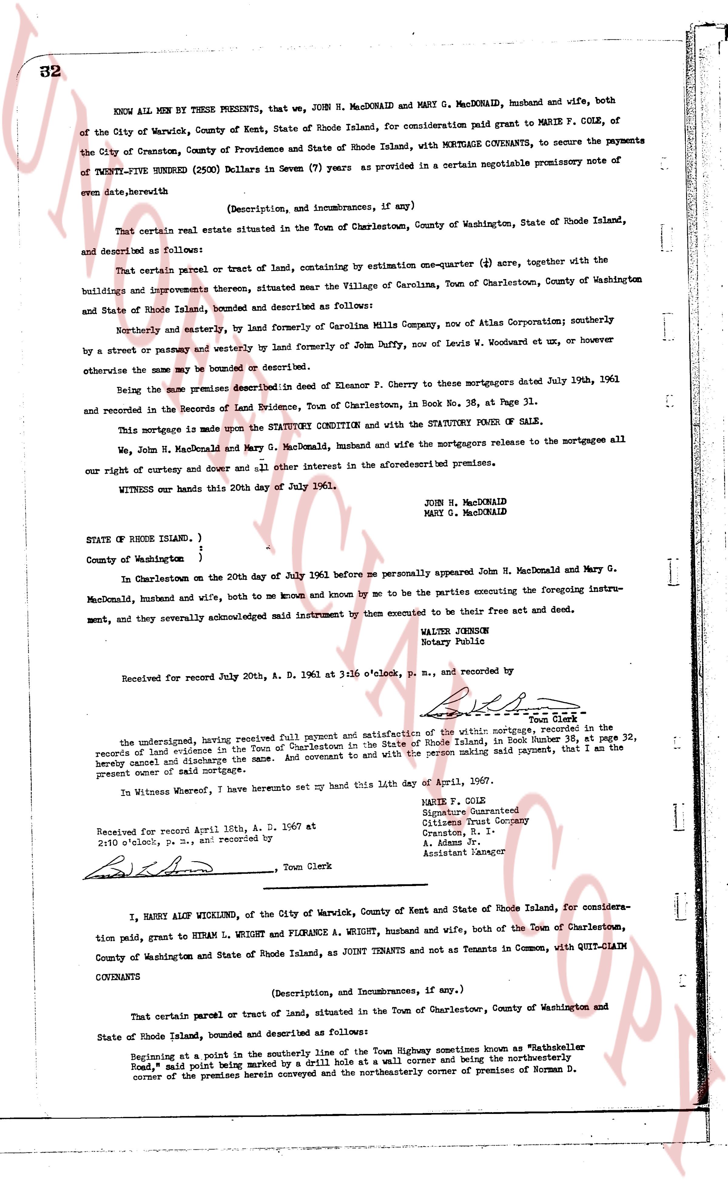
KNOW ALL MEN BY THESE PRESENTS, that we, JOHN H. MacDONALD and MARY G. MacDONALD, husband and wife, both of the City of Warwick, County of Kent and State of Rhode Island, for consideration paid grant to MARIE F. COLE, of the City of Cranston, County of Providence and State of Rhode Island, with MORTGAGE COVENANTS, to secure the payments of TWENTY-FIVE HUNDRED (2500) Dollars in Seven (7) years as provided in a certain negotiable promissory note of even date, herewith
(Description, and incumbrances, if any)
That certain real estate situated in the Town of Charlestown, County of Washington, State of Rhode Island, and described as follows:
That certain parcel or tract of land, containing by estimation one-quarter (1/4) acre, together with the buildings and improvements thereon, situated near the Village of Carolina, Town of Charlestown, County of Washington and State of Rhode Island, bounded and described as follows:
Northerly and easterly, by land formerly of Carolina Mills Company, now of Atlas Corporation; southerly by a street or passageway and westerly by land formerly of John Duffy, now of Lewis W. Woodcut et ux, or however otherwise the same may be bounded or described.
Being the same premises described in Deed of Eleanor F. Cherry to these mortgagors dated July 19th, 1961 and recorded in the Records of Land Evidence, Town of Charlestown, in Book No. 36, at Page 31.
This mortgage is made upon the STATUTORY CONDITION and with the STATUTORY POWER OF SALE.
We, John H. MacDonald and Mary G. MacDonald, husband and wife the mortgagors release to the mortgagee all our right of curtesy and dower and all other interest in the aforementioned premises.
WITNESS our hands this 20th day of July 1961.
JOHN H. MacDONALD
MARY G. MacDONALD
STATE OF RHODE ISLAND, )
County of Washington )
In Charlestown on the 20th day of July 1961 before me personally appeared John H. MacDonald and Mary G. MacDonald, husband and wife, both to me known and by me to be the parties executing the foregoing instrument, and they severally acknowledged said instrument by them executed to be their free act and deed.
WALTER JOHNSON
Notary Public
Received for record July 20th, A. D. 1961 at 3:16 o'clock, p. m., and recorded by [signature] Town Clerk
The undersigned, having received full payment and satisfaction of the mortgage of this writing, recorded in the records of land evidence in the Town of Charlestown in the State of Rhode Island, Book Number 38, at page 32, hereby cancel and discharge the same. And covenant and with the person making said payment, that I am the present owner and grant of said mortgage.
In Witness whereof, I have hereunto set my hand this 14th day of April, 1967.
MARIE F. COLE
Signature Guaranteed
Citizens Trust Company
Cranston, R. I.
A. Adams Pr.
Assistant Manager
Received for record April 16th, A. D. 1967 at 2:10 o'clock, p. m., and recorded by [signature] Town Clerk
----
I, HARRY ALOF WICKLUND, of the City of Warwick, County of Kent and State of Rhode Island, for consideration paid, grant to HIRAM L. WRIGHT and FLORANCE A. WRIGHT, husband and wife, both of the Town of Charlestown, County of Washington and State of Rhode Island, as JOINT TENANTS and not as Tenants in Common, with QUIT-CLAIM COVENANTS
(Description, and incumbrances, if any)
That certain parcel or tract of land, situated in the Town of Charlestown, County of Washington and State of Rhode Island, bounded and described as follows:
Beginning at a point in the southerly line of the Town Highway sometimes known as "Wathskeller Road," and said point being marked by a Drill hole at a wall corner and being the northwesterly corner of the premises herein conveyed and the northeasterly corner of premises of Norman D.
page 2 · read by Gemma vision
33
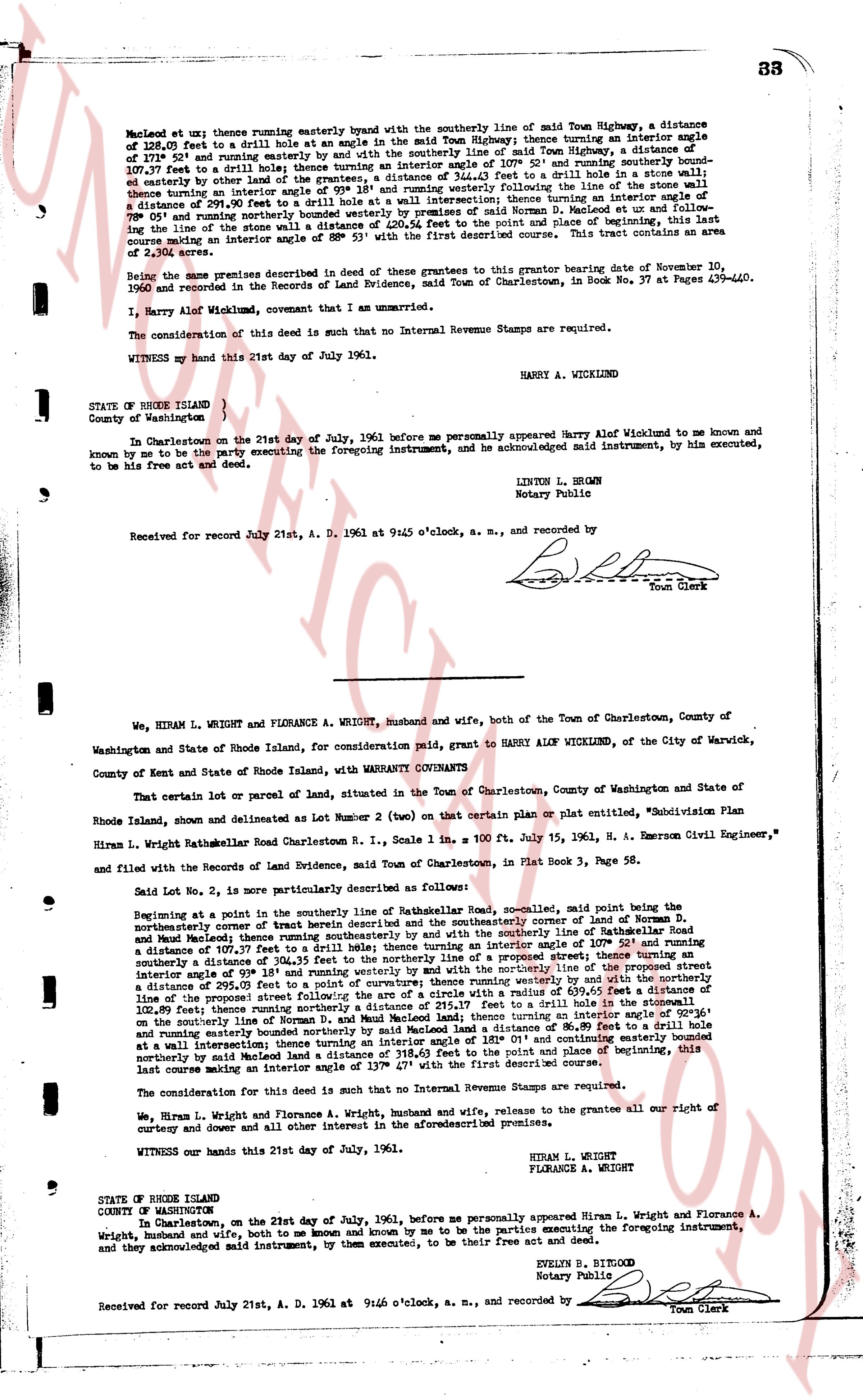
Meadow lot uz east; then running easterly enter by angle with the southerly line of said Town Highway, a distance of 128.07 feet to a drill hole set in the edge of the said Town Highway; thence turning an interior angle of 107° 21' and running courselly an easterly by and with the southerly line of said Town Highway, a distance of 107.37 feet to a drill hole set in the edge; thence turning an interior angle of 107° 52' and running southerly bounden easterly by other land of the grantor to a drill hole set in the edge of a wall; thence turning an interior angle of 98° 18' and running westerly along the line of the stone wall to a distance of 294.99 feet, 290.90 feet to a drill hole set at a wall; thence turning an interior angle of 107° 21' and running northerly, bounded westerly by premises of named S. Norman D. Maples set out and follow ing the line of the stone s wall a distance of 230.54 feet to the point of beginning as first described. This tract contains an area consisting of an interior angle of 107° 21' and running northerly, described course. This tract contains an area of 2,304 acres.
Being the same parcel described in Deed of these grantees to the grantor bearing date of November 10, 1960 and recorded in the Records of Land Evidence, said Town of Charlestown, in Book No. 37 at Pages 439-440.
I, Harry Alof Wicklund, covenant that I am the owner.
The consideration of this deed is such that no Internal Revenue Stamps are required.
WITNESS my hand this 21st day of July 1961.
HARRY A. WICKLUND
STATE OF RHODE ISLAND )
County of Washington )
In Charlestown on the 21st day of July, 1961 before me personally appeared Harry Alof Wicklund to me known and known by me to be the party executing the foregoing instrument, and he acknowledged said instrument, by his executed, to be his free act and deed.
LINTON L. BROWN
Notary Public
Received for record July 21st, A. D. 1961 at 9:45 o'clock, a. m., and recorded by
[Signature]
Town Clerk
----
We, HIRAM L. WRIGHT and FLORANCE A. WRIGHT, husband and wife, both of the Town of Charlestown, County of Washington and State of Rhode Island, for consideration paid, grant to HARRY ALOF WICKLUND, of the City of Warwick, County of Kent and State of Rhode Island, with WARRANTY COVENANTS
That certain lot or parcel of land, situated in the Town of Charlestown, County of Washington and State of Rhode Island, shown and delineated as Lot Number 2 (two) on that certain plan or plat entitled, "Subdivision Plan Hiram L. Wright Rathsmeare Road Charlestown R. I., Scale 1 in 100 ft. July 15, 1961, H. A. Emerson Civil Engineer," and filed with the Records of the Land Evidence, said Town of Charlestown, in Plat Book 3, Page 58.
Said Lot No. 2, is more particularly described as follows:
Beginning at a point on the southerly line of the Rathsmeare Road, so called, named point being the northeasterly corner of that tract described and on the southerly line of Rathsmeare Road and said Maples; thence running easterly by and with the southerly line of Rathsmeare Road a distance of 107.37 feet to a drill hole set in the edge; thence turning an interior angle of 107° 52' and running southerly a distance of 304.35 feet to the southerly line of the proposed street thence turning an interior angle of 98° 18' and running westerly by and with the southerly line of the proposed street a distance of 295.99 feet to a point of curvature; thence running westerly along a curve with a radius of 439.95 feet a distance of 109.89 feet then running northerly a distance of 215.17 feet to a drill hole set in a wall; thence turning an interior angle of 107° 21' and running northerly, bounded westerly by premises of named S. Norman D. Maples and running easterly bounded northerly by said Maples land a distance of 98.89 feet to a drill hole set at a wall; thence turning an interior angle of 107° 21' and running easterly 107.37 feet and continuing east and southerly northerly by said Maples land a distance of 318.43 feet to the point and place of beginning, this last course making an interior angle of 107° 21' with the first described convergence.
The consideration for this deed is such that no Internal Revenue Stamps are required.
We, Hiram L. Wright and Florance A. Wright, husband and wife, release to the grantee all our right of curtesy and dower and all other interest in the above described premises.
WITNESS our hands this 21st day of July, 1961.
HIRAM L. WRIGHT
FLORANCE A. WRIGHT
STATE OF RHODE ISLAND
COUNTY OF WASHINGTON
In Charlestown, on the 21st day of July, 1961, before me personally appeared Hiram L. Wright and Florance A. Wright, husband and wife, both to me known and known by me to be the parties executing the foregoing instrument, and they acknowledged said instrument, by them executed, to be their free act and deed.
EVELYN B. RITEOUT
Notary Public
Received for record July 21st, A. D. 1961 at 9:46 o'clock, a. m., and recorded by
[Signature]
Town Clerk
The page as recorded