The instrument's own words
page 1 · read by Gemma vision
25
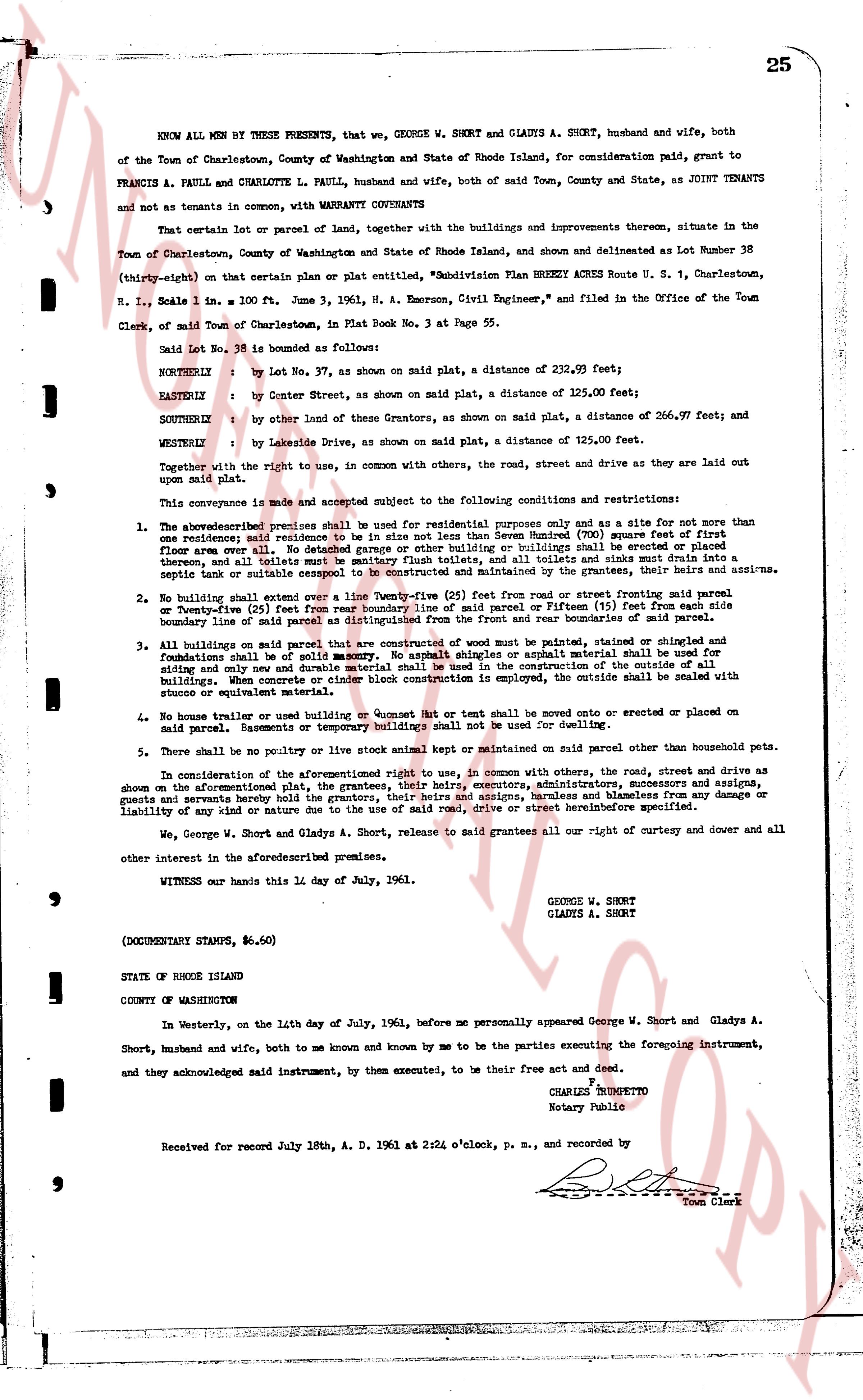
KNOW ALL MEN BY THESE PRESENTS, that we, GEORGE W. SHORT and GLADYS A. SHORT, husband and wife, both of the Town of Charlestown, County of Washington and State of Rhode Island, for consideration paid, grant to FRANCIS A. PAULL and CHARLOTTE L. PAULL, husband and wife, both of said Town, County and State, as JOINT TENANTS and not as tenants in common, with WARRANTY CONVEYANTS
That certain lot or parcel of land, together with the improvements thereon, situate in the Town of Charlestown, County of Washington and State of Rhode Island, shown and delineated as Lot Number 38 (thirty-eight) on that certain plat or plan entitled, "Subdivision Plan BRUNET ACRES Route U. S. 1, Charlestown, R. I., Scale 1 in. = 100 ft. June 3, 1961, A. N. Emerson, Civil Engineer", and filed in the Office of the Town Clerk, of said Town of Charlestown, in Plat Book No. 3 at Page 55.
Said Lot No. 38 is bounded as follows:
NORTHLY: by Lot No. 37, as shown on said plat, a distance of 232.99 feet;
EASTERLY: by Center Street, as shown on said plat, a distance of 125.00 feet;
SOUTHERLY: by other land of these Grantors, as shown on said plat, a distance of 266.97 feet; and
WESTERLY: by Lakeside Drive, as shown on said plat, a distance of 125.00 feet.
Together with the right to use, in common with others, the road, the street, road and drive as they are laid out upon said plat.
This conveyance is made and accepted subject to the following conditions and restrictions:
1. The above described premises shall be used for residential purposes only and as a site for not more than one residence; said residence to be situated not less than Seven Hundred (700) feet from first street corner all over. No garage, stable, barn, shed or other building or buildings shall be erected or placed thereon, and all toilets and sinks must be sanitary flush toilets, and all toilets and sinks must drain into a septic tank or suitable sewage disposal system, and no such tank or system shall be located closer than 100 feet to any stream.
2. No building shall extend over a line Twenty-five (25) feet from road or street front and no building shall extend over a line Twenty-five (25) feet from rear boundary line of said parcel or fifteen (15) feet from each side boundary line of said parcel and the building shall not extend over the rear boundaries of the lot.
3. All buildings on said parcel that are constructed of wood must be painted, stained or shingled and foundations shall be of solid masonry. No asphalt shingles or asphalt material shall be used for siding and any shed, basement or temporary buildings shall be constructed in the same manner as the residential buildings. When concrete or cinder block construction is employed, the outside shall be sealed with stucco or cement material.
4. No house trailer or used building or Boat Net or boat shall be moved onto or erected or placed on said parcel. Garages, basements or temporary buildings shall not be used for dwelling.
5. There shall be no poultry or live stock animal kept or maintained on said parcel other than household pets.
In consideration of the aforementioned right to use, in common with others, the road, street and drive as shown on the aforementioned plat, the grantees, their heirs, executors, administrators, successors and assigns, covenant to keep said roads in good repair and to maintain the same, and agree to indemnify the grantors, guests or tenants hereby conveyed for any damage or liability of any kind or nature due to the use of said road, drive or street hereinbefore specified.
We, George W. Short and Gladys A. Short, release to said grantees all our right of curtesy and dower and all other interest in the Aforedescribed premises.
WITNESS our hands this 11 day of July, 1961.
GEORGE W. SHORT
GLADYS A. SHORT
(DOCUMENTARY STAMPS, $6.60)
STATE OF RHODE ISLAND
COUNTY OF WASHINGTON
In Westerly, on the 14th day of July, 1961, before me personally appeared George W. Short and Gladys A. Short, husband and wife, both to me known and by me known to be the parties executing the foregoing instrument, and they acknowledged said instrument, by them executed, to be their free act and deed.
CHARLES COMPETTO
Notary Public
Received for record July 18th, A. D. 1961 at 2:24 o'clock, p. m., and recorded by
[Signature]
Town Clerk
The page as recorded