The instrument's own words
page 1 · read by Gemma vision
20
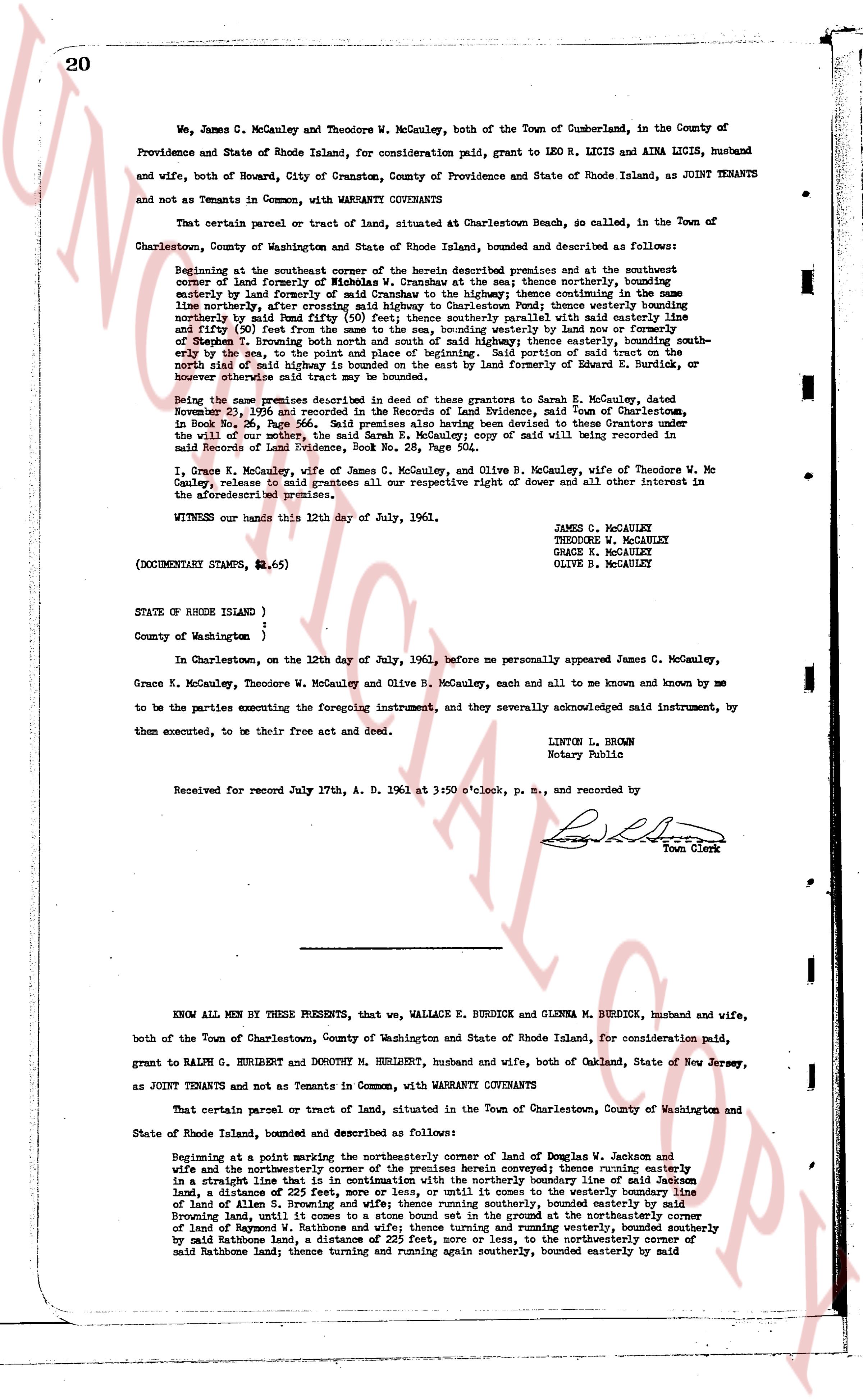
We, James C. McCauley and Theodore W. McCauley, both of the Town of Cumberland, in the County of Providence and State of Rhode Island, for consideration paid, grant to LEO R. LICIS and AINA LICIS, husband and wife, both of Howard, City of Cranston, County of Providence and State of Rhode Island, as JOINT TENANTS and not as Tenants in Common, with WARRANTY COVENANTS
That certain parcel or tract of land, situated at Charlestown Beach, so called, in the Town of Charlestown, County of Washington and State of Rhode Island, bounded and described as follows:
Beginning at the southeast corner of the above described premises and at the southeast corner of land formerly of Nicholas W. Cramshaw; thence easterly, thence northerly, bounding easterly by land formerly of Sarah Dumont Cramshaw to the highway thence continuing the same line northerly (after a curve of 100 feet to the right) westerly bounding easterly by land formerly of Sarah Dumont Cramshaw (after a curve of 100 feet to the right) thence westerly bounding easterly by land formerly of Sarah Dumont Cramshaw (50 feet) thence southerly parallel with said easterly line and fifty (50) feet therefrom to the highway thence easterly by said line or fence of former owner of Section 7, bounding north and south of said highway, thence easterly, bounding south easterly by said highway, to the intersection of said highway and the partition of said tract of land, the north side of said highway is bounded on the east by land formerly of Edward E. Burdick, or whoever shall now be the owner thereof.
Being the same premises described in deed of their grantors to Sarah E. McCauley, dated November 23, 1936 and recorded in the Records of Land Evidence, town of Charlestown, in Book No. 28, Page 504. The said Sarah E. McCauley conveyed to them Grantors by deed executed the will of the owner, the said Sarah E. McCauley; copy of said will being recorded in Records of Land Evidence, Book No. 28, Page 504.
I, Grace K. McCauley, wife of James C. McCauley, and Olive B. McCauley, wife of Theodore W. McCauley, release to said grantees all our respective right not devise of dower and other all interest in the aforementioned premises.
WITNESS our hands this 12th day of July, 1961.
JAMES C. MCCAULEY
THEODORE W. MCCAULEY
GRACE K. MCCAULEY
OLIVE B. MCCAULEY
(DOCUMENTARY STAMPS, $4.65)
STATE OF RHODE ISLAND )
County of Washington )
In Charlestown, on the 12th day of July, 1961, before me personally appeared James C. McCauley, Grace K. McCauley, Theodore W. McCauley and Olive B. McCauley, each and all to me known and known by me to be the parties executing the foregoing instrument, and they severally acknowledged said instrument, by them executed, to be their free act and deed.
LINTON L. BROWN
Notary Public
Received for record July 17th A. D. 1961 at 3:50 o'clock, p. m., and recorded by
[Signature]
Town Clerk
----
KNOW ALL MEN BY THESE PRESENTS, that we, WALLACE E. BURDICK and GLENNA M. BURDICK, husband and wife, both of the Town of Charlestown, County of Washington and State of Rhode Island, for consideration paid, grant to RALPH G. HERLIBERT and DOROTHY M. HERLIBERT, husband and wife, both of Oakland, State of New Jersey, as JOINT TENANTS and not as Tenants in Common, with WARRANTY COVENANTS
That certain parcel or tract of land, situated in the Town of Charlestown, County of Washington and State of Rhode Island, bounded and described as follows:
Beginning at a point marking the northeasterly corner of land of Douglas W. Jackson and wife and the northeasterly corner of the premises herein conveyed; thence running easterly in a straight line 115 feet to the northeasterly corner of land of Sarah Dumont Cramshaw, bounding easterly on land, a distance of 225 feet, more or less, or until it comes to the westerly boundary line of land of Allen S. Browning and wife; thence running southerly, bounded easterly by said Browning land, until it comes to the intersection of the boundary of the northeasterly corner of land of Raymond W. Rathnone and wife; thence turning and running westerly, bounded southerly by said Rathnone land, a distance of 150 feet, more or less, to the northeasterly corner of said Rathnone land; thence turning and running again southerly, bounded easterly by said
The page as recorded