The instrument's own words
page 1 · read by Gemma vision
629
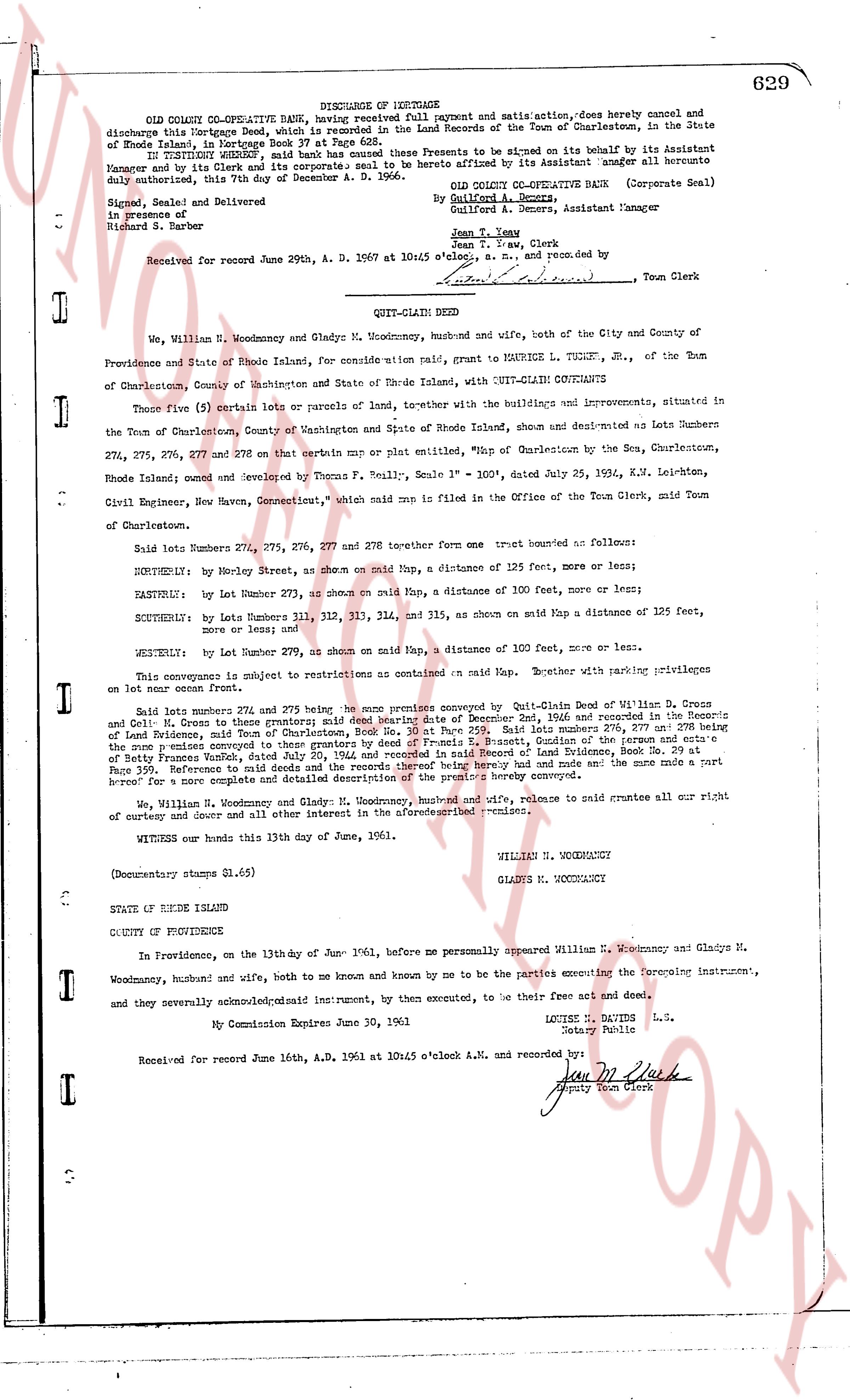
DISCHARGE OF MORTGAGE
OLD COLONY CO-OPERATIVE BANK, hereby declaring full payment and satis action, does hereby cancel and discharge this Mortgage Deed, which is recorded in the Land Records of the Town of Charlestown, in the State of Rhode Island, in land-evidence Book 37 at Page 629.
WITNESS our hand and corporate seal to these Presents to be signed on its behalf by its Assistant Manager and by its Clerk and its corporate seal to be hereto affixed by its Assistant manager all hereto duly authorized, this 7th day of September A. D. 1956.
OLD COLONY CO-OPERATIVE BANK
(Corporate Seal)
By Guilford A. D. Ames,
Guilford A. D. Ames, Assistant Manager
Jean T. Law
Jean T. Law, Clerk
Signed, Sealed and Delivered
in presence of
Richard S. Barber
Received for record June 29th, A. D. 1957 at 10:45 o'clock A. M. and recorded by:
[Signature] Town Clerk
----
QUIT-CLAIM DEED
We, William N. Woodmancy and Gladys M. Woodmancy, husband and wife, both of the City and County of Providence and State of Rhode Island, for consideration paid, GRANT to MAURICE L. TUCKER, Jr., of the Town of Charlestown, County of Washington and State of Rhode Island, with QUIT-CLAIM COVENANTS
Those five (5) certain lots or parcels of land, together with the buildings and improvements situated therein, in the Town of Charlestown, County of Washington and State of Rhode Island, shown and designated as Lots numbers 274, 275, 276, 277 and 278 on that certain map or plat entitled "Map of Charlestown by the S.C.A. Charlestown, Rhode Island owned and surveyed by Thomas F. Scully, Scale 1" = 100", dated July 25, 1934, K.M. Leighton, Civil Engineer, New Haven, Connecticut," which said map is filed in the Office of the Town Clerk, mid Town of Charlestown.
Said lots numbers 274, 275, 276, 277 and 278 together form one tract bounded as follows:
NORTHERLY: by lot number 273, as shown on said map, a distance of 125 feet, more or less;
EASTERLY: by lot number 273, as shown on said map, a distance of 100 feet, more or less;
SOUTHERLY: by lots numbers 311, 312, 313, 314, and 315, as shown on said map a distance of 125 feet, more or less; and
WESTERLY: by lot number 279, as shown on said map, a distance of 100 feet, more or less.
This conveyance is subject to restrictions as contained on said map, together with parking privileges on lot number 273 front.
Said lots numbers 274, 275 and 276 being more precisely conveyed by Quit-Claim Deed of William D. Cress and Coll. M. Cress to these grantors; said deed bearing date of December 2nd, 1946 and recorded in the Providence County land-evidence Book 1143 at Page 114, and said lots numbers 277 and 278 being the same premises conveyed to these grantors by deed of Francis B. Bassett, Guardian of the person and estate of Mary Bassett, dated July 2nd, 1948 and recorded in the Providence County land-evidence Book 1242 Page 199. Reference to said deeds and the records thereof being hereby had and made and the same made a part hereof for a more complete and detailed description of the premises hereby conveyed.
We, William N. Woodmancy and Gladys M. Woodmancy, husband and wife, do hereby remise release and forever renounce to said grantee all our right of entry and claim and all other interest in the aforementioned premises.
WITNESS our hands this 13th day of June, 1961.
WILLIAM N. WOODMANCY
GLADYS M. WOODMANCY
(Documentary stamps $1.65)
STATE OF RHODE ISLAND
COUNTY OF PROVIDENCE
In Providence, on the 13th day of June 1961, before me personally appeared William N. Woodmancy and Gladys M. Woodmancy, husband and wife, both to me known and known by me to be the parties executing the foregoing instrument, and they severally acknowledged said instrument, for their execution, to be their free act and deed.
LOUISE M. DAVIS L.S.
Notary Public
My Commission Expires June 30, 1962
Received for record June 16th, A.D. 1961 at 10:45 o'clock A.M. and recorded by:
[Signature] Deputy Town Clerk
The page as recorded