The instrument's own words
page 1 · read by Gemma vision
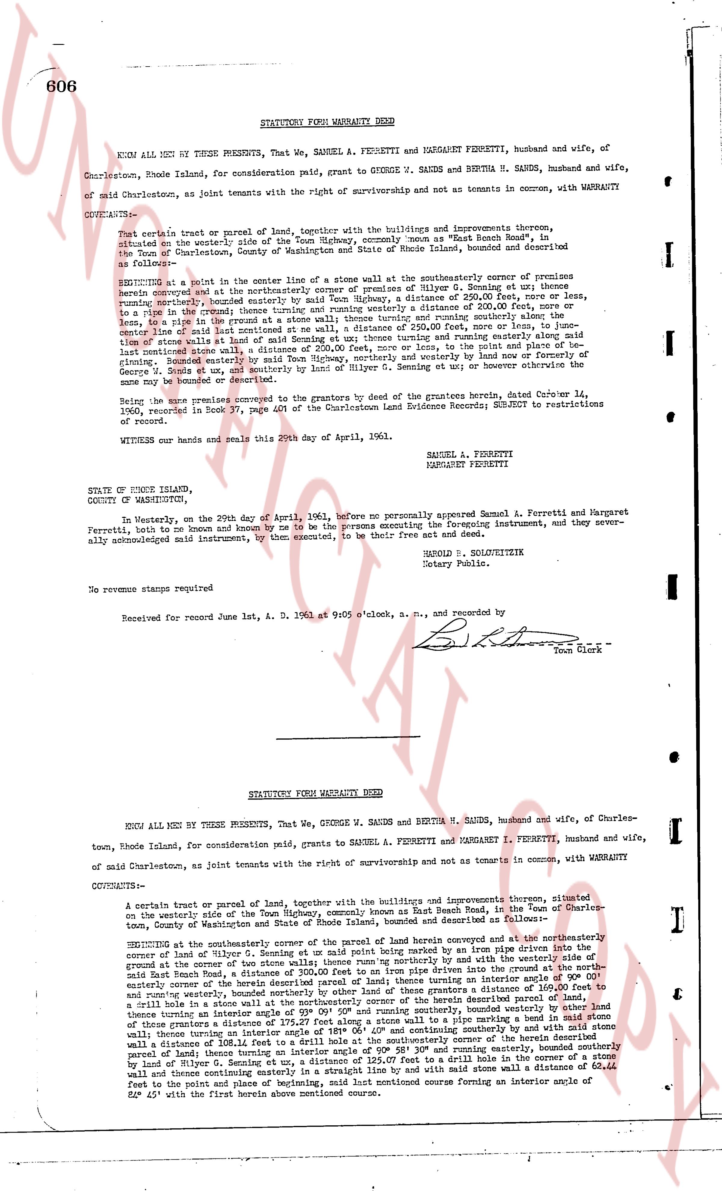
606 STATUTORY FORM WARRANTY DEED
KNOW ALL MEN BY THESE PRESENTS, That We, SAMUEL A. FERRETTI and MARGARET FERRETTI, husband and wife, of Charlestown, Rhode Island, for consideration paid, grant to GEORGE W. SANDS and BERTHA H. SANDS, husband and wife, of said Charlestown, as joint tenants with the right of survivorship and not as tenants in common, with WARRANTY COVENANTS:
That certain tract or parcel of land, together with the buildings and improvements thereon, situated on the westerly side of the Town Highway, commonly known as "East Beach Road", in the Town of Charlestown, County of Washington and State of Rhode Island, bounded and described as follows:-
BEGINNING at a point in the center line of a stone wall at the southeasterly corner of premises of Hylton G. Seming ex w[?] [?] [?] [?] running westerly, bounded northerly by the premises of Hylton G. Seming a distance of 250.00 feet, more or less, to a stone [?] at the corner, thence turning an interior angle of 90° 00' and running southerly a distance of 200.00 feet, more or less, to the center line of said last mentioned stone wall, a distance of 250.00 feet, more or less, to fence, or fence line, thence turning an interior angle of 90° 00' and running easterly a distance of 200.00 feet, more or less, to said last mentioned stone wall, a distance of 250.00 feet, more or less, to the point of place and beginning of said tract, the whole of said tract being bounded on the north and easterly by land of or conveyed to George W. Sands et ux, and southerly by land of Hylton G. Seming et ux, or however otherwise the same may be bounded or described.
Being the same premises conveyed to the grantors by the deed of the grantors herein recite, dated October 14, 1960, and recorded in Book 37, page 401 of the Charlestown Land Evidence Records; SUBJECT to restrictions of record.
WITNESS our hands and seals this 20th day of April, 1961.
SAMUEL A. FERRETTI
MARGARET FERRETTI
STATE OF RHODE ISLAND,
COUNTY OF WASHINGTON,
In Westerly, on the 20th day of April, 1961, before me personally appeared Samuel A. Ferretti and Margaret Ferretti, both of me known and known by me to be the persons executing the foregoing instrument, and they severally acknowledged said instrument, by them executed, to be their free act and deed.
HAROLD R. SOLOWITZKE
Notary Public.
No revenue stamps required
Received for record June 1st, A. D. 1961 at 9:05 o'clock, a. m., and recorded by
[Signature]
Town Clerk
----
STATUTORY FORM WARRANTY DEED
KNOW ALL MEN BY THESE PRESENTS, That We, GEORGE W. SANDS and BERTHA H. SANDS, husband and wife, of Charlestown, Rhode Island, for consideration paid, grant to SAMUEL A. FERRETTI and MARGARET I. FERRETTI, husband and wife, of said Charlestown, as joint tenants with the right of survivorship and not as tenants in common, with WARRANTY COVENANTS:
A certain tract or parcel of land together with the buildings and improvements thereon, situated on the westerly side of the Town Highway, commonly known as East Beach Road, in the Town of Charlestown, County of Washington and State of Rhode Island, bounded and described as follows:-
BEGINNING at the southeasterly corner of the parcel of land herein conveyed and at the northeasterly corner of land of Hylton G. Seming et ux said point being marked by an iron pipe driven into the ground at the corner of fence or fence line running northerly by said fence or fence line and with the westerly side of said East Beach Road, a distance of 300.00 feet to an iron pipe driven into the ground at the northeasterly corner of the tract of land herein conveyed, thence turning an interior angle of 90° 00' and running southerly, bounded northerly by other lands of these grantors a distance of 169.00 feet to a stone wall, thence turning an interior angle of 90° 00' and running easterly along said stone wall a distance of 250.00 feet, thence turning an interior angle of 90° 00' and running southerly, bounded easterly by other lands of these grantors a distance of 108.12 feet to a stone wall, thence turning an interior angle of 90° 00' and continuing southerly by and with said stone wall a distance of 108.12 feet to a drill hole in a stone, thence turning an interior angle of 90° 28' 30" and running easterly, bounded southerly by land of Hylton G. Seming et ux, a distance of 125.00 feet, and thence turning an interior angle of 90° 00' and running northerly by and with stone wall a distance of 62.44 feet to the point and place of beginning, said last mentioned course forming an interior angle of 90° 00' [?] feet to the point and place of beginning, said last mentioned course forming an interior angle of 52° 45' to the point and first herein above mentioned course.
The page as recorded