The instrument's own words
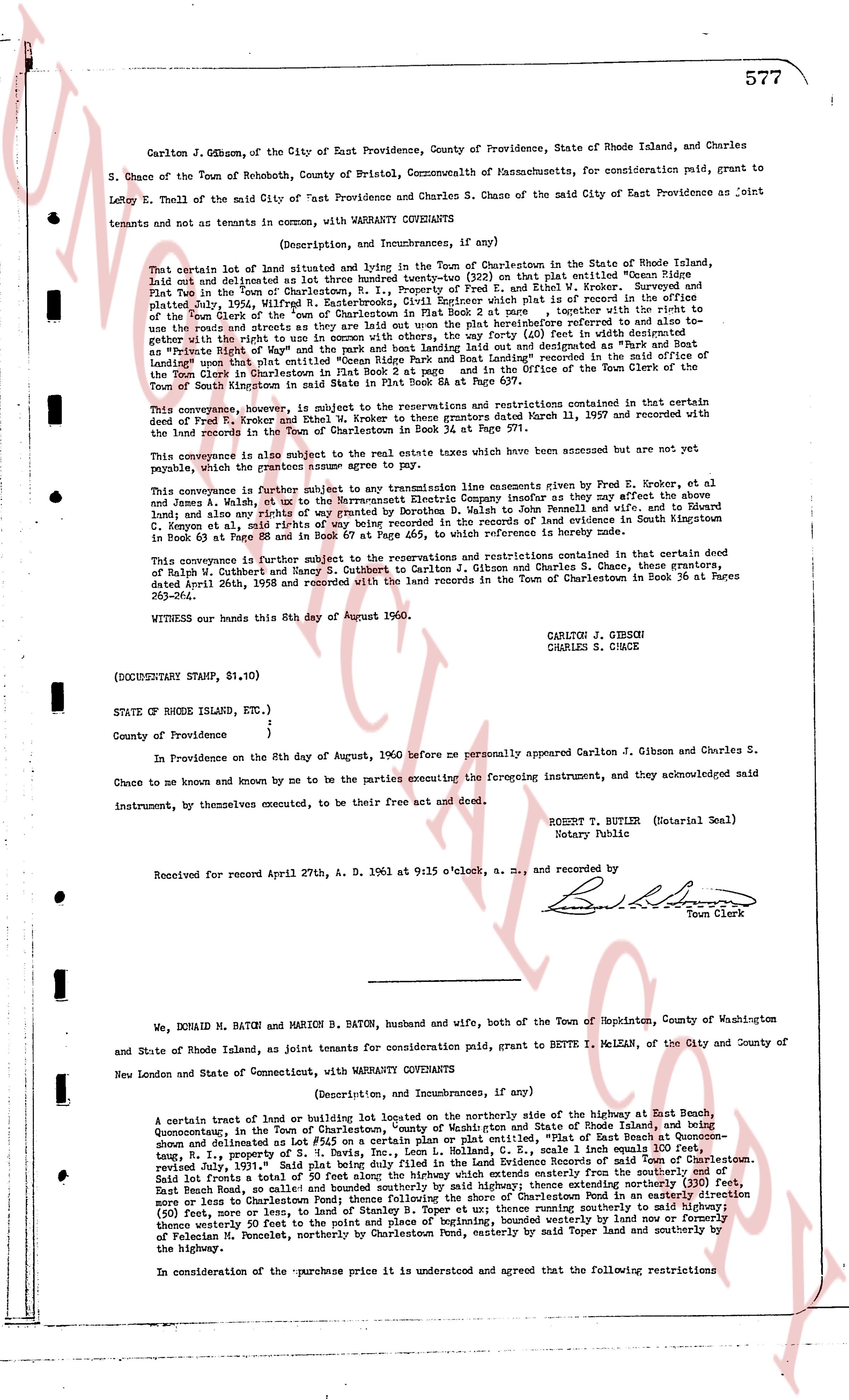
page 1 · read by Gemma vision
577
Carlton J. Gibson, of the City of East Providence, County of Providence, State of Rhode Island, and Charles
S. Chase of the Town of Rehoboth, County of Bristol, Commonwealth of Massachusetts, for consideration paid, grant to
Lloyd E. Thell of the said City of East Providence and Charles S. Chase of the said City of East Providence as joint
tenants and not as tenants in common, with WARRANTY COVENANTS
(Description, and Incumbrances, if any)
That certain lot of land situated and lying in the Town of Charlestown in the State of Rhode Island,
laid out and delineated as lot three hundred twenty-three (323) on that plat entitled "Ocean View
Plat" in the Town of Charlestown, County of Kent, State of Rhode Island, and as shown and approved
and plated July, 1954, W.R. Easterbrooks, Civil Engineer, which plat is on record in the office of
the Town Clerk of the "town" of Charlestown, Rhode Island, together with the right, power and
privilege to use the roads and streets whereon the said lot are upon the plat heretofore referred to and also to
gether with the right to use in common with others the right of way (60 feet in width) laid out and designated as "Park and Boat
Landing" upon that plat entitled "Ocean Ridge Park and Boat Landing" recorded in the Office of the Town Clerk of the
City of East Providence, Rhode Island, and also recorded in the Office of the Town Clerk of the
Town of South Kingstown in said State in Book 21 Page 84 et seq.
This conveyance, however, is subject to the reservations and restrictions contained in that certain deed
of Todd R. Moore and others to Robert Moore et al, dated and recorded March 11, 1957 and recorded with
the land records in the Town of Charlestown in Book 34 at Page 571.
This conveyance is also subject to the real estate taxes which have been accrued but are not yet payable,
which the grantor guarantees to pay.
This conveyance is further subject to any transmission line easements given by Fred E. Krokry, et al
and James A. Walsh, et al to the Narragansett Electric Company insofar as they affect the above
land and also any right of way for the use of the public given by Donald M. Baton and wife and Robert
G. Simpson et al in deed with right of way being recorded in the land records of evidence in South Kingstown
in Book 63 at Page 83 and in Book 67 at Page 465, to which reference is hereby made.
This conveyance is further subject to the reservations and restrictions contained in that certain deed
of Ralph W. Cuthbert and Robert G. Simpson et al to Carlton J. Gibson and Charles S. Chase, these grantors,
dated April 26th, 1958 and recorded with the land records in the Town of Charlestown in Book 36 at Pages
383-384.
WITNESS our hands this 8th day of August 1960.
CARLTON J. GIBSON
CHARLES S. CHASE
(DOCUMENTARY STAMP, $1.10)
STATE OF RHODE ISLAND, }
}
County of Providence }
In Providence on the 8th day of August, 1960 before me personally appeared Carlton J. Gibson and Charles S.
Chase to me known and known by me to be the parties executing the foregoing instrument, and they acknowledged said
instrument, by themselves executed, to be their free act and deed.
ROBERT T. BUTLER (Notarial Seal)
Notary Public
Received for record April 27th, A. D. 1961 at 9:15 o'clock, a. m., and recorded by
[Signature]
Town Clerk
----
We, DONALD M. BATON, and MARION B. BATON, husband and wife, both of the Town of Hopkinton, County of Washington
and State of Rhode Island, as Joint tenants, for consideration paid, grant to BETTE I. MCLEAN, of the City and County of
New London and State of Connecticut, with WARRANTY COVENANTS
(Description, and Incumbrances, if any)
A certain tract of land or undeveloped lot located on the northerly side of the highway at East Beach,
Quonsetown, in the Town of Charlestown, County of Kent, State of Rhode Island, being a tract of land since
shown and delineated as Lot #54 on a certain plan or plat entitled, "East Beach, scale 1 inch equals 100 feet,
range 1, property of a certain partnership", dated and recorded May 11, 1953 and approved
Revised July, 1959," said plat being duly filed in the Land Evidence Records of said Town of Charlestown.
Said lot fronts West on Main Rd. of East Beach, and called bounded on the easterly from the highway and the
East Beach Road, and scale bounded on the southerly side by highway, thence extending northerly (330 feet)
more or less to the intersection of the highway and the line of a tract of land in Quonsetown in said Town of Charlestown
(50 feet), more or less, to the land of Stanley B. Toper et al; thence running southerly to said highway;
thence westerly 50 feet to the point of beginning and thence northerly by highway to land and property of
Fabian R. Poncellet, northerly by Charlestown Pond, easterly by said Toper land and southerly by
the highway.
In consideration of the purchase price it is understood and agreed that the following restrictions
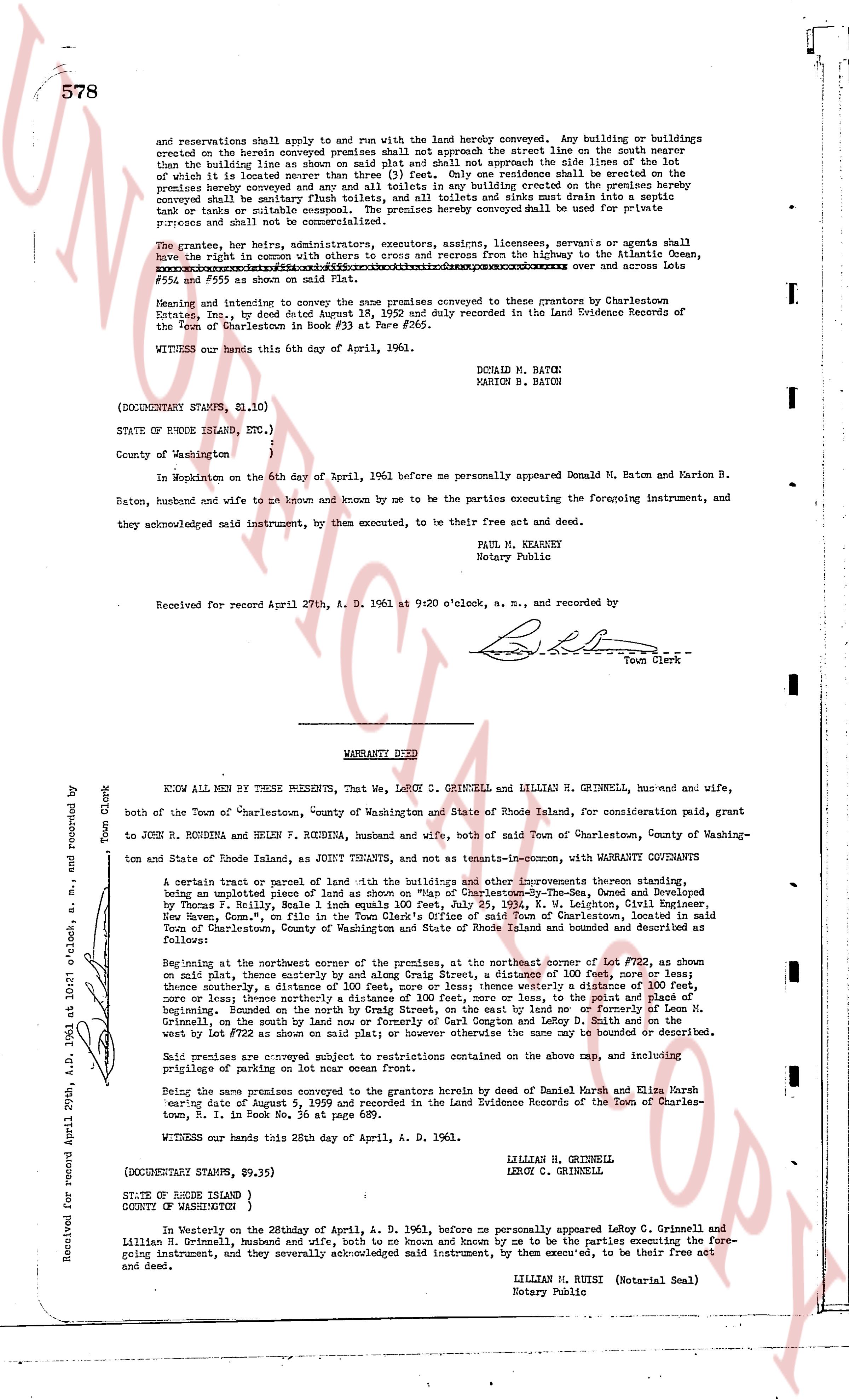
page 2 · read by Gemma vision
578
and reservations shall apply and run with the land hereby conveyed. Any building or buildings
erected on the herein conveyed premises shall not approach the street line on the south nearer
than the building line as shown on said plat and shall not approach the side lines of the lot
of which the lot is included nearer than 10 feet. No more than two residences shall be erected on the
premises hereby conveyed and any and all toilets in any building erected on the premises hereby
conveyed shall be of the sanitary sewered type and no cess pools or sinks shall drain into any septic
tank or tanks or suitable cesspool. The premises hereby conveyed shall be used for private
purposes and shall not be used for business.
The grantees, their heirs, administrators, executors, assigns, licensees, servients or agents shall
have the right in common with others to egress and recess from the highway to the Atlantic Ocean,
[?][?][?][?][?][?][?][?][?][?][?][?][?][?][?][?][?][?][?][?][?][?][?][?][?][?][?][?][?][?][?][?][?][?][?][?][?][?][?][?][?][?][?][?][?][?][?][?][?][?][?][?][?][?][?][?][?][?][?][?][?][?][?][?][?][?][?][?][?][?][?][?][?][?][?][?][?][?][?][?][?][?][?][?][?][?][?][?][?][?][?][?][?][?][?][?][?][?][?][?][?][?][?][?][?][?][?][?][?][?][?][?][?][?][?][?][?][?][?][?][?][?][?][?][?][?][?][?][?][?][?][?][?][?][?][?][?][?][?][?][?][?][?][?][?][?][?][?][?][?][?][?][?][?][?][?][?][?][?][?][?][?][?][?][?][?][?][?][?][?][?][?][?][?][?][?][?][?][?][?][?][?][?][?][?][?][?][?][?][?][?][?][?][?][?][?][?][?][?][?][?][?][?][?][?][?][?][?][?][?][?][?][?][?][?][?][?][?][?][?][?][?][?][?][?][?][?][?][?][?][?][?][?][?][?][?][?][?][?][?][?][?][?][?][?][?][?][?][?][?][?][?][?][?][?][?][?][?][?][?][?][?][?][?][?][?][?][?][?][?][?][?][?][?][?][?][?][?][?][?][?][?][?][?][?][?][?][?][?][?][?][?][?][?][?][?][?][?][?][?][?][?][?][?][?][?][?][?][?][?][?][?][?][?][?][?][?][?][?][?][?][?][?][?][?][?][?][?][?][?][?][?][?][?][?][?][?][?][?][?][?][?][?][?][?][?][?][?][?][?][?][?][?][?][?][?][?][?][?][?][?][?][?][?][?][?][?][?][?][?][?][?][?][?][?][?][?][?][?][?][?][?][?][?][?][?][?][?][?][?][?][?][?][?][?][?][?][?][?][?][?][?][?][?][?][?][?][?][?][?][?][?][?][?][?][?][?][?][?][?][?][?][?][?][?][?][?][?][?][?][?][?][?][?][?][?][?][?][?][?][?][?][?][?][?][?][?][?][?][?][?][?][?][?][?][?][?][?][?][?][?][?][?][?][?][?][?][?][?][?][?][?][?][?][?][?][?][?][?][?][?][?][?][?][?][?][?][?][?][?][?][?][?][?][?][?][?][?][?][?][?][?][?][?][?][?][?][?][?][?][?][?][?][?][?][?][?][?][?][?][?][?][?][?][?][?][?][?][?][?][?][?][?][?][?][?][?][?][?][?][?][?][?][?][?][?][?][?][?][?][?][?][?][?][?][?][?][?][?][?][?][?][?][?][?][?][?][?][?][?][?][?][?][?][?][?][?][?][?][?][?][?][?][?][?][?][?][?][?][?][?][?][?][?][?][?][?][?][?][?][?][?][?][?][?][?][?][?][?][?][?][?][?][?][?][?][?][?][?][?][?][?][?][?][?][?][?][?][?][?][?][?][?][?][?][?][?][?][?][?][?][?][?][?][?][?][?][?][?][?][?][?][?][?][?][?][?][?][?][?][?][?][?][?][?][?][?][?][?][?][?][?][?][?][?][?][?][?][?][?][?][?][?][?][?][?][?][?][?][?][?][?][?][?][?][?][?][?][?][?][?][?][?][?][?][?][?][?][?][?][?][?][?][?][?][?][?][?][?][?][?][?][?][?][?][?][?][?][?][?][?][?][?][?][?][?][?][?][?][?][?][?][?][?][?][?][?][?][?][?][?][?][?][?][?][?][?][?][?][?][?][?][?][?][?][?][?][?][?][?][?][?][?][?][?][?][?][?][?][?][?][?][?][?][?][?][?][?][?][?][?][?][?][?][?][?][?][?][?][?][?][?][?][?][?][?][?][?][?][?][?][?][?][?][?][?][?][?][?][?][?][?][?][?][?][?][?][?][?][?][?][?][?][?][?][?][?][?][?][?][?][?][?][?][?][?][?][?][?][?][?][?][?][?][?][?][?][?][?][?][?][?][?][?][?][?][?][?][?][?][?][?][?][?][?][?][?][?][?][?][?][?][?][?][?][?][?][?][?][?][?][?][?][?][?][?][?][?][?][?][?][?][?][?][?][?][?][?][?][?][?][?][?][?][?][?][?][?][?][?][?][?][?][?][?][?][?][?][?][?][?][?][?][?][?][?][?][?][?][?][?][?][?][?][?][?][?][?][?][?][?][?][?][?][?][?][?][?][?][?][?][?][?][?][?][?][?][?][?][?][?][?][?][?][?][?][?][?][?][?][?][?][?][?][?][?][?][?][?][?][?][?][?][?][?][?][?][?][?][?][?][?][?][?][?][?][?][?][?][?][?][?][?][?][?][?][?][?][?][?][?][?][?][?][?][?][?][?][?][?][?][?][?][?][?][?][?][?][?][?][?][?][?][?][?][?][?][?][?][?][?][?][?][?][?][?][?][?][?][?][?][?][?][?][?][?][?][?][?][?][?][?][?][?][?][?][?][?][?][?][?][?][?][?][?][?][?][?][?][?][?][?][?][?][?][?][?][?][?][?][?][?][?][?][?][?][?][?][?][?][?][?][?][?][?][?][?][?][?][?][?][?][?][?][?][?][?][?][?][?][?][?][?][?][?][?][?][?][?][?][?][?][?][?][?][?][?][?][?][?][?][?][?][?][?][?][?][?][?][?][?][?][?][?][?][?][?][?][?][?][?][?][?][?][?][?][?][?][?][?][?][?][?][?][?][?][?][?][?][?][?][?][?][?][?][?][?][?][?][?][?][?][?][?][?][?][?][?][?][?][?][?][?][?][?][?][?][?][?][?][?][?][?][?][?][?][?][?][?][?][?][?][?][?][?][?][?][?][?][?][?][?][?][?][?][?][?][?][?][?][?][?][?][?][?][?][?][?][?][?][?][?][?][?][?][?][?][?][?][?][?][?][?][?][?][?][?][?][?][?][?][?][?][?][?][?][?][?][?][?][?][?][?][?][?][?][?][?][?][?][?][?][?][?][?][?][?][?][?][?][?][?][?][?][?][?][?][?][?][?][?][?][?][?][?][?][?][?][?][?][?][?][?][?][?][?][?][?][?][?][?][?][?][?][?][?][?][?][?][?][?][?][?][?][?][?][?][?][?][?][?][?][?][?][?][?][?][?][?][?][?][?][?][?][?][?][?][?][?][?][?][?][?][?][?][?][?][?][?][?][?][?][?][?][?][?][?][?][?][?][?][?][?][?
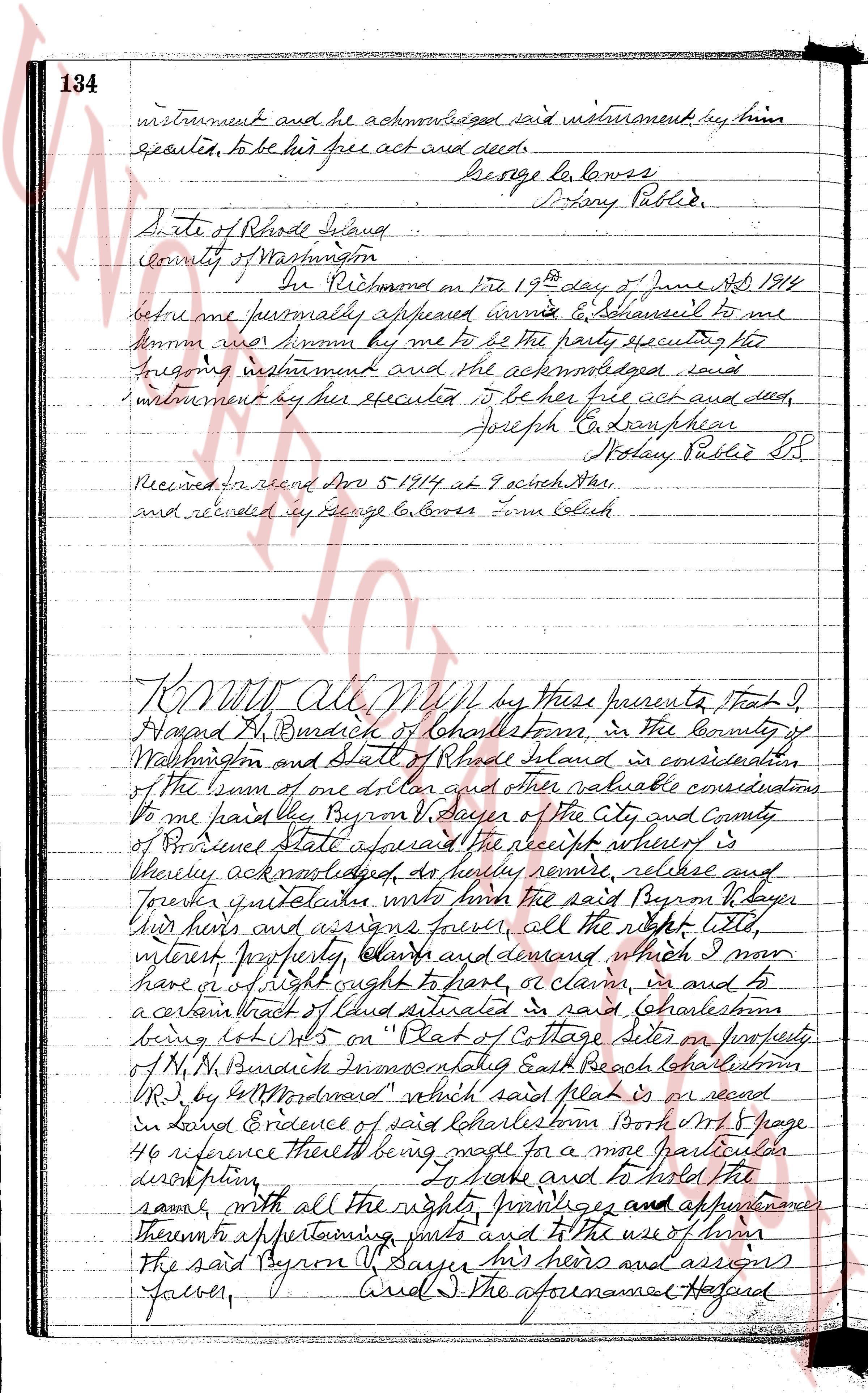
The page as recorded