The instrument's own words
page 1 · read by Gemma vision
570
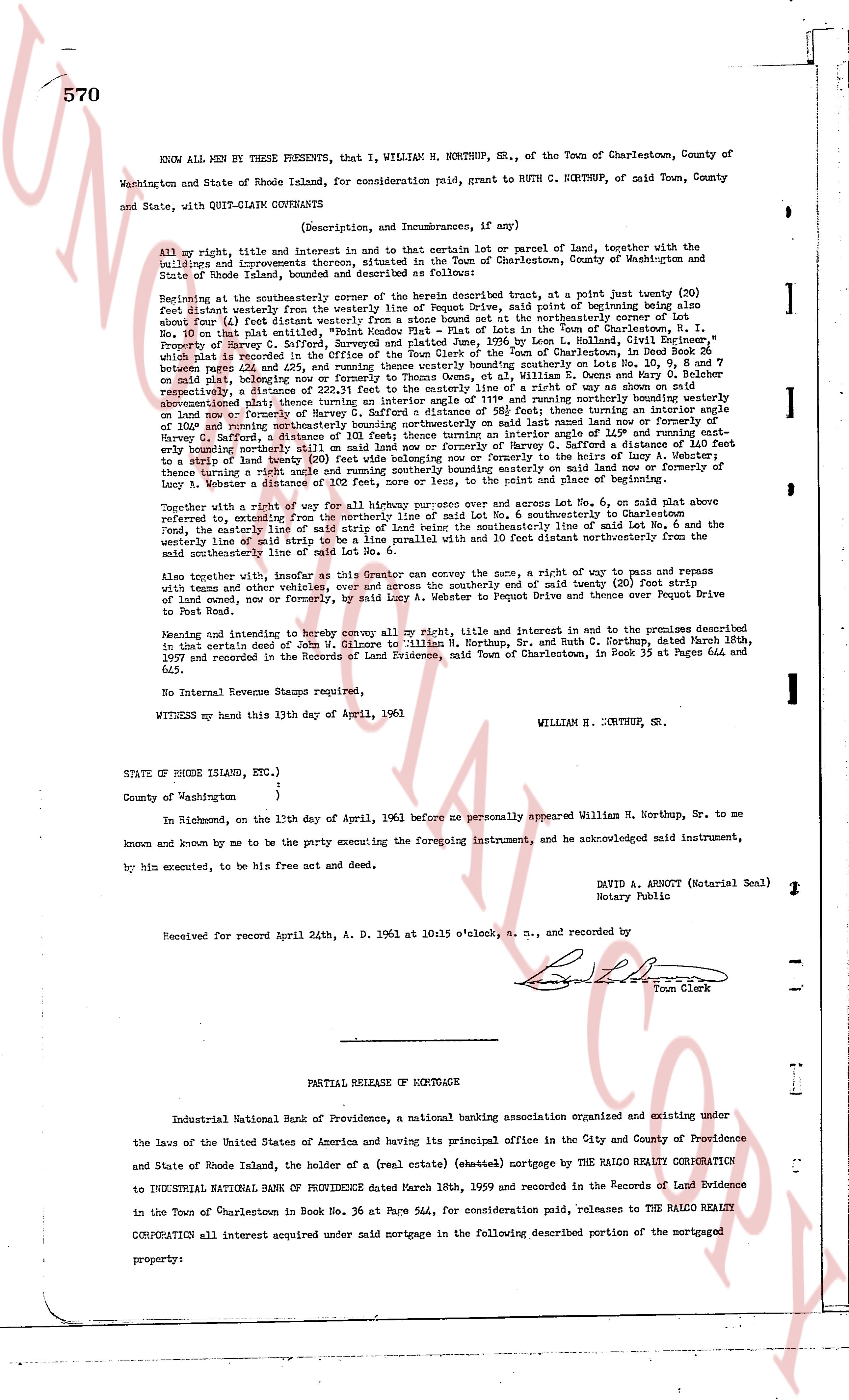
KNOW ALL MEN BY THESE PRESENTS, THAT I, WILLIAM H. NORTHUP, Sr., of the Town of Charlestown, County of Washington and State of Rhode Island, for consideration paid, grant to RUTH C. NORTHUP, of said Town, County and State, with QUIT-CLAIM COVENANTS
(Description, and Incumbrances, if any)
All my right, title and interest in and to that certain lot or parcel of land, together with the buildings and improvements thereon, situated in the Town of Charlestown, County of Washington and State of Rhode Island, bounded and described as follows:
Beginning at the southeasterly corner of the herein described tract, at a point joint twenty (20) feet distant westerly from the northwesterly corner of Lot No. 6, said point being at the same bearing about four (4) feet distant westerly from a stone bound not at the northwesterly corner of Lot No. 6 nor on that plat showing Lot No. 6 and other lots in the Town of Charlestown, I. P. Proverty of Harvey C. Sarford, surveyed and platted June, 1936 by Leon L. Collins, Civil Engineer, which is referred to in the deed to William H. Northup, Sr. and Ruth C. Northup, recorded in the book between pages 422 and 425, and running thence westerly bounding southerly on Lots No. 10, 9, 8 and 7 on said plat, whereas the distance from the northwesterly corner of Lot No. 6 to the northwesterly corner respectively, a distance of 232.11 feet to the easterly line of a way or show on said plat abovementioned, thence turning northerly a distance of 100.00 feet running easterly bounding northerly on Lot No. 100 or formerly of Harvey C. Sarford a distance of 58 feet 9 3/8 inches turning an angle of 149 1/2 degrees and running easterly a distance of 101 feet bounding northerly on said Lot No. 100 or formerly of Harvey C. Sarford a distance of 101 feet hence turning an angle of 101 1/2 degrees then running southerly bounding easterly on Lot No. 6, said Lot No. 6 being formerly of Harvey C. Sarford a distance of 101 feet 200 value bounding northerly to the line of Lucy A. Webster, thence turning a right angle and running southerly bounding westerly to the point and place of beginning.
Together with a right of way for all highway purposes over and across said Lot No. 6, on said plat above referred to, extending from the northerly line of said Lot No. 6, southeasterly to Charlestown Road, the easterly line of said right of way being a line parallel with the easterly line of said Lot No. 6 and the westerly line of said strip to be a line parallel with the same 10 feet distant northerly from the said easterly line, bounding line of said Lot No. 6.
Also together with, insofar as the Grantor can convey the same, a right of way to pass and repass with teams and other vehicles, over and across the southerly end of said twenty (20) foot strip of land mentioned above northerly, by said Lot No. 6, along a way known as Dupont Drive or formerly Dupont Drive to Port Road.
Meaning and intending to convey to the Grantee, all the right, title and interest in and to the premises described referred to, as that certain deed of William H. Gilmore to William H. Northup, Sr. and Ruth C. Northup, dated March 18th, 1957 and recorded in the Records of Land Evidence, said Town of Charlestown, in Book 35 at Pages 644 and 645.
No Internal Revenue Stamps required,
WITNESS my hand this 13th day of April, 1961
WILLIAM H. NORTHUP, Sr.
STATE OF RHODE ISLAND, ETC.)
)
County of Washington )
In Richmond, on the 13th day of April, 1961 before me personally appeared William H. Northup, Sr. to me known and known by me to be the party executing the foregoing instrument, and be acknowledged said instrument, by his own execution, to be his free act and deed.
DAVID A. ABBOTT (Notarial Seal)
Notary Public
Received for record April 24th, A. D. 1961 at 10:15 o'clock, a. m., and recorded by
[Signature]
Town Clerk
----
PARTIAL RELEASE OF MORTGAGE
Industrial National Bank of Providence, a national banking association organizing and existing under the laws of the United States of America and having its principal office in the City and County of Providence and State of Rhode Island, the holder of a (real estate) (chatte) mortgage by THE RALCO CORPORATION to INDUSTRIAL NATIONAL BANK OF PROVIDENCE dated March 18th, 1959 and recorded in the Records of Land Evidence in the Town of Charlestown in Book No. 36 at Page 544, for consideration paid, releases to THE RALCO CORPORATION all interest acquired under said mortgage in the following described portion of the mortgaged property:
The page as recorded