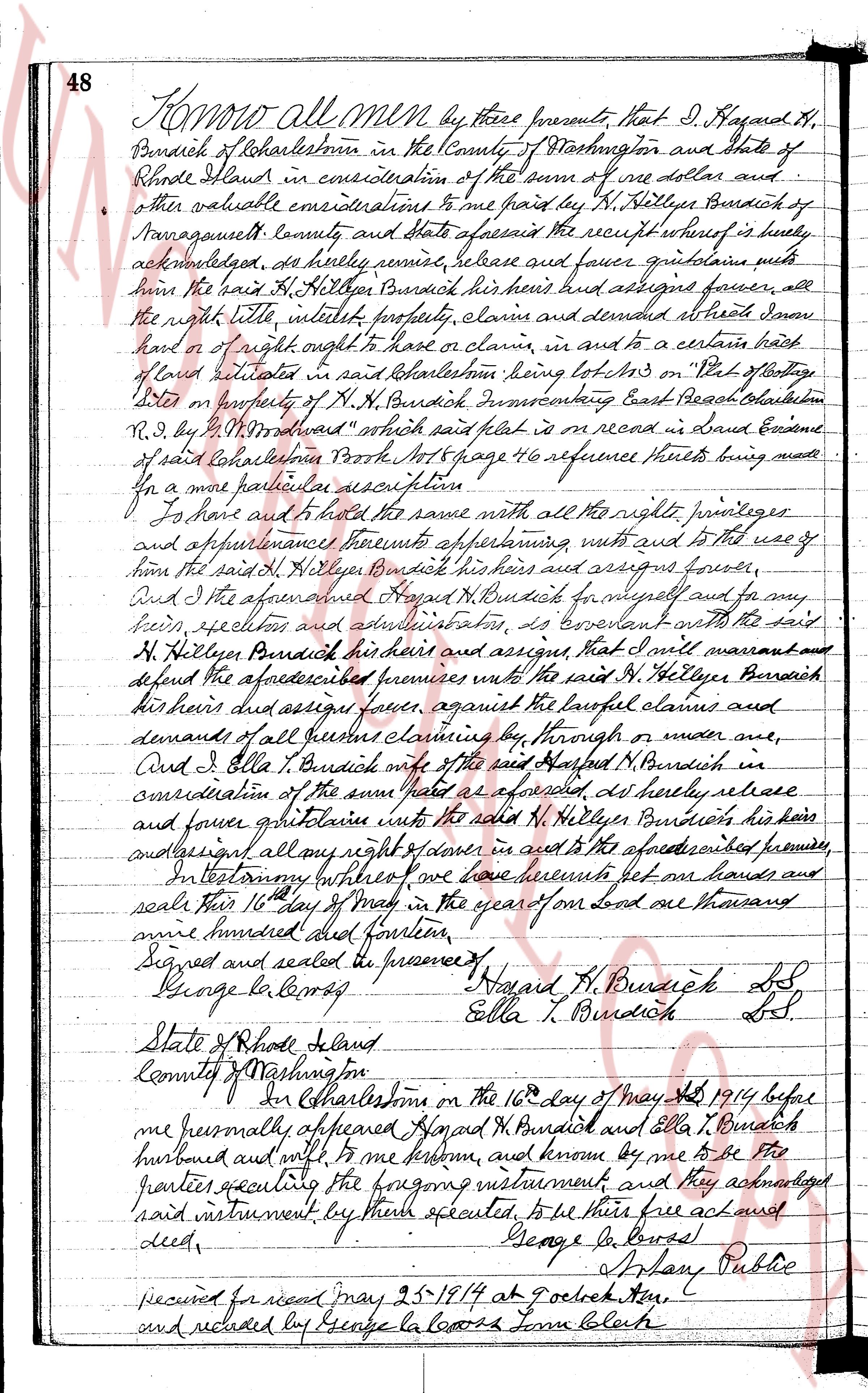
The instrument's own words
Attribution under review. The portal's file number is shared by more than one instrument, and the words below could not be placed with certainty on this one by their own evidence (page stamp, parties, dates); they may belong to a neighbouring instrument. Read them as the record of the page, not yet as this deed's own.
page 1
270
We, Michael A. Pietila and Mary K. Pietila, husband and wife, both of the Town
of Charlestown, County of Washington, State of Rhode Island, for consideration paid, grant
to HILMA PIETILA, of Runtington Station, Long Island, State of New York, with WARRANTY
COVENANTS.
A certain parcel or tract of land, situated in the Town of Charlestown, County
of Washington, state of Rhode Island, bounded and described as follows:
Beginning at a point on the easterly side of a road or driftway, leading from
the State Highway to premises of the Grantors; said point being the northeasterly corner
of the premises hereby conveyed and the northwesterly corner of premises of Victor Mal-
gren; thence running southerly, bounded westerly by said road or driftway, a distance of
130 feet; thence turning and running easterly or southeasterly, maintaining a distance of
130 feet distant from and parallel to said Malgren's land, to the westerly shore of
Pasquisset Pond; thence turning and following the shore of said Pasquisset Pond in a north-
erly direction a distance of 130 feet, to land of said Malgren; thence turning and run-
ning westerly, bounded northerly or northwesterly by said Malgren's land to the point and
place of beginning, or however otherwise the same may be bounded or described.
The Grantees, her heirs and assigns, are hereby granted the right to pass and
repass with vehicles or on foot, over the said road or driftway, as now travelled, to
and from said State Highway and the premises hereby conveyed.
WITNESSE our hands this 12th day of September, 1944.
MICHAEL A. PIETILA
MARY K. PIETILA
(DOCUMENTARY STAMPS, 55#)
STATE OF RHODE ISLAND, ETC.)
County of Washington }
In Charlestown on the 12th day of September, 1944, before me personally appeared
Michael A. Pietila and Mary K. Pietila, husband and wife, both to me known and known by me
to be the parties executing the foregoing instrument, and they acknowledged said instrument,
by them executed, to be their free act and deed.
LINTON L. BROWN
Notary Public
Received for record September 12th, A. D. 1944 at 10:00 o'clock, a. m., and recorded by
Tpwn Clerk
page 2
558
much time that a community association is formed to take over this function. 7. All structures
must comply with municipal and government laws, ordinances and regulations and if any restrictions
or conditions herein do not comply thereof it shall not be construed as a waiver by the grantors
or compliance with such laws, ordinances and regulations. 8. No fence or row of trees, shrub
brush higher than Thirty (30) inches shall be erected, grown or maintained on the premises. 9.
No house is to be constructed nearer than Twenty-Five (25) feet from lot or Six (6) feet on
either side of lot.
WITNESS our hands this 19th day of February 1958.
EVERETT R. GRAICHEN [SEAL]
LUCY GRAICHEN [SEAL]
(DOCUMENTARY STAMP, $1.10)
STATE OF RHODE ISLAND, ETC.
County of Washington, in Charlestown in said County on the 12 day of February A. D. 1958 before me personally
appeared the above Grantors, EVERETT R. GRAICHEN and wife, LUCY GRAICHEN each and all to me known, and known by
me to be the persons executing the foregoing instrument, and they acknowledged said instrument by them executed,
to be their free act and deed.
CHARLES S. BRIGHTMAN (Notarial Seal)
Notary Public
Received for record April 4th, A. D. 1960 at 11:05 o'clock, a. m., and recorded by
[Signature] Town Clerk
WARRANTY DEED
We, EVERETT R. GRAICHEN and LUCY GRAICHEN, husband and wife, both of the Town of Charlestown, County of
Washington, State of Rhode Island, for consideration paid, grant to JAMES P. HORTON and WINIFRED L. HORTON, husband
and wife, both of the Town of Westerly, County of Washington, State of Rhode Island, as Joint Tenants, with the
right of survivorship, and not as Tenants in Common, with WARRANTY COVENANTS, excepting the hereinafter mentioned
restrictions:
That certain parcel or tract of land situated at "Study Beach Water", so-called, in the Town of
Charlestown, County of Washington, State of Rhode Island, bounded and described as follows:
Beginning at a point on the southerly side of Low Street, so-called, at the northeasterly
corner of the premises herein conveyed and at the northeasterly corner of Lot No. 29, as
shown on a map or plat entitled "Westerly-Charlestown Map" containing R. Stewart, Reg. Land Surveyor",
belonging to Everett Graichen and Sydney Cohn, May 1949, Scale 1" = 100', Clifford R. Stewart,
Surveyor, said plat being attached hereto and made a part hereof; thence said line runs southeasterly,
in Plat Book No. 9, page 10, thence running easterly along said Low Street at an angle of
59° 5' a distance of 100 feet to a point which is the northeasterly corner of the premises herein conveyed,
of said parcel being hereby conveyed; thence running southerly at an angle of 74° 31' a distance
One Hundred Twenty-one and 94/100 (121.94) feet to a point which is the southeasterly corner of the
premises herein conveyed and at the southeasterly corner of said Lot No. 29; thence running northerly, bounded
by said Lot No. 29, a distance of Ninety-nine and 63/100 (99.63) feet to the point and place of
beginning, or near thereabout as shown on said plat above described.
Meaning and intending to convey that certain tract of land containing 6549 square feet as shown and
delineated on that certain plat entitled, "Beach of Land in Charlestown, R. I. owned by
Everett Graichen, Sept. 1st, 1949, surveyed and drawn by R. Stewart, Reg. Land Surveyor", said
plat being attached hereto and made a part hereof.
Said parcel or tract of land is subject to the following restrictions:
1. No trailer, basement, Guest House, shed or temporary buildings may be placed on said land.
2. The parcel hereby sold shall be used only for residential purposes, nor shall signs for adver-
tising purposes be placed, erected, or maintained on premises.
3. No painting shall be done, nor shall any plant be maintained or altered until the plans, specifications and
plot plans have been approved in writing by the grantors, their heirs, executors, administrators
or assigns.
4. Each house must have a full foundation, Foundation wall, said house to be at least 22 1/2 feet, net
including plazas, porches, porticos, verandas, or garage, said garage to be attached to house.
5. There shall be no live stocks, animals or poultry kept or maintained on the premises, other than
household pets.
6. Each lot is subject to an Assessment of Five Dollars ($5.) per year for the maintenance of roads
and general improvement of said first mentioned plat. Said assessment shall be paid to party of
the first part until such time that a community association is formed to take over this function.
The page as recorded