The instrument's own words
page 1 · read by Gemma vision
544
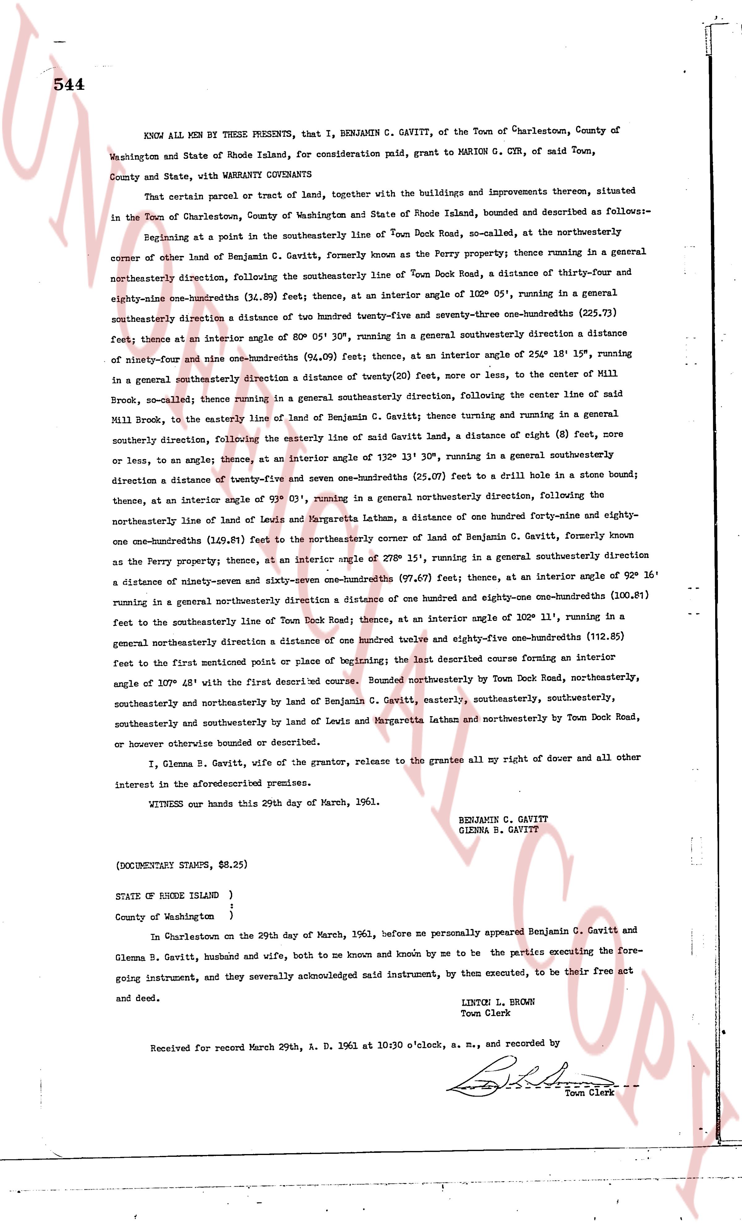
KNOW ALL MEN BY THESE PRESENTS, that I, BENJAMIN C. GAVITT, of the Town of Charlestown, County of Washington and State of Rhode Island, for consideration paid, grant to MARION G. CYR, of said Town, County and State, with WARRANTY COVENANTS
That certain parcel or tract of land, together with the buildings and improvements thereon, situated in the Town of Charlestown, County of Washington and State of Rhode Island, bounded and described as follows:-
Beginning at a point in the southwesterly line of Town Dock Road, so-called, at the northeasterly corner of other land of Benjamin C. Gavitt, formerly known as the Perry property; thence running in a general northeasterly direction, following the southwesterly line of Town Dock Road, a distance of thirty-four and eighty-nine one-hundredths (34.89) feet, thence at an interior angle of 102° 05', running in a general southeasterly direction a distance of one hundred twenty-five and seventy-three one-hundredths (125.73) feet; thence at an interior angle of 80° 05' 30", running in a general southeasterly direction a distance of ninety-four and nine one-hundredths (94.09) feet; thence at an interior angle of 254° 18' 19", running in a general southeasterly direction a distance of twenty (20) feet, or more or less, to the center of Mill Brook, so-called; thence running in a general southeasterly direction, following the center line of said Mill Brook, to the easterly line of land of Benjamin C. Gavitt; thence running and turning in a general southeasterly direction, following the easterly line of said Gavitt land, a distance of eight (8) feet, curve or less, to an angle; thence, at an interior angle of 132° 13' 30", running in a general southeasterly direction a distance of twenty-five and seven one-hundredths (25.07) feet to a drill hole in a stone bound; thence, at an interior angle of 91° 03', running in a general northeasterly direction, following the northeasterly line of land of Lewis and Margaretta Latham, a distance of one hundred forty-nine and eighty-one one-hundredths (149.81) feet to the northeasterly corner of land of Benjamin C. Gavitt, formerly known as the Perry property; thence, at an interior angle of 270° 15', running in a general southeasterly direction a distance of ninety-seven and sixty-seven one-hundredths (97.67) feet, thence at an interior angle of 92° 16' running in a general northeasterly direction a distance of one hundred and eighty-one one-hundredths (100.81) feet to the southwesterly line of Town Dock Road; thence, at an interior angle of 102° 11', running in a general northeasterly direction a distance of one hundred twelve and eighty-five one-hundredths (112.85) feet to the first mentioned point or place of beginning; the last described course forming an interior angle of 109° 48' with the first described course. Bounded northeasterly by Town Dock Road, northeasterly, southeasterly and northeasterly by land of Benjamin C. Gavitt, easterly, southeasterly, southeasterly, southeasterly and southeasterly by land of Lewis and Margaretta Latham and northeasterly by Town Dock Road, or however otherwise bounded or described.
I, Glenna B. Gavitt, wife of the grantor, release to the grantee all my right of dower and all other interest in the aforesaid premises.
WITNESS our hands this 29th day of March, 1961.
BENJAMIN C. GAVITT
GLENNA B. GAVITT
(DOCUMENTARY STAMPS, $8.25)
STATE OF RHODE ISLAND }
}
County of Washington }
In Charlestown on the 29th day of March, 1961, before me personally appeared Benjamin C. Gavitt and Glenna B. Gavitt, husband and wife, both to me known and by me to be the parties executing the foregoing instrument, and they severally acknowledged said instrument, by them executed, to be their free act and deed.
LINTON L. BROWN
Town Clerk
Received for record March 29th, A. D. 1961 at 10:30 o'clock, a. m., and recorded by
[Signature]
Town Clerk
The page as recorded