The instrument's own words
page 1 · read by Gemma vision
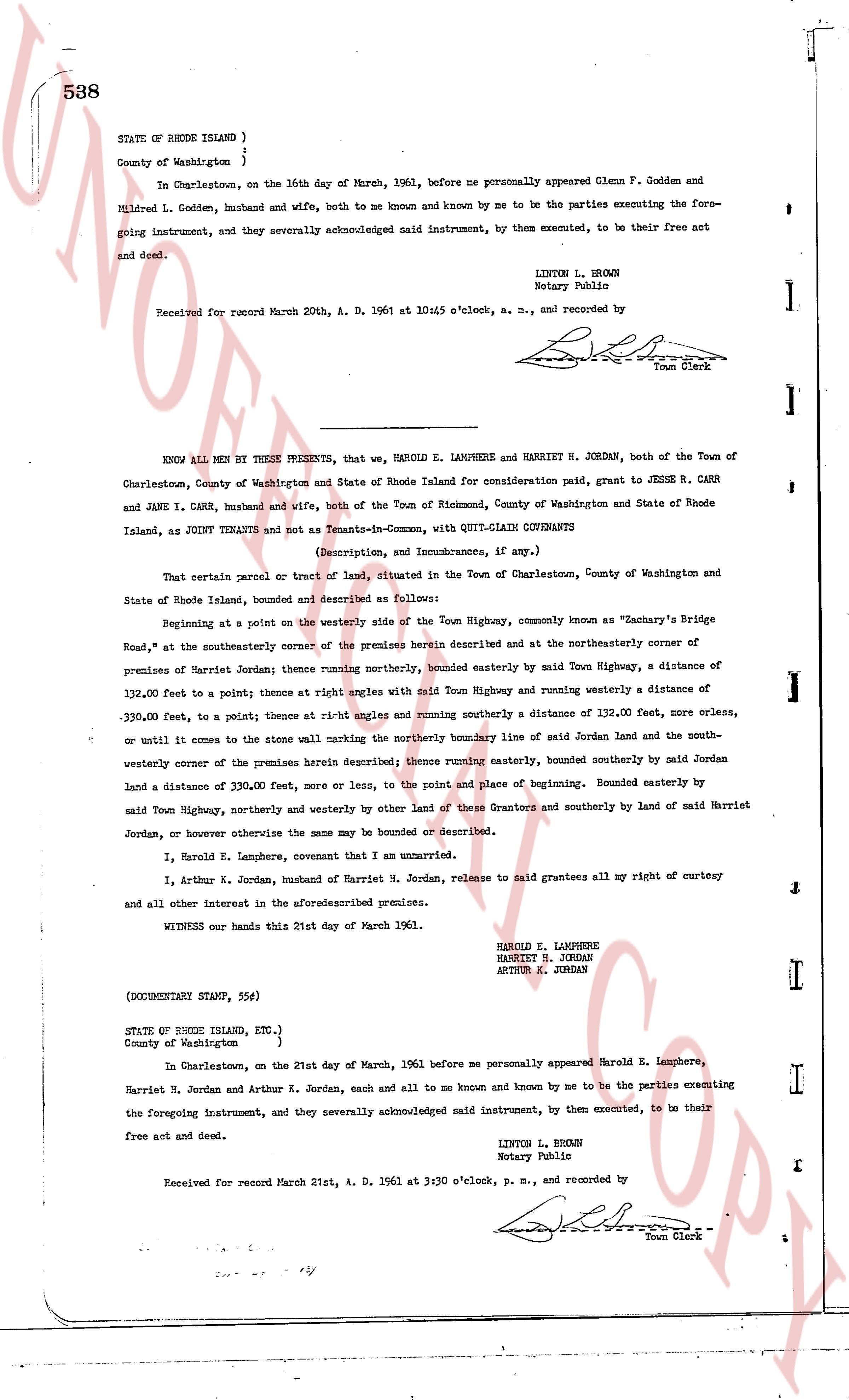
538
STATE OF RHODE ISLAND )
County of Washington )
In Charlestown, on the 16th day of March, 1961, before me personally appeared Glenn F. Godden and Mildred L. Godden, husband and wife, both to me known and known by me to be the parties executing the foregoing instrument, and they severally acknowledged said instrument, by them executed, to be their free act and deed.
LINTON L. BROWN
Notary Public
Received for record March 20th, A. D. 1961 at 10:45 o'clock, a. m., and recorded by [signature]
Town Clerk
----
KNOW ALL MEN BY THESE PRESENTS, that we, HAROLD E. LAMPHERE and HARRIET H. JORDAN, both of the Town of Charlestown, County of Washington and State of Rhode Island for consideration paid, grant to JESSE R. CARR and JANE I. CARR, husband and wife, both of the Town of Richmond, County of Washington and State of Rhode Island, as JOINT TENANTS and not as Tenants-in-Common, with QUIT-CLAIM COVENANTS
(Description, and Incumbrances, if any.)
That certain parcel or tract of land, situated in the Town of Charlestown, County of Washington and State of Rhode Island, bounded and described as follows:
Beginning at a point on the westerly side of the Town Highway, commonly known as "Zachary's Bridge Road," at the southerlymost corner of the premises herein described and at the northeasterly corner of premises of Harriet Jordan; thence running northerly, bounded easterly by said Town Highway, a distance of 132.00 feet to a point; thence at right angles with said Town Highway and running westerly a distance of 330.00 feet, to a point; thence at rt-angles and running southerly a distance of 132.00 feet, more or less, or until it comes to the stone wall marking the northerly boundary line of said Jordan land and the southwesterly corner of the premises herein described thence running easterly, bounded southerly by said Jordan land a distance of 330.00 feet, more or less, to the point and place of beginning. Bounded easterly by said Town Highway, northerly and westerly by other land of these Grantors and southerly by land of said Harriet Jordan, or however otherwise the same may be bounded or described.
I, Harold E. Lamphere, covenant that I am unmarried.
I, Arthur K. Jordan, husband of Harriet H. Jordan, release to said grantees all my right of curtesy and all other interest in the aforesaid premises.
WITNESS our hands this 21st day of March 1961.
HAROLD E. LAMPHERE
HARRIET H. JORDAN
ARTHUR K. JORDAN
(DOCUMENT STAMP, 55¢)
STATE OF RHODE ISLAND, etc.)
County of Washington )
In Charlestown, on the 21st day of March, 1961 before me personally appeared Harold E. Lamphere, Harriet H. Jordan and Arthur K. Jordan, each and all to me known and known by me to be the parties executing the foregoing instrument, and they severally acknowledged said instrument, by them executed, to be their free act and deed.
LINTON L. BROWN
Notary Public
Received for record March 21st, A. D. 1961 at 3:30 o'clock, p. m., and recorded by [signature]
Town Clerk
The page as recorded